Delve into Meridan Plains
The district Meridan Plains of in Sunshine Coast (Queensland) with it's 787 habitants Meridan Plains is a subburb in Australia about 632 mi north of Canberra, the country's capital town.
If you need a hotel, we compiled a list of available hotels close to the map centre further down the page.
While being here, you might want to pay a visit to some of the following locations: Sunshine Coast, Brisbane, Carrolls Creek, and . To further explore this place, just scroll down and browse the available info.
Local weather forecast
Todays Local Weather Conditions & Forecast: 21°C / 69 °F
| Morning Temperature | 18°C / 64 °F |
| Evening Temperature | 21°C / 70 °F |
| Night Temperature | 20°C / 68 °F |
| Chance of rainfall | 6% |
| Air Humidity | 79% |
| Air Pressure | 1024 hPa |
| Wind Speed | Moderate breeze with 12 km/h (8 mph) from North-West |
| Cloud Conditions | Broken clouds, covering 62% of sky |
| General Conditions | Light rain |
Sunday, 28th of April 2024
22°C (72 °F)
21°C (69 °F)
Light rain, moderate breeze, few clouds.
Monday, 29th of April 2024
22°C (72 °F)
20°C (68 °F)
Light rain, gentle breeze, few clouds.
Tuesday, 30th of April 2024
21°C (70 °F)
21°C (69 °F)
Light rain, gentle breeze, scattered clouds.
Hotels and Places to Stay
BEST WESTERN PLUS LAKE KAWANA
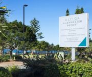
ULTIQA Shearwater Resort
Amore On Buderim Luxury Rainforest Cabins
Aspect Caloundra
Centrepoint Holiday Apartments
WorldMark Resort Golden Beach by Wyndham
MONACO CALOUNDRA
CALOUNDRA CENTRAL APARTMENT
Fairseas Apartments
Pumicestone Blue
Videos from this area
These are videos related to the place based on their proximity to this place.
Henzells Caloundra Christmas Message Caloundra 4551 QLD by H...
Property Video shoot of Henzells Caloundra Christmas Message Caloundra 4551 QLD by PlatinumHD http://www.platinumhd.tv for Henzells Caloundra.
Circuits at Caloundra (YCDR) in an Evektor Sportstar
A couple of quick circuits on a windy day at Caloundra airport, Runway 12. Thanks to the guys at Inspire aviation for the training! https://www.facebook.com/pages/Inspire-Aviation-Caloundra-Airpo...
53 Huntley Place Caloundra West 4551 QLD by Danelle Wiseman
Property Video shoot of 53 Huntley Place Caloundra West 4551 QLD by PlatinumHD http://www.platinumhd.tv for Ray White Caloundra.
Ruby and Daniels Wedding Oaks Oasis Caloundra 04/01/2014
Ruby and Daniels wedding Oaks Oasis Caloundra 04/01/2014. Want to make your Wedding or event as fun and memorable as Ruby and Daniels wedding was? Give us a call on 0402023834 or go to ...
Oaks Oasis Caloundra
Oaks Oasis Caloundra is set amongst a beautiful tropical landscape. Offering hotel, studio one, two and three bedroom apartments. Visit http://www.oakshotelsresorts.com/oaks-oasis/ for further...
Enclacve Buderim Unit 32 1 Figbird Crescent, Buderim QLD By Kieren Gray
Property Video shoot of Enclacve Buderim Unit 32 1 Figbird Crescent, Buderim QLD by PlatinumHD http://www.platinumhd.tv for Ray White Maroochydore.
26 Evergreen Drive - Glenview (4553) Queensland by Matt O'Grady
Property Video shoot of 26 Evergreen Drive - Glenview (4553) Queensland by PlatinumHD http://www.platinumhd.tv for.
Top 10 scariest rides at Aussie World on the Sunshine Coast
Local blogger and kid friendly expert Sarah Pye heads to the iconic Sunshine Coast attraction Aussie World with her daugher and a friend in tow. Their mission - to rate the 10 scariest rides...
Impact test
This is an impact test on the fiberglass composite panel used to construct Gemhunter Caravans.
Videos provided by Youtube are under the copyright of their owners.
Attractions and noteworthy things
Distances are based on the centre of the city/town and sightseeing location. This list contains brief abstracts about monuments, holiday activities, national parcs, museums, organisations and more from the area as well as interesting facts about the region itself. Where available, you'll find the corresponding homepage. Otherwise the related wikipedia article.
Mooloolah River National Park
Mooloolah River is a national park in Queensland, Australia, 84 km north of Brisbane. It contains important wallum heathland. Mooloolah River National Park is mostly made up of two different zones, these include alluvial flats and low undulation flats (mostly found in floodplains) along a section of the lower Mooloolah River. A small population of the endangered Emu Mountain Sheoak is located in the park. The national park has no facilities including walking tracks.
University of the Sunshine Coast
The University of the Sunshine Coast is a public university based on the Sunshine Coast in Queensland, Australia. Having opened in 1996 as the Sunshine Coast University College with 524 students, it was renamed the University of the Sunshine Coast in 1999. As at Semester 1 2013 the student body was ~9,300. About 100 km north of Brisbane, the campus is a 100 hectare flora and fauna reserve, adjoining the Mooloolah River National Park.
Siena Catholic College
Siena Catholic College, Queensland, Australia is a co-educational Catholic day college situated at Sippy Downs on Queensland’s Sunshine Coast. Opened in 1997, it caters for students in Years 8-12 and has an enrolment of approximately 750 students. The college shares its campus with Siena Primary School, a Prep -Year 7 school. The College is an Archdiocesan College administered by Brisbane Catholic Education and has close links with the Stella Maris Parish, having S.
Sippy Downs, Queensland
Sippy Downs is a suburb of the Sunshine Coast, Queensland, Australia, and is part of the Buderim urban centre. It contains the locality of Chancellor Park, and Australia's newest university, the University of the Sunshine Coast.
Kawana, Queensland
Kawana is an urban centre on the Sunshine Coast in Queensland, Australia, between Caloundra and Maroochydore along the Coral Sea coast. The suburbs are connected by the Nicklin Way arterial road. Many shopping and sporting facilities, including Kawana Shoppingworld are located in Kawana.
Currimundi, Queensland
Currimundi is a suburb of the Sunshine Coast, Queensland, Australia, located within the Caloundra urban centre 5 kilometres north of Caloundra. It was named by Sir Leslie Wilson, in which he used the local aboriginal name for the area, Garrimundi or Girrimundi, meaning Place of flying foxes. Currimundi Lake is a saltwater lake situated beside Currimundi Beach. Nicklin Way, the main road between Caloundra and Maroochydore, crosses Ahern Bridge over Currimundi Lake.
City of Caloundra
The City of Caloundra was a local government area about 90 kilometres north of Brisbane in the Sunshine Coast region of South East Queensland, Australia. The shire covered an area of 1,093.1 square kilometres, and existed as a local government entity from 1912 until 2008, when it amalgamated with councils further north to form the Sunshine Coast Region.
Birtinya, Queensland
Birtinya is a suburb of the Sunshine Coast, Queensland, Australia, located within the Kawana urban centre. It contains the locality of Kawana Forest.
Wurtulla, Queensland
Wurtulla is a suburb of the Sunshine Coast, Queensland, Australia, located within the Kawana urban centre. The name means "southward" in the local Aboriginal language, and it was named by Kawana Estates employees in the 1970s.
Tanawha, Queensland
Tanawha is a suburb of the Sunshine Coast, Queensland, Australia, and is part of the Buderim urban centre. It is home of the Tanawha Tourist Drive, which contains the Bellingham Maze. This road once carried the Bruce Highway until 16 November 1989 when the Tanawha Deviation opened to traffic.
Palmview, Queensland
Palmview is a suburb in the Sunshine Coast, Queensland, Australia. It is home to Aussie World and the Ettamogah Pub.
Chancellor State College
Chancellor State College is a public, co-educational, day school located in the suburb of Sippy Downs, Queensland, Australia. The school opened in 1997, and has grown quickly. It currently has approximately 2070 students enrolled from Prep to Year 12 (2008 numbers). Chancellor State College has links to the Sunshine Coast.
Head of the River (Queensland)
The Queensland Head of the River refers to two high school rowing regattas in Queensland Australia, one for boys and one for girls (Brisbane Schoolgirls' Rowing Association. , BSRA). The boys' regatta is held in mid to late March while the girls' regatta is held in late August to early September. Due to the lack of water at Wivenhoe Dam the boys' Head of the River was moved to Hinze Dam for 2006, and was then moved to Lake Kawana on the Sunshine Coast, Queensland the following year.
Ewen Maddock Dam
Ewen Maddock Dam is one of many smaller dams on Queensland's Sunshine Coast. It is situated approximately 5 km south east of Mooloolah and 3 km from Landsborough. The dam is managed by the Qld Water. Ewen Maddock Dam has a surface area of 370 hectares and holds 16 700 ML of water at an average depth of 4.5 m . It was built across Addlington Creek, a tributary of the Mooloolah River in 1973, to supply the fast growing region with town water.
Aussie World
Aussie World is a family amusement park located behind the Ettamogah Pub in the Australian state of Queensland on the Bruce Highway, Sunshine Coast. It is set in native Australian gardens and trees and themed like an Australian fairground of old.
Aroona, Queensland
Aroona is a suburb of the Sunshine Coast, Queensland, Australia, located within the Caloundra urban centre 4 kilometres north-west of Caloundra. It is situated between Little Mountain and Currimundi. Aroona is an aboriginal word usually meaning "place of refreshing" or "place of running water".
University of the Sunshine Coast bus station
The University of the Sunshine Coast Bus Station, at Sippy Downs, is serviced by TransLink bus routes. It is located in the campus grounds at the University of the Sunshine Coast. It is in Zone 16 of the TransLink integrated public transport system.
Stockland Caloundra
Stockland Caloundra is a sub-regional shopping centre located at the southern end of the Sunshine Coast, Queensland, Australia. The shopping centre has 50 specialty stores and two anchor stores. Stockland Caloundra is the largest shopping mall in the Caloundra region and hosts the only discount department within a 15-kilometre radius.
Little Mountain, Queensland
Little Mountain is a suburb of the Sunshine Coast, Queensland, Australia, located within the Caloundra urban centre 6 kilometres west of Caloundra CBD. The Corbould Park racecourse is located in the suburb, as well as the Caloundra Pony Club and Sunshine Coast Clay Targer club.
Glenview, Queensland
Glenview is a small town on the Sunshine Coast in Queensland, Australia. Its Local Government Area is the Sunshine Coast Regional Council. The Aussie World family park is located in the town, and part of the Ewen Maddock Dam is in the area.
Meridan Plains, Queensland
Meridan Plains is a suburb of the Sunshine Coast, Queensland, Australia, located partly within the Caloundra urban centre 8 kilometres west-northwest of Caloundra. Meridan Plains is named after an early property in the area, which was named from Aboriginal words meaning "place of kangaroos or dingoes".
Battery Hill, Queensland
Battery Hill is a suburb of the Sunshine Coast, Queensland, Australia, located within the Caloundra urban centre 4 kilometres north of Caloundra.
Bells Creek, Queensland
Bells Creek is a mostly rural locality of the Sunshine Coast, Queensland, Australia. It is located 8 kilometres west of Caloundra along the eastern side of the Bruce Highway. The majority of the locality's area is part of the Beerburrum State Forest.
Caloundra West, Queensland
Caloundra West is a suburb of the Sunshine Coast, Queensland, Australia, located within the Caloundra urban centre directly west of the central business district. It contains an industrial area, as well as Caloundra Aerodrome which is home to the Queensland Air Museum.
Roy Henzell Oval
Roy Henzell Oval is a cricket ground in Caloundra, Queensland, Australia. The first recorded match on the ground came in 1981 when Queensland Country played the touring West Indians. It held its only first-class match in 1993 when Queensland played the touring England A side, with the match ending in a draw. Three Youth One Day Internationals were played there in 2007 between Australia Under-19s and Pakistan Under-19.


