Discover Glenview
The district Glenview of in Sunshine Coast (Queensland) is a district in Australia about 632 mi north of Canberra, the country's capital city.
Looking for a place to stay? we compiled a list of available hotels close to the map centre further down the page.
When in this area, you might want to pay a visit to some of the following locations: Sunshine Coast, Brisbane, Carrolls Creek, and . To further explore this place, just scroll down and browse the available info.
Local weather forecast
Todays Local Weather Conditions & Forecast: 20°C / 68 °F
| Morning Temperature | 17°C / 63 °F |
| Evening Temperature | 18°C / 64 °F |
| Night Temperature | 18°C / 64 °F |
| Chance of rainfall | 7% |
| Air Humidity | 79% |
| Air Pressure | 1025 hPa |
| Wind Speed | Moderate breeze with 9 km/h (6 mph) from North-West |
| Cloud Conditions | Broken clouds, covering 64% of sky |
| General Conditions | Moderate rain |
Thursday, 9th of May 2024
19°C (67 °F)
16°C (61 °F)
Light rain, gentle breeze, overcast clouds.
Friday, 10th of May 2024
19°C (66 °F)
17°C (62 °F)
Light rain, gentle breeze, overcast clouds.
Saturday, 11th of May 2024
21°C (70 °F)
18°C (64 °F)
Moderate rain, light breeze, scattered clouds.
Hotels and Places to Stay
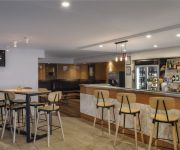
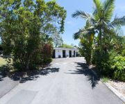
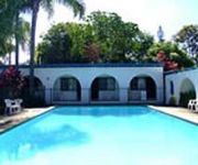
Poppies Bed and Breakfast
Amore On Buderim Luxury Rainforest Cabins
The Sebel Pelican Waters Resort
Arabella Guesthouse
Buderim Fiesta Motel
Buderim Motor Inn
Videos from this area
These are videos related to the place based on their proximity to this place.
Another Mooloolah Valley property Sold by Lee Sutherland 0499 993 311 RE/MAX Nambour
Real estate SOLD at 88 Eudlo Road Mooloolah Valley by RE/MAX Nambour and Sunshine Coasts best agent Lee Sutherland. Call Lee today on 0499 993 311. Lifestyle Property...First Time ...
137 Old Gympie Road - Mooloolah Valley (4553) Queensland by Matt...
Property Video shoot of 137 Old Gympie Road - Mooloolah Valley (4553) Queensland by PlatinumHD http://www.platinumhd.tv for.
44 Paget Street - Mooloolah Valley (4553) Queensland by Dean...
Property Video shoot of 44 Paget Street - Mooloolah Valley (4553) Queensland by PlatinumHD http://www.platinumhd.tv for.
27 Ridge Court - Mooloolah Valley (4553) Queensland by Trudi Gow...
Property Video shoot of 27 Ridge Court - Mooloolah Valley (4553) Queensland by PlatinumHD http://www.platinumhd.tv for.
147 Old Gympie Road - Mooloolah Valley (4553) Queensland by Matt O'Grady
Property Video shoot of 147 Old Gympie Road - Mooloolah Valley (4553) Queensland by PlatinumHD http://www.platinumhd.tv for.
Ewen Maddock Dam
Hans and Ross fishing in Ewen Maddock Dam on the Sunshine Coast, Queensland, Australia in the late afternoon. Plenty of small fish around and lots of birds. Filmed in low light with a Lumix...
Landsborough Day 2013
Steam Train arriving at Landsborough Train Station Saturday 19 October 2013 at the annual Landsborough Day Festivities on the Sunshine Coast.
26 Evergreen Drive - Glenview (4553) Queensland by Matt O'Grady
Property Video shoot of 26 Evergreen Drive - Glenview (4553) Queensland by PlatinumHD http://www.platinumhd.tv for.
Top 10 scariest rides at Aussie World on the Sunshine Coast
Local blogger and kid friendly expert Sarah Pye heads to the iconic Sunshine Coast attraction Aussie World with her daugher and a friend in tow. Their mission - to rate the 10 scariest rides...
Videos provided by Youtube are under the copyright of their owners.
Attractions and noteworthy things
Distances are based on the centre of the city/town and sightseeing location. This list contains brief abstracts about monuments, holiday activities, national parcs, museums, organisations and more from the area as well as interesting facts about the region itself. Where available, you'll find the corresponding homepage. Otherwise the related wikipedia article.
Dularcha National Park
Dularcha is a national park in Queensland, Australia, 78 km north of Brisbane.
Mooloolah River National Park
Mooloolah River is a national park in Queensland, Australia, 84 km north of Brisbane. It contains important wallum heathland. Mooloolah River National Park is mostly made up of two different zones, these include alluvial flats and low undulation flats (mostly found in floodplains) along a section of the lower Mooloolah River. A small population of the endangered Emu Mountain Sheoak is located in the park. The national park has no facilities including walking tracks.
University of the Sunshine Coast
The University of the Sunshine Coast is a public university based on the Sunshine Coast in Queensland, Australia. Having opened in 1996 as the Sunshine Coast University College with 524 students, it was renamed the University of the Sunshine Coast in 1999. As at Semester 1 2013 the student body was ~9,300. About 100 km north of Brisbane, the campus is a 100 hectare flora and fauna reserve, adjoining the Mooloolah River National Park.
Mooloolah Valley, Queensland
Mooloolah Valley is a small town on the Sunshine Coast hinterland, Queensland, Australia. It is situated north of Landsborough on the main railway line from Brisbane with regular services southbound to Brisbane and northbound to Nambour and Gympie. Mooloolah is referred to as Mooloolah Valley to distinguish it from the nearby Mooloolaba, Mooloolah is under the postcode 4553, and hence is in the Federal Electoral area of Fisher
Landsborough railway station
Landsborough is a railway station on the Nambour and Gympie North Line of the Queensland Rail City rail network, in the northern part of South East Queensland; it is also a stop for many state-wide rail services. Located near the southern end of the Sunshine Coast, it falls within Zone 13 of the TransLink integrated public transport system.
Landsborough, Queensland
Landsborough is a small town on the Sunshine Coast hinterland of Queensland, Australia. It is situated north of the Glasshouse Mountains just off Steve Irwin Way, 82 km north of Brisbane at the base of the southern end of the Blackall Range. At the 2006 census, Landsborough had a population of 2,805. Landsborough is situated on the main railway line from Brisbane and there are several services daily southbound to Brisbane and northbound to Nambour and Gympie.
Mooloolah railway station
Mooloolah is a railway station on the Nambour and Gympie North Line of South East Queensland, Australia. It is part of the Queensland Rail City network. The station is in Zone 14 of the TransLink integrated public transport system.
Eudlo railway station
Eudlo is a railway station on the Nambour and Gympie North Line of South East Queensland, Australia. It is part of the Queensland Rail City network. The station is in Zone 15 of the TransLink integrated public transport system. Eudlo has a short platform and can only accommodate three cars at a time. Passengers wishing to use Eudlo should always ensure that they are in the front three cars of any train.
Siena Catholic College
Siena Catholic College, Queensland, Australia is a co-educational Catholic day college situated at Sippy Downs on Queensland’s Sunshine Coast. Opened in 1997, it caters for students in Years 8-12 and has an enrolment of approximately 750 students. The college shares its campus with Siena Primary School, a Prep -Year 7 school. The College is an Archdiocesan College administered by Brisbane Catholic Education and has close links with the Stella Maris Parish, having S.
Sippy Downs, Queensland
Sippy Downs is a suburb of the Sunshine Coast, Queensland, Australia, and is part of the Buderim urban centre. It contains the locality of Chancellor Park, and Australia's newest university, the University of the Sunshine Coast.
Kawana, Queensland
Kawana is an urban centre on the Sunshine Coast in Queensland, Australia, between Caloundra and Maroochydore along the Coral Sea coast. The suburbs are connected by the Nicklin Way arterial road. Many shopping and sporting facilities, including Kawana Shoppingworld are located in Kawana.
Eudlo, Queensland
Eudlo is a small hinterland town on the Sunshine Coast in Queensland, Australia. The name originated from the fresh water eel (Anguilla reinhardtii). At the 2006 census, Eudlo had a population of 852.
Tanawha, Queensland
Tanawha is a suburb of the Sunshine Coast, Queensland, Australia, and is part of the Buderim urban centre. It is home of the Tanawha Tourist Drive, which contains the Bellingham Maze. This road once carried the Bruce Highway until 16 November 1989 when the Tanawha Deviation opened to traffic.
Palmview, Queensland
Palmview is a suburb in the Sunshine Coast, Queensland, Australia. It is home to Aussie World and the Ettamogah Pub.
Chevallum, Queensland
Chevallum is a suburb in the Sunshine Coast, Queensland, Australia. It had a population of 438 at the 2011 Australian Census. Part of the western boundary of the suburb is marked by the Bruce Highway. Eudlo Creek, a tributary of the Maroochy River courses through the suburb. Chevallum is known for its strawberries and participates in the local Strawbfest. It has a local permaculture group devoted to organic and sustainable farming, which holds regular meetings at Chevallum School.
Mons, Queensland
Mons is a suburb of the Sunshine Coast, Queensland, Australia, and is part of the Buderim urban centre. It is home to the former Forest Glen Deer Sanctuary on the Tanawha Tourist Drive.
Chancellor State College
Chancellor State College is a public, co-educational, day school located in the suburb of Sippy Downs, Queensland, Australia. The school opened in 1997, and has grown quickly. It currently has approximately 2070 students enrolled from Prep to Year 12 (2008 numbers). Chancellor State College has links to the Sunshine Coast.
Ewen Maddock Dam
Ewen Maddock Dam is one of many smaller dams on Queensland's Sunshine Coast. It is situated approximately 5 km south east of Mooloolah and 3 km from Landsborough. The dam is managed by the Qld Water. Ewen Maddock Dam has a surface area of 370 hectares and holds 16 700 ML of water at an average depth of 4.5 m . It was built across Addlington Creek, a tributary of the Mooloolah River in 1973, to supply the fast growing region with town water.
Matthew Flinders Anglican College
Matthew Flinders Anglican College (MFAC) is an independent, co-educational day school located on Queensland's Sunshine Coast in Buderim, approximately 90 kilometres north of Brisbane. It has grown from an enrolment of 160 students in its foundation year, 1990, to over 1200 today. It includes a Primary School (Preparatory to Year 6) and a Secondary School (Years 7 to 12). The school is associated with the Anglican Church of Australia.
Aussie World
Aussie World is a family amusement park located behind the Ettamogah Pub in the Australian state of Queensland on the Bruce Highway, Sunshine Coast. It is set in native Australian gardens and trees and themed like an Australian fairground of old.
University of the Sunshine Coast bus station
The University of the Sunshine Coast Bus Station, at Sippy Downs, is serviced by TransLink bus routes. It is located in the campus grounds at the University of the Sunshine Coast. It is in Zone 16 of the TransLink integrated public transport system.
Little Mountain, Queensland
Little Mountain is a suburb of the Sunshine Coast, Queensland, Australia, located within the Caloundra urban centre 6 kilometres west of Caloundra CBD. The Corbould Park racecourse is located in the suburb, as well as the Caloundra Pony Club and Sunshine Coast Clay Targer club.
Glenview, Queensland
Glenview is a small town on the Sunshine Coast in Queensland, Australia. Its Local Government Area is the Sunshine Coast Regional Council. The Aussie World family park is located in the town, and part of the Ewen Maddock Dam is in the area.
Meridan Plains, Queensland
Meridan Plains is a suburb of the Sunshine Coast, Queensland, Australia, located partly within the Caloundra urban centre 8 kilometres west-northwest of Caloundra. Meridan Plains is named after an early property in the area, which was named from Aboriginal words meaning "place of kangaroos or dingoes".
Bells Creek, Queensland
Bells Creek is a mostly rural locality of the Sunshine Coast, Queensland, Australia. It is located 8 kilometres west of Caloundra along the eastern side of the Bruce Highway. The majority of the locality's area is part of the Beerburrum State Forest.


