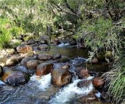
Delve into Cotswold
Cotswold in Scenic Rim (Queensland) is a town located in Australia about 535 mi (or 860 km) north-east of Canberra, the country's capital town.
Time in Cotswold is now 09:47 PM (Friday). The local timezone is named Australia / Brisbane with an UTC offset of 10 hours. We know of 8 airports closer to Cotswold, of which one is a larger airport. The closest airport in Australia is Southport Airport in a distance of 42 mi (or 68 km), North-East. Besides the airports, there are other travel options available (check left side).
Also, if you like the game of golf, there are some options within driving distance. In need of a room? We compiled a list of available hotels close to the map centre further down the page.
Since you are here already, you might want to pay a visit to some of the following locations: Brisbane, Carrolls Creek, Sunshine Coast, and . To further explore this place, just scroll down and browse the available info.
Local weather forecast
Todays Local Weather Conditions & Forecast: 21°C / 70 °F
| Morning Temperature | 14°C / 58 °F |
| Evening Temperature | 17°C / 63 °F |
| Night Temperature | 15°C / 58 °F |
| Chance of rainfall | 0% |
| Air Humidity | 56% |
| Air Pressure | 1024 hPa |
| Wind Speed | Gentle Breeze with 7 km/h (4 mph) from North-West |
| Cloud Conditions | Overcast clouds, covering 94% of sky |
| General Conditions | Light rain |
Saturday, 4th of May 2024
21°C (70 °F)
13°C (56 °F)
Broken clouds, gentle breeze.
Sunday, 5th of May 2024
21°C (69 °F)
14°C (57 °F)
Light rain, light breeze, overcast clouds.
Monday, 6th of May 2024
20°C (68 °F)
15°C (59 °F)
Light rain, gentle breeze, scattered clouds.
Hotels and Places to Stay
Barney Creek Vineyard Cottages
Videos from this area
These are videos related to the place based on their proximity to this place.
Tips for new riders - Part 1
I've decided to throw together some bits and pieces aimed at people who have just got their license. This topic covers selecting a bike that's right for you and deciding if you want a new or...
Gaming for a Cause!
Just a quick catch up with whats been happening in my life since the last video, an update about the Hyosung and preparation for Gaming For A Cause. http://www.gamingforacause.org.au - Please...
Rokk Mann
Rokk Mann is an animated VFX short film. He is the metaphorical figure of all life. He is born, he learns, he grows and progresses, and, like all living, must return to where he came from....
Alpaca Farm Tour at Mt Barney, Australia
Share a tea party with Sheila and Osama Ben Llama. Enjoy watching the daily hijinks of the alpaca herd including the cria (babies).
WATERFALL CREEK ROAD - MOUNT BARNEY
Located at Mount Barney - South east Queensland A nice easy track - It does arrive to a dead end, so have to return back the same way. However the scenery on the way back down the mountain...
Lower Portals Overnight Hike
An awesome overnight hike into the Lower Portals waterhole and bush camp in Mount Barney National Park with my wife and 2 of my children. Distance - 3.7km ...
Videos provided by Youtube are under the copyright of their owners.
Attractions and noteworthy things
Distances are based on the centre of the city/town and sightseeing location. This list contains brief abstracts about monuments, holiday activities, national parcs, museums, organisations and more from the area as well as interesting facts about the region itself. Where available, you'll find the corresponding homepage. Otherwise the related wikipedia article.
Mount Maroon
Mount Maroon is a mountain in South East Queensland that is part of the McPherson Range. The mountain rises to 966 m above sea level about 12 km west of Rathdowney. The original indigenous name for the mountain was Wahlmoorum which meant sand goanna in the Yuggera language. The current name for the mountain comes from the first grazing property in the area called Maroon. Mount Maroon consists mainly of rhyolite and has its geological origins in the cooling of molten rock beneath the surface.


