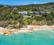
Touring Point Lookout
The district Point Lookout of in Redland (Queensland) is a subburb located in Australia about 602 mi north-east of Canberra, the country's capital place.
Need some hints on where to stay? We compiled a list of available hotels close to the map centre further down the page.
Being here already, you might want to pay a visit to some of the following locations: Brisbane, Sunshine Coast, Carrolls Creek, and . To further explore this place, just scroll down and browse the available info.
Local weather forecast
Todays Local Weather Conditions & Forecast: 21°C / 70 °F
| Morning Temperature | 19°C / 67 °F |
| Evening Temperature | 21°C / 69 °F |
| Night Temperature | 19°C / 66 °F |
| Chance of rainfall | 11% |
| Air Humidity | 71% |
| Air Pressure | 1026 hPa |
| Wind Speed | Moderate breeze with 11 km/h (7 mph) from North-West |
| Cloud Conditions | Overcast clouds, covering 100% of sky |
| General Conditions | Moderate rain |
Friday, 17th of May 2024
21°C (70 °F)
16°C (61 °F)
Light rain, moderate breeze, overcast clouds.
Saturday, 18th of May 2024
21°C (70 °F)
17°C (62 °F)
Light rain, fresh breeze, clear sky.
Sunday, 19th of May 2024
18°C (65 °F)
14°C (58 °F)
Light rain, moderate breeze, clear sky.
Hotels and Places to Stay
Stradbroke Island Beach Hotel & Spa
Whale Watch Ocean Beach Resort
Pandanus Palms Holiday Resort
Videos from this area
These are videos related to the place based on their proximity to this place.
Stingray City-Flatrock,Morton Bay
Giant Bull Rays & Spotted Eagle Rays filmed from MV SuperSport 12-13 Dec 2009. Flatrock,Morton Bay, QLD, Australia.
Dolphins at Sunset - Amity Point - North Stradbroke Island presented by Peter Bellingham Photography
Dolphins at Sunset - Amity Point - North Stradbroke Island.
Cleaning up Amity
In one hour, nineteen divers removed an enormous quantity of discarded recreational fishing gear. The video shows the thick knotted mats of nylon fishing lines covering the sea floor rendering...
Feeding dolphins at Amity Jetty
Amity Point, North Stradbroke Island, Queensland - people come to the jetty most afternoons to feed and pet wild but friendly dolphins who come right over to the jetty to say hello. This was...
Spotted Dove (Spilopelia chinensis) / Perlhalstaube [1]
A Spotted Dove (Spilopelia chinensis) on an overhead line at Amity Point, North Stradbroke Island, Australia Eine Perlhalstaube, Gefleckte Perlhalstaube oder Tigerhalstaube auf einer Oberleitung...
Australian Pelican (Pelecanus conspicillatus) / Brillenpelikan [4]
An Australian Pelican (Pelecanus conspicillatus) at Amity Point, North Stradbroke Island, Queensland, Australia Ein Brillenpelikan bei Amity Point, North Stradbroke Island, Queensland, Australien...
Head of a Crested Tern, Greater Crested Tern or Swift Tern (Thalasseus bergii) - 1
Head of a Crested Tern, Greater Crested Tern or Swift Tern (Thalasseus bergii) / Kopf einer Eilseeschwalbe 17.12.2012 Amity Point, North Stradbroke Island, Queensland Australia Camera: Panasonic.
Chick of the Masked Lapwing (Vanellus miles) / Küken vom Maskenkiebitz [2]
Chick of the Masked Lapwing (Vanellus miles) near Amity Point, North Stradbroke Island, Queensland, Australia They are so small but at the coast I enjoyed to see them running really fast! ...
Australian Pied Cormorant (Phalacrocorax varius) / Elsterscharbe - 2
Australian Pied Cormorant (Phalacrocorax varius) / Elsterscharbe 17.12.2012 Amity Point, North Stradbroke Island, Queensland, Australia Camera: Panasonic Lumix GH3 Lens / Objektiv: Panasonic...
Australian Pelican (Pelecanus conspicillatus) / Brillenpelikan [3]
An Australian Pelican (Pelecanus conspicillatus) at Amity Point, North Stradbroke Island, Queensland, Australia Ein Brillenpelikan bei Amity Point, North Stradbroke Island, Queensland, Australien...
Videos provided by Youtube are under the copyright of their owners.
Attractions and noteworthy things
Distances are based on the centre of the city/town and sightseeing location. This list contains brief abstracts about monuments, holiday activities, national parcs, museums, organisations and more from the area as well as interesting facts about the region itself. Where available, you'll find the corresponding homepage. Otherwise the related wikipedia article.
Blue Lake National Park
Blue Lake is a national park in Queensland, 44 km east of Brisbane on North Stradbroke Island. Access is provided by road 9 km west of Dunwich. The park's main features is Blue Lake which is known as a window lake and is just under 10 metres deep when full. It is home to the southern sun fish. Water from the lake overflows into the Eighteen Mile Swamp. The aboriginal name for Blue Lake is Karboora. The ephemeral Tortoise Lagoon is also found in the national park.
Stradbroke Island
Stradbroke Island, also known as Minjerribah, was a large sand island that formed much of the eastern side of Moreton Bay near Brisbane, Queensland until the late 19th century. Today the island is split into two by the Jumpinpin Channel.
North Stradbroke Island
North Stradbroke Island is an Australian island in the state of Queensland, 30 km southeast of the capital Brisbane. Before 1896 the island was part of the Stradbroke Island. In that year a storm separated it from South Stradbroke Island, forming the Jumpinpin Channel. It is known colloquially as Straddie.
Dunwich, Queensland
Dunwich is a small town on the western side of North Stradbroke Island in the Australian state of Queensland. The town is part of the Redland City local government area, based on the mainland in the Brisbane bayside suburb of Cleveland. Dunwich is one of three towns on North Stradbroke Island - the others being Amity Point and Point Lookout. At the 2006 census, Dunwich had a population of 804.
Point Lookout, Queensland
Point Lookout is a headland and small coastal village located on the eastern coast of North Stradbroke Island. To the north lies Cape Moreton and to the south the next major headland is Point Danger on the New South Wales/Queensland border. The other towns on the island are Dunwich and Amity Point. The point was first sighted by James Cook in 1770. Point Lookout is an excellent fishing spot, as is Jumpinpin Channel on the south of the island.
Amity Point, Queensland
Amity Point is a small close knit township located on the north western point of North Stradbroke Island, Queensland, Australia in Redland City. At the 2006 census, Amity Point had a population of 408. Directly north is the South Passage and the southern tip of Moreton Island. To the east lies the small town of Point Lookout and to the south lies the main town of North Stradbroke Island, Dunwich. Wallum Creek snakes along the southern border of the town.
Brown Lake (Stradbroke Island)
Brown Lake is a lake on North Stradbroke Island, in Queensland, Australia. Known as a perched lake like other lakes on the sandy islands in the region of South-East Queensland it retains its water due to a layer of leaves lining the lake floor. This is particularly apparent in the Brown Lake as tannin is exuded from the leaves, dropped from surrounding Paperbark Melaleuca and Ti-trees Leptospermum, stains the water to a rich brown colour not dissimilar to that of tea.
2009 southeast Queensland oil spill
The 2009 southeast Queensland oil spill occurred on 11 March 2009 off the coast of southeast Queensland, Australia, in which 230 tonnes of fuel oil, 30 tonnes of other fuel and 31 shipping containers (620 tonnes) of ammonium nitrate spilled into the Coral Sea, north of Moreton Bay during Cyclone Hamish after unsecured cargo on the container ship, MV Pacific Adventurer damaged other cargo, causing the spillage.
South Passage (Queensland)
South Passage is channel between the South Pacific Ocean and Moreton Bay. The other entrances to the bay are the North Passage and Jumpinpin Channel in the south. It was once the main entrance for ships entering the bay. South Passage begins in the shallow sand-barred channel between Moreton Island and North Stradbroke Island and continues along North Stradbroke Island past Amity Point to Dunwich.


!['Spotted Dove (Spilopelia chinensis) / Perlhalstaube [1]' preview picture of video 'Spotted Dove (Spilopelia chinensis) / Perlhalstaube [1]'](https://img.youtube.com/vi/2YFUpiwvM2I/mqdefault.jpg)
!['Australian Pelican (Pelecanus conspicillatus) / Brillenpelikan [4]' preview picture of video 'Australian Pelican (Pelecanus conspicillatus) / Brillenpelikan [4]'](https://img.youtube.com/vi/lXAlMExfj-k/mqdefault.jpg)

!['Chick of the Masked Lapwing (Vanellus miles) / Küken vom Maskenkiebitz [2]' preview picture of video 'Chick of the Masked Lapwing (Vanellus miles) / Küken vom Maskenkiebitz [2]'](https://img.youtube.com/vi/rdczYRoyTyM/mqdefault.jpg)

!['Australian Pelican (Pelecanus conspicillatus) / Brillenpelikan [3]' preview picture of video 'Australian Pelican (Pelecanus conspicillatus) / Brillenpelikan [3]'](https://img.youtube.com/vi/J4rwyPXTuPY/mqdefault.jpg)
