Discover Lawnton
The district Lawnton of in Moreton Bay (Queensland) is a subburb in Australia about 598 mi north of Canberra, the country's capital city.
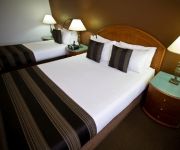
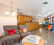
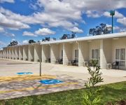
If you need a hotel, we compiled a list of available hotels close to the map centre further down the page.
While being here, you might want to pay a visit to some of the following locations: Brisbane, Sunshine Coast, Carrolls Creek, and . To further explore this place, just scroll down and browse the available info.
Local weather forecast
Todays Local Weather Conditions & Forecast: 22°C / 72 °F
| Morning Temperature | 17°C / 62 °F |
| Evening Temperature | 20°C / 68 °F |
| Night Temperature | 16°C / 61 °F |
| Chance of rainfall | 0% |
| Air Humidity | 56% |
| Air Pressure | 1026 hPa |
| Wind Speed | Gentle Breeze with 8 km/h (5 mph) from West |
| Cloud Conditions | Broken clouds, covering 59% of sky |
| General Conditions | Light rain |
Saturday, 11th of May 2024
21°C (69 °F)
17°C (63 °F)
Light rain, light breeze, overcast clouds.
Sunday, 12th of May 2024
22°C (72 °F)
16°C (61 °F)
Light rain, light breeze, overcast clouds.
Monday, 13th of May 2024
21°C (70 °F)
16°C (61 °F)
Sky is clear, light breeze, clear sky.
Hotels and Places to Stay
RENDEZVOUS BRISBANE ON GEORGE
Best Western Plus North Lakes Hotel
Brisbane International Virginia
Kallangur Motel
Videos from this area
These are videos related to the place based on their proximity to this place.
Taekwondo and Hapkido Black Belts - Snippetts - Factorten Martial Arts
here is some snippets from some of our Black Belts at their recent grading. Why is this important? Well not everyone works hard enough for long enough to make Black Belt and these guys commitment...
Jay and Noah's High Kick - Hanmadang 2013 - Factorten Martial Arts
The traditional Hanmadang -- a technical festival of Korean Martial Arts (both Taekwondo and Hapkido -- has at its core purpose to encourage, nurture and challenge the pursuit of excellence...
South East Queensland Drone User Group
South East Queensland Drone User Group meet up. Saturday June 21, 2014, Pine Rivers Park (Brisbane) My first meet up and I'm hooked on these cool toys! :-)
Waterski day F10 staff and their family
Master O invited F10 staff and their family to enjoy a day water skiing with his family. A fun day was had by all. If you listen you will hear the excitement from the boat also, even though...
Martial Arts Demo - Factorten Martial Arts Demo Squad
Factorten Martial Arts Demo squad travels to schools, fetes and even corporate promotional events. They demonstrate Taekwondo, Hapkido and Martial Acrobatic ...
Bowling in Fast Foward
Filmed this while my Family went bowling but camer ran out of battery. Please Like & Subscribe & Comment Feedback is welcome.
Hanmadang May 2104 Power Breaking Jay and Brentton
Power Breaking Factorten Martial Arts traditional Hanmadang -- a technical festival of Korean Martial Arts (both Taekwondo and Hapkido -- has at its core purpose to encourage, nurture and...
Meeting the Janoskians at Westfield Strathpine 24/6/12
I was so excited when I got on stage that all I could say was "OMG I love you guys so much" Luke & Jai said "aw I love you too". Daniel (Skip) called me sweetie & Beau called me Babe & my mum...
Videos provided by Youtube are under the copyright of their owners.
Attractions and noteworthy things
Distances are based on the centre of the city/town and sightseeing location. This list contains brief abstracts about monuments, holiday activities, national parcs, museums, organisations and more from the area as well as interesting facts about the region itself. Where available, you'll find the corresponding homepage. Otherwise the related wikipedia article.
Carseldine railway station
Carseldine is a railway station on the Caboolture Line of Brisbane, Australia. It is part of the QR Citytrain network. The station is in Zone 4 of the TransLink integrated public transport system.
Bald Hills railway station
Bald Hills is a railway station on the Caboolture Line of Brisbane, Australia. It is part of the QR Citytrain network. The station is in a transition precinct between Zone 4 and Zone 5 of the TransLink integrated public transport system.
Strathpine railway station
Strathpine is a railway station on the Caboolture Line of Brisbane, Australia. It is part of the QR Citytrain network. The station is in Zone 5 of the TransLink integrated public transport system.
Bray Park railway station
Bray Park is a railway station on the Caboolture Line of Brisbane, Australia. It is part of the QR Citytrain network. The station is in Zone 5 of the TransLink integrated public transport system.
Petrie railway station
Petrie is a railway station on the Caboolture Line of Brisbane, Australia. It is part of the Queensland Rail City network. The station is in Zone 6 of the TransLink integrated public transport system.
Bald Hills, Queensland
Bald Hills is the northernmost suburb of the Brisbane City Council in Queensland, Australia. Bald Hills is a largely residential suburb. It is mostly surrounded by bushland, but in the last few years some of the bush areas have been cleared to make way for new residential areas. It also borders onto the Bald Hills Flats – a large flood plain on the western side of the suburb that is used for cattle grazing.
Petrie, Queensland
Petrie is a suburb north of Brisbane, Queensland, Australia. Its Local Government Area is the Moreton Bay Region. It is located in the North Pine River section of its local council 24 kilometres north of Brisbane City. The origin of the suburb name is from an early inhabitant by the name of Tom Petrie. The township was named Petrie after his death. Prior to this, the area was known as North Pine.
612 ABC Brisbane
612 ABC Brisbane is an ABC Local Radio station in Brisbane, Queensland. It is one of the largest stations in the network, serving as a base for Queensland programming - many programs are broadcast across the ABC Local Radio network in regional and rural areas of Queensland when those stations are not carrying local programming. The 2012 on-air team includes Spencer Howson, Steve Austin, Kelly Higgins-Devine, Tim Cox and Rebecca Levingston.
Warner, Queensland
Warner is a suburb north of Brisbane, Queensland, Australia. Its local government area is the Moreton Bay Region 22 kilometres north of the Brisbane central business district. Warner is situated east of Lake Samsonvale and west of the urban localities of Strathpine, Brendale, Bray Park and Lawnton.
St Paul's School, Bald Hills
St Paul's is a co-educational private school conducted under the auspices of the Anglican diocese of Brisbane. In 2010, the school celebrated 50 years since its foundation. The school first opened on 31 January 1960. It is named after St Paul's School in London. St. Paul's School offers an academic and technical education as well as a range of co-curricular activities.
Westfield Strathpine
Westfield Strathpine is a regional shopping centre located in Strathpine, a suburb in Moreton Bay, north of Brisbane. The centre was built and opened in 1983 by The Westfield Group. It is anchored by Big W and Target discount department stores, Woolworths supermarket, Coles supermarket and ALDI Food Store. The centre has a food court anchored by fast food chains such as McDonalds, KFC and Subway (restaurant) .
South Pine River
South Pine River flows from the foothills of Mount Glorious, north-west of Brisbane City, to its convergence with North Pine River at Lawnton, Queensland Australia. On early maps the river was called Eden River. It is South Pine, North Pine and Pine rivers from which the former Pine Rivers Shire was named.
Strathpine, Queensland
Strathpine is a suburb north of Brisbane, Queensland, Australia in the local government area of Moreton Bay Region. It is home to the Pine Rivers District offices of the Moreton Bay Region as well as many businesses. The area contains a medium-sized Westfield shopping centre. Strathpine is a Scottish place name, it means a large valley with a river and pine trees.
Kallangur, Queensland
Kallangur is a suburb north of Brisbane, the state capital of Queensland, Australia. Its Local Government Area is the Moreton Bay Region. The area once belonged to Mrs. Griffin of Whiteside located west of Petrie which was acquired by a Scottish migrant by the name of Thomas Petrie in 1855. The name Kallangur is originated from the Aboriginal word kalangoor, meaning a goodly or satisfactory place.
Bray Park, Queensland
Bray Park is a suburb north of Brisbane, Queensland, Australia. Its Local Government Area is the Moreton Bay Regional Council. Bray Park is located north of Brisbane. It is named after John Bray, a former Shire councillor. Bray Park is bounded by Four Mile Creek in the south, the Caboolture railway line in the east, Francis Road in the north, and Old North Road in the west. Bray Park is on the Caboolture line of the Citytrain network; see Bray Park railway station, Brisbane.
Brendale, Queensland
Brendale is a suburb north of Brisbane, Queensland, Australia, located immediately south of Strathpine on the South Pine River. Its local government area is the Moreton Bay Region. The origin of the suburb name is from the name given to a horse stud established by William Bowden in the early 1960s. Brendale is mostly an industrial suburb, although several parks exist within it.
Genesis Christian College
Genesis Christian College is an independent school (P–12) located at Bray Park, Brisbane, Australia. The college was established in 1991 by members of the Reformed Church. It is presently affiliated to the Bray Park Community Church.
Dakabin, Queensland
Dakabin is a suburb 26 kilometres north of Brisbane, the state capital of Queensland, Australia. Its local government area is the Moreton Bay Region. The origin of the suburb name is from the Yugarabul Aboriginal language meaning grass tree or grass root. Alma Park Zoo is a tourist attraction in Dakabin, it is a 20-acre park which contains Australian and exotic species as well as tropical gardens.
Lawnton, Queensland
Lawnton is a suburb north of Brisbane, Queensland, Australia. Its Local Government Area is the Moreton Bay Region. The origin of the suburb name is from an early property owner by the name of Stephen Lawn. The property was acquired by Queensland Rail and was named Lawnton. The Lawnton industrial estate as well as retail and commerce establishments along Gympie Road provide local services and employment. Alluvial gravel and sand mining also occur in Lawnton.
Moreton Bay Region
The Moreton Bay Region is a local government area in South East Queensland, Australia, immediately to the north of Brisbane, the state capital. Established in 2008, it replaced three established local government areas, the City of Redcliffe and the Shires of Pine Rivers and Caboolture.
Griffin, Queensland
Griffin is a suburb north of Brisbane, Queensland, Australia in the local government area of the Moreton Bay Region. The origin of the suburb name is from the Griffin family who migrated to Australia from the Orkney Islands off the northern coast of Scotland. Griffin contains both residential and agricultural land usage as well as recreational, boating and fishing facilities along the northern shore of the Pine River.
Lake Kurwongbah
Lake Kurwongbah is a potable water supply for urban areas in Moreton Bay in Queensland, Australia. Its catchment adjoins the localities of Petrie, Kallangur and Dakabin. To the east of the lake is the Lakeside Park motor racing circuit. The lake was created in 1958 after the construction of Sideling Creek Dam wall just to the north of Dayboro Road. The lake is just 2 km east of North Pine Dam and 4 km northwest of Petrie. The primary inflow is Sideling Creek, a tributary of the North Pine River.
Pine Rivers State High School
Pine Rivers State High School is an Australian Queensland state secondary school situated north of Brisbane in the suburb of Strathpine.
Dakabin State High School
Dakabin State High School is a large secondary school located at Dakabin, north of Brisbane, Queensland, Australia. Dakabin is a co-educational school with approximately 1,100 students enrolling every year.
Petrie Airfield
Petrie Airfield was a World War II military airfield located just to the south of the North Pine River in Petrie, Queensland, Australia. After the war, the airfield was dismantled and the area is now part of the urban area of Petrie-Strathpine.


