Discover Eatons Hill
The district Eatons Hill of in Moreton Bay (Queensland) is a district in Australia about 593 mi north of Canberra, the country's capital city.
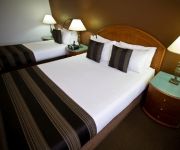
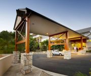
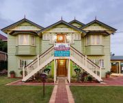
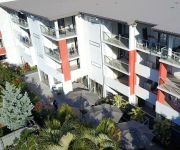
Looking for a place to stay? we compiled a list of available hotels close to the map centre further down the page.
When in this area, you might want to pay a visit to some of the following locations: Brisbane, Sunshine Coast, Carrolls Creek, and . To further explore this place, just scroll down and browse the available info.
Local weather forecast
Todays Local Weather Conditions & Forecast: 22°C / 72 °F
| Morning Temperature | 18°C / 64 °F |
| Evening Temperature | 20°C / 67 °F |
| Night Temperature | 18°C / 65 °F |
| Chance of rainfall | 0% |
| Air Humidity | 61% |
| Air Pressure | 1020 hPa |
| Wind Speed | Gentle Breeze with 6 km/h (4 mph) from North-West |
| Cloud Conditions | Overcast clouds, covering 86% of sky |
| General Conditions | Light rain |
Sunday, 5th of May 2024
24°C (75 °F)
17°C (63 °F)
Light rain, light breeze, broken clouds.
Monday, 6th of May 2024
22°C (71 °F)
16°C (61 °F)
Light rain, light breeze, broken clouds.
Tuesday, 7th of May 2024
20°C (69 °F)
18°C (65 °F)
Moderate rain, gentle breeze, broken clouds.
Hotels and Places to Stay
RENDEZVOUS BRISBANE ON GEORGE
Mercure Clear Mountain Lodge
Murphys Bed and Breakfast
Essence Serviced Apartments
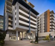
Quest Chermside
Aspley Motor Inn
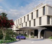
Brook Hotel
Aabon Apartments & Motel
Quest Chermside on Playfield
THE CHERMSIDE APARTMENTS
Videos from this area
These are videos related to the place based on their proximity to this place.
SOLD by Real estate agent in Eatons Hill, Jonathan Wein 0430 485 430 a Smakk Media video
SOLD Eatons Hill property has been Sold at 20 Brigadoon Crescent Eatons Hill. Call Jonathan Wein on 0430 485 430 SPACIOUS, IMMACULATE & MODERN!! Situated in the highly sought after Eatons ...
SOLD BY VICKI HARPER for LJ Hooker Albany Creek PROPERTY & REAL ESTATE AGENTS Smakk Media
SOLD SOLD SOLD SOLD SOLD 21 Alberic Court, Eatons Hill SOLD SOLD SOLD Have you been looking for something special, offering everything you could wish for, well your search may be over.
Vicki Harper has SOLD another Albany Creek property. 0417 771 397 LJ Hooker a Smakk Media video
SOLD 106 Albany Forest Drive Albany Creek house has been SOLD by Vicki Harper. Call today on 0417 771 397 Step inside and discover a comfortable family home within close proximity to the...
Vicki Harper 0417 771 397 has sold this Qld beauty, Brisbane, LJ Hooker video by Smakk
Vicki Harper from LJ Hooker Real Estate Albany Creek. Call Vicki today on 0417 771 397 Eatons Hill real estate 12 Angel Court is now Sold. Mountain views, pool and privacy on 1576 M2 - Offers...
Eatons Hill property SOLD by Jonathan Wein 0430 485 430, a Smakk video production
110 Queen Elizabeth Drive Eatons Hill Marketed by Qld real estate agent Jonathan Wein. Call LJ Hooker Albany Creek today on 0430 485 430 or 32649000 This immaculately presented home offers...
Albany Creek house SOLD by Real estate agent Vicki Harper LJ Hooker
SOLD 15 Flamingo Drive Albany Creek marketed and SOLD by the delightful real estate agent Vicki Harper. call her on 0417 771 397 and make the time to inspect this family home in Albany Creek....
Eatons Hill property and real estate is now SOLD by Marc Gregory 0417 407 437 Smakk Media
151 Saraband Drive, Eatons Hill is for sale by LJ Hooker Albany Creek's Marc Gregory 0417 407 437 - Offers over $599000 You will feel you are on top of the world in this modern day Queenslander....
SOLD by Eatons Hill Real estate agent Jonathan Wein for LJ Hooker Albany Creek
Sold 4 Paringa Close, Eatons Hill Marketed and sold by Jonathan Wein 0430 485 430 Sold Sold DIRECTIONS: http://www.whereis.com/qld/eatons-hill/4-paringa-cl YouTube: http://www.youtube.com/LJH.
Sold by Marc Gregory 0417 407 437 LJ Hooker real estate Albany Creek - Smakk Media video
Sold 54 Tanager St, Albany Creek has been SOLD: This stunning family home offers panoramic views over the South Pine River which gives you the privacy of acreage living with a backdrop to...
Albany Creek Townhouse SOLD by Vicki Harper for LJ Hooker Albany Creek Real Estate
Sold 3 Fresco Street, Albany Creek Marketed and sold by Vicki Harper 0417 771 397 SOLD YouTube: http://www.youtube.com/LJHAlbanyCreekTV Not a cent to spend here, this very appealing and...
Videos provided by Youtube are under the copyright of their owners.
Attractions and noteworthy things
Distances are based on the centre of the city/town and sightseeing location. This list contains brief abstracts about monuments, holiday activities, national parcs, museums, organisations and more from the area as well as interesting facts about the region itself. Where available, you'll find the corresponding homepage. Otherwise the related wikipedia article.
Carseldine railway station
Carseldine is a railway station on the Caboolture Line of Brisbane, Australia. It is part of the QR Citytrain network. The station is in Zone 4 of the TransLink integrated public transport system.
Bald Hills railway station
Bald Hills is a railway station on the Caboolture Line of Brisbane, Australia. It is part of the QR Citytrain network. The station is in a transition precinct between Zone 4 and Zone 5 of the TransLink integrated public transport system.
Strathpine railway station
Strathpine is a railway station on the Caboolture Line of Brisbane, Australia. It is part of the QR Citytrain network. The station is in Zone 5 of the TransLink integrated public transport system.
Bray Park railway station
Bray Park is a railway station on the Caboolture Line of Brisbane, Australia. It is part of the QR Citytrain network. The station is in Zone 5 of the TransLink integrated public transport system.
Carseldine, Queensland
Carseldine is a suburb of Brisbane, Queensland, Australia, located about 16 kilometres north and about a half-hour drive from the Central Business District of Brisbane. It is surrounded by Bald Hills and Bracken Ridge to the north, Aspley to the south, Fitzgibbon to the east and Bridgeman Downs to the west. Carseldine is a mainly residential suburb in the north of Brisbane.
Warner, Queensland
Warner is a suburb north of Brisbane, Queensland, Australia. Its local government area is the Moreton Bay Region 22 kilometres north of the Brisbane central business district. Warner is situated east of Lake Samsonvale and west of the urban localities of Strathpine, Brendale, Bray Park and Lawnton.
St Paul's School, Bald Hills
St Paul's is a co-educational private school conducted under the auspices of the Anglican diocese of Brisbane. In 2010, the school celebrated 50 years since its foundation. The school first opened on 31 January 1960. It is named after St Paul's School in London. St. Paul's School offers an academic and technical education as well as a range of co-curricular activities.
Westfield Strathpine
Westfield Strathpine is a regional shopping centre located in Strathpine, a suburb in Moreton Bay, north of Brisbane. The centre was built and opened in 1983 by The Westfield Group. It is anchored by Big W and Target discount department stores, Woolworths supermarket, Coles supermarket and ALDI Food Store. The centre has a food court anchored by fast food chains such as McDonalds, KFC and Subway (restaurant) .
McDowall, Queensland
McDowall is a northern suburb within the city of Brisbane, the capital city of Queensland, Australia. McDowall is notable for the Raven Street Reserve, which is a 24.3 hectare bushland area surrounded by urban housing and busy roads. It is part of a long stretch of forest and green areas going from the mountains in the west to the mangrove areas on the coast.
Eatons Hill, Queensland
Eatons Hill is a suburb located approximately 20 kilometres north-west of Brisbane, Australia. It is located in Moreton Bay Region. Its postcode is 4037. Eatons Hill generally consists of low-density residential housing with acreage properties in the western portions. Most of the suburb has been developed since the 1980s. New subdivisions are still being built.
Albany Creek, Queensland
Albany Creek is a suburb located approximately 17 kilometres north-west of Brisbane, Australia; about a half hour drive to the central business district.
Bridgeman Downs, Queensland
Bridgeman Downs is a suburb located approximately 12 kilometres north-west of Brisbane CBD. In November 1860 Henry St John Bridgeman bought land bounded by Albany Creek Road, Bridgeman Road and Beams Road. Bridgeman Downs has long been associated with large acreage properties, but these are mostly restricted to the end of Beckett Road and down Bridgeman Road.
Bray Park, Queensland
Bray Park is a suburb north of Brisbane, Queensland, Australia. Its Local Government Area is the Moreton Bay Regional Council. Bray Park is located north of Brisbane. It is named after John Bray, a former Shire councillor. Bray Park is bounded by Four Mile Creek in the south, the Caboolture railway line in the east, Francis Road in the north, and Old North Road in the west. Bray Park is on the Caboolture line of the Citytrain network; see Bray Park railway station, Brisbane.
Brendale, Queensland
Brendale is a suburb north of Brisbane, Queensland, Australia, located immediately south of Strathpine on the South Pine River. Its local government area is the Moreton Bay Region. The origin of the suburb name is from the name given to a horse stud established by William Bowden in the early 1960s. Brendale is mostly an industrial suburb, although several parks exist within it.
Arana Hills, Queensland
Arana Hills is a suburb within Moreton Bay, 12 km north-west of Brisbane, the capital city of Queensland, Australia on the edge of the Bunyaville Forest Reserve. Its local government area is the Moreton Bay Region.
Bunya, Queensland
Bunya is a suburb north-west of Brisbane, the capital city of Queensland, Australia. Its local government area is the Moreton Bay Region. Bunya is home to the Bunyaville Forest Reserve, operated by the Queensland Parks and Wildlife Service. Spotted gum, grey ironbark, narrow-leaved ironbark, white mahogany, tallowwood, forest red gum, grey gum and brush box grow in the open forests.
Ferny Hills, Queensland
Ferny Hills is an outer suburb north-west of Brisbane, Australia, and is located along Samford Road at the edge of the Brisbane Forest Park. Its local government area is the Moreton Bay Region. Ferny Hills is almost entirely a residential suburb. It contains two primary schools, Ferny Hills State School, which opened in 1970 and is among the last Queensland primary schools to be built in the more traditional high-set format, and Patricks Road State School, which opened in 1977.
Everton Hills, Queensland
Everton Hills is a suburb north-west of Brisbane, in Queensland, Australia. The suburb extends northwest from Everton Park; this separation of suburbs is marked by a park called 'Boundary Park'. It is also located at the edge of the Bunyaville Forest Reserve. Everton Hills is a suburb that is a part of Pine Rivers Shire, a council which controls multiple suburbs.
Genesis Christian College
Genesis Christian College is an independent school (P–12) located at Bray Park, Brisbane, Australia. The college was established in 1991 by members of the Reformed Church. It is presently affiliated to the Bray Park Community Church.
Lawnton, Queensland
Lawnton is a suburb north of Brisbane, Queensland, Australia. Its Local Government Area is the Moreton Bay Region. The origin of the suburb name is from an early property owner by the name of Stephen Lawn. The property was acquired by Queensland Rail and was named Lawnton. The Lawnton industrial estate as well as retail and commerce establishments along Gympie Road provide local services and employment. Alluvial gravel and sand mining also occur in Lawnton.
Moreton Bay Region
The Moreton Bay Region is a local government area in South East Queensland, Australia, immediately to the north of Brisbane, the state capital. Established in 2008, it replaced three established local government areas, the City of Redcliffe and the Shires of Pine Rivers and Caboolture.
Pine Rivers State High School
Pine Rivers State High School is an Australian Queensland state secondary school situated north of Brisbane in the suburb of Strathpine.
Albany Creek State High School
Albany Creek State High School is a state secondary school located approximately 16 kilometres north of Brisbane in the suburb of Albany Creek. The school, occupying 15.9 hectares, is situated on the corner of Old Northern Road and Albany Forest Drive. The school is located in the Albany Creek / Albany Forest district of Moreton Bay Region.
McDowall State School
McDowall State School is a state primary school located on the north side of Brisbane, Queensland in the suburb of McDowall. Established in 1975, the McDowall State School caters for students from prep to grade 7 with approximately 850 students in the whole school. McDowall State School is administered by Education Queensland.
Prince of Peace Lutheran College
Established in 1984, Prince of Peace Lutheran College is a co-educational Christian College for students in Kindergarten to Year 12 based on two closely located campuses in Everton Hills, North Brisbane. The Junior Campus on Rogers Parade West, is the home to 500 students in Prep to Year 6. The Kindergarten and Outside Hours School Care facilities are also based on the Junior Campus and run on behalf of the College by Queensland Lutheran Early Childhood Services.


