Touring Molendinar
The district Molendinar of Gold Coast in Gold Coast (Queensland) is a subburb located in Australia about 563 mi north-east of Canberra, the country's capital place.
Need some hints on where to stay? We compiled a list of available hotels close to the map centre further down the page.
Being here already, you might want to pay a visit to some of the following locations: Brisbane, Sunshine Coast, Carrolls Creek, and . To further explore this place, just scroll down and browse the available info.
Local weather forecast
Todays Local Weather Conditions & Forecast: 21°C / 69 °F
| Morning Temperature | 18°C / 65 °F |
| Evening Temperature | 20°C / 68 °F |
| Night Temperature | 19°C / 66 °F |
| Chance of rainfall | 1% |
| Air Humidity | 65% |
| Air Pressure | 1021 hPa |
| Wind Speed | Gentle Breeze with 9 km/h (5 mph) from North-West |
| Cloud Conditions | Overcast clouds, covering 100% of sky |
| General Conditions | Light rain |
Sunday, 5th of May 2024
20°C (68 °F)
17°C (62 °F)
Moderate rain, moderate breeze, scattered clouds.
Monday, 6th of May 2024
21°C (70 °F)
20°C (67 °F)
Light rain, fresh breeze, clear sky.
Tuesday, 7th of May 2024
22°C (71 °F)
18°C (65 °F)
Moderate rain, fresh breeze, broken clouds.
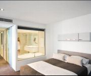
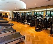
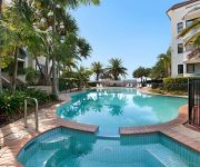
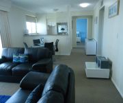
Hotels and Places to Stay
Q1 RESORT & SPA
Palazzo Versace
Sandcastles on the Broadwater
Crest Apartments
Royal Woods Resort
Aqualine Apartments
Oscar on Main Resort
Atrium Resort
Pacific Views Resort
Runaway Bay Motor Inn
Videos from this area
These are videos related to the place based on their proximity to this place.
EP14 Clip04 BIG4 Ashmore Palms Holiday Village H264 480x360
Ashmore Palms Holiday Village, Gold Coast, Australia, as seen on a recent episode of What's Up Downunder on Channel 10 nationally, 4:30pm Saturdays.
30 West King Street Southport 4215 QLD by Jade-Leigh Howcrof...
This renovated home is in a highly sought-after pocket of Southport, there is nothing to do other than move in. Our motivated sellers have clear instructions to sell!The home is fully equipped...
ELFloors Testimonial at Nerang Mall - Karndean LooseLay Country Oak
http://www.EvolvedLuxuryFloors.com.au Inspired by Design. Karndean Country Oak - at Nerang Mall, Gold Coast Evolved Luxury Floors brings together the most innovative luxury loose lay and fully...
110 Minnie Street Southport 4215 QLD by Kristoffer Sonter
Approximately 577m2 land area zoned 'Trades Precinct' and approximately One hundred and seventy five square metres (175m2) of buildingDevelopment and renovation upside and the elevated ...
Apartment 1 Sphere 154 Musgrave Avenue Southport 4215 QLD by...
This rare opportunity, surrounded by landscaped gardens and loads of outdoor al-fresco living, offers a huge one hundred ninety nine square metres of living with a modern open plan design comprisin.
RR Wraith : Sunshine Automotive, 179 Nerang Road - Southport (42...
Property Video shoot of RR Wraith : Sunshine Automotive, 179 Nerang Road - Southport (4215) Queensland by PlatinumHD http://www.platinumhd.tv for.
7/94-100 Pohlman Street - Southport (4215) Queensland by Bra...
Property Video shoot of 7/94-100 Pohlman Street - Southport (4215) Queensland by PlatinumHD http://www.platinumhd.tv for Smart Real Estate.
The Benefits Of Chiropractic Care In Nerang And Gold Coast
http://goldcoastchiropractor.com/the-benefits-of-chiropractic-care-in-nerang-and-gold-coast The Benefits Of Chiropractic Care In Nerang And Gold Coast Chiropractic care goes beyond treating...
Nerang Plumbers - Which Type To Use
http://www.NerangPlumber.com - Ph 07 5534 8322 - Nerang Plumbers: What Type Should I Use? Generally there are two types of Nerang plumbers - construction plumbers and maintenance plumbers.
Worlds Greatest Shave | Kellie | My Centre Nerang ( Gold Coast )
The World's Greatest Shave was done by Kellie who works at the Chemmart (store) within My Centre Nerang (on the Gold Coast). Also featured are various other bold brave people who donated...
Videos provided by Youtube are under the copyright of their owners.
Attractions and noteworthy things
Distances are based on the centre of the city/town and sightseeing location. This list contains brief abstracts about monuments, holiday activities, national parcs, museums, organisations and more from the area as well as interesting facts about the region itself. Where available, you'll find the corresponding homepage. Otherwise the related wikipedia article.
Carrara Stadium
Carrara Stadium (known commercially as Metricon Stadium) is a sporting venue on the Gold Coast in Queensland, Australia, located in the suburb of Carrara. It received substantial redevelopment work prior to the entry of the Brisbane Bears to the VFL/AFL in 1987, but since the Bears relocated to the Gabba in 1993, it has been used for other sports including rugby league, rugby union and even baseball. The stadium will host the opening and closing ceremonies of the 2018 Commonwealth Games.
Southport, Queensland
Southport is a suburb and a business district near the midpoint of the Gold Coast, Australia and has one of the city's largest communities. At the 2011 Census, Southport had a population of 28,315. Originally known as Nerang Creek Heads it was named Southport because it was the southernmost port of the colony of Queensland. Southport is recognised as the central business district of the Gold Coast City. It has the city's largest area of office space at 103,818 m².
Division of Moncrieff
The Division of Moncrieff is an Australian Electoral Division in Queensland. The division was created in 1984 and is named for Gladys Moncrieff, an Australian singer who resided in the area. Moncrieff is located in south east Queensland, and is based on the central portion of the Gold Coast, including Surfers Paradise. It has always been a very safe Liberal seat.
Harbour Town
Harbour Town refers to the shopping centre concept to collocate factory outlets in one centre. There are presently four such centres operating in Australia. They are especially popular with tourists, although many locals also shop there. As at September 2009, there were four locations: Biggera Waters, on Queensland's Gold Coast; Water Front City, Docklands in Melbourne, Victoria; Adelaide Airport, in South Australia and at West Perth, in Western Australia.
Nerang railway station
Nerang railway station is a railway station on the Gold Coast Line of South East Queensland, Australia. It is part of the Queensland Rail City network.
Helensvale, Queensland
Helensvale is a suburb on the Gold Coast in Queensland, Australia and was named after Helena White. At the 2006 Census, Helensvale had a population of 14,767. In the next five years, Helensvale is expected to develop further as a transport hub, with the current linking of the Gold Coast Highway and Pacific Motorway, the two most important road routes on the Gold Coast with Helensvale Railway Station at Westfield Helensvale.
Ashmore, Queensland
Ashmore is a suburb on the Gold Coast in Queensland, Australia. At the 2006 Census, Ashmore had a population of 11,514. The area's name derives from a locality or family property in England. Also a local thoroughfare with residents travelling from Benowa Road to Nerang Road, the suburb was officially perpetuated in 1976 when a housing estate was developed in the area called Ashmore Village.
Benowa, Queensland
Benowa is an affluent Gold Coast suburb west of Surfers Paradise. At the 2006 Census, Benowa had a population of 7,269. The name was originally derived from the aboriginal "Boonow", meaning red bloodwood. This word was later corrupted by European settlers in search of sugar cane growing on the shores of the Nerang River. The name was perpetualised in 1870 when a pioneer named Robert Muir used the name for his sugar plantation on the northern bank of the river.
Molendinar, Queensland
Molendinar also known as Silver Bridle is a small, mainly industrial suburb on the Gold Coast in Queensland, Australia. At the 2006 Census, Molendinar had a population of 5,606. On Monday 2 April 2012 an official dedication of the Lynne Richardson Community Centre was held by The Gold Coast City Council The area was a Queensland State Government project supported by the Gold Coast City, with initial development beginning circa 1969.
Trinity Lutheran College (Queensland)
Trinity Lutheran College is a primary, middle, and high school in Ashmore, Gold Coast, Australia. In January 1981, Trinity Lutheran Primary School was founded and The Ashmore Road Campus was founded in 1987.
Gold Coast University Hospital
Gold Coast University Hospital is a major health facility for the Gold Coast, Australia, due for completion in 2013. It involves building a new tertiary hospital on a greenfields site adjacent to the Griffith University Gold Coast campus at a cost of $1.55 billion. Construction commenced on Tuesday, 16 December 2008 when Queensland Premier, Anna Bligh turned the first sod. Bovis Lend Lease are building the hospital.
Gold Coast Regional Botanic Gardens
The Gold Coast Regional Botanic Gardens, formerly known as the Rosser Park Regional Botanic Gardens, and before that simply Rosser Park, are located on Ashmore Road, Benowa, Gold Coast, Australia. The development of the master plan for the botanic gardens involved more than 18 months' investigation, site analysis and community consultation. The plan was adopted by Gold Coast City in 2002 and the first plantings took place in 2003.
Harbour Town bus station
The Harbour Town Bus Station, at Biggera Waters, is serviced by TransLink bus routes. It is part of the Harbour Town Shopping Centre. It is in Zone 12 of the TransLink integrated public transport system.
Nerang State High School
Nerang State High School (NSHS) is a state high school located on the Gold Coast of Queensland, Australia.
William Duncan State School
William Duncan State School (WDSS) is a state school located Gold Coast, Queensland, Australia. The school was opened in 1987 with just 186 students enrolled, which has now grown to approximately 800 in the present day.
Queensland Academy for Health Sciences
The Queensland Academies - Health Sciences Campus (QAHS) is a State Government selective high school located in Queensland, Australia. QAHS offers the International Baccalaureate Diploma Program to students in years 11 and 12, and is also open to year 10 students, who study a shortened version of the IB Middle Years Programme.
Biggera Creek Dam
The Biggera Creek Flood Mitigation Dam is owned by Gold Coast City Council. The height of the dam wall is 15 m.
Shire of Albert
The Shire of Albert was a local government area in Queensland, located south of the capital, Brisbane, and taking in areas to the north and west of the Gold Coast. It was named after the Prince Consort of the United Kingdom, and husband of Queen Victoria, Prince Albert. When created in 1948, it was primarily a rural area, but its growth started in earnest in the late 1960s with the development of Logan on Brisbane's southern frontier.
Surfers Paradise International Raceway
Surfers Paradise International Raceway was a motor racing complex at Gold Coast, Queensland, Australia. The circuit was designed and built by Keith Williams, a motor racing enthusiast. It was located opposite the Surfers Paradise Ski Gardens at Carrara. The complex included a dragstrip along the main straight, with a very fast right-hander under a Dunlop Bridge leading to a tight corner that turned the track back to a medium-length straight.
Southport State High School
Southport State High School is a school situated on the Gold Coast, Queensland in Australia. It was the first public high school on the Gold Coast to be opened, originally established in 1916 and moved to its current position in 1954. It is known for raising exceptional students, including past students such as Clive Palmer (Australia's 5th richest man and Queensland's wealthiest), Vice Admiral Russ Crane (Chief of the Royal Australian Navy) and many others.
Carrara Indoor Stadium
Carrara Indoor Stadium is a multi-purpose arena located at Carrara on Queenslands Gold Coast and can accommodate 1,600 fans, with additional seating provided if required which can push total capacity for events such as basketball up to 2,962. The stadium stands next door to the 25,000 seat Metricon Stadium and forms part of the Carrara Sports Complex.
Sir Bruce Small Park
Sir Bruce Small Park is a sporting facility located in Benowa, a suburb of the Gold Coast, Queensland in Australia. Its baseball facilities are home to the Surfers Paradise Baseball Club, current premiers of the Greater Brisbane League. It has hosted many high profile Australian baseball events such as the Masters Games and University Games. The adjacent oval is home to the Surfers Paradise-Benowa Cricket Club and Surfers Paradise Australian Football Club, which plays in the QAFL.
Emmanuel College (Queensland)
Emmanuel College is an independent, co-educational, multi-denominational Christian school located in the suburb of Carrara on the Gold Coast, Queensland, Australia. The College caters for students from Preparatory through to Year 12. Emmanuel College is a privately owned and operated educational institute run by the Emmanuel Ministry of Education (Pty) Ltd.
Pacific Pines, Queensland
Pacific Pines is a suburb on the Gold Coast in Queensland, Australia. It is located between the Pacific Motorway (M1) and the NNE side of the Nerang State Forest. At the 2006 Census, Pacific Pines had a population of 5,967. Currently Pacific Pines is selling its last available land lots.
Aquinas College, Southport
Aquinas College is a Roman Catholic, coeducational, day school, located in Southport, Queensland, Australia.


