Explore Sun Valley
The district Sun Valley of Gladstone in Gladstone (Queensland) is located in Australia about 798 mi north of Canberra, the country's capital.
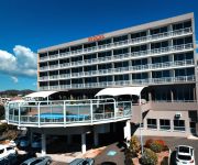
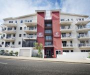
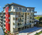
If you need a place to sleep, we compiled a list of available hotels close to the map centre further down the page.
Depending on your travel schedule, you might want to pay a visit to some of the following locations: Sunshine Coast, Brisbane, Bowen, and . To further explore this place, just scroll down and browse the available info.
Local weather forecast
Todays Local Weather Conditions & Forecast: 23°C / 73 °F
| Morning Temperature | 20°C / 68 °F |
| Evening Temperature | 22°C / 71 °F |
| Night Temperature | 19°C / 67 °F |
| Chance of rainfall | 3% |
| Air Humidity | 75% |
| Air Pressure | 1017 hPa |
| Wind Speed | Gentle Breeze with 8 km/h (5 mph) from North-West |
| Cloud Conditions | Broken clouds, covering 80% of sky |
| General Conditions | Light rain |
Monday, 6th of May 2024
25°C (78 °F)
19°C (66 °F)
Light rain, moderate breeze, clear sky.
Tuesday, 7th of May 2024
24°C (75 °F)
19°C (66 °F)
Sky is clear, moderate breeze, clear sky.
Wednesday, 8th of May 2024
23°C (74 °F)
19°C (67 °F)
Light rain, fresh breeze, clear sky.
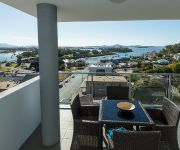
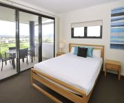
Hotels and Places to Stay
Heron Island Resort
METRO APARTMENTS GLADSTONE
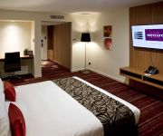
Mercure Gladstone
Harbour Sails Motor Inn
Curtis Central Apartments
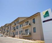
Quest Gladstone Serviced Apts
Apartments G60 by Metro Hotels
RYDGES GLADSTONE
Gladstone City Central Apartment Hotel
Gladstone Central Plaza
Videos from this area
These are videos related to the place based on their proximity to this place.
Gladstone Region Vision 2035
Several industries have partnered together to find out what residents would like the region to look like in twenty years' time. #Vision2035 www.vision2035.com.au.
Solo - First time from start up to shut down - Nathan - Gladstone
Nice early morning solo on RWY 10 @ Gladstone- First time start up/shut down - Sony HDR AS15 video camera on bar style mount - flight school: Pro Sky Maryborough - CFI Russel Middleton.
Spearfishing Gladstone Teaser
Spearfishing Gladstone, by Lachlan Williams, just a small taste of what I love doing.
Gladstone Harbour Festival Parade '08 (Part 1 of 2)
Gladstone Harbour Festival Parade 16th March 2008. Part 1 of 2.
Port City Power v Rockhampton Cyclones Highlights 2011
Jess Bibby is in fine form with a 45 point haul and leads the defensive lockdown of Rocky star Nicole Romeo, holding her to 10 points on 16 percent shooting as 8 WNBL Players grace the court...
SOLD by ALICIA WILLIAMS Gladstone Real Estate RE/MAX Gold Qld Real Estate Agents
SOLD SOLD SOLD 11 Coolongolook Close, Gladstone Marketed by Alicia Williams on 0432 686 751 SOLD SOLD SOLD OUR WEBSITE: http://www.remaxgladstone.com.au YOUTUBE: ...
Christmas Lights Gladstone 2014 Part 1 - Preview
Christmas means something different to every person and family, but everyone appreciates a simple kind gesture and this year again, a just quick drive- by taking video's for a bit of history...
Gladstone Calligraffiti
Wall art for the opening of Creative Gladstone, by Wendy T. Calligraphy www.rawdesign.net.au.
South Gladstone 4 Bedroom Home With Ocean Views, Saltwater
Gladstone 4 Bedroom Home With Ocean Views, Saltwater Pool and Covered Entertaining Area this quietly positioned home is in a truly superb location. THIS IS THE LIFE...ocean views, sparkling...
Videos provided by Youtube are under the copyright of their owners.
Attractions and noteworthy things
Distances are based on the centre of the city/town and sightseeing location. This list contains brief abstracts about monuments, holiday activities, national parcs, museums, organisations and more from the area as well as interesting facts about the region itself. Where available, you'll find the corresponding homepage. Otherwise the related wikipedia article.
Wild Cattle Island National Park
Wild Cattle Island is a national park in Queensland, Australia, 424 km northwest of Brisbane.
Gladstone, Queensland
Gladstone is an Australian city approximately 550 kilometres by road north of Brisbane and 100 kilometres south-east of Rockhampton. Situated between the Calliope and Boyne Rivers, Gladstone is home to Queensland's largest multi-commodity port. The city's population at the 2006 Census was 28,808, of whom 3.7 percent are of Aboriginal and Torres Strait Islander origin. The City of Gladstone contains a land area of 128 square kilometres.
Calliope, Queensland
Calliope is a town located in Central Queensland, Australia. It is located near the 'cross-roads' of the Bruce Highway and the Dawson Highway, 20 kilometres SSW of the port city of Gladstone. At the 2006 census, Calliope had a population of 1,550. The town is reputedly named after the ship Calliope, which brought the Governor of New South Wales, Sir Charles Augustus FitzRoy to Port Curtis in 1854.
Calliope River
The Calliope River is located in Central Queensland, Australia. The river rises in the Calliope Range inland from the industrial port city of Gladstone, flows past the town of Calliope, before emptying into the Pacific Ocean just north of Gladstone. River length is approximately 100 kilometres, with a catchment area of approximately 2230 square kilometres. Oakey, Paddock and Larcom Creeks are the main tributaries of the river. The major industry in the river area is the raising of beef cattle.
Tannum Sands, Queensland
Tannum Sands is a coastal town on the Central East Coast of Queensland, Australia. At the 2006 census, Tannum Sands had a population of 4,139. The population of Tannum Sands and neighbouring twin town Boyne Island is approaching 10,000. The two localities are separated only by the Boyne River.
Chanel College (Gladstone)
Chanel College is a Catholic co-educational college in Gladstone, Queensland, Australia. Founded in 1966 by the Marist Brothers, the school was originally located at Star of the Sea Catholic Primary School, but it moved to share the grounds of 11 Paterson Street with Stella Maris College. The girls were educated at Stella Maris College and the boys, at Chanel. It wasn’t until a later date, around 1976, that Chanel College became a co-educational school.
Zinc 927
Zinc 927 is a radio station serving Gladstone, Queensland, owned by Prime Media Group Limited. The station broadcasts on 927 kHz in Gladstone, 666 kHz in Biloela and 1584 kHz in Rockhampton.
Shire of Calliope
Shire of Calliope was a local government area in the Capricornia region of Queensland, Australia. It was centred on the town of Calliope . In 2008 it was amalgamated with the City of Gladstone and the Miriam Vale Shire Council to form the Gladstone Regional Council. Other urban areas in the Shire included Tannum Sands, Boyne Island, and Benaraby, as well as the rural townships of Mount Larcom, Ambrose, Raglan, Yarwun, and The Boyne Valley.
Boyne Island, Queensland
Boyne Island is a town in Queensland, Australia, 25 km south of Gladstone. It is located on the west bank of the Boyne River and is made an island by the adjoining South Trees Inlet. It is a twin town with Tannum Sands located directly across the river. At the 2006 census, Boyne Island has a population of 3,687. The town was named for the Boyne River, which was named by John Oxley in 1823.
City of Gladstone
City of Gladstone is a local government area in central Queensland, Australia. It covers the urban locality of Gladstone and parts of the surrounding area. Being a port city, its local commerce is primarily industrial-based and include large-scale industrial plants include alumina refineries, aluminium smelting, heavy chemicals and shale oil.
Port of Gladstone
The Port of Gladstone is Queensland's largest multi-commodity port and the fifth largest multi-commodity port in Australia. It is the world's fourth largest coal exporting terminal. It forms an integral part of the City of Gladstone in Central Queensland and is located about 525 km north of Brisbane at Latitude of 23°49.61’S, Longitude 151°34.6’E. It is owned and managed by the Gladstone Ports Corporation, which is a statutory corporate body of the Government of Queensland.
Queensland Alumina Limited
Queensland Alumina Limited is one of the largest alumina refineries by alumina production capacity in the world, located in Gladstone, Australia. Operating since 1967, the refinery has a capacity to produce 3.95 million tonnes of alumina a year. QAL is a consortium of international aluminium producers and is currently owned by Rusal (20%), and Rio Tinto Alcan (80%). Rusal purchased a 20% stake in QAL in April 2005.
Gladstone Region
Gladstone Regional Council is a local government area in Queensland, Australia. It came into being on 15 March 2008 as a result of the report of the Local Government Reform Commission released in July 2007. The legal standing of the council is sourced from the Local Government Reform Act 2007 (Qld). The new Council, located in Central Queensland, contains the entire area of three former local government areas; City of Gladstone; Shire of Calliope; and Shire of Miriam Vale.
Boyne Island aluminium smelter
The Boyne Island Aluminium Smelter is located on Boyne Island, Queensland, Australia, approximately 20 km south of the port of Gladstone. The smelter has a production capacity of 545,000 tonnes of aluminium per year The operating company Boyne Smelters Ltd is 59.4% owned by Rio Tinto Alcan with the balance held by a consortium of Japanese participants including Sumitomo, Marubeni and Mitsubishi .
4RGL
4RGL, Rhema FM 91.9 is a radio station in Gladstone Queensland, Australia, which is situated about 600 km north of the capital Brisbane and just 100 km south of the Tropic of Capricorn. The city has a population of almost 30,000 and more than 50,000 in the district.
Boyne River (Queensland)
Boyne River is a river in Queensland, Australia. It flows between the twin towns of Boyne Island and Tannum Sands. The river was named by John Oxley as it reminded him of the River Boyne in Ireland. A bridge was built to cross the river joining the two towns in 1980. The river is damed by the Awoonga Dam which is the major water source for the Gladstone Region. The Boyne River is considered by Queensland authorities to be the southern habitat extent of the saltwater crocodile.
Benaraby, Queensland
Benaraby is a town 20 kilometres south of Gladstone in Central Queensland, Australia. It is on the Boyne River and is the access point to Lake Awoonga. The population of Benaraby at the 2006 census was 594. Benaraby was primarily a rural locality, but in recent times has become more of a residential suburb for the workers in Gladstone, Boyne Island and Tannum Sands. Currently, Benaraby contains 2 petrol stations, a primary school, a community hall, a nursery and three accommodation providers.
Tannum Sands State High School
"Tannum Sands State High School" ("TSSHS" or often "Tannum High") is a public high school located in Tannum Sands, Queensland, Australia. Each grade has an average of about 213 students. It is the first and only secondary school established in the Tannum Sands area. The school offers an extensive curriculum for its students, and receives approximately 95% of the students living in the Tannum Sands catchment area for Year 8 each year.
Sea Hill Light
Sea Hill Light, also known as Sea Hill Point Light{{#invoke:Footnotes|sfn}} Little Sea Hill Light{{#invoke:Footnotes|sfn}}, was a lighthouse on the northwest point of Curtis Island, Queensland, Australia. Its purpose was to mark the east side of the entrance to Keppel Bay,{{#invoke:Footnotes|sfn}} on passage to Fitzroy River and Port Alma.
Gladstone railway station, Queensland
Gladstone is a railway station on the North Coast railway line, Queensland. It is serviced by several Queensland Rail passenger trains, including the Tilt Train. It is a major hub for Central Queensland rail services, and is a major freight depot.


