Touring Eli Waters
The district Eli Waters of Urraween in Fraser Coast (Queensland) is a subburb located in Australia about 725 mi north of Canberra, the country's capital place.
Need some hints on where to stay? We compiled a list of available hotels close to the map centre further down the page.
Being here already, you might want to pay a visit to some of the following locations: Sunshine Coast, Brisbane, Carrolls Creek, and . To further explore this place, just scroll down and browse the available info.
Local weather forecast
Todays Local Weather Conditions & Forecast: 22°C / 71 °F
| Morning Temperature | 21°C / 70 °F |
| Evening Temperature | 22°C / 72 °F |
| Night Temperature | 22°C / 71 °F |
| Chance of rainfall | 0% |
| Air Humidity | 76% |
| Air Pressure | 1020 hPa |
| Wind Speed | Gentle Breeze with 6 km/h (4 mph) from West |
| Cloud Conditions | Few clouds, covering 17% of sky |
| General Conditions | Few clouds |
Monday, 13th of May 2024
22°C (72 °F)
21°C (70 °F)
Sky is clear, gentle breeze, clear sky.
Tuesday, 14th of May 2024
22°C (71 °F)
22°C (71 °F)
Sky is clear, moderate breeze, clear sky.
Wednesday, 15th of May 2024
22°C (71 °F)
23°C (73 °F)
Light rain, fresh breeze, broken clouds.
Hotels and Places to Stay
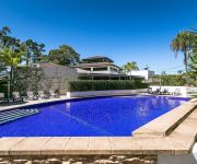
Grand Mercure Allegra Hervey Bay
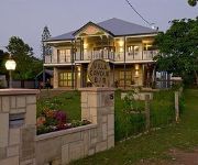
Villa Cavour Bed & Breakfast
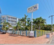
White Crest Luxury Apartments
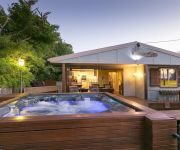
The Beachside Cottages
Alexander Lakeside Bed & Breakfast
Hervey Bay Motel
Five 3 Five The Beachside Barracks
Emeraldene Inn & Eco-Lodge
Econo Lodge Fraser Gateway Hervey Bay
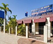
Main Street Motel
Videos from this area
These are videos related to the place based on their proximity to this place.
GIFTIGE JELLYFISHES | Work and Travel #28
Das Abenteur läuft. Immoment bin ich unterwegs mit einem Work and Travel Visum ! Alles passt in meinen Backpacker Rucksack und ich Reise bis ich irgendwo bleiben will. Mein selbstgebautes...
Sim City episode 1- It's Still Monet Plateau
Thanks for watching! Click Like and Subscribe! http://www.youtube.com/playlist?list=PLBx9rklIaEAI3EMxhenbGyxvX7qc_XWZr - Minecraft Let's Play Playlist http://www.youtube.com/playlist?list=PLBx9r.
Sim City episode 2- Australian internet sucks
Thanks for watching! Click Like and Subscribe! http://www.youtube.com/playlist?list=PLBx9rklIaEAI3EMxhenbGyxvX7qc_XWZr - Minecraft Let's Play Playlist http://www.youtube.com/playlist?list=PLBx9r.
Hervey Bay Humpbacks Swim Meet Feb 2013 (9 of 11)
Hervey Bay Humpbacks Swimming Carnival Video (9 of 11)___ No_9 100 Breaststroke Event 9 Heat 6. Swimmers: Lane 1. Nil Lane 2 Rebecca Beardmore-Rum City Lane 3. Meegan ...
Hervey Bay Humpbacks Swim Meet Feb 2013 (3 of 11)
Hervey Bay Humpbacks Swimming Carnival Video (3 of 11)___ No_3 200 Backstroke Event 7 Heat 3. Swimmers: Lane1. (closest) Rod Porteous-Gladstone Lane 2. Bob Morse-Noosa Lane 3.
Measuring Distance and Area Using Fraser Coast Regional Council's Online Mapping
This video demonstrates how to measure distance and area using Fraser Coast Regional Council's online mapping system. The mapping system is available to the general public and showcases a ...
AC III TOKW DLC | The Infamy | Let's Play Ep.5: Very Strong Tea
Derp1 here, episode 5 is finally here! I will have new episodes here soon. Keep checking back regularly, and I'm working on the quality of these to make them better for you guys...girls (and...
Dennis Fire Engine Extra Footage
Extra footage added to the previous video. 1932 Dennis 250 Fire Engine fully restored.
Hervey Bay Marketing Services
Hervey Bay Marketing Services Technology is rapidly changing and so our behaviours are evolving with it. Traditional media is losing its effectiveness. Thus Beautiful Web Designs has been...
Videos provided by Youtube are under the copyright of their owners.
Attractions and noteworthy things
Distances are based on the centre of the city/town and sightseeing location. This list contains brief abstracts about monuments, holiday activities, national parcs, museums, organisations and more from the area as well as interesting facts about the region itself. Where available, you'll find the corresponding homepage. Otherwise the related wikipedia article.
Hervey Bay
Hervey Bay is a city in Queensland, Australia. The city is situated approximately 290 kilometres or 4 hours north of the state capital, Brisbane, and lies on the coast of a natural bay between the Queensland mainland and nearby Fraser Island. The local economy relies on tourism, for which whale watching, Fraser Island and Lady Elliot Island and Hervey Bay's calm beaches are the major drawcards. Hervey Bay is an area of high population growth.
River Heads, Queensland
River Heads is a town in Queensland, Australia, 18 km south of the city of Hervey Bay. The town is built on a narrow peninsula surrounded by the Great Sandy Strait (to the east), the mouth of the Mary River (south) and the mouth of the Susan River (a tributary of the Mary) to the west. At the 2006 census, River Heads had a population of 931. Vehicular ferries linking the mainland with Wanggoolba Creek and Kingfisher Bay Resort on Fraser Island depart from River Heads.
Fraser Coast Region
The Fraser Coast Region is a local government area in the Wide Bay-Burnett region of Queensland, Australia, about 250 kilometres north of Brisbane, the state capital. It is centred on the twin cities of Hervey Bay and Maryborough, and also contains Fraser Island. It was created in 2008 from a merger of the Cities of Maryborough and Hervey Bay and the Shires of Woocoo and most of Tiaro. The Regional Council, which governs the Region, has an estimated operating budget of A$110 million.
Torquay, Queensland
Torquay is a suburb in Hervey Bay, Queensland located 294 kilometres north of Brisbane. Torquay is one of five beachside suburbs in Hervey Bay that is made up of primarily residential homes with some tourist accommodation in apartment buildings.
Susan River (Queensland)
The Susan River is a short river that flows in an easterly direction, south of Hervey Bay in Queensland. It is a tributary of the Mary River, joining the Mary River at River Heads in the Great Sandy Strait. The Susan River bridge built for the road that links Maryborough and Hervey Bay, was built in 1977 and carries more than 10,000 vehicles each day. It remained unnamed until 2009. In 2007, an unusual angler fish was found by a local fisherman.
Urangan Pier
Urangan Pier is a historic pier in Urangan, Hervey Bay, Queensland, Australia. It is a former deep-water, cargo-handling facility originally built to facilitate the export of sugar, timber and coal. The pier, served by the extension of the railway line from Pialba, was used for the transfer of cargo between rail and ships. It was built between 1913 and 1917, originally to a length of 1107 metres. The pier was closed in 1985, and 239 metres of it was demolished.
Colton railway station
Colton railway station is a closed railway station on the North Coast railway line in Queensland. It was the junction for the (now closed) Urangan railway line that extended from Colton to Takura, Stockyard Creek, Walligan, Nikenbah, Urraween, Kawungan, Pialba, Scarness, Torquay and finally Urangan and the Urangan Pier in Hervey Bay. Much of the Urangan line has now been removed, as has Colton station itself.
Hervey Bay railway line
Hervey Bay railway line, sometimes known as Urangan railway line, is a closed railway line in Queensland, Australia. It was opened in 1896 to Pialba and it was extended to Urangan in 1913. It was extended to the end of the Urangan Pier in 1917, along with the opening of the pier. It was closed in 1993.
Urangan, Queensland
Urangan is a suburb of Hervey Bay in Queensland, Australia. At the 2006 census, Urangan had a population of 8,009.


