Explore Coral Cove
The district Coral Cove of Innes Park in Bundaberg (Queensland) is located in Australia about 746 mi north of Canberra, the country's capital.
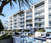
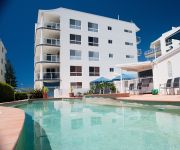
If you need a place to sleep, we compiled a list of available hotels close to the map centre further down the page.
Depending on your travel schedule, you might want to pay a visit to some of the following locations: Sunshine Coast, Brisbane, Carrolls Creek, and . To further explore this place, just scroll down and browse the available info.
Local weather forecast
Todays Local Weather Conditions & Forecast: 21°C / 69 °F
| Morning Temperature | 11°C / 52 °F |
| Evening Temperature | 19°C / 66 °F |
| Night Temperature | 14°C / 57 °F |
| Chance of rainfall | 0% |
| Air Humidity | 49% |
| Air Pressure | 1016 hPa |
| Wind Speed | Gentle Breeze with 9 km/h (5 mph) from North-East |
| Cloud Conditions | Clear sky, covering 0% of sky |
| General Conditions | Sky is clear |
Monday, 20th of May 2024
21°C (70 °F)
14°C (57 °F)
Scattered clouds, light breeze.
Tuesday, 21st of May 2024
22°C (71 °F)
15°C (59 °F)
Sky is clear, gentle breeze, clear sky.
Wednesday, 22nd of May 2024
21°C (70 °F)
15°C (59 °F)
Light rain, gentle breeze, clear sky.
Hotels and Places to Stay
Grand Mercure Apartments Bargara
Bargara Blue Resort
THE POINT RESORT
12th Tee Bed and Breakfast
Pacific Sun Motor Inn Bargara
KELLYS BEACH RESORT
Videos from this area
These are videos related to the place based on their proximity to this place.
30 Selmar Place, Innes Park, Queensland, Australia
PRICE MOVEMENT - GRAND BEACH-SIDE & OCEANSIDE LIFESTYLE HAS JUST GOT TO GO! Yes our sellers need to see their holiday home sold. Time is ticking and other projects beckon, so if you ...
20 Durdins Road, Bargara, Queensland, Australia
NEAT AND TIDY HOME ONLY 300 FOOTSTEPS TO KELLYS BEACH 20 Durdins Road, Bargara is a very neat and established property right in the heart of a tightly held area of Bargara. Tightly held ...
13 Whale Circuit, Bargara, Queensland, Australia
INVESTORS WANT TO ESCAPE THE INVESTMENT ROLLER COASTER If you are looking for a great opportunity in this market to secure a smart modern home surrounded by other quality homes in a ...
4/108 Woongarra Scenic Drive, Bargara, Queensland, Australia
URGENT SALE OF SMART TOWNHOUSE WITH OCEAN VIEWS NEEDED THIS WEEKEND! Coral Isle Villas, the name does say it all! And this great townhouse unit does capture the essence of life at ...
69 Garson Drive, Bargara, Queensland, Australia
SMARTLY DESIGNED BARGARA BEACH-SIDE HOME This astutely designed rendered brick Bargara home offers exceptional value for money. 69 Garson Drive is surrounded by contemporary homes ...
Develop a Customer Service Plan
http://www.horticulture-nextgeneration.com.au - Russell Cummings, Business Coach, outlines the key steps in developing a Customer Service plan for your horticulture business.
3/108 Woongarra Scenic Drive, Bargara
Ultra-convenient location, ocean views from your large balcony, immaculate complex with a sub $300k price tag? Be the envy of your friends securing that Bargara lifestyle with views and walking...
38 Masthead Drive, Bargara, Queensland, Australia
IS IT TIME TO MOVE TO BARGARA BEACH! THIS IS ONE HOME WITH ALL THE TICKS! Situated in at the end of a cul-de-sac Bargara's most sought after estate of Beach Milieu, this spectacular, quality ...
395 Woongarra Scenic Drive, Innes Park North, Queensland, Australia
AFTER AUCTION INSTRUCTIONS ARE TO SELL IMMEDIATELY AND OUR SELLERS INSTRUCT IF NOT SOLD WITHIN 10 DAYS IT HAS GOT TO BE RENTED! There is absolutely no doubt this ...
4 Bounty Court, Bargara, Queensland, Australia
SELLERS HAVE BOUGHT ELSEWHERE - NEED AN URGENT SALE Comfortable living at its finest can be had at 4 Bounty Court, Bargara. The 3 bedroom home has been immaculately looked after ...
Videos provided by Youtube are under the copyright of their owners.
Attractions and noteworthy things
Distances are based on the centre of the city/town and sightseeing location. This list contains brief abstracts about monuments, holiday activities, national parcs, museums, organisations and more from the area as well as interesting facts about the region itself. Where available, you'll find the corresponding homepage. Otherwise the related wikipedia article.
Bundaberg
Bundaberg is a city in Queensland, Australia. It is part of the local government area of the Bundaberg Region and is a major centre within Queensland's broader Wide Bay-Burnett geographical region. The city is on the Burnett River, approximately 385 kilometres north of the state capital, Brisbane and 15 kilometres inland from the coast. The first Europeans in the area, were timbergetters and farmers who arrived in 1867.
Burrum Coast National Park
Burrum Coast is a national park in Queensland, 281 km north of Brisbane.
Shalom Catholic College
Shalom College is a Catholic school in Bundaberg, Queensland. The College was established in 1984 as a merger of the local Christian Brothers College for Boys and the Loyola College for Girls. The school's principal (as of 2012) is Dan McMahon.
Mon Repos Conservation Park
Mon Repos Conservation Park is a turtle rookery located on Queensland's central coast, 14 km east of Bundaberg. Mon Repos hosts the largest concentration of nesting marine turtles on the eastern Australian mainland and supports the most significant nesting population of the endangered loggerhead turtle in the South Pacific Ocean region. Successful breeding here is critical if the loggerhead species is to survive.
Bargara, Queensland
Bargara is a town located on the central coast of Queensland, Australia. The town lies 384 kilometres north of the state capital Brisbane and just 13 kilometres east of Bundaberg. Bargara is considered to be a satellite town of Bundaberg, with only sugar cane fields separating the two centres. Between 1912 and 1948, a railway connected the two centres. At the 2006 census, Bargara had a population of 5,525.
Bundaberg Hummock
The Bundaberg Hummock, also referred to as The Hummock, is an inactive volcano remnant situated in Bundaberg, Queensland, Australia.
Bundaberg Base Hospital
Bundaberg Base Hospital is the public hospital of Bundaberg, Queensland, Australia. A base hospital is a regional centre that takes referrals from outlying hospitals, and concentrates specialised skills. Australia has a universal publicly funded health insurance scheme, so a 'public' hospital is one that is supported by public funds rather than by charging individual patients. There are two private hospitals in the same city. The Hospital has an annual budget of $56 million.
Shire of Burnett
The Shire of Burnett was a local government area located in the Wide Bay-Burnett region of Queensland, Australia. It completely surrounded, but did not include, the regional city of Bundaberg, and covered an area of 2,000.8 square kilometres .
Burnett Heads, Queensland
Burnett Heads is a town at the mouth of the Burnett River in Queensland, Australia, located 16 km north of the regional city of Bundaberg. At the 2006 census, Burnett Heads had a population of 2,419. The town's most notable feature is its historic timber lighthouse, the Old Burnett Heads Light, dating from 1873.
St Luke's Anglican School
St Luke's Anglican School is a kindergarten to year 12 school in Bundaberg, Queensland, Australia. The school was established in 1994, and has approximately 820 students.
City of Bundaberg
The City of Bundaberg was a local government area located in the Wide Bay-Burnett region of Queensland, Australia, encompassing the centre and inner suburbs of the regional city of Bundaberg. The city covered an area of 95.5 square kilometres, and existed as a local government entity in various forms from 1881 until 2008, when it amalgamated with several other councils in the surrounding area to form the Bundaberg Region.
Elliott Heads, Queensland
Elliott Heads is a town in the Bundaberg region of Queensland, Australia. The town is located at the mouth of the Elliott River, 359 kilometres north of the state capital, Brisbane. At the 2006 census, Elliott Heads had a population of 810. Elliott Heads is surrounded by small crop and sugarcane farms and is a popular recreation area, offering both surf and stillwater areas for swimming, fishing, sailboarding and jet skiing.
Innes Park, Queensland
Innes Park is a town in the Bundaberg region of Queensland, Australia. The town is located in the Bundaberg local government area, 360 kilometres north of the state capital, Brisbane. At the 2006 census, Innes Park had a population of 1,659. Facilities at Innes Park include the Innes Park Country Club, a creekside park and a general store. Barolin Rocks is a popular fishing and scuba diving site. The Coral Cove resort and residential development is immediately south of the town.
Bundaberg Region
The Bundaberg Region is a local government area in the Wide Bay-Burnett region of Queensland, Australia, about 360 kilometres north of Brisbane, the state capital. It is centred on the city of Bundaberg, and also contains a significant rural area surrounding the city. It was created in 2008 from a merger of the City of Bundaberg with the Shires of Burnett, Isis and Kolan. The Bundaberg Regional Council, which administers the Region, has an estimated operating budget of A$89 million.
Shire of Gooburrum
The Shire of Gooburrum was a local government area to the north and west of the regional city of Bundaberg, Australia. The shire, administered from Bundaberg itself, covered an area of 1,312.6 square kilometres, and existed as a local government entity from 1886 until 1994, when it amalgamated with Woongarra to form the Shire of Burnett.
Shire of Woongarra
The Shire of Woongarra was a local government area located to the south and east of the regional city of Bundaberg. The shire, administered from Bundaberg itself, covered an area of 722.4 square kilometres, and existed as a local government entity from 1885 until 1994, when it amalgamated with Gooburrum to form the Shire of Burnett.
Bundaberg Christian College
Bundaberg Christian College is a Prep - Year 12 school in Bundaberg, Queensland, Australia. The school was established in 1996 and has 80 staff members and 584 students.
Elliot railway station
Elliot railway station is a closed railway station on the North Coast railway line, Queensland.
Alloway railway station, Queensland
Alloway railway station is a closed railway station on the North Coast railway line, Queensland. The name is derived from the Scottish town of Robert Burns fame.
Clayton railway station, Queensland
Clayton Railway Station is a closed railway station on the North Coast railway line in Queensland. It is named after one of the early settlers in Bundaberg.
Thabeban railway station
Thabeban Railway Station is a closed railway station on the North Coast railway line in Queensland. It is located on the outskirts of Bundaberg.
Bundaberg railway station
Bundaberg railway station is on the North Coast railway line, Queensland. Bundaberg is serviced by several Queensland Rail passenger trains, including the Tilt Train and is approximately four and a half hours north of Brisbane by rail, a vast improvement on days gone by when Bundaberg was an overnight journey away.
County of Cook, Queensland
The County of Cook is a county in Queensland, Australia. Like all counties in Queensland, it is a non-functional administrative unit, that is used mainly for the purpose of registering land titles. The county is centred on the city of Bundaberg, and its name honours Captain James Cook. It was officially named and bounded by the Governor in Council on 7 March 1901 under the Land Act 1897.
Bundaberg Central, Queensland
Bundaberg Central is a suburb of Bundaberg, Queensland, Australia, containing its central business district.
Paddy Island
Paddy Island is an island (latitude 24° 50’ S X longitude 152° 22’E) situated on the Burnett River, northeast of the city of Bundaberg in Queensland, Australia.


