Discover Bundaberg city centre
The district Bundaberg city centre of in Bundaberg (Queensland) is a district in Australia about 745 mi north of Canberra, the country's capital city.
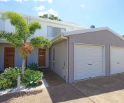
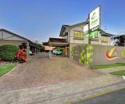
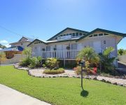
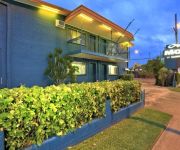
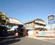
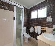
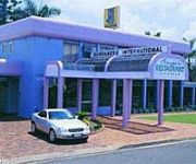
Looking for a place to stay? we compiled a list of available hotels close to the map centre further down the page.
When in this area, you might want to pay a visit to some of the following locations: Sunshine Coast, Brisbane, Carrolls Creek, and . To further explore this place, just scroll down and browse the available info.
Local weather forecast
Todays Local Weather Conditions & Forecast: 24°C / 76 °F
| Morning Temperature | 17°C / 63 °F |
| Evening Temperature | 21°C / 70 °F |
| Night Temperature | 19°C / 67 °F |
| Chance of rainfall | 0% |
| Air Humidity | 62% |
| Air Pressure | 1022 hPa |
| Wind Speed | Gentle Breeze with 7 km/h (4 mph) from West |
| Cloud Conditions | Scattered clouds, covering 40% of sky |
| General Conditions | Scattered clouds |
Sunday, 12th of May 2024
25°C (76 °F)
19°C (66 °F)
Light rain, light breeze, scattered clouds.
Monday, 13th of May 2024
25°C (78 °F)
20°C (68 °F)
Sky is clear, light breeze, clear sky.
Tuesday, 14th of May 2024
23°C (74 °F)
20°C (68 °F)
Sky is clear, gentle breeze, clear sky.
Hotels and Places to Stay
Alexandra Apartments
BEST WESTERN BOULEVARD LODGE
Chalet Motor Inn
Alexandra Park Motor Inn
Alexandra Lodge
Oscar Motel
BEST WESTERN BUNDABERG CITY
ALEXANDRAS ON TAKALVAN
Country Comfort Bundaberg
MAS Country Bert Hinkler
Videos from this area
These are videos related to the place based on their proximity to this place.
RYBY BEZ WODY? - BUNDABERG [1/2] [07-08.02.2015]
Pierwsza część z naszej najdalszej jak do tej pory wyprawy na północ - wzdłuż wschodniego wybrzeża. Jechaliśmy do Bundaberg - miejsca słynącego z wykluwających się tutaj żółwi...
Catamaran Trip - East Coast Australia
http://www.traveltelling.net/life-changing-sailing-trip/ - A pure adventure: Sailing along Australia's East Coast on a catamaran.
Indulge Bundaberg Exceptional Five Star Review by A G
http://www.BundabergDirectory.com.au https://www.facebook.com/Bundaberg.Local.Directory http://indulgecafe.com.au/ 07 4154 2344 Indulge Bundaberg reviews By far the best breakfast, lunch,...
Alowishus Delicious Bundaberg Terrific Five Star Review by Various
http://www.BundabergDirectory.com.au https://www.facebook.com/Bundaberg.Local.Directory http://www.alowishus.com.au/ (07) 4154 2233 Alowishus Delicious Bundaberg reviews Excellent Rating ...
Sabrosa Steakhouse Bundaberg Superb 5 Star Review by Matt G
http://www.BundabergDirectory.com.au https://www.facebook.com/Bundaberg.Local.Directory 07 4151 3666 Sabrosa Steakhouse Bundaberg reviews Food was excellent! The steak was succulent and ...
1942 Floods - Bundaberg
The 1942 floods in Bundaberg were devastating for residents and farmers alike. They were also the first floods photographed by hundreds of residents. These are some of the images.
Spinnaker Restaurant & Bar Bundaberg Incredible Five Star Review by Ian F
http://www.BundabergDirectory.com.au https://www.facebook.com/Bundaberg.Local.Directory 07 4151 1634 Spinnaker Restaurant & Bar Bundaberg 18/6/14 Excellent food, service and position on...
WYLĘG ŻÓŁWI I ATAK JASZCZURKI - BUNDABERG [2/2] [07-08.02.2015]
To już druga część naszej wyprawy do Bundaberg - na około 350km na północ od Brisbane. W tym odcinku skupimy się przede wszystkim na wylęgu żółwi, choć nie zabraknie również...
Bundaberg Humpback Family Whaling Wall
In 1990 marine artist Wyland was invited to Bundaberg to paint one of his famous 'whaling walls'. 'Bundaberg Humpback Family' was completed in September 1990. It is wall #23 of 100 around the...
The Place Hairdressing & Makeup Bundaberg Outstanding Five Star Review by Ka
http://www.BundabergDirectory.com.au https://www.facebook.com/Bundaberg.Local.Directory http://www.theplacehairdressing.com.au/ 07 4152 1800 The Place Hairdressing & Makeup Bundaberg ...
Videos provided by Youtube are under the copyright of their owners.
Attractions and noteworthy things
Distances are based on the centre of the city/town and sightseeing location. This list contains brief abstracts about monuments, holiday activities, national parcs, museums, organisations and more from the area as well as interesting facts about the region itself. Where available, you'll find the corresponding homepage. Otherwise the related wikipedia article.
Bundaberg
Bundaberg is a city in Queensland, Australia. It is part of the local government area of the Bundaberg Region and is a major centre within Queensland's broader Wide Bay-Burnett geographical region. The city is on the Burnett River, approximately 385 kilometres north of the state capital, Brisbane and 15 kilometres inland from the coast. The first Europeans in the area, were timbergetters and farmers who arrived in 1867.
Shalom Catholic College
Shalom College is a Catholic school in Bundaberg, Queensland. The College was established in 1984 as a merger of the local Christian Brothers College for Boys and the Loyola College for Girls. The school's principal (as of 2012) is Dan McMahon.
Browne Park
Browne Park is a rectangular football stadium located in the Rockhampton suburb of Wandal, Queensland, Australia. The stadium has been the home of rugby league football in Central Queensland since the 1980s and today also hosts rugby union and soccer matches. It hosted a match of the 2008 Rugby League World Cup.
Mon Repos Conservation Park
Mon Repos Conservation Park is a turtle rookery located on Queensland's central coast, 14 km east of Bundaberg. Mon Repos hosts the largest concentration of nesting marine turtles on the eastern Australian mainland and supports the most significant nesting population of the endangered loggerhead turtle in the South Pacific Ocean region. Successful breeding here is critical if the loggerhead species is to survive.
Bargara, Queensland
Bargara is a town located on the central coast of Queensland, Australia. The town lies 384 kilometres north of the state capital Brisbane and just 13 kilometres east of Bundaberg. Bargara is considered to be a satellite town of Bundaberg, with only sugar cane fields separating the two centres. Between 1912 and 1948, a railway connected the two centres. At the 2006 census, Bargara had a population of 5,525.
Bundaberg Hummock
The Bundaberg Hummock, also referred to as The Hummock, is an inactive volcano remnant situated in Bundaberg, Queensland, Australia.
Bundaberg Base Hospital
Bundaberg Base Hospital is the public hospital of Bundaberg, Queensland, Australia. A base hospital is a regional centre that takes referrals from outlying hospitals, and concentrates specialised skills. Australia has a universal publicly funded health insurance scheme, so a 'public' hospital is one that is supported by public funds rather than by charging individual patients. There are two private hospitals in the same city. The Hospital has an annual budget of $56 million.
Shire of Burnett
The Shire of Burnett was a local government area located in the Wide Bay-Burnett region of Queensland, Australia. It completely surrounded, but did not include, the regional city of Bundaberg, and covered an area of 2,000.8 square kilometres .
Burnett Heads, Queensland
Burnett Heads is a town at the mouth of the Burnett River in Queensland, Australia, located 16 km north of the regional city of Bundaberg. At the 2006 census, Burnett Heads had a population of 2,419. The town's most notable feature is its historic timber lighthouse, the Old Burnett Heads Light, dating from 1873.
St Luke's Anglican School
St Luke's Anglican School is a kindergarten to year 12 school in Bundaberg, Queensland, Australia. The school was established in 1994, and has approximately 820 students.
City of Bundaberg
The City of Bundaberg was a local government area located in the Wide Bay-Burnett region of Queensland, Australia, encompassing the centre and inner suburbs of the regional city of Bundaberg. The city covered an area of 95.5 square kilometres, and existed as a local government entity in various forms from 1881 until 2008, when it amalgamated with several other councils in the surrounding area to form the Bundaberg Region.
Bundaberg Region
The Bundaberg Region is a local government area in the Wide Bay-Burnett region of Queensland, Australia, about 360 kilometres north of Brisbane, the state capital. It is centred on the city of Bundaberg, and also contains a significant rural area surrounding the city. It was created in 2008 from a merger of the City of Bundaberg with the Shires of Burnett, Isis and Kolan. The Bundaberg Regional Council, which administers the Region, has an estimated operating budget of A$89 million.
Ben Anderson Barrage
Ben Anderson Barrage forms part of the Bundaberg Irrigation Scheme, and is located in southeast Queensland, Australia, near the towns of Bundaberg, Gin Gin, and Childers. It is composed of water storages, a channel distribution system, and a state government developed irrigation area. Storages in this part of the scheme include Ben Anderson Barrage (30,300ML) Walla Weir (29,500 ML) and Bingera Weir (4800 ML).
Shire of Gooburrum
The Shire of Gooburrum was a local government area to the north and west of the regional city of Bundaberg, Australia. The shire, administered from Bundaberg itself, covered an area of 1,312.6 square kilometres, and existed as a local government entity from 1886 until 1994, when it amalgamated with Woongarra to form the Shire of Burnett.
Shire of Woongarra
The Shire of Woongarra was a local government area located to the south and east of the regional city of Bundaberg. The shire, administered from Bundaberg itself, covered an area of 722.4 square kilometres, and existed as a local government entity from 1885 until 1994, when it amalgamated with Gooburrum to form the Shire of Burnett.
Bundaberg Christian College
Bundaberg Christian College is a Prep - Year 12 school in Bundaberg, Queensland, Australia. The school was established in 1996 and has 80 staff members and 584 students.
Elliot railway station
Elliot railway station is a closed railway station on the North Coast railway line, Queensland.
Alloway railway station, Queensland
Alloway railway station is a closed railway station on the North Coast railway line, Queensland. The name is derived from the Scottish town of Robert Burns fame.
Clayton railway station, Queensland
Clayton Railway Station is a closed railway station on the North Coast railway line in Queensland. It is named after one of the early settlers in Bundaberg.
Thabeban railway station
Thabeban Railway Station is a closed railway station on the North Coast railway line in Queensland. It is located on the outskirts of Bundaberg.
Bundaberg railway station
Bundaberg railway station is on the North Coast railway line, Queensland. Bundaberg is serviced by several Queensland Rail passenger trains, including the Tilt Train and is approximately four and a half hours north of Brisbane by rail, a vast improvement on days gone by when Bundaberg was an overnight journey away.
County of Cook, Queensland
The County of Cook is a county in Queensland, Australia. Like all counties in Queensland, it is a non-functional administrative unit, that is used mainly for the purpose of registering land titles. The county is centred on the city of Bundaberg, and its name honours Captain James Cook. It was officially named and bounded by the Governor in Council on 7 March 1901 under the Land Act 1897.
Bundaberg Central, Queensland
Bundaberg Central is a suburb of Bundaberg, Queensland, Australia, containing its central business district.
Paddy Island
Paddy Island is an island (latitude 24° 50’ S X longitude 152° 22’E) situated on the Burnett River, northeast of the city of Bundaberg in Queensland, Australia.
Salter Oval
Salter Oval (known prior to 1945 as the West End Recreation Reserve) is a cricket ground in Bundaberg, Queensland, Australia. The first recorded match on the ground came in 1948 when Queensland Country Women played England Women. It held its only first-class match in 1981 when Queensland played the touring New Zealanders. Two List A matches have been played there.




!['RYBY BEZ WODY? - BUNDABERG [1/2] [07-08.02.2015]' preview picture of video 'RYBY BEZ WODY? - BUNDABERG [1/2] [07-08.02.2015]'](https://img.youtube.com/vi/PZNh5jqsKXk/mqdefault.jpg)


!['WYLĘG ŻÓŁWI I ATAK JASZCZURKI - BUNDABERG [2/2] [07-08.02.2015]' preview picture of video 'WYLĘG ŻÓŁWI I ATAK JASZCZURKI - BUNDABERG [2/2] [07-08.02.2015]'](https://img.youtube.com/vi/guZ4B7FRvmk/mqdefault.jpg)


