Discover Cobaki
The district Cobaki of in Tweed (New South Wales) with it's 225 citizens Cobaki is a district in Australia about 552 mi north-east of Canberra, the country's capital city.
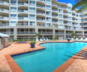
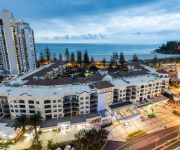
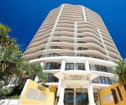
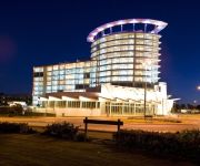
Looking for a place to stay? we compiled a list of available hotels close to the map centre further down the page.
When in this area, you might want to pay a visit to some of the following locations: Brisbane, Carrolls Creek, Sunshine Coast, and . To further explore this place, just scroll down and browse the available info.
Local weather forecast
Todays Local Weather Conditions & Forecast: 23°C / 73 °F
| Morning Temperature | 18°C / 65 °F |
| Evening Temperature | 19°C / 67 °F |
| Night Temperature | 18°C / 64 °F |
| Chance of rainfall | 0% |
| Air Humidity | 51% |
| Air Pressure | 1026 hPa |
| Wind Speed | Gentle Breeze with 9 km/h (5 mph) from North-West |
| Cloud Conditions | Clear sky, covering 4% of sky |
| General Conditions | Light rain |
Saturday, 11th of May 2024
19°C (66 °F)
18°C (65 °F)
Moderate rain, light breeze, overcast clouds.
Sunday, 12th of May 2024
21°C (70 °F)
17°C (62 °F)
Moderate rain, gentle breeze, scattered clouds.
Monday, 13th of May 2024
20°C (69 °F)
16°C (60 °F)
Sky is clear, light breeze, clear sky.
Hotels and Places to Stay
Kirra Beach Apartments
The Rocks Resort
Oceanside Resort
Pacific Place Apartments
Oaks Calypso Plaza
Isle of Palms Resort
MANTRA COOLANGATTA BEACH
Kirra Surf Apartments
Comfort Inn Tweed Heads
The Hill Apartments
Videos from this area
These are videos related to the place based on their proximity to this place.
6 STAR LUXURY - ONE OF TUGUN'S FINEST HOME
45 Dilgara Street, Tugun Unquestionably, one of Tugun's finest homes, this grand residence lives and breathes pure opulence. Boasting stunning, panoramic views across the Southern Gold...
31 Taperell Drive, Tugun QLD By Matt Morris
Property Video shoot of 31 Taperell Drive, Tugun QLD by PlatinumHD http://www.platinumhd.tv for Ray White Coolangatta.
Pacific highway wintersun roadtrip in custom FC holden Part 3
Part 3 of 3 of our Pacific highway roadtrip from Sydney NSW Australia to Coolangatta in Queensland for the 2010 Wintersun festival including a slide show of the trip and Wintersun festival....
Melbourne to Gold Coast airport
Flight to Coolangatta for a 10 day holiday around Queensland on 8/31/09.
Moda Marine
Australian made, custom aluminium recreational sports boats, Clontarf, Brisbane, Queensland, Australia.
Penny Ridge Retreat 363 Carool Road, Terranorra NSW By Stuart Reeder
Property Video shoot of Penny Ridge Retreat 363 Carool Road, Terranorra NSW by PlatinumHD http://www.platinumhd.tv for Ray White Broadbeach.
Penny Ridge Golf Resort
Just 12 minutes from Coolangatta Gold Coast airport and yet what seems a world away, perched on a ridge top several hundred metres above sea level on the New South Wales far north coast, you...
Eating More Seafood for Good Health with Prof MA Crawford
Professor Michael Crawford, Director Brain Chemistry and Human Nutrition Institute, London.
Videos provided by Youtube are under the copyright of their owners.
Attractions and noteworthy things
Distances are based on the centre of the city/town and sightseeing location. This list contains brief abstracts about monuments, holiday activities, national parcs, museums, organisations and more from the area as well as interesting facts about the region itself. Where available, you'll find the corresponding homepage. Otherwise the related wikipedia article.
Gold Coast, Queensland
The Gold Coast is a coastal city located in the South East of Queensland, Australia. The city is 94 km (58 mi) south of the state capital Brisbane. It is the second most populous city in the state, the sixth most populous city in the country, and the most populous non-capital city in Australia. The Gold Coast has the largest cross-state metropolitan area population in Australia, due to the inclusion of Tweed Heads, New South Wales in its metropolitan area.
Nicoll Scrub National Park
Nicoll Scrub is a national park in South East Queensland, Australia, 88 km southeast of Brisbane. It adjoins the Currumbin Valley Reserve and protects remnant rainforest vegetation. The park occupies the area between Mount Coolagang and Mount Boololagung of the McPherson Range.
Tweed Heads, New South Wales
Tweed Heads is a town located on the Tweed River in north-eastern New South Wales, Australia, in Tweed Shire. Tweed Heads is located next to the border with Queensland, adjacent to the "Twin Town" of Coolangatta, a suburb of the Gold Coast.
Coolangatta, Queensland
Coolangatta is the southernmost suburb of the Gold Coast, Queensland, Australia. It has a population of 4,869 and is named after the schooner Coolangatta which was wrecked there in 1846. Coolangatta and its immediate neighbouring "Twin Town" Tweed Heads in New South Wales have a shared economy. The Tweed River supports a thriving fishing fleet, and the seafood is a local specialty offered in the restaurants and clubs of the holiday and retirement region on both sides of the state border.
Currumbin, Queensland
Currumbin is a suburb in the Gold Coast region of Queensland, Australia. At the 2011 Census, Currumbin had a population of 2,785.
Division of McPherson
The Division of McPherson is an Australian Electoral Division in Queensland. The division was created in 1948 and is named for the McPherson Range, which forms one of the divisional boundaries. McPherson is located in south east Queensland, and is based on the southern portion of the Gold Coast City.
Currumbin Wildlife Sanctuary
Currumbin Wildlife Sanctuary at Currumbin on the Gold Coast, Queensland in Australia, is world renowned for its feeding of huge flocks of free-flying wild Rainbow Lorikeets, which come to the Sanctuary to feast off the special mixture which the Lorikeets eat. The multitude of events, shows and attractions include dingo encounters, free flight bird shows and even crocodile feeding of the park's massive saltwater crocodile.
Greenmount Beach
Greenmount Beach is the name of the southern end of Coolangatta Beach, located in Coolangatta on Queensland's Gold Coast. Greenmount Point is a coastal headland separating the Coolangatta stretch of beach to the north and Rainbow Bay to the south. Greenmount Beach is home to Tweed Heads and Coolangatta Surf Life Saving Club.
Point Danger (Tweed Heads)
Point Danger is a headland, located at the southern end of the Gold Coast on the east coast of Australia. Separated by Snapper Rocks and Rainbow Bay to the West, with Duranbah Beach and the Tweed River mouth to the south. Present-day Point Danger has also indicated the border between New South Wales and Queensland, Australia, since 1863.
Banora Point, New South Wales
Banora Point is a suburb of Tweed Heads in the Northern Rivers region of New South Wales, Australia in Tweed Shire. Together with Tweed Heads South and Terranora it had a combined population of 27,368 in 2001, including 21,457 (78.4%) Australian-born persons and 525 (1.9%) indigenous persons. On Census night 2006, Banora Point had a population of 14,682 people.
Bilinga, Queensland
Bilinga is a southern suburb of the Gold Coast on the Nerang-Tweed Railway line. At the 2006 Census, Bilinga had a population of 1,436.
Gold Coast Desalination Plant
The Gold Coast desalination plant is a reverse osmosis, water desalination plant that supplies water to the Gold Coast and South East Queensland via the South East Queensland Water Grid, located in Tugun. After investigations by the Gold Coast Desalination Alliance, the Gold Coast City Council chose Tugun as the most suitable site for the desalination plant. The cost is expected to be in excess of $1 billion.
Terranora, New South Wales
Terranora is a suburb of Tweed Heads on the northern boundary of New South Wales, Australia. At the 2006 census, Terranora had a population of 3,137 people. The town is part of the Tweed Shire local Government area. Its postcode is 2486. Two schools are located there - Terranora Public School and the senior campus of Lindisfarne Anglican Grammar School. Well known children's author, Hesba Fay Brinsmead, made her home in Terranora from 1976 until the early 2000s (she died in nearby Murwillumbah).
Lindisfarne Anglican Grammar School
Lindisfarne Anglican Grammar School is a co-educational private day school on the southern end of the Gold Coast, Australia offering an integrated NSW curriculum from Pre-School through to Year 12. The School has two campuses, Pre-School through to Year 4 at Tweed Heads South, and Year 5 through to Year 12 in Terranora, New South Wales. It is located in the Anglican Diocese of Grafton.
Elanora State High School
Elanora State High School is the high school serving the Elanora area of the Gold Coast, Queensland, Australia. Founded in 1990, it currently has a student body of 950.
Elanora, Queensland
Elanora is a suburb on the Gold Coast in Queensland, Australia. At the 2006 Census, Elanora had a population of 11,681. Elanora is located between Tallebudgera Creek and Currumbin Creek, 13 kilometres west-north-west of the coastal border town of Coolangatta and 94 kilometres south-southeast of Brisbane, the state capital. Its Local Government Area is the Gold Coast City.
St Andrews Lutheran College
St Andrews Lutheran College is a private Lutheran based junior school, middle school, and senior school in the Gold Coast, Australia area.
Currumbin Valley Reserve
Currumbin Valley Reserve is a 4 ha nature reserve in the Gold Coast hinterland of south-east Queensland, Australia, west of Coolangatta, 105 km south of Brisbane. It is owned and managed by Bush Heritage Australia (BHA), to which it was donated in 1999 by the Wildlife Preservation Society of Queensland according to the wishes of the previous owner, Dr Alex Griffiths, founder of the Currumbin Wildlife Sanctuary.
Currumbin Creek
Currumbin Creek is a large creek on the Gold Coast of Queensland, running from Mount Cougal in the west to its mouth at Currumbin Alley in the east. It is apporoximately 24 kilometres in length. It provides a popular and tranquil setting for many rowing clubs, kayakers, jet skiers, boat-goers and fishermen. The first bridge across the creek was opened in 1926. The road was then known as the Main Ocean Road, later to be upgraded to the Pacific Highway.
Swell Sculpture Festival
The Swell Sculpture Festival is held annually in September, alongside the beach at Currumbin, Gold Coast, Australia.
Elanora bus station
The Elanora Bus Station, at Elanora, is serviced by TransLink bus routes. The bus station is located within the car park of The Pines Shopping Centre. It is in Zone 17 of the TransLink integrated public transport system.
Banora Point High School
Banora Point High School is a high school located in Banora Point, New South Wales, Australia. The school was founded in 2004, and as of 2010, has 542 students enrolled.
Tumbulgum
Tumbulgum is a town in northern New South Wales, Australia. The town is in the Tweed Shire local government area, at the confluence of the Rous and Tweed Rivers, 818 kilometres north east of the state capital, Sydney and 120 kilometres south east of Brisbane. At the 2006 census, Tumbulgum had a population of 349.
1949 Queensland Airlines Lockheed Lodestar crash
On 10 March 1949 a Lockheed Lodestar aircraft became airborne at Coolangatta, Queensland, Australia for a flight to Brisbane. Before reaching a height of 300 feet it suddenly pitched nose-up, stalled and crashed onto its belly beyond the end of the airstrip. Fuel from the aircraft's tanks caught fire and the aircraft burned fiercely. All 21 people on board died, either of injuries during the crash or in the ensuing conflagration.
Currumbin Waters, Queensland
Currumbin Waters is a suburb of South Eastern, Gold Coast & Hinterland, Queensland, Australia. According to the 2011 census it had a population of 8883. There is Tallebudgera Golf Course, which is a 5 minute drive from Currumbin Waters.


