Safety Score: 3,3 of 5.0 based on data from 9 authorites. Meaning please reconsider your need to travel to Brazil.
Travel warnings are updated daily. Source: Travel Warning Brazil. Last Update: 2024-04-29 08:03:39
Delve into Santa Luzia
The district Santa Luzia of in Belo Horizonte (Minas Gerais) is a district located in Brazil about 433 mi south-east of Brasilia, the country's capital town.
In need of a room? We compiled a list of available hotels close to the map centre further down the page.
Since you are here already, you might want to pay a visit to some of the following locations: Belo Horizonte, Diamantina, Juiz de Fora, Vitoria and Campos dos Goytacazes. To further explore this place, just scroll down and browse the available info.
Local weather forecast
Todays Local Weather Conditions & Forecast: 30°C / 86 °F
| Morning Temperature | 19°C / 66 °F |
| Evening Temperature | 26°C / 80 °F |
| Night Temperature | 21°C / 70 °F |
| Chance of rainfall | 0% |
| Air Humidity | 52% |
| Air Pressure | 1017 hPa |
| Wind Speed | Light breeze with 3 km/h (2 mph) from West |
| Cloud Conditions | Clear sky, covering 0% of sky |
| General Conditions | Sky is clear |
Tuesday, 30th of April 2024
29°C (85 °F)
20°C (69 °F)
Sky is clear, light breeze, clear sky.
Wednesday, 1st of May 2024
30°C (86 °F)
21°C (69 °F)
Sky is clear, light breeze, clear sky.
Thursday, 2nd of May 2024
31°C (87 °F)
21°C (69 °F)
Sky is clear, light breeze, clear sky.
Hotels and Places to Stay
San Diego Suites Ipatinga
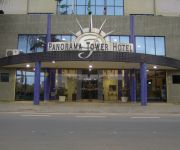
Hotel Panorama Tower
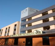
Dom Henrique
La Fontaine Residencial e apart-hotel
Grande Hotel Ipatinga
Videos from this area
These are videos related to the place based on their proximity to this place.
POLÍTICA 2014 - CANDIDATO LUIZ CARLOS MIRANDA - 77123 - joão dorneles
REUNIÃO DA VITÓRIA COM A PRESENÇA DO CANDIDATO A DEPUTADO ESTADUAL LUIZ CARLOS MIRANDA, NO DISTRITO BARRA ALEGRE (CASA EX VEREADOR JOÃO DORNELES) DIA ...
Videos provided by Youtube are under the copyright of their owners.
Attractions and noteworthy things
Distances are based on the centre of the city/town and sightseeing location. This list contains brief abstracts about monuments, holiday activities, national parcs, museums, organisations and more from the area as well as interesting facts about the region itself. Where available, you'll find the corresponding homepage. Otherwise the related wikipedia article.
Santana do Paraíso
Santana do Paraíso is a Brazilian municipality situated in the state of Minas Gerais which was founded in 1992. It forms part of the Vale do Aço metropolitan area. Its estimated population in 2004 was of 20.760 inhabitants. Before its foundation, Santana do Paraiso's location was a rest spot for people who travelled the road between the cities of Ferros and Coronel Fabriciano.
Ipatinga
Ipatinga (postal code 35160-000) is a city and municipality located in eastern Minas Gerais state, Brazil. The city was founded in April,29/1964 and covers a total area of 166.5 km². Its population is 240,338. It is part of the Vale do Aço Metropolitan Area (population 430,700). Ipatinga is located at the site where the Piracicaba River flows into the Doce River, 217 km. from the state capital of Belo Horizonte. It is served by highway and railroad connections (Minas-Vitória).
Coronel Fabriciano
Coronel Fabriciano is a town and municipality in the state of Minas Gerais in the Southeast region of Brazil. It is located in the mesoregion of the Vale do Rio Doce and microregion of Ipatinga and is situated 200 km from the capital. The municipal population was estimated in 2012 by IBGE in 104,637 inhabitants, thus the 27th most populous in the Minas Gerais state. The area is 221.049 km² (13.1549 km² of urban area).
Estádio Municipal João Lamego Netto
Estádio Municipal João Lamego Netto, usually known as Lamegão, is a multi-purpose stadium in Ipatinga, Brazil. It is currently used mostly for football matches. Ideal futebol Clube usually play their home matches at the stadium. Social Futebol Clube, from the neighbor city Coronel Fabriciano, has its own soccer stadium, but sometimes plays its home matches at Ipatingão, because of its larger capacity and better structure. The stadium has a maximum capacity of 20,500 people.
Cathedral of Salvador
The Cathedral Basilica of Salvador (Catedral Basílica de Salvador), officially dedicated to the Transfiguration of Christ and named Primatial Cathedral Basilica of the Transfiguration of the Lord is the seat of the Archbishop of the city of Salvador, in the State of Bahia, in Brazil. The Archbishop of Salvador is also ex officio Primate of Brazil.
Estádio Louis Ensch
Estádio Louis Ensch is the football stadium of the Brazilian football club Social Futebol Clube. It is in the city of Coronel Fabriciano, Minas Gerais.
Timóteo
Timóteo is a Brazilian city in the state of Minas Gerais, located by the Piracicaba River. The population as of 2006 was 81,219 inhabitants. the city belongs to the metropolitan area of the Steel Valley. It is the hometown of Acesita, a steel factory specialized in the production of stainless steel.


