Safety Score: 4,0 of 5.0 based on data from 9 authorites. Meaning please reconsider your need to travel to U.S. Virgin Islands.
Travel warnings are updated daily. Source: Travel Warning U.S. Virgin Islands. Last Update: 2024-04-19 08:03:45
Delve into Santa Maria Estate
Santa Maria Estate in West End (Saint Thomas Island) is a city located in U.S. Virgin Islands a little west of Charlotte Amalie, the country's capital town.
Current time in Santa Maria Estate is now 07:20 AM (Friday). The local timezone is named America / St Thomas with an UTC offset of -4 hours. We know of 10 airports closer to Santa Maria Estate, of which two are larger airports. The closest airport in U.S. Virgin Islands is Cyril E. King Airport in a distance of 2 mi (or 2 km), South. Besides the airports, there are other travel options available (check left side).
There is one Unesco world heritage site nearby. The closest heritage site is La Fortaleza and San Juan National Historic Site in Puerto Rico in United states at a distance of 59 mi (or 95 km). Also, if you like playing golf, there is an option about 2 mi (or 4 km). away. We saw 4 points of interest near this location. In need of a room? We compiled a list of available hotels close to the map centre further down the page.
Since you are here already, you might want to pay a visit to some of the following locations: Charlotte Amalie, Cruz Bay, Culebra, Road Town and Isabel Segunda. To further explore this place, just scroll down and browse the available info.
Local weather forecast
Todays Local Weather Conditions & Forecast: 26°C / 79 °F
| Morning Temperature | 26°C / 79 °F |
| Evening Temperature | 26°C / 80 °F |
| Night Temperature | 26°C / 79 °F |
| Chance of rainfall | 0% |
| Air Humidity | 73% |
| Air Pressure | 1014 hPa |
| Wind Speed | Gentle Breeze with 9 km/h (5 mph) from South-West |
| Cloud Conditions | Scattered clouds, covering 26% of sky |
| General Conditions | Scattered clouds |
Friday, 19th of April 2024
26°C (79 °F)
26°C (79 °F)
Light rain, moderate breeze, few clouds.
Saturday, 20th of April 2024
26°C (79 °F)
26°C (79 °F)
Light rain, moderate breeze, broken clouds.
Sunday, 21st of April 2024
27°C (80 °F)
27°C (80 °F)
Light rain, moderate breeze, clear sky.
Hotels and Places to Stay
Marriott's Frenchman's Cove
Frenchman's Reef & Morning Star Marriott Beach Resort
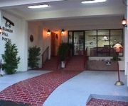
Bunker Hill Hotel
Villa Marbella Suites
ISLAND BEACHCOMBER HOTEL
Emerald Beach Resort
Lindbergh Bay Hotel and Villas
Olga's Fancy
Windward Passage Hotel
POINT PLEASANT RESORT
Videos from this area
These are videos related to the place based on their proximity to this place.
Blackbeard's Castle - Charlotte Amalie, St. Thomas, Virgin Islands US
http://tripwow.tripadvisor.com/tripwow/ta-00a0-9152-5437?ytv2=1 - Created at TripWow by TravelPod Attractions (a TripAdvisor™ company) Blackbeard's Castle Charlotte Amalie Once the 17th-centu...
Three bedroom Family Home, St. Thomas, VI
For more details click here: http://www.visualtour.com/showvt.asp?t=2779672 37-29 Estate Pearl St. Thomas, VI 00801 $2, 3 bed, 2.0 bath, 1250 SF, MLS# 12=0000 Three bedrooms, two bathroom...
Larry's Hidaway - 1978 Surfing, Hull Bay, St. Thomas - U.S. Virgin Islands
After graduating from College, Jeff Wallace and his brother Mitch took off on a 35 day surf trip to the Caribbean. Joining them was Mitch's future wife, Lee Haladay. They stayed at Larry's...
Take off from St Thomas
From David & Vickie's Recent trip to St. Thomas. Video taken aboard a USAirways 757 Flight 1041 December 2008.
A visit to Brewers Bay, St. Thomas, Virgin Islands
Took the safari bus from Red Hook across the island to Brewers Bay, located next to the University of the Virgin Islands, just west of the Cyril E. King airport. Gorgeous bay with lots of...
St. Thomas, Virgin Islands - Lindberg Beach
http://www.vinow.com Lindberg Bay, also known as Emerald Beach, is beautiful. Palm trees and sea grape trees line the shore and provide natural shade. Typically sparsely populated It is a...
Videos provided by Youtube are under the copyright of their owners.
Attractions and noteworthy things
Distances are based on the centre of the city/town and sightseeing location. This list contains brief abstracts about monuments, holiday activities, national parcs, museums, organisations and more from the area as well as interesting facts about the region itself. Where available, you'll find the corresponding homepage. Otherwise the related wikipedia article.
University of the Virgin Islands
The University of the Virgin Islands (or UVI) is a public university located in the United States Virgin Islands. The university is a member-school of Thurgood Marshall College Fund.
WVGN (FM)
WVGN, is a National Public Radio member radio station in Charlotte Amalie, U.S. Virgin Islands.
WGOD-FM
WGOD-FM is a radio station licensed to serve Charlotte Amalie, U. S. Virgin Islands. The station is owned by Three Angels Corporation. WGOD-FM airs a religious radio format featuring a mix of teaching programs and Christian music. The station receives the majority of its programming as part of the Three Angels Broadcasting Network. This station operated under the call letters WIBS from initial licensing in 1979 until August 13, 1985, when it became WGOD.
WIVI
WIVI (96.1 FM, "Hitz 96") is a radio station licensed to serve Charlotte Amalie, U. S. Virgin Islands. The station is owned by Gordon P. Ackley through GARK LLC. It airs a hip hop, R&B, pop, rock music format. Lonely Planet's 2001 guide to the Virgin Islands described this station as, "probably the most popular rock & roll station" in the USVI. The station was assigned the WIVI call sign by the U.S. Federal Communications Commission on May 17, 1988.
WZIN
WZIN is a radio station licensed to serve Charlotte Amalie, U. S. Virgin Islands. The station is owned by Pan Caribbean Broadcasting de P.R. , Inc. It airs an active rock format. The Federal Communications Commission assigned the call letters WSTT to this station on May 23, 1983 until they requested a switch to WCWI on March 15, 1987. This call sign was short-lived as the station would switch calls again on September 13, 1987 to become WIYC.
WVJZ
WVJZ is a radio station licensed to serve Charlotte Amalie, U. S. Virgin Islands. The station is licensed to GARK LLC which is wholly owned by Gordon P. Ackley as part of the Ackley Media Group. It airs an Mainstream Urban and Reggae music format. Lonely Planet's guide to the Virgin Islands describes this station as "the station for continuous R&B" in the USVI. The Federal Communications Commission assigned the WVGN call letters to this station on December 23, 1985.
Adelphi, United States Virgin Islands
Adelphi is a settlement on the island of Saint Thomas in the United States Virgin Islands.
Caret Bay Estate, United States Virgin Islands
Caret Bay Estate is a settlement on the island of Saint Thomas in the United States Virgin Islands.
Neltjeberg, United States Virgin Islands
Neltjeberg is a settlement on the island of Saint Thomas in the United States Virgin Islands.
Santa Maria Estate, United States Virgin Islands
Santa Maria Estate is a settlement on the island of Saint Thomas in the United States Virgin Islands.
Sorgenfri, United States Virgin Islands
Sorgenfri is a settlement on the island of Saint Thomas in the United States Virgin Islands.
Zambee, United States Virgin Islands
Zambee is a settlement on the island of Saint Thomas in the United States Virgin Islands.


