Safety Score: 2,7 of 5.0 based on data from 9 authorites. Meaning we advice caution when travelling to United States.
Travel warnings are updated daily. Source: Travel Warning United States. Last Update: 2024-04-16 08:26:06
Discover Earness
Earness in City of Poquoson (Virginia) is a city in United States about 129 mi (or 208 km) south of Washington DC, the country's capital city.
Local time in Earness is now 09:17 AM (Tuesday). The local timezone is named America / New York with an UTC offset of -4 hours. We know of 8 airports in the vicinity of Earness, of which 5 are larger airports. The closest airport in United States is Newport News Williamsburg International Airport in a distance of 8 mi (or 14 km), West. Besides the airports, there are other travel options available (check left side).
There is one Unesco world heritage site nearby. It's Monticello and the University of Virginia in Charlottesville in a distance of 90 mi (or 144 km), North-West. Also, if you like golfing, there are a few options in driving distance. We discovered 6 points of interest in the vicinity of this place. Looking for a place to stay? we compiled a list of available hotels close to the map centre further down the page.
When in this area, you might want to pay a visit to some of the following locations: Poquoson, Hampton, Newport News, Yorktown and Norfolk. To further explore this place, just scroll down and browse the available info.
Local weather forecast
Todays Local Weather Conditions & Forecast: 15°C / 59 °F
| Morning Temperature | 15°C / 59 °F |
| Evening Temperature | 15°C / 58 °F |
| Night Temperature | 15°C / 59 °F |
| Chance of rainfall | 0% |
| Air Humidity | 71% |
| Air Pressure | 1022 hPa |
| Wind Speed | Moderate breeze with 10 km/h (6 mph) from West |
| Cloud Conditions | Overcast clouds, covering 91% of sky |
| General Conditions | Overcast clouds |
Tuesday, 16th of April 2024
19°C (65 °F)
19°C (67 °F)
Light rain, moderate breeze, overcast clouds.
Wednesday, 17th of April 2024
23°C (73 °F)
16°C (61 °F)
Light rain, moderate breeze, broken clouds.
Thursday, 18th of April 2024
14°C (56 °F)
15°C (59 °F)
Overcast clouds, moderate breeze.
Hotels and Places to Stay
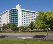
Embassy Suites by Hilton Hampton Hotel Convention Ctr - Spa
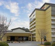
Hampton Inn Hampton-Newport News
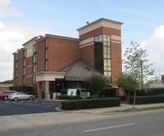
Hilton Garden Inn Hampton Coliseum Central
LA QUINTA INN NORFOLK HAMPTON NEWPORT N
ExecuStay at Monticello Twn Ct
Courtyard Hampton
Holiday Inn Express HAMPTON - COLISEUM CENTRAL
Quality Inn Near Hampton Coliseum
SpringHill Suites Hampton
BEST WESTERN HAMPTON COLISEUM
Videos from this area
These are videos related to the place based on their proximity to this place.
Poquoson croakers 2010; fishing in Virginia
Two early season croakers caught in the Back River, Poquoson, VA.
Somebodys Watching
Branson Matheson, Tom Bastian playing some songs Tom wrote for Senior Skit in Poquoson class of 1987.
1987 Oshkosh Tilt-T Fire Truck on GovLiquidation.com
http://www.GovLiquidation.com - You're looking at a 1987 Oshkosh Tilt-T Fire Truck. It is available for bidding from December 24-27. This fire truck is located at Langley AFB, VA, and can be...
F-22 Raptor Demo and Heritage Flight 2007
Recorded at the Air Power Over Hampton Roads Air Show on Langley AFB 4-28-2007. Planes in the Heritage Flight are, F-86 Sabre, A-10 Thunderbolt 2, F-15 Eagle and F-22 Raptor.
Back River 18 Speckled Trout Catch and Release
Fishing a shallow grass flat surrounded by deep water.
Nandua 2003 Poor Sport Cheap Shot!
The 2003 Nandua team couldn't stand being owned, 44-16, by a small white boy team in the first round of the Play offs, ending their 10 win streek. This was the first play from scrimmage after...
Videos provided by Youtube are under the copyright of their owners.
Attractions and noteworthy things
Distances are based on the centre of the city/town and sightseeing location. This list contains brief abstracts about monuments, holiday activities, national parcs, museums, organisations and more from the area as well as interesting facts about the region itself. Where available, you'll find the corresponding homepage. Otherwise the related wikipedia article.
Poquoson, Virginia
Poquoson is an independent city located on the Virginia Peninsula, in the Hampton Roads metropolitan area of the U.S. state of Virginia. The population was 12,150 according to the 2010 Census. The Bureau of Economic Analysis combines the city of Poquoson with surrounding York county for statistical purposes. Poquoson, which was formerly part of York County, became an incorporated town in 1952 and an independent city in 1975.
Langley Research Center
Langley Research Center (LaRC) is the oldest of NASA's field centers, located in Hampton, Virginia, United States. It directly borders Poquoson, Virginia and Langley Air Force Base. LaRC focuses primarily on aeronautical research, though the Apollo lunar lander was flight-tested at the facility and a number of high-profile space missions have been planned and designed on-site.
Back River (Virginia)
The Back River is an estuarine inlet of the Chesapeake Bay between the independent cities of Hampton and Poquoson in the Hampton Roads area of southeastern Virginia. Formed by the confluence of the Northwest and Southwest Branches, and at just over two miles long, the Back River is a breeding ground for many of the Bay's prized sport fish and the well known blue crab.
Poquoson High School
Poquoson High School is a public secondary school, located in Poquoson, Virginia and serves as the sole public secondary school for students in the City. The school was opened in 1910 and currently has approximately 920 students. The school competes in athletics and activities in the Virginia High School League's AA Bay Rivers District. Poquoson High has historically been known for its wrestling program, which has won numerous state championships and has occasionally been ranked nationally.
Langley Field
Langley Field is a United States military facility located adjacent to Hampton and Newport News, Virginia. It was one of thirty-two Air Service training camps established after the United States entry into World War I in April 1917. On 1 October 2010, Langley Field was joined with Fort Eustis to become Joint Base Langley–Eustis. The base was established in accordance with congressional legislation implementing the recommendations of the 2005 Base Realignment and Closure Commission.
Joint Base Langley–Eustis
Joint Base Langley–Eustis is a United States military facility located adjacent to Hampton and Newport News, Virginia. The base is an amalgamation of the United States Air Force's Langley Air Force Base and the United States Army's Fort Eustis which were merged on 1 October 2010. The base was established in accordance with congressional legislation implementing the recommendations of the 2005 Base Realignment and Closure Commission.


