Safety Score: 2,7 of 5.0 based on data from 9 authorites. Meaning we advice caution when travelling to United States.
Travel warnings are updated daily. Source: Travel Warning United States. Last Update: 2024-04-25 08:17:04
Delve into Beverley Hills
Beverley Hills in City of Alexandria (Virginia) is a town located in United States a little south-west of Washington DC, the country's capital town.
Time in Beverley Hills is now 01:53 PM (Thursday). The local timezone is named America / New York with an UTC offset of -4 hours. We know of 8 airports closer to Beverley Hills, of which 4 are larger airports. The closest airport in United States is Ronald Reagan Washington National Airport in a distance of 2 mi (or 3 km), North-East. Besides the airports, there are other travel options available (check left side).
There is one Unesco world heritage site nearby. It's Monticello and the University of Virginia in Charlottesville in a distance of 60 mi (or 97 km), South. Also, if you like the game of golf, there are some options within driving distance. We saw 10 points of interest near this location. In need of a room? We compiled a list of available hotels close to the map centre further down the page.
Since you are here already, you might want to pay a visit to some of the following locations: Alexandria, Arlington, Washington DC, Falls Church and Fairfax. To further explore this place, just scroll down and browse the available info.
Local weather forecast
Todays Local Weather Conditions & Forecast: 14°C / 57 °F
| Morning Temperature | 11°C / 51 °F |
| Evening Temperature | 12°C / 54 °F |
| Night Temperature | 9°C / 48 °F |
| Chance of rainfall | 0% |
| Air Humidity | 49% |
| Air Pressure | 1026 hPa |
| Wind Speed | Gentle Breeze with 6 km/h (4 mph) from South |
| Cloud Conditions | Overcast clouds, covering 86% of sky |
| General Conditions | Overcast clouds |
Thursday, 25th of April 2024
16°C (61 °F)
9°C (48 °F)
Sky is clear, gentle breeze, clear sky.
Friday, 26th of April 2024
13°C (55 °F)
11°C (52 °F)
Light rain, gentle breeze, overcast clouds.
Saturday, 27th of April 2024
27°C (80 °F)
20°C (67 °F)
Broken clouds, light breeze.
Hotels and Places to Stay
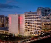
The Ritz-Carlton Pentagon City
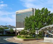
Crystal Gateway Marriott
Crystal City Marriott at Reagan National Airport
Hilton Crystal City at Washington Reagan National Airport
Global Luxury Suites at Pentagon City North
Reagan Airport Apartments
The Westin Crystal City
Residence Inn Arlington Capital View
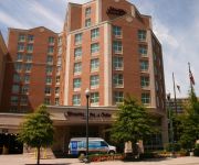
Hampton Inn - Suites Reagan National Airport - Crystal City
Bridgestreet at Millennium at Metropolitan Park
Videos from this area
These are videos related to the place based on their proximity to this place.
2720 Arlington Mill Dr S #804, Arlington, VA 22206, Shirlington Village
Video walk-through of 2720 Arlington Mill Dr S #804 located in Shirlington Village, Arlington, VA 22206. This property is listed with Rob Allen of Long & Foster Real Estate. For more information...
ALEXANDRIA CITY PUBLIC SCHOOLS PARTNER IN EDUCATION
ACPS PARTNER IN EDUCATION BONNIE BAXLEY TAKES A MOMENT TO PROVIDE INFORMATION ABOUT THE WORK THAT COMMUNITY LODGINGS HAS BEEN ENGAGED IN WITH STUDENTS ...
ALEXANDRIA CITY PUBLIC SCHOOLS PARTNER IN EDUCATION
ACPS PARTNER IN EDUCATION TAMMY L. MANN, PhD, TAKES A MOMENT TO PROVIDE INFORMATION ABOUT THE WORK THAT THE CAMPAGNA CENTER HAS BEEN ENGAGED IN WITH ...
ALEXANDRIA CITY PUBLIC SCHOOLS PARTNER IN EDUCATION
ACPS PARTNER IN EDUCATION RICH TRENT TAKES A MOMENT TO PROVIDE INFORMATION ABOUT THE WORK THAT HIGHER ACHIEVEMENT HAS BEEN ENGAGED IN WITH STUDENTS AND ...
ALEXANDRIA CITY PUBLIC SCHOOLS PARTNER IN EDUCATION
ACPS PARTNER IN EDUCATION GREG BALDWIN TAKES A MOMENT TO PROVIDE INFORMATION ABOUT THE WORK THAT THE YOUNG STARS PROGRAM HAS BEEN ENGAGED IN WITH ...
ALEXANDRIA CITY PUBLIC SCHOOLS PARTNER IN EDUCATION
ACPS PARTNERS IN EDUCATION TAMMY CAVAZOS AND CATALINA MANRIQUEZ TAKE A MOMENT TO PROVIDE INFORMATION ABOUT THE WORK THAT THE TAU NU CHAPTER OF PHI ...
ALEXANDRIA CITY PUBLIC SCHOOLS PARTNER IN EDUCATION
ACPS PARTNERS IN EDUCATION JOHN ROSENTHALL OF THE ALFRED STREET BAPTIST CHURCH AND HARRY STUART OF THE SHILOH BAPTIST CHURCH TAKE A MOMENT TO PROVIDE ...
ALEXANDRIA CITY PUBLIC SCHOOLS PARTNER IN EDUCATION
ACPS PARTNER IN EDUCATION JIM ROBERTS TAKES A MOMENT TO PROVIDE INFORMATION ABOUT THE WORK THAT THE ALEXANDRIA TUTORING CONSORTIUM HAS BEEN ENGAGED IN ...
ALEXANDRIA CITY PUBLIC SCHOOLS PARTNER IN EDUCATION
ACPS PARTNER IN EDUCATION CAROLYN MILLER TAKES A MOMENT TO PROVIDE INFORMATION ABOUT THE WORK THAT THE OPTIMIST CLUB HAS BEEN ENGAGED IN WITH STUDENTS ...
New 2013 Cadillac Escalade EXT Alexandria Woodbridge VA Lindsay Cadillac Alexandria Woodbridge VA
http://www.lindsaycadillac.com/ Lindsay Cadillac 1525 Kenwood Ave Alexandria Woodbridge VA, 22302 888-392-1890 The staff at Lindsay Cadillac is ready to help you purchase a new Cadillac or...
Videos provided by Youtube are under the copyright of their owners.
Attractions and noteworthy things
Distances are based on the centre of the city/town and sightseeing location. This list contains brief abstracts about monuments, holiday activities, national parcs, museums, organisations and more from the area as well as interesting facts about the region itself. Where available, you'll find the corresponding homepage. Otherwise the related wikipedia article.
Traffic circle
A traffic circle or rotary is a type of intersection that has a generally circular central island. Entering traffic must typically alter direction and speed to avoid the island, creating a circular flow in one direction. In most applications, traffic circles replace the stop lights and traffic signs that regulate flow in other intersections.
T. C. Williams High School
T. C. Williams High School is a public high school in Alexandria, Virginia, named after former superintendent Thomas Chambliss Williams of Alexandria City Public Schools who served from the mid-1930s to the mid-1960s. It is located near the geographic center of the city, at 3330 King Street and is referred to informally as "T.C. " (rather than "Williams") by students, faculty and locals. Approximately 2,100 students from grades 10–12 are enrolled at T.C.
Shirlington, Arlington, Virginia
Shirlington is an unincorporated urban area, officially called an "urban village", in the southern part of Arlington County, Virginia, United States, adjacent to the Fairlington area. The word "Shirlington" is a combination of "Shirley" and "Arlington". Shirlington is billed as "Arlington’s Arts and Entertainment District" and is largely mixed-use development based on New Urbanist principles.
The Birchmere
The Birchmere is a concert hall in Alexandria, Virginia, known for presenting performers in the bluegrass, country, folk, and jazz genres. The main stage has table seating with dinner service. The room seats 500 people and the tables in front are about two feet from the stage. The bandstand includes a dance area. The Four Bitchin' Babes recorded two of their albums, Buy Me, Bring Me, Take Me, Don't Mess My Hair and Gabby Road, at the Birchmere.
Fort Richardson (Arlington, Virginia)
Fort Richardson was a detached redoubt constructed by the Union Army in September 1861 as part of the defense of Washington during the American Civil War. It was named for General Israel B. Richardson, whose division was then deployed to defend against attack by way of Columbia Turnpike. It had a perimeter of 316 yards and emplacements for 15 guns. It is now marked only by an historic marker on South 18th Street off of Glebe Road.
Fort Scott (Arlington, Virginia)
Named for General Winfield Scott, who was then General-in-Chief of the Union Army, Fort Scott was a detached lunette constructed in May 1861 to guard the south flank of the defenses of Washington during the American Civil War. An historic marker and a small remnant of the fort are the only evidence of the site of the fort on the grounds of what is now the Fort Scott Park in Arlington County, Virginia. When originally built, the fort had a perimeter of 313 yards and emplacements for 8 guns.
Luna Park, Arlington
Luna Park (also known as Luna Park Arlington, Luna Park Washington, and Luna Park Washington D.C. ) was an amusement park in Arlington, Virginia, USA, from 1906 to 1915.
The Village at Shirlington
The Village at Shirlington opened as Shirlington Shopping Center in 1944, and was the first large shopping center to open in the Washington, D.C. suburbs and one of the earliest in the United States. It is located along Campbell Avenue (formerly South 28th Street) at the intersection of Shirley Highway and Quaker Lane / Shirlington Road in Arlington, Virginia. The center has been known since the mid-1980s as The Village at Shirlington.
Arlington Ridge, Virginia
Arlington Ridge is an unincorporated community in Arlington County, Virginia, United States. It is bordered on the north by The Pentagon, on the west by the Army Navy Country Club, and on the south the City of Alexandria. The main thoroughfare is the eponymous Arlington Ridge Road, a mansion-lined boulevard that, due to its high elevation, offers picturesque views of Washington D.C. and the surrounding areas.
Agudas Achim Congregation (Alexandria, Virginia)
Agudas Achim Congregation is a Conservative synagogue located at 2908 Valley Drive in Alexandria, Virginia, a suburb of Washington, DC. The synagogue was founded in 1914, and its cemetery was founded in 1933.


