Safety Score: 2,7 of 5.0 based on data from 9 authorites. Meaning we advice caution when travelling to United States.
Travel warnings are updated daily. Source: Travel Warning United States. Last Update: 2024-04-18 08:12:24
Explore Alpine Village
Alpine Village in Washington County (Vermont) is located in United States about 418 mi (or 673 km) north-east of Washington DC, the country's capital.
Local time in Alpine Village is now 03:39 AM (Friday). The local timezone is named America / New York with an UTC offset of -4 hours. We know of 13 airports in the wider vicinity of Alpine Village, of which 5 are larger airports. The closest airport in United States is Burlington International Airport in a distance of 32 mi (or 52 km), North-West. Besides the airports, there are other travel options available (check left side).
There is one Unesco world heritage site nearby. The closest heritage site is Rideau Canal in Canada at a distance of 94 mi (or 151 km). Also, if you like golfing, there are multiple options in driving distance. If you need a place to sleep, we compiled a list of available hotels close to the map centre further down the page.
Depending on your travel schedule, you might want to pay a visit to some of the following locations: Montpelier, Middlebury (village), Chelsea, Rutland and Woodstock. To further explore this place, just scroll down and browse the available info.
Local weather forecast
Todays Local Weather Conditions & Forecast: 11°C / 52 °F
| Morning Temperature | 3°C / 38 °F |
| Evening Temperature | 9°C / 48 °F |
| Night Temperature | 6°C / 44 °F |
| Chance of rainfall | 0% |
| Air Humidity | 65% |
| Air Pressure | 1016 hPa |
| Wind Speed | Moderate breeze with 11 km/h (7 mph) from North |
| Cloud Conditions | Overcast clouds, covering 91% of sky |
| General Conditions | Light rain |
Friday, 19th of April 2024
9°C (47 °F)
-0°C (32 °F)
Light rain, moderate breeze, overcast clouds.
Saturday, 20th of April 2024
6°C (42 °F)
0°C (33 °F)
Broken clouds, gentle breeze.
Sunday, 21st of April 2024
6°C (43 °F)
1°C (34 °F)
Scattered clouds, gentle breeze.
Hotels and Places to Stay
Beaver Pond Farm Inn
The Warren Lodge
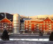
Sugar Lodge At Sugarbush
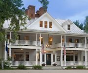
The Pitcher Inn
PowderHound At Sugarbush House
BRIDGES FAMILY RESORT AND TENN
SUGARBUSH CONDOS
Clay Brook At Sugarbush
THE SUGARBUSH INN
Videos from this area
These are videos related to the place based on their proximity to this place.
Skateboard Tour du Warren Vermont - Int'l Skateboarding Day and Solstice June 2013
GRAVITYDANCE.COM presents a longboard skate Tour du Warren VT. Locations: Sugarbush Resort sunset, Warren Village, Lincoln Gap, East Warren Rd, Brook Rd, Plunkton Rd. Soundtrack - GD ...
SnowCat Skiing on 1/7/13 In Warren, VT
A day out in the woods of Warren. It's always nice when a friend has land AND their own Tucker SnowCat to go backcountry skiing with. Having your own driver do loops as you get to ski down...
Wild Turkey Hen and Poults
I took this video this morning of a Turkey Hen and her poults as they crossed the road. I think this is the same hen that has been hanging out in the field a lot.
Posse skiing Bear Claw - Sugarbush February 24, 2013
Sugarbush - The posse skiing Bear Claw at Sugarbush on February 24, 2013.
Vermont Powder- POV
Personal edit of Isaac Wilson, skiing some side country at Sugarbush, Vermont. For Non- Profit Entertainment use only. No Copyright infringement intended.
PhilResponse519
Why using a hacked iphone to stream video while driving across the country may not work. Response to Philip De Franco's Vlog on May 19th, 2009.
The Human Canvas
Please rate and comment. I would like to hear feedback, both positive and negative, so I can improve this project for future performances. Done as a performance piece for my Modern Art/Psych...
Videos provided by Youtube are under the copyright of their owners.
Attractions and noteworthy things
Distances are based on the centre of the city/town and sightseeing location. This list contains brief abstracts about monuments, holiday activities, national parcs, museums, organisations and more from the area as well as interesting facts about the region itself. Where available, you'll find the corresponding homepage. Otherwise the related wikipedia article.
Granville Notch
Granville Notch, or Granville Gulf, is a notch, or mountain pass, located in Granville, Vermont. North of the height of land, the notch is the source of the Mad River, which drains into the Winooski River, and into Lake Champlain. Lake Champlain drains into the Richelieu River in Quebec, thence into the Saint Lawrence River, and into the Gulf of Saint Lawrence.
Mad River (Vermont)
The Mad River is a tributary to the Winooski River in Vermont. It has its headwaters in Granville Gulf, then flows north through the towns of Warren, Waitsfield, and Moretown before entering the Winooski River just downstream from Middlesex. Other towns within the Mad River watershed are the entire Town of Fayston and a portion of the Town of Duxbury. Relative to other rivers in the state, the Mad River is fairly rocky and clear, making it a popular for swimming.
WMRW-LP
WMRW-LP is a radio station broadcasting a variety music format. Licensed to Warren, Vermont, USA, the station is currently owned by Rootswork Inc. It is a community radio station. There are 53 volunteers on the staff.


