Safety Score: 2,7 of 5.0 based on data from 9 authorites. Meaning we advice caution when travelling to United States.
Travel warnings are updated daily. Source: Travel Warning United States. Last Update: 2024-04-19 08:03:45
Delve into Jerusalem
Jerusalem in Addison County (Vermont) is a city located in United States about 421 mi (or 677 km) north-east of Washington DC, the country's capital town.
Current time in Jerusalem is now 05:09 AM (Friday). The local timezone is named America / New York with an UTC offset of -4 hours. We know of 12 airports closer to Jerusalem, of which 4 are larger airports. The closest airport in United States is Burlington International Airport in a distance of 23 mi (or 37 km), North-West. Besides the airports, there are other travel options available (check left side).
There is one Unesco world heritage site nearby. The closest heritage site is Rideau Canal in Canada at a distance of 84 mi (or 136 km). Also, if you like playing golf, there are some options within driving distance. We saw 1 points of interest near this location. In need of a room? We compiled a list of available hotels close to the map centre further down the page.
Since you are here already, you might want to pay a visit to some of the following locations: Middlebury (village), Burlington, Montpelier, Hyde Park and Chelsea. To further explore this place, just scroll down and browse the available info.
Local weather forecast
Todays Local Weather Conditions & Forecast: 11°C / 52 °F
| Morning Temperature | 3°C / 38 °F |
| Evening Temperature | 9°C / 48 °F |
| Night Temperature | 6°C / 44 °F |
| Chance of rainfall | 0% |
| Air Humidity | 65% |
| Air Pressure | 1016 hPa |
| Wind Speed | Moderate breeze with 11 km/h (7 mph) from North |
| Cloud Conditions | Overcast clouds, covering 91% of sky |
| General Conditions | Light rain |
Friday, 19th of April 2024
9°C (47 °F)
-0°C (32 °F)
Light rain, moderate breeze, overcast clouds.
Saturday, 20th of April 2024
6°C (42 °F)
0°C (33 °F)
Broken clouds, gentle breeze.
Sunday, 21st of April 2024
6°C (43 °F)
1°C (34 °F)
Scattered clouds, gentle breeze.
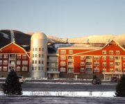
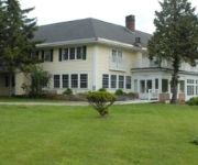
Hotels and Places to Stay
Inn at Baldwin Creek
White Horse Inn
Mad River Barn
Clay Brook At Sugarbush
SUGARBUSH CONDOS
Videos from this area
These are videos related to the place based on their proximity to this place.
Sunray Peace Village's Gaiagraphic Study
Sunray Peace Village is the center of a growing matrix of peace in the center of geophysical North America. Presented as a primer to the bioneering new science of Gaiagraphy this study show...
SkiRackDemo
Demo showing Camels Hump Woodworking Ski Racks Go to www.camelshumpwoodworking,com to purchase or learn more aobut the ski rack.
Harley Davidson Crash Mad River Glen
www.powderbank.com - the online snow show - bringing the mountains home - the latest information & entertainment in skiing & snowboarding from your favorite ski areas, mountains, and resorts....
Scenes from Vermont
These are scenic scenes from our trip around Vermont during the fall foliage of 2007.
Take flight over 75 acres in Starksboro
75 acres offers unparalleled natural beauty including a swimming pond, 2200 of the Huntington River, large barn, sugar house, and lush open pastures. For more information about this property,...
Sugarbush 1st Tracks Snow Report - Dec 26th, 2013
Snowing again and great turns! Check out all our holiday fun at www.sugarbush.com.
Pat Sugarbush VT Switch ski- snowball springfling
Sugarbush VT Patrick Forenza skiing some woods then back up Bravo chair for a fast switch trip down Snowball Springfling. Made it till the very end. Almost!
Sugarbush 1st Tracks Snow Report - March 16th, 2015
Clear skies and rising temps are on the menu this morning. There should be plenty of windblown leftovers from the 4" we received since Saturday night. Expect temps in the mid to high 30's,...
Sugarbush 1st Tracks Snow Report - April 16th, 2015
One of the finest spring skiing and riding days this season!
Videos provided by Youtube are under the copyright of their owners.
Attractions and noteworthy things
Distances are based on the centre of the city/town and sightseeing location. This list contains brief abstracts about monuments, holiday activities, national parcs, museums, organisations and more from the area as well as interesting facts about the region itself. Where available, you'll find the corresponding homepage. Otherwise the related wikipedia article.
Buels Gore, Vermont
Buels Gore is a gore in Chittenden County, Vermont, United States. The population was 12 at the 2000 census. In Vermont, gores and grants are unincorporated portions of a county which are not part of any town and have limited self-government (if any, as many are uninhabited).
Lincoln Peak (Vermont)
Lincoln Peak is a mountain located on the border between Vermont's Washington and Addison counties, within the Green Mountain National Forest. The mountain is named after President Abraham Lincoln (1809–1865), and is part of the Lincoln Mountain section of the Green Mountains. Lincoln Peak is flanked to the southwest by Mount Abraham, and to the north by Nancy Hanks Peak.
Appalachian Gap
Appalachian Gap, is a mountain pass in the Green Mountains of Vermont. The highest point of the pass is located in Chittenden County, about 0.2 mi west of the boundary between Chittenden and Washington County. The pass is in the Camel's Hump State Park. On the east side, Appalachian Gap is drained by Mill Brook, which drains into the Mad River, the Winooski River, and into Lake Champlain.


