Safety Score: 2,7 of 5.0 based on data from 9 authorites. Meaning we advice caution when travelling to United States.
Travel warnings are updated daily. Source: Travel Warning United States. Last Update: 2024-04-24 08:14:40
Delve into Banksville
Banksville in Allegheny County (Pennsylvania) is located in United States about 191 mi (or 307 km) north-west of Washington DC, the country's capital town.
Current time in Banksville is now 12:24 AM (Thursday). The local timezone is named America / New York with an UTC offset of -4 hours. We know of 12 airports close to Banksville, of which 5 are larger airports. The closest airport in United States is Allegheny County Airport in a distance of 7 mi (or 11 km), South-East. Besides the airports, there are other travel options available (check left side).
Also, if you like playing golf, there are some options within driving distance. If you need a hotel, we compiled a list of available hotels close to the map centre further down the page.
While being here, you might want to pay a visit to some of the following locations: Pittsburgh, Washington, Beaver, Butler and Greensburg. To further explore this place, just scroll down and browse the available info.
Local weather forecast
Todays Local Weather Conditions & Forecast: 12°C / 54 °F
| Morning Temperature | 3°C / 38 °F |
| Evening Temperature | 13°C / 55 °F |
| Night Temperature | 7°C / 44 °F |
| Chance of rainfall | 0% |
| Air Humidity | 37% |
| Air Pressure | 1026 hPa |
| Wind Speed | Light breeze with 5 km/h (3 mph) from South-West |
| Cloud Conditions | Broken clouds, covering 74% of sky |
| General Conditions | Broken clouds |
Thursday, 25th of April 2024
18°C (64 °F)
14°C (56 °F)
Few clouds, gentle breeze.
Friday, 26th of April 2024
18°C (64 °F)
16°C (60 °F)
Light rain, gentle breeze, overcast clouds.
Saturday, 27th of April 2024
25°C (76 °F)
18°C (64 °F)
Light rain, gentle breeze, overcast clouds.
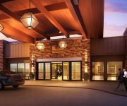
Hotels and Places to Stay
Fairmont Pittsburgh
Doubletree by Hilton Pittsburgh Greentree
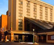
Sheraton Pittsburgh Hotel at Station Square
Embassy Suites by Hilton Pittsburgh Downtown
BRIDGESTREET THE ENCORE
Distrikt Hotel Pittsburgh
Renaissance Pittsburgh Hotel
WY GRAND PITTSBURGH DOWNTOWN
Holiday Inn Express & Suites PITTSBURGH WEST - GREEN TREE
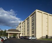
Hampton Inn Pittsburgh-Greentree
Videos from this area
These are videos related to the place based on their proximity to this place.
Flash Flood on Saw Mill Run in Pittsburgh - July 20th, 2012
After a series of slow-moving, powerful thunderstorms pushed through Pittsburgh and Allegheny County, flash floods popped up all over the place. This video was taken at the Beechview Seldom-Seen.
2011 Kennywood Christmas Holiday Lights Press Announcement
Kennywood Park announces their new for December 2011 Holiday Lights. The announcement was made on Wednesday, July 6, 2011.
Re: The real miracle image of our lady at our home.
SAME THING! My mom found this and yelled about it like your husbad did. She yelled something like... "WHO KEEPS DOING THIS TO MY CANDLES? IS IT YOU, OR IS IT THE SUN" Get it? The Sun...
Ervin invites delegates to Pittsburgh 2011
Mennonite Church USA's executive director, Ervin Stutzman, invites congregations and constituency groups to send delegates to Pittsburgh 2011.
Hotel Feliz
Short Silent Film. Film was completed for the 48 Hour Film Competition. The piece was shot and edited within 48 hours. WINNER: Best Musical Score, Pittsburgh 48 Film Project 2008.
Truck wreck in the snow
Hector Saddy was transporting 44000 pounds of U.S. mail from N.J. to the Pittsburgh's North Side when lost control of his truck and jack-knifed in the snow on Route 65 just about a mile from...
Perils For Pedestrians 177: Pittsburgh
http://www.pedestrians.org --Pittsburgh, Pennsylvania, has more sets of stairs than any other city in the United States. --Snow can be a problem for pedestrians in Pittsburgh. --We look at...
2011 CSX-City Year, Service Day: Pittsburgh, PA
On August 17, 2011, CSX and City Year came together to transform Rangers Field in McKees Rocks. Volunteers worked to build picnic tables & benches, restore baseball fields and paint murals....
The Beechview Seldom-Seen Greenway and Saw Mill Run
Aside from the litter (yuck) this is a very beautiful and rarely seen piece of Pittsburgh. Tucked away behind Brashear High School in the Beechview neighborhood of Pittsburgh, Pa, this trail...
Videos provided by Youtube are under the copyright of their owners.
Attractions and noteworthy things
Distances are based on the centre of the city/town and sightseeing location. This list contains brief abstracts about monuments, holiday activities, national parcs, museums, organisations and more from the area as well as interesting facts about the region itself. Where available, you'll find the corresponding homepage. Otherwise the related wikipedia article.
Canton Avenue
Canton Avenue, in Pittsburgh, Pennsylvania's Beechview neighborhood, is the steepest officially recorded public street in the United States. Canton Avenue may be steeper, but the Guinness Book of World Records says Baldwin Street in New Zealand is the world's steepest perhaps because of its length. Baldwin Street is 1,150 ft (350 meters) long and is said to include a grade of 35%.
Potomac (PAT station)
Potomac is a station on the "Beechview" branch of the Port Authority of Allegheny County's light rail network. It is located in Dormont, Pennsylvania. The station serves as a small commuter stop, featuring 22 parking spaces. It is located in a densely populated residential area and is designed to provide the primary access route for area residents to Downtown Pittsburgh.
Kelton (PAT station)
Kelton was a station on the Port Authority of Allegheny County's light rail network, located in Dormont, Pennsylvania. The street level stop was located in a densely populated residential area. It served commuters within walking distance, providing access toward Downtown Pittsburgh, South Hills Village, or Library. The busy commercial corridor along West Liberty Avenue was also accessible, located two blocks from the station.
Stevenson (PAT station)
Stevenson is a station on the Port Authority of Allegheny County's light rail network, located in Dormont, Pennsylvania. The street level stop is located in a highly populated residential area that features many medium density multi-unit facilities. It serves commuters within walking distance, providing access toward Downtown Pittsburgh, South Hills Village, or Library.
Neeld (PAT station)
Neeld was a station on the Port Authority of Allegheny County's light rail network, located in the Beechview neighborhood of Pittsburgh, Pennsylvania. The street level stop was located on a small island platform in the middle of Broadway Avenue, through which the T travels along former streetcar tracks. The station served a densely populated residential area through which bus service is limited because of the hilly terrain.
Shiras (PAT station)
Shiras is a station on the Port Authority of Allegheny County's light rail network, located in the Beechview neighborhood of Pittsburgh, Pennsylvania. The street level stop is located on a small island platform in the middle of Broadway Avenue, through which The T travels along former streetcar tracks. The station serves a densely populated residential area through which bus service is limited because of the hilly terrain.
Boustead (PAT station)
Boustead was a station on the Port Authority of Allegheny County's light rail network, located in the Beechview neighborhood of Pittsburgh, Pennsylvania. The street level stop was located on a small island platform in the middle of Broadway Avenue, through which the T travels along former streetcar tracks. The station served a densely populated residential area through which bus service is limited because of the hilly terrain.
Belasco (PAT station)
Belasco is a station on the Port Authority of Allegheny County's light rail network, located in the Beechview neighborhood of Pittsburgh, Pennsylvania. The street level stop is located on a small island platform in the middle of Broadway Avenue, through which The T travels along former streetcar tracks. The station serves a densely populated residential area through which bus service is limited because of the hilly terrain.
Coast (PAT station)
Coast was a station on the Port Authority of Allegheny County's light rail network, located in the Beechview neighborhood of Pittsburgh, Pennsylvania. The street level stop was located on a small island platform in the middle of Broadway Avenue, through which The T traveled along former streetcar tracks. The station served a densely populated residential area through which bus service was limited because of the hilly terrain.
Hampshire (PAT station)
Hampshire is a station on the Port Authority of Allegheny County's light rail network, located in the Beechview neighborhood of Pittsburgh, Pennsylvania. The street level stop is located on a small island platform in the middle of Broadway Avenue, through which The T travels along former streetcar tracks. The station serves a densely populated residential area and also the neighborhood's small but crowded business district.
Fallowfield (PAT station)
Fallowfield is a station on the Port Authority of Allegheny County's light rail network, located in the Beechview neighborhood of Pittsburgh, Pennsylvania. The high level stop is located at the end of Broadway Avenue, built where the tracks transition from a street to a private right-of-way. The station serves a densely populated residential area through which bus service is limited because of the hilly terrain.
W63AU
W63AU is an independent television station licensed to Pittsburgh, PA. The station has applied to operate a digital transmitter on channel 39.


