Safety Score: 2,7 of 5.0 based on data from 9 authorites. Meaning we advice caution when travelling to United States.
Travel warnings are updated daily. Source: Travel Warning United States. Last Update: 2024-04-24 08:14:40
Explore Mill Basin
The district Mill Basin of Brooklyn in Kings County (New York) is located in United States about 204 mi north-east of Washington DC, the country's capital.
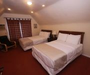
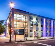
If you need a place to sleep, we compiled a list of available hotels close to the map centre further down the page.
Depending on your travel schedule, you might want to pay a visit to some of the following locations: Queens, Manhattan, Jersey City, Staten Island and The Bronx. To further explore this place, just scroll down and browse the available info.
Local weather forecast
Todays Local Weather Conditions & Forecast: 16°C / 60 °F
| Morning Temperature | 10°C / 51 °F |
| Evening Temperature | 17°C / 62 °F |
| Night Temperature | 9°C / 48 °F |
| Chance of rainfall | 0% |
| Air Humidity | 59% |
| Air Pressure | 1010 hPa |
| Wind Speed | Fresh Breeze with 16 km/h (10 mph) from South |
| Cloud Conditions | Overcast clouds, covering 98% of sky |
| General Conditions | Light rain |
Thursday, 25th of April 2024
9°C (48 °F)
8°C (47 °F)
Sky is clear, fresh breeze, clear sky.
Friday, 26th of April 2024
11°C (53 °F)
10°C (49 °F)
Sky is clear, moderate breeze, clear sky.
Saturday, 27th of April 2024
12°C (53 °F)
11°C (52 °F)
Light rain, fresh breeze, overcast clouds.
Hotels and Places to Stay
Delz Bed & Breakfast
Loralei Bed and Breakfast
Serenity at Home Guest House
Lefferts Manor Bed & Breakfast
Lxure Brooklyn Suites
Gabbs Apartment
La Quinta Inn and Suites Brooklyn East
Eve's Place
Midwood Suites Brooklyn
BEST WESTERN PLUS BROOKLYN BAY
Videos from this area
These are videos related to the place based on their proximity to this place.
Brooklyn MMA Promo
Footage from out Women's Kickboxing, Teens MMA, Brazilian Jiujitsu, Beginner and Advanced Mixed Martial Arts classes. Come try a free class! 5012 Avenue N, Brooklyn, NY 11234 Contact us: (718)...
2014 Chrysler Town And Country Vs.Dodge Grand Caravan | Chrysler, Dodge, Jeep, Ram Dealer
2014 Chrysler Town And Country Vs.Dodge Grand Caravan | Chrysler, Dodge, Jeep, Ram Dealer Brooklyn NY 112344 | http://www.kingschrysler.com | CALL CALL US: 888-430-3512 At Kings Chrysler ...
Chrysler Town And Country Vs. Toyota Sienna – Brooklyn Chrysler Dodge Ram Dealer
Chrysler Town And Country Vs. Toyota Sienna – Brooklyn Chrysler Dodge Ram Dealer| http://www.kingschrysler.com | CALL CALL US: 888-430-3512 At Kings Chrysler Dodge Jeep Ram, it's not just...
kayak trip from Martins Creek to Phillipsburg, N.J.
kayak trip,canoe,surf,ski,delaware,easton,pa,new jersey,Phillipsburg,ski,tennis,fishing,
MTA New York City Transit: On Board 2011 New Flyer XD40 #4888
On board a New Flyer Xcelsior on the B3 heading to Nostrand Avenue via Avenue U. 2011 New Flyer XD40 "Xcelsior" Low Floor Engine: Cummins ISL-9 EPA 10 Transmission: Allison World B400R ...
Chrysler Town Country Vs. Honda Odyssey – Brooklyn Chrysler Dodge Ram Dealer
Chrysler Town Country Vs. Honda Odyssey – Brooklyn Chrysler Dodge Ram Dealer| http://www.kingschrysler.com | CALL CALL US: 888-430-3512 At Kings Chrysler Dodge Jeep Ram, it's not just about...
NYC DEP Oyster Restoration Pilot, Gerritsen Creek: 8/23/11
NYC DEP Oyster Restoration Pilot Gerritsen Crek, Oyster Balls Jamaica Bay, NYC 08/23/2011.
NYC DEP Oyster Restoration Pilot, Gerritsen Creek: 06/08/11 (3)
NYC DEP Oyster Restoration Pilot Gerritsen Creek, Oyster Balls Jamaica Bay, NYC 06/08/2011.
NYC DEP Oyster Restoration Pilot, Gerritsen Creek: 06/08/11 (1)
NYC DEP Oyster Restoration Pilot Gerritsen Creek, Oyster Balls Jamaica Bay, NYC 06/08/2011.
Thomas Jefferson Club Holiday Party 2013 (1 of 3)
Brooklyn Democratic Chairman Frank Seddio Announces Roxanne Persaud's Candidacy for the 59th Assembly District to replace Councilman-elect Alan Maisel.
Videos provided by Youtube are under the copyright of their owners.
Attractions and noteworthy things
Distances are based on the centre of the city/town and sightseeing location. This list contains brief abstracts about monuments, holiday activities, national parcs, museums, organisations and more from the area as well as interesting facts about the region itself. Where available, you'll find the corresponding homepage. Otherwise the related wikipedia article.
Floyd Bennett Field
Floyd Bennett Field was New York City's first municipal airport, later a naval air station, and is now a park. While no longer used as an operational commercial, military or general aviation airfield, it is still used as a helicopter base by the New York Police Department (NYPD).
Flatlands, Brooklyn
Flatlands is a neighborhood in the south east part of the New York City borough of Brooklyn. The area is part of Brooklyn Community Board 18.
Canarsie, Brooklyn
Canarsie is a neighborhood in the southeastern portion of the borough of Brooklyn, in New York City, United States. The area is part of Brooklyn Community Board 18. Canarsie, which includes the entire 11236 ZIP code, is bordered on the east by Fresh Creek Basin, East 108th Street, and the BMT Canarsie Line to Linden Boulevard; on the north by Linden Boulevard; on the west by Remsen Avenue to Ralph Avenue and the Paerdegat Basin; and on the south by Jamaica Bay.
Gerritsen Beach, Brooklyn
Gerritsen Beach is a small town/community in the New York City borough of Brooklyn, located between Sheepshead Bay to the west and Marine Park to the east. The area is served by Brooklyn Community Board 15.
Mill Basin, Brooklyn
Mill Basin is a neighborhood in New York City in the southern portion of the borough of Brooklyn lying along Jamaica Bay and bounded to the north by Avenue U, and to the east, south, and west by the Mill Basin/Mill Island Inlet. The area is part of Brooklyn Community Board 18.
Marine Park (Brooklyn)
Marine Park is a public park located in the borough of Brooklyn in New York City. Its 798 acres surround the westernmost inlet of Jamaica Bay. Most of the land for Marine Park was donated to New York City to be turned into public park land by the Whitney family in 1920 and by Frederic B. Pratt and Alfred T. White, who jointly donated 150 acres in 1917. The land donated consists of the area between the current day Fillmore Avenue and Gerritsen Avenue and East 38th Street.
Yeshiva Derech HaTorah
Yeshiva Derech HaTorah is an Orthodox Jewish elementary school and high school for boys in Brooklyn, New York. Yeshiva Derech HaTorah is chartered by the Board of Regents of the University of the State of New York. The school is dedicated to the teachings of Orthodox Judaism, and has a fully approved New York State general studies curriculum as well. It enrolls students from nursery through 12th grade.
Kings Highway (Brooklyn)
Kings Highway is a broad avenue that passes mostly through areas in the southern part of the New York City borough of Brooklyn. The west end is at Bay Parkway and 78th Street. East of Ocean Avenue the street becomes mostly residential, tending generally east, then northeast, then north through Brooklyn and reaching East 98th Street in central Brooklyn.
Georgetown, Brooklyn
Georgetown is a small neighborhood located in southeastern Brooklyn. It is considered a subset of Bergen Beach. Georgetown is bounded by Ralph Avenue to the west, Veterans Avenue to the south, either Avenue T or Avenue U to the southeast, and Paerdegat Basin to the northeast.
Canarsie – Rockaway Parkway (BMT Canarsie Line)
Canarsie – Rockaway Parkway is the southern terminal station of the BMT Canarsie Line of the New York City Subway, and is one of the few grade-level stations in the system. Located at the intersection of Rockaway Parkway and Glenwood Road in the Canarsie neighborhood of Brooklyn, it is served by the L train at all times. This grade level station, opened on December 28, 1906, has two tracks and a single island platform. The two tracks end at offset bumper blocks at the south end of the station.
Aviator Sports and Recreation
Aviator Sports and Events Center http://www. aviatorsports. com is a concession for the National Park Servicehttp://www. nps. gov/ operating in New York City's historic first municipal airport, Floyd Bennett Field, which opened its hangars in 1931 and was decommissioned in 1972. Floyd Bennett Field (FBF) in Southeast Brooklyn is now part of the 4th most visited unit of the National Park System: Gateway National Recreation Area.
Dead Horse Bay
Dead Horse Bay is a small water body off Barren Island between the Gerritsen Inlet and Rockaway Inlet in the New York City borough of Brooklyn. During the seventeenth century, Dutch settlers built tide mills to grind wheat into flour. A remaining millstone can still be found along the Millstone trail.
Kings Plaza
Kings Plaza is a shopping center that opened in 1970, within the Marine Park/Mill Basin section of Brooklyn, east of Flatbush Avenue. The mall was originally owned by a joint venture between RH Macy's and Alexander's and is currently owned and managed by The Macerich Company. Kings Plaza originally hosted the now-defunct Alexander's, as well as Macy's department store chains.
Rockaway Parkway
Rockaway Parkway is a major commercial street in the Canarsie neighborhood of Brooklyn, New York. Canarsie High School, as well as a firehouse and several homes and businesses are on Rockaway Parkway. The Rockaway Parkway station is the southern terminus of the BMT Canarsie Line. The B42 bus runs primarily along Rockaway Parkway, and riders can board free at the Rockaway Parkway subway station.
Sheepshead Bay High School
Sheepshead Bay High School is a public high school in Brooklyn, New York City, New York.
South Shore High School (Brooklyn)
South Shore High School is one of the two defunct New York City public high schools in the neighborhood of Canarsie in Brooklyn. Opened in 1970, it had the capacity to educate 4000 students in grades nine through twelve. At the peak of enrollment, during the 1975–76 school year, the high school had a student population of 6,800, making South Shore the second largest high school in the United States, at that time. To accommodate the large capacity of students 13 class periods were provided.
Nazareth Regional High School (Brooklyn)
Nazareth Regional High School is a private, Roman Catholic high school in Brooklyn, New York. It is located within the Roman Catholic Diocese of Brooklyn. Nazareth is a multi-ethnic, multi-religious, co-educational private Catholic high school that offers a 4-year academic, college preparatory and religious education curriculum. It is governed by a policy-making lay board of trustees and is affiliated with the American Central Province of the Xaverian Brothers.
New York City DOE District 22
New York City DOE District 22 was a district in New York City encompassing New York City Public Schools in Brooklyn. However, districts were abolished in 2002 when the school system was reorganized.
Sheepshead Bay Houses
The Sheepshead Bay/Nostrand Houses housing projects are located in the Sheepshead Bay section of Brooklyn, New York, bounded by Nostrand Avenue, Bragg St. , Avenue V and Avenue X. Avenue W and Batchelder Street run through the development to divide it into a four block complex. All of its 34 buildings are six stories high. Some have lobbies, others do not.
Plumb Beach, Brooklyn
Plum Beach (sometimes spelled "Plumb") is a beach and surrounding neighborhood along the north shore of Rockaway Inlet, in the New York City borough of Brooklyn. It is located near the neighborhoods of Sheepshead Bay and Gerritsen Beach, just off the Belt Parkway. Originally an island, Hog Creek was filled in during the late 1930's.
Canarsie High School
Canarsie High School is a public high school in the Brooklyn neighborhood of Canarsie in New York City.
Hebrew Language Academy Charter School
Hebrew Language Academy Charter School is a public Charter school in Brooklyn, New York chartered to teach the Hebrew language "and aspects of Jewish culture" but like all public schools will not provide religious instruction and will neither encourage nor prohibit religious devotion.
High School for Medical Professions
The High School for Medical Professions is a public high school located in the Brooklyn neighborhood of Canarsie in New York City. It teaches grades 9 through 12, and enrolls students throughout the New York City school system. This high school opened in the buildings of the former Canarsie High School, which was closed due to poor performance and will graduate its last class in 2011.
Flatlands Avenue
Flatlands Avenue is a major street in the New York City borough of Brooklyn. It runs approximately five miles (8 km) east / west, from Avenue N and East 35th Street in Flatlands, Brooklyn in the west to Forbell Street, east of Fountain Avenue in East New York. The avenue runs a diagonal path and intersects with several other major streets in Brooklyn, including Flatbush Avenue, Utica Avenue, Ralph Avenue, Rockaway Parkway, and Pennsylvania Avenue.
Jans Martense Schenck house
Jan Martense Schenck, (1631 in Amersfoort, Utrecht, Netherlands - Aug, 27 1687) arrived in New Netherlands on June 28, 1650, on the ship De Valckener (the Falconer) with his sister Annetje and brother Roelof. He bought a parcel of land on Molen Eylandt (Mill Island) in the Dutch town of Nieuw Amersfoort in what is now the Mill Basin section of Brooklyn, New York.


