Safety Score: 2,7 of 5.0 based on data from 9 authorites. Meaning we advice caution when travelling to United States.
Travel warnings are updated daily. Source: Travel Warning United States. Last Update: 2024-04-24 08:14:40
Delve into Zarephath
Zarephath in Somerset County (New Jersey) with it's 37 habitants is located in United States about 173 mi (or 279 km) north-east of Washington DC, the country's capital town.
Current time in Zarephath is now 08:45 PM (Wednesday). The local timezone is named America / New York with an UTC offset of -4 hours. We know of 8 airports close to Zarephath, of which 4 are larger airports. The closest airport in United States is Morristown Municipal Airport in a distance of 20 mi (or 32 km), North-East. Besides the airports, there are other travel options available (check left side).
There are two Unesco world heritage sites nearby. The closest heritage site in United States is Statue of Liberty in a distance of 34 mi (or 55 km), East. Also, if you like playing golf, there are some options within driving distance. We encountered 1 points of interest near this location. If you need a hotel, we compiled a list of available hotels close to the map centre further down the page.
While being here, you might want to pay a visit to some of the following locations: Somerville, New Brunswick, Morristown, Flemington and Trenton. To further explore this place, just scroll down and browse the available info.
Local weather forecast
Todays Local Weather Conditions & Forecast: 12°C / 54 °F
| Morning Temperature | 2°C / 35 °F |
| Evening Temperature | 14°C / 57 °F |
| Night Temperature | 5°C / 41 °F |
| Chance of rainfall | 0% |
| Air Humidity | 23% |
| Air Pressure | 1028 hPa |
| Wind Speed | Gentle Breeze with 6 km/h (4 mph) from South |
| Cloud Conditions | Clear sky, covering 0% of sky |
| General Conditions | Sky is clear |
Thursday, 25th of April 2024
15°C (58 °F)
7°C (44 °F)
Sky is clear, gentle breeze, clear sky.
Friday, 26th of April 2024
13°C (56 °F)
11°C (52 °F)
Overcast clouds, gentle breeze.
Saturday, 27th of April 2024
18°C (64 °F)
17°C (62 °F)
Light rain, light breeze, broken clouds.
Hotels and Places to Stay
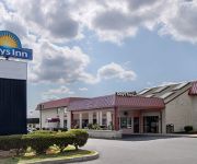
DAYS INN HILLSBOROUGH
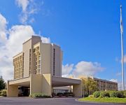
Crowne Plaza SOMERSET-BRIDGEWATER
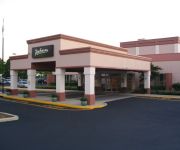
Radisson Hotel Piscataway-Somerset
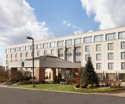
Embassy Suites by Hilton Piscataway Somerset
Bridgewater Marriott
Doubletree by Hilton Somerset Hotel and Conference Center
LA QUINTA INN STE SOMERSET
SpringHill Suites Somerset Franklin Township
Econo Lodge Somerset
Residence Inn Somerset
Videos from this area
These are videos related to the place based on their proximity to this place.
Levee Break in Bound Brook NJ Tropical Storm Irene 2011
Tropical Storm Irene Struck in 2011 dumping inches of rain across Central NJ. Bound Brook's almost completed flood walls and levee system did not hold. A break occured at the area of Main...
Union Pacific EMD Trio on NS 214 at Manville, NJ
A foreign delight in a set of 3 UP EMD's powering NS intermodal train 214 eastbound on the Lehigh Line through Manville, NJ.
CSX OCS P904 at Manville, NJ 8/5/09
CSX Office Car Special P904-04 heads north on the Trenton Sub past Manville Yard. This train was running from Jacksonville, FL, to North Bergen, NJ. CSX Trenton Subdivision MP QA56.6 CSXT...
BNSF ES44AC leads NS intermodal 214 at Manville, NJ
New BNSF unit leads NS intermodal 214 eastbound on the Lehigh Line at Manville, NJ.
CSX Q300 at Manville, NJ 8/5/09
CSX Q300-05 starts up after completing its work at Manville. CSX Trenton Subdivision MP QA56.6 CSXT 9005 (CW44-9) CSXT 822 (ES44AH) 11:22AM.
Petey's Manville films: scene 29 - parade
I believe this is the annual Memorial Day Parade that marched from Dukes Parkway Park to the Sacred Heart Cemetery, where they held ceremonies. The Manville National Bank can be seen in the...
Petey's Manville films: scene 44 - parade
This may be the 25th Silver Anniversary Jubilee (1954). One of the cars (minute 0:36) has a sign that says "25". Featuring: "The Original Hobo Band", Petey's float with band, Troop 193 (not...
2003 Toyota Celica Used Cars Manville NJ
http://www.manvilleautosales.net This 2003 Toyota Celica is available from Manville Auto Sales. For details, call us at (908)393-5900.
Videos provided by Youtube are under the copyright of their owners.
Attractions and noteworthy things
Distances are based on the centre of the city/town and sightseeing location. This list contains brief abstracts about monuments, holiday activities, national parcs, museums, organisations and more from the area as well as interesting facts about the region itself. Where available, you'll find the corresponding homepage. Otherwise the related wikipedia article.
Manville, New Jersey
Manville is a borough in Somerset County, New Jersey, United States. As of the 2010 United States Census, the borough's population was 10,344, reflecting an increase of 1 (+0.0%) from the 10,343 counted in the 2000 Census, which had in turn declined by 224 (-2.1%) from the 10,567 counted in the 1990 Census. Manville was named after the Johns-Manville Corporation, which maintained a large manufacturing facility in the borough for decades.
Zarephath, New Jersey
Zarephath (pronounced ZARRA-fath) is a census-designated place and unincorporated community located in Franklin Township, in Somerset County, New Jersey, United States. As of the 2010 United States Census, the CDP's population was 37.
Van Nest – Weston Burying Ground
The Van Nest - Weston Burying Ground is in Hillsborough Township, New Jersey on the border with Manville. It is also referred to as the Van Nest Burying Ground and the Frelinghuysen Burying Ground. The cemetery is located on Millstone River Road and the corner of Schmidt Street. It resides on the edge of Kupper Airport (Central Jersey Regional Airport). On the opposite side of the Millstone River and slightly north is the Davis Burial Ground in Zarephath, New Jersey.
Somerset Christian College
Somerset Christian College is a private evangelical Christian college and is owned and operated by Pillar of Fire International, a religious denomination. The college was located in the Zarephath section of Franklin Township in Somerset County, New Jersey. Due to the latest flood, the Zarephath campus building have been condemned, and all classes meet at Stonecrest Church in Warren, NJ. SCC is the only accredited evangelical college in the state of New Jersey.
Manville School District
The Manville School District is a comprehensive community public school district that serves students in kindergarten through twelfth grade from Manville, in Somerset County, New Jersey, United States. As of the 2007-08 school year, the district's four schools had an enrollment of 1,250 students and 107 classroom teachers (on an FTE basis), for a student–teacher ratio of 11.68.
Davis Burial Ground
The Davis Burial Ground is between Zarephath, New Jersey and South Bound Brook, New Jersey. It is on Weston Canal Road near the Delaware and Raritan Canal. It contains about 100 graves with maybe 50 extant tombstones. On the opposite side of the canal is a similar cemetery: Van Nest - Weston Burying Ground, Bound Brook.
Weston, New Jersey
Weston is a census-designated place and unincorporated community located in Franklin Township, in Somerset County, New Jersey, United States. As of the 2010 United States Census, the CDP's population was 1,235. Situated on the east side of the Millstone River north of East Millstone and south of Zarephath (which has grown to include some of the area once considered Weston), early names used for the area were Schenck's Mill, Van Neste's Mill and Frogtown.
Randolph Brook
Randolph Brook is a tributary of the Millstone River in northern Franklin Park, New Jersey, United States.


