Safety Score: 2,7 of 5.0 based on data from 9 authorites. Meaning we advice caution when travelling to United States.
Travel warnings are updated daily. Source: Travel Warning United States. Last Update: 2024-04-18 08:12:24
Touring Communipaw
The district Communipaw of Jersey City in Hudson County (New Jersey) is a subburb located in United States about 202 mi north-east of Washington DC, the country's capital place.
Need some hints on where to stay? We compiled a list of available hotels close to the map centre further down the page.
Being here already, you might want to pay a visit to some of the following locations: Newark, Manhattan, Brooklyn, Elizabeth and Staten Island. To further explore this place, just scroll down and browse the available info.
Local weather forecast
Todays Local Weather Conditions & Forecast: 9°C / 49 °F
| Morning Temperature | 9°C / 49 °F |
| Evening Temperature | 9°C / 48 °F |
| Night Temperature | 9°C / 47 °F |
| Chance of rainfall | 1% |
| Air Humidity | 77% |
| Air Pressure | 1018 hPa |
| Wind Speed | Moderate breeze with 11 km/h (7 mph) from South-West |
| Cloud Conditions | Overcast clouds, covering 100% of sky |
| General Conditions | Light rain |
Friday, 19th of April 2024
13°C (55 °F)
11°C (52 °F)
Broken clouds, moderate breeze.
Saturday, 20th of April 2024
17°C (63 °F)
10°C (50 °F)
Light rain, moderate breeze, overcast clouds.
Sunday, 21st of April 2024
12°C (53 °F)
12°C (54 °F)
Scattered clouds, moderate breeze.
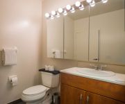
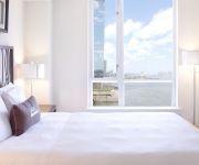
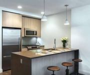
Hotels and Places to Stay
Sky City Apartments at The Marina
The Stella - Self Catering Apartments
Sky City Apartments at Grand
Sky City at Park
Sky City Apartments at The Harbor
Sky City at The Powerhouse Arts District
Sky City Apartments at Riverfront North
Sky City Apartments at Soho West
Dharma Home Suites at the Arts District
Luxy Suites Columbus
Videos from this area
These are videos related to the place based on their proximity to this place.
Jersey City, New Jersey - Scarinci Hollenbeck
The Law offices of Scarinci Hollenbeck, a Regional Law Firm based in Lyndhurst, NJ is opening a new office in Jersey City, New Jersey. This video is the unveiling of their Logo in conjunction...
Jersey City Personal Injury Super Lawyer Anthony Carbone
For over 26 years, Anthony Carbone has been Jersey's top injury lawyer for the people of Jersey City, Hudson County, Newark, New Jersey and surrounding areas. Call today for free consultation....
Super G: Pole Position Raceway (Jersey City, NJ) 08/18/14 (1 of 5)
Race 1 (Viking Cam) 8 Laps Best Lap Times: Viking- 41.530 DuG- 41.980.
Jersey City Real Estate I 201.562.6850 I Best Two Bedroom Values in Downtown Jersey City Real Estate
Best Two Bedroom Values in Downtown Jersey City Real Estate, http://jerseycityrealestate.net/2012/04/best-two-bedroom-values-in-downtown-jersey-city-real-estate/ a survery of the best two bedroom.
Speed Race the Cube at Pole Position Raceway Jersey City
Anthony Brooks takes on David Dalton, the fastest racer at Pole Position Raceway in Jersey City, NJ. It's kart vs is cube in a battle to see who's the fastest in New Jersey! Visit http://www.beyo...
Computer Repair and Laptop Repair in Jersey City and Hoboken
Computer Repair and Laptop Repair in Jersey City and Hoboken. Call Us Now! 609-936-8407 -Don't get forced into buying a new computer. At Pc-Cured we have developed the CSO package that will.
Chiropractor Jersey City | Call 201 624 2111
Chiropractor Jersey City - http://jerseycitypainmanagement.com Watch this video to discover the best information on Chiropractor Jersey City available on the internet today. It is by far the...
Jersey City, New Jersey - PATH Train arrives at Journal Square HD (2015)
The Journal Square Transportation Center is a multi-modal transportation hub located on Kennedy Boulevard at Journal Square in Jersey City, New Jersey, United States. Owned and operated by...
Computer Repair in Jersey City NJ
http://www.stepuptechsite.com Step Up Technical Solutions of Union City Nj for the goal of encouraging individuals prevent terrible computer difficulties. Step up, located at 4407 Park Avenue...
Videos provided by Youtube are under the copyright of their owners.
Attractions and noteworthy things
Distances are based on the centre of the city/town and sightseeing location. This list contains brief abstracts about monuments, holiday activities, national parcs, museums, organisations and more from the area as well as interesting facts about the region itself. Where available, you'll find the corresponding homepage. Otherwise the related wikipedia article.
Liberty State Park
Liberty State Park is located on Upper New York Bay in Jersey City, New Jersey, opposite the Liberty Island and Ellis Island. The park opened in 1976 to coincide with bicentennial celebrations and is operated and maintained by the New Jersey Division of Parks and Forestry.
Black Tom explosion
The Black Tom explosion on July 30, 1916, in Jersey City, New Jersey, was an act of sabotage on American ammunition supplies by German agents to prevent the materiel from being used by the Allies in World War I.
Lincoln High School (New Jersey)
Lincoln High School is a four-year public high school located in Jersey City, in Hudson County, New Jersey, United States, operated as part of the Jersey City Public Schools, serving students in ninth through twelfth grade. The school has been accredited by the Middle States Association of Colleges and Schools Commission on Secondary Schools since 1928.
Jersey Avenue (HBLR station)
Jersey Avenue is a station on the Hudson–Bergen Light Rail (HBLR) located south of Grand Street in Jersey City, New Jersey. The station opened on April 22, 2000. There are two tracks and an island platform. Northbound service from the station is available to Hoboken Terminal and Tonnelle Avenue in North Bergen. Southbound service is available to terminals at West Side Avenue in Jersey City or 8th Street in Bayonne.
Liberty State Park (HBLR station)
Liberty State Park is a station on the Hudson–Bergen Light Rail (HBLR) located between Communipaw and Johnston Avenues in Jersey City, New Jersey. The station opened on April 15, 2000. There are two tracks and two side platforms. Northbound service from the station is available to Hoboken Terminal and Tonnelle Avenue in North Bergen. Southbound service is available to terminals at West Side Avenue in Jersey City or 8th Street in Bayonne.
Garfield Avenue (HBLR station)
Garfield Avenue is a station on the Hudson–Bergen Light Rail (HBLR) located at Union Street CR 610 in the Claremont Section of Jersey City, New Jersey. The station opened on April 22, 2000. It is at the eastern end of a railroad cut originally excavated in Bergen Hill in 1869 for the Central Railroad of New Jersey Newark and New York Railroad Branch. Garfield Avenue, presumably named for assassinated president James A.
Greenville, Jersey City
Greenville is the southernmost section of Jersey City, New Jersey, United States. In its broadest definition Greenville encompasses the area south of the West Side Branch of Hudson-Bergen Light Rail and north of the city line with Bayonne, between the Upper New York Bay and the Newark Bay, and corresponds to the postal area zip code 07305. The Claremont Section straddles Greenville and Bergen-Lafayette.
Bergen Hill
Bergen Hill refers to the lower Hudson Palisades in New Jersey, United States, where they emerge on Bergen Neck, which in turn is the peninsula between the Hackensack and Hudson River, and their bays. In Hudson County, it reaches a height of 260 feet.
Van Vorst Township, New Jersey
Van Vorst was a township that existed in Hudson County, New Jersey, United States, from 1841 to 1851, that is now a neighborhood in Jersey City. The township was located on the Hudson River, immediately south of downtown Jersey City and across from Manhattan. Van Vorst was incorporated as a township by an Act of the New Jersey Legislature on April 12, 1841, from portions of Bergen Township. As of the 1850 United States Census, the township had a total population of 4,617.
Jersey City Museum
Jersey City Museum is an art museum located in the Van Vorst Park section of Downtown Jersey City, New Jersey. Serving a diverse community, the Museum collects, exhibits, preserves, and interprets its collections of 19th- and 20th-century paintings, works on paper, sculpture, and material culture from the region. The mission of the museum is to serve the community by "maintaining, preserving, and interpreting the region's cultural heritage.
County Prep High School
County Prep High School is a full-time public high school, located in Jersey City, New Jersey, United States, operating as part of the Hudson County Schools of Technology. As of the 2010-11 school year, the school had an enrollment of 612 students and 63.5 classroom teachers (on an FTE basis), for a student–teacher ratio of 9.64:1. There were 179 students (29.2% of enrollment) eligible for free lunch and 98 (16.0% of students) eligible for reduced-cost lunch.
Boyle's Thirty Acres
Boyle's Thirty Acres was a large wooden bowl arena in Jersey City, New Jersey. It was built specifically for the world heavyweight championship bout between Jack Dempsey of the United States and Georges Carpentier of France on July 2, 1921. It held approximately 80,000 fans and was built at a cost of $250,000. It was situated around Montgomery Street and Cornelison Avenue, on a plot of marshland owned by John P. Boyle.
James J. Ferris High School
James J. Ferris High School is a four-year public high school located in Jersey City, New Jersey, operated as part of the Jersey City Public Schools. The school has been accredited by the Middle States Association of Colleges and Schools Commission on Secondary Schools since 1940. The school is named after James J.
Liberty National Golf Club
Liberty National Golf Club is a country club in Jersey City, New Jersey with a 7,346 yard course designed by Robert E. Cupp and Tom Kite. The club cost over $250 million to build, making it one of the most expensive golf courses in history. Club designers added amenities such as an on-site heliport, yacht services, a spa and a restaurant. Nine hundred adjacent homes, slated to be built in the coming years, are said to cost between $1,500,000 to $5,000,000.
Van Vorst Park
Van Vorst Park is a neighborhood in Historic Downtown in Jersey City, centered around a park sharing the same name. The neighborhood is located west of Paulus Hook and Marin Boulevard, north of Grand Street, east of the Turnpike Extension, and south of The Village and Christopher Columbus Drive. Much of it is included in the Van Vorst Park Historical District. The park was a centerpiece of Van Vorst Township, a township that existed in Hudson County from 1841 to 1851.
McGinley Square
McGinley Square is in Jersey City, New Jersey, located near the middle of the city, south of Journal Square. The square itself is at the intersection of two of the city's major thoroughfares, Montgomery Street, and Bergen Avenue. The area was named after Monsignor Roger McGinley, the builder of St. Aedans Church. Hudson Catholic Regional High School, the Jersey City Armory, the Jersey City YMCA, St. Mark Coptic Orthodox Church, and Bergen Square are all within a short walk from the square.
Bergen-Lafayette, Jersey City
Bergen-Lafayette is a section of Jersey City, New Jersey. As its name implies, Bergen-Lafayette is made of different neighborhoods. It lies west-southwest of Downtown and Liberty State Park. Its less-defined other borders overlap those of Greenville at Hudson-Bergen Light Rail to the south, Lincoln Park/West Bergen to the west, and Montgomery Street at McGinley Square to the north.
Summit Avenue (Hudson Palisades)
County Route 617 is 4.55 miles long and follows one street, Summit Avenue along the ridge of the Hudson Palisades in Hudson County, New Jersey. Its southern end is CR 622, or Grand Street, at Communipaw Junction in the Bergen-Lafayette Section of Jersey City (although Summit Avenue continues one block south to Garfield and Communipaw Avenues without county maintenance). Its northern end is CR 691, 32nd Street, a section of the Bergen Turnpike, in Union City.
Martin Luther King Drive (HBLR station)
The Martin Luther King Drive station of the Hudson–Bergen Light Rail is located near the intersection of Virginia Avenue. The station opened on April 22, 2000, with a memorial to slain civil rights leader Martin Luther King, Jr. at its entrance. and other related public art throughout the station.
Bergen Point Plank Road
The Jersey City and Bergen Point Plank Road was a road in the 19th century in Hudson County, New Jersey which ran between Paulus Hook and Bergen Point. The company which built the road received its charter on March 6, 1850. to improve one that had been built in the 18th century. It has subsequently become Grand Street and Garfield Avenue in Jersey City and Broadway in Bayonne.
Jersey City Armory
The Jersey City Armory is located at 678 Montgomery Street near McGinley Square in Jersey City, New Jersey, USA. In addition to being a military training and mustering facility of the New Jersey National Guard (New Jersey National Guard 2–133 Infantry 250 Jersey City), the WPA era armory has long been used as a sports arena, particularly for boxing, basketball, and track and field events, and more recently mixed martial arts.
Dixon Mills
Dixon Mills are a residential complex in Jersey City, New Jersey that uses the buildings of the former location of the Joseph Dixon Crucible Company, which was in use between 1847 and 1895. There is a small museum with artifacts from the building and its history in the lobby of the complex.
Bergen Hill, Jersey City
For lower Hudson Palisades, see: Bergen Hill. Bergen Hill the name given to the emergence of the Hudson Palisades along the Bergen Neck peninsula in Hudson County, New Jersey and the inland neighborhood of the Jersey City where they rise from the coastal plain at the Upper New York Bay. The name is taken from the original 17th century New Netherland settlement of Bergen, which in Dutch means hills.
Liberation (Holocaust memorial)
Liberation is a bronze Holocaust memorial created by the sculptor Nathan Rapoport, located in Liberty State Park in Jersey City, New Jersey. Officially dedicated on May 30, 1985, the monument portrays an American soldier, carrying the body of a Holocaust survivor out of a Nazi concentration camp.
Canal Crossing, Jersey City
Canal Crossing is a New Urbanism project on the eastern side of Jersey City, New Jersey between the Greenville Section, Bergen-Lafayette and Liberty State Park. The approximately 111 acre area, previously designated for industrial and distribution uses has been re-zoned for transit-oriented residential and commercial use and the construction of a neighborhood characterized as a sustainable community.


