Safety Score: 2,7 of 5.0 based on data from 9 authorites. Meaning we advice caution when travelling to United States.
Travel warnings are updated daily. Source: Travel Warning United States. Last Update: 2024-04-23 08:18:23
Touring Riverside
Riverside in Essex County (Massachusetts) is a town located in United States about 411 mi (or 662 km) north-east of Washington DC, the country's capital place.
Time in Riverside is now 05:29 AM (Tuesday). The local timezone is named America / New York with an UTC offset of -4 hours. We know of 9 airports nearby Riverside, of which 3 are larger airports. The closest airport in United States is Manchester Airport in a distance of 23 mi (or 37 km), North-West. Besides the airports, there are other travel options available (check left side).
Also, if you like the game of golf, there are several options within driving distance. We collected 2 points of interest near this location. Need some hints on where to stay? We compiled a list of available hotels close to the map centre further down the page.
Being here already, you might want to pay a visit to some of the following locations: Brentwood, Boston, Dover, Allenstown and Dedham. To further explore this place, just scroll down and browse the available info.
Local weather forecast
Todays Local Weather Conditions & Forecast: 15°C / 59 °F
| Morning Temperature | 2°C / 35 °F |
| Evening Temperature | 14°C / 58 °F |
| Night Temperature | 7°C / 45 °F |
| Chance of rainfall | 0% |
| Air Humidity | 30% |
| Air Pressure | 1020 hPa |
| Wind Speed | Gentle Breeze with 8 km/h (5 mph) from North-West |
| Cloud Conditions | Clear sky, covering 0% of sky |
| General Conditions | Sky is clear |
Tuesday, 23rd of April 2024
7°C (44 °F)
1°C (33 °F)
Moderate rain, moderate breeze, overcast clouds.
Wednesday, 24th of April 2024
9°C (48 °F)
4°C (39 °F)
Sky is clear, gentle breeze, clear sky.
Thursday, 25th of April 2024
14°C (57 °F)
7°C (45 °F)
Sky is clear, gentle breeze, clear sky.
Hotels and Places to Stay
BW MERRIMACK VALLEY
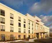
Hampton Inn Haverhill MA
Videos from this area
These are videos related to the place based on their proximity to this place.
Haverhill DUI Lawyer | 617-488-9488 | Haverhill DUI Attorney
Haverhill DUI Lawyer for immediate help call 617-488-9488 your Haverhill DUI defense attorney. Have you been caught drunk driving? A serious error of judgment like this, Can put your driving...
REVENGE @ Anchors Up Haverhill Massachusetts
Revenge Darwinism Anchors Up 2.15.10 Haverhill Massachusetts 3 camera shoot for INTO THE PIT documentary.
Woolworth Dept Store Demolition 3-13-2015 Haverhill Ma
The old Woolworth Dept. store building opened in 1949 and closed in 1969 and has been vacant since, it is the last of the buildings to be demolished to make way for a new building called The...
Haverhill, MA Ocasio Building Demolished
Downtown Haverhill Ma is getting a facelift with the first of 4 building coming down. The Ocasio Building Bets known as the Bonin building, came down to make way for a Satellite Campus for...
Kenoza Lake Haverhill MA virtual hike
No audio. Had some minor issue with the file so it didn't get come up as a complete loop. None the less here's a 45 minute walk at about 3.5 mph. Enjoy.
Drone video of Woolworth Building Haverhill, Ma 2014
I wanted to make a video of the Woolworth Building and the buildings next to it, before they come down. This was the first store Woolworth opened, and it was in Haverhill, Ma The yellow, art...
Sunroom Additions Haverhill MA - 603-890-6777 - NH Sunrooms
Looking for Sunroom Addition Ideas? This video covers 3 benefits to a new Sunroom in Haverhill MA. Watch now! 0:08 The Benefits Are Clear, You'll Gain... 0:20 Lower Heating Bills 0:54 Proper...
Dog Obedience Training in Haverhill, MA by First Choice Canine
Matt Bates: Being an outdoors person, Matt enjoys fishing, hunting, and hiking. Training helped to make his dog Brady the perfect companion to share these hobbies with. Not having to worry...
Advanced Dog Obedience Training in Haverhill, MA
Visit us at http://www.firstchoicecanine.com and https://www.facebook.com/FirstChoiceCanine.
Isaiah Williams (Haverhill) vs. Wilmington @ 171lbs
Haverhill Invitational, January 9, 2010. Semifinal match at 171lbs. One of the best high school wrestlers in Mass. Complete domination.
Videos provided by Youtube are under the copyright of their owners.
Attractions and noteworthy things
Distances are based on the centre of the city/town and sightseeing location. This list contains brief abstracts about monuments, holiday activities, national parcs, museums, organisations and more from the area as well as interesting facts about the region itself. Where available, you'll find the corresponding homepage. Otherwise the related wikipedia article.
Bradford, Massachusetts
Bradford is a village in Essex County, Massachusetts, United States. The village, located on the south side of the Merrimack River, was annexed to the city of Haverhill in 1897. Bradford has its own post office and zip code: 01835.
Bradford College (United States)
Bradford College operated in the part of Haverhill, Massachusetts that was once the town of Bradford. Founded in 1803, Bradford College began as Bradford Academy, one of New England's earliest coeducational institutions. In 1836 Bradford chose to devote itself exclusively to the education of women. By 1932, the school had grown from a secondary school and became Bradford Junior College. In 1971 Bradford was authorized to grant bachelor's degrees.
Northpoint Bible College
-Northpoint Bible College {{#invoke:InfoboxImage|InfoboxImage|image=zbclogo. png|size=200px|sizedefault=frameless|alt=}}Zion Bible College logoMotto Zion, the joy of the whole earth!Motto in English /Users/marcst/Desktop/npbc. jpgEstablished 1924Type PrivateReligious affiliation Assemblies of God USAPresident Rev. Dr.
Ski Bradford
Ski Bradford (also known as Bradford Ski Area) is a small ski area located in the Bradford section of Haverhill, Massachusetts.
Hales Island (Massachusetts)
Hale's Island is a 54-acre island located on the Merrimack River in Haverhill / Bradford, Massachusetts. The property is part of Silsby's farm. Although there is not much there now, the island has reportedly been home to a golf course, a hotel, and even a small airport. The golf course was destroyed in 1936 when the island flooded. There is still the remnants of a foundation on the island. This was the foundation of the golf course club house. There are also four artesian wells on the island.
Winnekenni Castle
Winnekenni Castle is located in the over 700-acre Winnekenni Park Conservation Area, overlooking Kenoza Lake, in Haverhill, Massachusetts. Inspired by stone buildings he saw while visiting England, Haverhill chemist Dr. James R. Nichols built it between 1873 and 1875 as a summer home, and he named it and the surrounding land "Winnekenni," an Algonquin word meaning "very beautiful.
Buttonwoods Museum
The Buttonwoods Museum is a museum operated by the Haverhill Historical Society in Haverhill, Massachusetts, in the Merrimack Valley. The museum includes a John Ward House, a Duncan House, and the Daniel Hunkins Shoe Shop.
Raid on Haverhill (1708)
The Raid on Haverhill was a military engagement that took place on August 29, 1708 during Queen Anne's War. French, Algonquin, and Abenaki warriors under the command of Jean-Baptiste Hertel de Rouville descended on Haverhill, then a small frontier community in the Province of Massachusetts Bay. In the surprise attack, 16 people were killed and another 14 to 24 were taken captive.


