Safety Score: 2,7 of 5.0 based on data from 9 authorites. Meaning we advice caution when travelling to United States.
Travel warnings are updated daily. Source: Travel Warning United States. Last Update: 2024-04-19 08:03:45
Delve into Cherry Hill
Cherry Hill in City of Baltimore (Maryland) is a city located in United States about 33 mi (or 53 km) north-east of Washington DC, the country's capital town.
Current time in Cherry Hill is now 10:40 PM (Friday). The local timezone is named America / New York with an UTC offset of -4 hours. We know of 8 airports closer to Cherry Hill, of which 3 are larger airports. The closest airport in United States is Baltimore/Washington International Thurgood Marshal Airport in a distance of 6 mi (or 9 km), South. Besides the airports, there are other travel options available (check left side).
There is one Unesco world heritage site nearby. It's Monticello and the University of Virginia in Charlottesville in a distance of 96 mi (or 155 km), South-West. Also, if you like playing golf, there are some options within driving distance. We saw 10 points of interest near this location. In need of a room? We compiled a list of available hotels close to the map centre further down the page.
Since you are here already, you might want to pay a visit to some of the following locations: Baltimore, Towson, Ellicott City, Annapolis and Bel Air. To further explore this place, just scroll down and browse the available info.
Local weather forecast
Todays Local Weather Conditions & Forecast: 17°C / 63 °F
| Morning Temperature | 12°C / 53 °F |
| Evening Temperature | 15°C / 59 °F |
| Night Temperature | 10°C / 51 °F |
| Chance of rainfall | 0% |
| Air Humidity | 32% |
| Air Pressure | 1016 hPa |
| Wind Speed | Moderate breeze with 11 km/h (7 mph) from South-East |
| Cloud Conditions | Broken clouds, covering 84% of sky |
| General Conditions | Light rain |
Saturday, 20th of April 2024
14°C (57 °F)
11°C (52 °F)
Overcast clouds, gentle breeze.
Sunday, 21st of April 2024
17°C (62 °F)
13°C (55 °F)
Sky is clear, gentle breeze, clear sky.
Monday, 22nd of April 2024
20°C (67 °F)
13°C (56 °F)
Scattered clouds, moderate breeze, broken clouds.
Hotels and Places to Stay
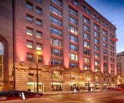
Hotel RL by Red Lion Baltimore Inner Harbor
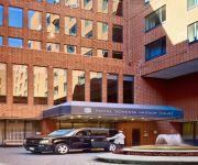
Royal Sonesta Harbor Court Baltimore
Renaissance Baltimore Harborplace Hotel
Delta Hotels Baltimore Inner Harbor
Royal Sonesta Harbor Court
Hyatt Regency Baltimore Inner Harbor
Sheraton Inner Harbor Hotel
Baltimore Marriott Inner Harbor at Camden Yards
Hilton Baltimore
Hampton Inn - Suites Baltimore Inner Harbor
Videos from this area
These are videos related to the place based on their proximity to this place.
Reunion of Friends from Lakeland in Baltimore, MD
These are friends who grew up together in an old community known as Lakeland in Baltimore, Maryland 21230. On 6/9/2012 they had a small reunion at the Hollinswood Inn near the old community.
Baltimore City, MD: Wrong Way Driver on I-295 On Ramp
Driver in 4D Sedan takes a different approach to entering I-295 in Baltimore City.
Ex-Conrail EMD SD60I On CSX Intermodal Train
Crossing Hollins Ferry Road in Baltimore City, Maryland.
Car Runs Gate in Front Of CSX W091
cool engineer on ballast work train crossing Hollins Ferry Road in Baltimore City, MD.
Innovative Uses for Living Walls
This segment of the Greenwall Mojo Blog is a simple progression of Living Retaining Wall projects, shot by Jimmy Dick with SmartSlope, LLC of their Baltimore, MD Headquarters. The SmartSlope...
Videos provided by Youtube are under the copyright of their owners.
Attractions and noteworthy things
Distances are based on the centre of the city/town and sightseeing location. This list contains brief abstracts about monuments, holiday activities, national parcs, museums, organisations and more from the area as well as interesting facts about the region itself. Where available, you'll find the corresponding homepage. Otherwise the related wikipedia article.
Cherry Hill, Baltimore
Cherry Hill is one of the southernmost neighborhoods in Baltimore, Maryland.
Westport, Baltimore
Westport is a neighborhood in south Baltimore, Maryland. It is bordered by the Middle Branch River on the east, Cherry Hill and Lansdowne to the south, Hollins Ferry Road to the west, and Interstate 95 to the north. The Baltimore Washington Parkway (MD Route 295) runs through the middle of Westport and intersects with I-95, and is along the Westport Baltimore Light Rail Stop, which is one stop from the Camden Yards and Baltimore Ravens stadiums and trendy Federal Hill.
Baltimore New Era Academy
New Era Academy is an innovation high school serving grades 9 through 12, located in the Cherry Hill neighborhood of South Baltimore, Maryland. It is operated as an "innovation high school" by Replications, Inc. for the Baltimore City Public School System. The school was changed to a transformation school for 2010-2011 school year serving grades 6-7/9-12. The school opened in 2003, serving students citywide. It is expected to have about 400 students at full capacity.
Southside Academy
Southside Academy is a public high school located in Baltimore, Maryland in the United States.
Baltimore bus terminals
The city of Baltimore, Maryland has several terminals for interstate bus travel
Patapsco (Baltimore Light Rail station)
The Patapsco Light Rail Stop is one of 33 stops on the Baltimore Light Rail. The stop is located along Patapsco Avenue from which its name is derived. The station serves as a hub for several MTA bus routes. The Patapsco stop was the final stop along the line for a period from September 1992 until April 1993, when the line was extended to Linthicum. The station has 216 spaces for commuters, some of that allow for overnight parking.
Cherry Hill (Baltimore Light Rail station)
Cherry Hill is a stop on the Baltimore Light Rail system. There is currently no free public parking at this station, but connections can be made to 3 of MTA Maryland's buses from here. The Cherry Hill stop is accessible to the streets via a walking tunnel. When the station opened in 1992, this raised concerns about safety, as the tunnel could be a hideout for muggers.
Westport Redevelopment Tower
Westport Redevelopment Tower is a proposed highrise residential-use building that would be located in Baltimore, Maryland. The building is expected to have sixty-five floors, once completed. If approved by state authorities, the project would be developed by the Turner Developmental Group. Once approved, the building is expected to start construction by 2012.
Westport (Baltimore Light Rail station)
Westport is a stop on the Baltimore Light Rail system and is named after the surrounding neighborhood. The station is located north of Smith Cove on the west side of the Patapsco River. It currently has no free public parking but has connections to MTA Maryland buses 27 and 51.
Mount Winans, Baltimore
Mt. Winans is a mixed use residential, commercial and industrial neighborhood in southwest Baltimore, Maryland. Its north, south and east boundaries are marked by the CSX Railroad. Hollins Ferry Road draws its west boundary. The neighborhood was named after Ross Winans, an inventor of railway steam engines.
Lakeland, Baltimore
Lakeland is a neighborhood in south Baltimore, Maryland. Its borders are Annapolis Road on the east, the Baltimore city/county line to the south, a CSX/MARC Railroad line to the west, and the same railroad line to the north.
Wheelabrator Incinerator
The Wheelabrator Incinerator is a waste incinerator located in the Westport neighborhood of Baltimore, Maryland and is operated by Wheelabrator Technologies, a subsidiary of Waste Management, Inc (WM).


