Safety Score: 2,7 of 5.0 based on data from 9 authorites. Meaning we advice caution when travelling to United States.
Travel warnings are updated daily. Source: Travel Warning United States. Last Update: 2024-04-19 08:03:45
Explore Congress Heights
Congress Heights in Washington County (District of Columbia) is located in United States a little south-east of Washington DC, the country's capital.
Local time in Congress Heights is now 04:01 PM (Friday). The local timezone is named America / New York with an UTC offset of -4 hours. We know of 8 airports in the wider vicinity of Congress Heights, of which 4 are larger airports. The closest airport in United States is Ronald Reagan Washington National Airport in a distance of 2 mi (or 3 km), West. Besides the airports, there are other travel options available (check left side).
There is one Unesco world heritage site nearby. It's Monticello and the University of Virginia in Charlottesville in a distance of 62 mi (or 100 km), South-West. Also, if you like golfing, there are multiple options in driving distance. We found 10 points of interest in the vicinity of this place. If you need a place to sleep, we compiled a list of available hotels close to the map centre further down the page.
Depending on your travel schedule, you might want to pay a visit to some of the following locations: Alexandria, Washington DC, Arlington, Falls Church and Upper Marlboro. To further explore this place, just scroll down and browse the available info.
Local weather forecast
Todays Local Weather Conditions & Forecast: 19°C / 65 °F
| Morning Temperature | 9°C / 49 °F |
| Evening Temperature | 16°C / 60 °F |
| Night Temperature | 12°C / 54 °F |
| Chance of rainfall | 0% |
| Air Humidity | 55% |
| Air Pressure | 1018 hPa |
| Wind Speed | Gentle Breeze with 7 km/h (4 mph) from West |
| Cloud Conditions | Broken clouds, covering 84% of sky |
| General Conditions | Light rain |
Friday, 19th of April 2024
18°C (65 °F)
10°C (51 °F)
Light rain, moderate breeze, scattered clouds.
Saturday, 20th of April 2024
15°C (59 °F)
11°C (52 °F)
Overcast clouds, gentle breeze.
Sunday, 21st of April 2024
18°C (64 °F)
10°C (50 °F)
Sky is clear, light breeze, clear sky.
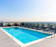
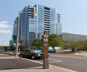
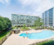
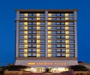
Hotels and Places to Stay
Mandarin Oriental WashingtonDC
Global Luxury Suites at Crystal City
EXECUSTAY AT 220 TWENTIETH STR
The View Apartment
HARBORSIDE HOTEL
Crowne Plaza OLD TOWN ALEXANDRIA
Canopy by Hilton Washington DC The Wharf
Holiday Inn WASHINGTON-CAPITOL
CRYSTAL QUARTERS CORPORATE HOUSING
Found Places Capitol Hill Bed & Breakfast
Videos from this area
These are videos related to the place based on their proximity to this place.
639 Atlantic St SE Washington DC Real Property Management DC Metro
Call 202-656-0014 or visit www.rpmdcmetro.com for a list of our properties that are currently available. 4 large Bedrooms, 2.5 baths, Completely handicap accessible, newly gutted and renovated....
Flight Taking off from Ronald Reagan Washington National Airport - View from Potomac river
Flight Taking off from Ronald Reagan Washington National Airport 1 Aviation Circle Arlington, Virginia (703) 417-8000 Video taken from Potomac River, on a ferry. Equipment : Sony Cybershot...
6th Grade Washington DC Trip
This video was created to engage parents and students in a discussion about an upcoming trip to Washington DC.
Heartless Journey ACT 1-1 Radio You Cant Hear
Stage play written, produced and directed by 20 year old playwrite Jimmy Jenkins.
Joan Gaither and the Journey to the White House Quilt
Dr. Joan M. E. Gaither talks about the process of putting together her documentary story quilt Journey to the White House at the Banneker-Douglass Museum. Journey to the White House (c)...
Down 100 Pounds - My Weightloss Journey! #1
I have decided to record a video journal for all of you guys to see. Hopefully through my weightloss journey, someone will be inspired and encouraged. Feel free to ask me anything at ...
Ocean city beach
Daniela and her cousin trying to make a sand castle when a tiny wave messed up with 'em !!!! huge laughing.
Military Defense Lawyers Bolling Air Force Base | Court Martial Attorneys JB Anacostia Bolling
http://www.ucmjdefense.com - Military Defense Lawyers Bolling Air Force Base | Court Martial Attorneys Joint Base Anacostia Bolling. Call 1-866-969-9860 to speak with a Bolling Air Force Base...
U.S. Rep. John Larson Introduces Bill for Free Computer Training at Community Colleges (4/23/09)
On April 23, 2009, on the Cannon Terrace, House Democratic Caucus Chairman John Larson introduces an NDN-inspired bill to offer free computer training for all Americans through the country's...
Videos provided by Youtube are under the copyright of their owners.
Attractions and noteworthy things
Distances are based on the centre of the city/town and sightseeing location. This list contains brief abstracts about monuments, holiday activities, national parcs, museums, organisations and more from the area as well as interesting facts about the region itself. Where available, you'll find the corresponding homepage. Otherwise the related wikipedia article.
Bolling Field
Bolling Field is a 905 acres military installation, located in Southeast Washington, D.C. , established on 1 October 2010 in accordance with congressional legislation implementing the recommendations of the 2005 Base Realignment and Closure Commission.
Congress Heights (WMATA station)
Congress Heights is an island platformed Washington Metro station in the Congress Heights neighborhood of Washington, D.C. , United States. The station was opened on January 13, 2001, and is operated by the Washington Metropolitan Area Transit Authority (WMATA). Providing service for only the Green Line, the station is located at Alabama Avenue and 13th Street, lying under St. Elizabeths Hospital. Congress Heights is the last Green Line station in the District of Columbia going southeast.
Congress Heights
Congress Heights is a largely residential neighborhood in Southeast Washington, D.C. Although it is in the poorest section of what is generally regarded as inner-city Washington—the area east of the Anacostia River -- it is very likely the most economically diverse, and most suburban, neighborhood in that section of the city. Congress Heights, in fact, contains the largest commercial district in Washington's Ward 8, along Martin Luther King Jr. and Malcolm X Avenues.
Ballou High School
Ballou Senior High School is a public school located in Washington, D.C. , United States. Ballou is a part of the District of Columbia Public Schools. The current principal is Rahman Branch. The marching band traveled to the 2009 Tournament of Roses Parade in Pasadena, California and the 2009 Macy's Thanksgiving Day Parade.
Barry Farm
Barry Farm is a small neighborhood in Southeast Washington, D.C. , adjacent to St. Elizabeths Hospital. It is today almost entirely occupied by public housing projects and has a reputation for violent crime, poverty, and neglect. The entire neighborhood of public housing is planned for a complete redevelopment from single-use, single-income (low) into a mixed-use, mixed-income neighborhood designed to complement its historic setting and location adjacent to the Anacostia Metro Station.
Bellevue (Washington, D.C.)
Bellevue is a residential neighborhood in far SW Washington, DC. It is bounded by South Capitol Street to the north and east, Joliet and First Streets to the south, and the Potomac River to the west.
Washington Highlands, Washington, D.C
Washington Highlands is a large residential neighborhood in Southeast Washington, D.C. , bounded on three sides by Oxon Run Park and on the fourth (southeast) side by Southern Avenue. It is the largest residential neighborhood in Ward 8, the poorest and least developed section of Washington.
Fort Greble
Fort Greble was an American Civil War-era Union fortification constructed as part of the defenses of Washington, D.C. during that war. Named for First-Lieutenant John T. Greble, the first West Point graduate killed in the U.S. Civil War, it protected the junction of the Anacostia and Potomac rivers, and from its position on a bluff in the Congress Heights, precluded any bombardment of the Washington Navy Yard and southeastern portions of the city.
Naval Support Facility Anacostia
Naval Support Facility (NSF) Anacostia is a United States Naval Base in Anacostia, Washington, D.C. and is conjoined with Bolling Air Force Base. NSF Anacostia falls under the command of Naval Support Activity Washington.
Oxon Run Parkway
The Oxon Run Parkway, is a roadway and small park in the Washington Highlands neighborhood of Washington, D.C.. 126 acres of important wetlands and deciduous forest is located in this urban environment. Only a single road, managed by the National Park Service, traverses the area, which is meant to demonstrate how a relatively wooded and pristine environment can be preserved within a city setting.
National Intelligence University
The National Intelligence University (NIU), (formerly known as the National Defense Intelligence College and the Joint Military Intelligence College), is an education and research institution that is federally chartered to prepare United States Intelligence Community (USIC) personnel for senior positions in the USIC and the national security structure. Since 1963, over 80,000 military and civilian students have completed courses or participated in the College's varied academic programs.
Joint Base Anacostia-Bolling
Joint Base Anacostia-Bolling (JBAB) is a 905 acres military installation, located in Southeast Washington, D.C. , established on 1 October 2010 in accordance with congressional legislation implementing the recommendations of the 2005 Base Realignment and Closure Commission.


