Safety Score: 2,7 of 5.0 based on data from 9 authorites. Meaning we advice caution when travelling to United States.
Travel warnings are updated daily. Source: Travel Warning United States. Last Update: 2024-04-24 08:14:40
Touring Lairport
Lairport in Los Angeles County (California) is a town located in United States about 2,304 mi (or 3,709 km) west of Washington DC, the country's capital place.
Time in Lairport is now 04:14 PM (Wednesday). The local timezone is named America / Los Angeles with an UTC offset of -7 hours. We know of 9 airports nearby Lairport, of which 4 are larger airports. The closest airport in United States is Los Angeles International Airport in a distance of 2 mi (or 4 km), North-West. Besides the airports, there are other travel options available (check left side).
Also, if you like the game of golf, there are several options within driving distance. We collected 8 points of interest near this location. Need some hints on where to stay? We compiled a list of available hotels close to the map centre further down the page.
Being here already, you might want to pay a visit to some of the following locations: Los Angeles, Santa Ana, Orange, Ventura and Riverside. To further explore this place, just scroll down and browse the available info.
Local weather forecast
Todays Local Weather Conditions & Forecast: 16°C / 62 °F
| Morning Temperature | 14°C / 57 °F |
| Evening Temperature | 16°C / 61 °F |
| Night Temperature | 14°C / 58 °F |
| Chance of rainfall | 0% |
| Air Humidity | 63% |
| Air Pressure | 1017 hPa |
| Wind Speed | Moderate breeze with 11 km/h (7 mph) from North-East |
| Cloud Conditions | Few clouds, covering 11% of sky |
| General Conditions | Few clouds |
Wednesday, 24th of April 2024
16°C (60 °F)
15°C (58 °F)
Broken clouds, gentle breeze.
Thursday, 25th of April 2024
16°C (60 °F)
16°C (60 °F)
Broken clouds, moderate breeze.
Friday, 26th of April 2024
17°C (63 °F)
16°C (60 °F)
Few clouds, gentle breeze.
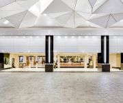
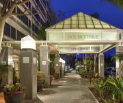
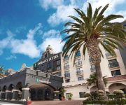
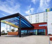
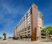
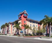
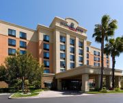
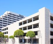
Hotels and Places to Stay
Manhattan Beach Marriott
Hilton Los Angeles Airport
DoubleTree by Hilton LAX - El Segundo
Embassy Suites by Hilton Los Angeles Int*l Airport South
Aloft El Segundo - Los Angeles Airport
La Quinta Inn and Suites LAX
TownePlace Suites Los Angeles LAX/Manhattan Beach
SpringHill Suites Los Angeles LAX/Manhattan Beach
The Westin Los Angeles Airport
AYRES HOTEL MANHATTAN BEACH
Videos from this area
These are videos related to the place based on their proximity to this place.
Floor Decal Graphic test print at Angel City Brewery by PROLAB Digital Imaging
Floor decal graphic being prepared to be installed at Angel City Brewery downtown Los Angeles by PROLAB Digital Imaging Contact Joseph Hill 310.846.4496 http://www.prolabdigital.com PROLAB...
Car Accident, East El Segundo Blvd. and Aviation Blvd. Hawthorne
Los Angeles Air Force Base 6/09/2014 Multiple Police Agencies on scene, Los Angeles Air Force Base Police, El Segundo Police Department and Hawthorne Police. Where is Tom Zebra's Drone...
Hawthorne Police Cleans Up Single Car Accident
Inglewood Avenue and Rosecrans Blvd 1/30/2014 Spotted this activity on my way home and stopped to video the scene. I questioned police officer Galindo about his encounters with Daniel Saulmon,...
UP El Segundo Local & Wig Wag action! 10/15/08
Here's my first "WigWag" action video! Here's a Union Pacific yard local train"El Segundo Job", going through, Vernon, California and then passing the Wig Wag Railroad crossing in Hawthorne,...
Mastering the GIRO Workshop with Luciano Brigante & Alejandra Orozco, El Segundo California
Argentine Tango Workshops by http://LivingTango.com Los Angeles, CA.
Hilton Garden Inn LAX Los Angeles El Segundo 2100 East Mariposa Av CA 90245 US part1 hallway
INSIDE THE ROOM CLICK HERE: http://www.youtube.com/my_videos_annotate?v=lsw6g9Duq5A Hilton Garden Inn LAX / Los Angeles El Segundo 2100 East Mariposa Avenue, El Segundo, CA ...
Hilton Garden Inn LAX/El Segundo Whirlpool
http://tlog.oi.sg/article/416732563.html Hilton Garden Inn LAX/El Segundo http://hiltongardeninn3.hilton.com/en/hotels/california/hilton-garden-inn-lax-el-segundo-LAXAGGI/index.html.
Advanced Eyecare Center - Short | El Segundo, CA
http://advancedeyecarecenter.net/ - Call us today at (310) 321-4932. At Advanced Eyecare Center, we specialize in contact lens evaluation, comprehensive exams, and children's vision. In addition...
FHA Loans El Segundo CA - VA Loans - Mortgage Broker - Jumbo Loans - Refinancing
http://anthonyyousif.com Yousif Mortgage Group is one of the top loan specialists in Southern California for first time buyers, Jumbo Loans, Conventional Loans, FHA Loans, VA Loans, Private...
Videos provided by Youtube are under the copyright of their owners.
Attractions and noteworthy things
Distances are based on the centre of the city/town and sightseeing location. This list contains brief abstracts about monuments, holiday activities, national parcs, museums, organisations and more from the area as well as interesting facts about the region itself. Where available, you'll find the corresponding homepage. Otherwise the related wikipedia article.
Del Aire, California
Del Aire is a census-designated place (CDP) in Los Angeles County, California, United States. The population was 10,001 at the 2010 census, up from 9,012 at the 2000 census. Del Aire is a tiny unincorporated middle-class residential neighborhood next to the giant interchange where Interstate 405 and Interstate 105 meet. It is surrounded by the incorporated cities of Los Angeles, El Segundo, and Hawthorne. Los Angeles Airport Courthouse and the Los Angeles Air Force Base are in the Del Aire area.
Los Angeles Air Force Base
Los Angeles Air Force Base is a United States Air Force Base located in El Segundo, California. Los Angeles Air Force Base houses and supports the headquarters of the Air Force Space Command's Space and Missile Systems Center (SMC). The center manages research, development and acquisition of military space systems. The 61st Air Base Wing provides support functions for the base.
JetBlue Airways Flight 292
JetBlue Airways Flight 292 was a scheduled flight from Bob Hope Airport (BUR) in Burbank, California to John F. Kennedy International Airport (JFK) in New York City. On September 21, 2005, flight 292 executed an emergency landing at Los Angeles International Airport (LAX) after the nose wheels jammed in an abnormal position. No one was injured.
Hawthorne High School (Hawthorne, California)
Hawthorne High School is a public High school located in Hawthorne, California, within the Centinela Valley Union High School District. It opened in the mid-1950s and is most notable for its association with The Beach Boys, whose original members Brian, Carl, and Dennis Wilson, and Al Jardine attended the school. Coincidentally, Olivia Trinidad Arias, who later became Olivia Harrison (George Harrison’s wife), also attended and graduated in 1965.
Hawthorne Math and Science Academy
Hawthorne Math and Science Academy is a state charter high school in Hawthorne, California, USA. It is part of the Hawthorne School District. Esau Berumen is the Principal. Sonya Smith is the Assistant Principal. Eleanor Reese is the Special Projects Coordinator.
Airport Tunnel (Los Angeles)
The Airport Tunnel (Los Angeles), also known as the Sepulveda Boulevard Tunnel, is a highway tunnel in Los Angeles, carrying Sepulveda Boulevard underneath several runways and taxiways at Los Angeles International Airport. This section of Sepulveda is a part of California State Route 1.
Rancho Sausal Redondo
Rancho Sausal Redondo (Round Willow-grove Ranch) was a 22,458-acre Mexican land grant in present day Los Angeles County, California given in 1837 to Antonio Ygnacio Avila by Juan Alvarado Governor of Alta California. Rancho Sausal Redondo covered the area that now includes Manhattan Beach, Lawndale, Hermosa Beach, Inglewood, Hawthorne, and Redondo Beach.
Da Vinci Schools
Da Vinci Schools are small, college-preparatory K-12 public charter schools located at the corners of Hawthorne, El Segundo, Manhattan Beach, and Redondo Beach in Los Angeles, California, United States, in close proximity to leading aerospace and high tech companies, design firms, and major universities.


