Safety Score: 2,7 of 5.0 based on data from 9 authorites. Meaning we advice caution when travelling to United States.
Travel warnings are updated daily. Source: Travel Warning United States. Last Update: 2024-04-18 08:12:24
Delve into Pitco
Pitco in Kings County (California) is located in United States about 2,318 mi (or 3,730 km) west of Washington DC, the country's capital town.
Current time in Pitco is now 05:49 PM (Thursday). The local timezone is named America / Los Angeles with an UTC offset of -7 hours. We know of 13 airports close to Pitco, of which 5 are larger airports. The closest airport in United States is Corcoran Airport in a distance of 18 mi (or 29 km), South. Besides the airports, there are other travel options available (check left side).
There is one Unesco world heritage site nearby. It's Yosemite National Park in a distance of 119 mi (or 191 km), North-East. Also, if you like playing golf, there are some options within driving distance. If you need a hotel, we compiled a list of available hotels close to the map centre further down the page.
While being here, you might want to pay a visit to some of the following locations: Hanford, Visalia, Fresno, Madera and Mariposa. To further explore this place, just scroll down and browse the available info.
Local weather forecast
Todays Local Weather Conditions & Forecast: 24°C / 75 °F
| Morning Temperature | 16°C / 61 °F |
| Evening Temperature | 26°C / 78 °F |
| Night Temperature | 18°C / 65 °F |
| Chance of rainfall | 0% |
| Air Humidity | 49% |
| Air Pressure | 1012 hPa |
| Wind Speed | Gentle Breeze with 7 km/h (4 mph) from South-East |
| Cloud Conditions | Overcast clouds, covering 100% of sky |
| General Conditions | Overcast clouds |
Friday, 19th of April 2024
24°C (76 °F)
17°C (62 °F)
Few clouds, gentle breeze.
Saturday, 20th of April 2024
22°C (71 °F)
18°C (64 °F)
Sky is clear, gentle breeze, clear sky.
Sunday, 21st of April 2024
24°C (75 °F)
18°C (65 °F)
Scattered clouds, gentle breeze.
Hotels and Places to Stay
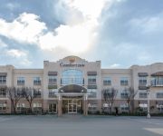
Comfort Inn Hanford
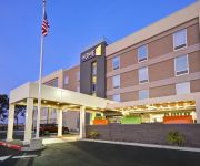
Home2 Suites by Hilton Hanford Lemoore
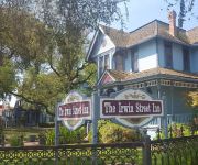
Irwin Street Inn
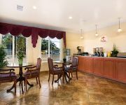
BEST WESTERN HANFORD INN - HANFORD
SUPER 8 HANFORD
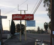
Holiday Lodge
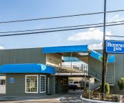
Rodeway Inn Hanford
THE SEQUOIA INN
Videos from this area
These are videos related to the place based on their proximity to this place.
Hanford House Fire Grangeville and Mary
A home burns on the corner of Grangeville Boulevard and Mary Street in Hanford, California. Kings County and Hanford firefighters respond to the call.
BNSF 552 E and BNSF 4012 E @ Hanford [HD]
On Thu 7 Nov 2013, two eastbounds pass the Amtrak station in Hanford CA: (1) BNSF 552, a local freight led by a very dull and faded Warbonnet B40-8W at 12:48 PM; (2) BNSF 4012 (manifest) at 12:59 ...
BNSF 7291 E and BNSF 4966 E @ Hanford [HD]
On Thu 5 Sep 2013, two eastbounds pass the Amtrak platform in Hanford CA: (1) BNSF 7291 (mixed intermodal) at 11:35 AM (as Amtrak #713 leaves, barely visible behind the intermodal); (2) BNSF...
Hanford Dancers Edge Dad's Dance 2
This is another version of the Dad's Dance from Dancers Edge's Hanford Dance Studio June 2009 Recital.
BNSF 5490 E and BNSF 6951 E @ Hanford [HD]
Two eastbounds through Hanford CA on Tue 16 Jul 2013: (1) BNSF 5490 East (empty intermodal) at 3:26 PM; (2) BNSF 6951 East (manifest freight) at 3:57 PM.
Hanford Joint Union High School District board meeting - 12/11/2012
Avery giving a speech in regards to her stance on the information being presented to the board. The information being presented is to eliminate the A.V.I.D. program, eliminate advanced courses...
BNSF 6751 E meets BNSF 6779 West @ Hanford (HD)
On Fri 15 Mar 2013, two BNSF freights meet near the SJVR diamond in Hanford CA at 1:36 PM: (1) BNSF 6751 East with two pusher (BNSF 4890, UP 4980); (2) BNSF4779 West with three trailing Union ...
BNSF 5264 manifest freight east [HQ]
A manifest freight comes through Hanford CA at 2:28 PM on Wed 15 Oct 2008.
Videos provided by Youtube are under the copyright of their owners.
Attractions and noteworthy things
Distances are based on the centre of the city/town and sightseeing location. This list contains brief abstracts about monuments, holiday activities, national parcs, museums, organisations and more from the area as well as interesting facts about the region itself. Where available, you'll find the corresponding homepage. Otherwise the related wikipedia article.
Hanford, California
Hanford is an important commercial and cultural center in the south central San Joaquin Valley and is the county seat of Kings County, California. It is the principal city of the Hanford-Corcoran, California Metropolitan Statistical Area (MSA Code 25260), which encompasses all of Kings County, including the cities of Hanford and Corcoran. The ZIP Code is 93230. The city of Hanford is surrounded by communities that do not fall within the city limits but use the same zip code.
Imperial Dynasty restaurant
The Imperial Dynasty restaurant was a five-star restaurant in Hanford, California. The restaurant was founded in 1883 in Hanford's Chinatown, and was run by the same family for four generations. Richard Wing combined French and Chinese cooking in the 1960s to create one of the first fusion cuisines. The restaurant closed in early 2006. Wing died in 2010 at the age of 89.
Hanford Municipal Airport
Hanford Municipal Airport, formerly O18, is a public airport located one mile (1.6 km) southeast of the central business district of Hanford, a city in Kings County, California, United States. It is owned by the City of Hanford. Although most U.S. airports use the same three-letter location identifier for the FAA and IATA, Hanford Municipal Airport is assigned HJO by the FAA but has no designation from the IATA.
Hanford (Amtrak station)
The Hanford Amtrak Station is a train station in Hanford, California served by Amtrak. It was built by the San Francisco and San Joaquin Valley Railway and is one of only three SF&SJV stations left in existence. In the early 1990s, the city sponsored a rehabilitation of the depot that included rebuilding the former freight section and enclosing the outdoor waiting room. A wide, curving canopy was added to the trackside façade to provide travelers with better protection from the sun and rain.
Hanford Community Medical Center
Hanford Community Medical Center is located in the city of Hanford, California. Hanford Community Medical Center is a part of the Seventh-day Adventist hospital system.
Rancho Laguna de Tache (Limantour)
Rancho Laguna de Tache was a Mexican land grant in present day Tulare County, Fresno County and Kings County, California claimed to have been given in 1843 by Governor Manuel Micheltorena to Joseph Yves Limantour. The grant extended along the (left) south bank of the Kings River and was bounded on the south Cross Creek, on the east by the Sierra Nevada, and on the west by Tulare Lake. The land claim was rejected.





!['BNSF 552 E and BNSF 4012 E @ Hanford [HD]' preview picture of video 'BNSF 552 E and BNSF 4012 E @ Hanford [HD]'](https://img.youtube.com/vi/crUCJ94Ywzc/mqdefault.jpg)
!['BNSF 7291 E and BNSF 4966 E @ Hanford [HD]' preview picture of video 'BNSF 7291 E and BNSF 4966 E @ Hanford [HD]'](https://img.youtube.com/vi/2k2LbNCzU5I/mqdefault.jpg)

!['BNSF 5490 E and BNSF 6951 E @ Hanford [HD]' preview picture of video 'BNSF 5490 E and BNSF 6951 E @ Hanford [HD]'](https://img.youtube.com/vi/4XiJnXGn3Sg/mqdefault.jpg)


!['BNSF 5264 manifest freight east [HQ]' preview picture of video 'BNSF 5264 manifest freight east [HQ]'](https://img.youtube.com/vi/slzo1IgVmpg/mqdefault.jpg)