Safety Score: 2,7 of 5.0 based on data from 9 authorites. Meaning we advice caution when travelling to United States.
Travel warnings are updated daily. Source: Travel Warning United States. Last Update: 2024-04-24 08:14:40
Delve into Country Club Mobile Home Park
Country Club Mobile Home Park in Pima County (Arizona) is a city located in United States about 1,950 mi (or 3,138 km) west of Washington DC, the country's capital town.
Current time in Country Club Mobile Home Park is now 03:46 PM (Wednesday). The local timezone is named America / Phoenix with an UTC offset of -7 hours. We know of 8 airports closer to Country Club Mobile Home Park, of which 3 are larger airports. The closest airport in United States is Tucson International Airport in a distance of 2 mi (or 4 km), South. Besides the airports, there are other travel options available (check left side).
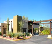
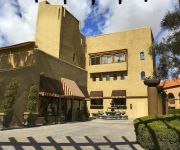
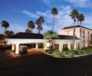
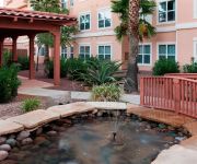
There is one Unesco world heritage site nearby. The closest heritage site is El Pinacate and Gran Desierto de Altar Biosphere Reserve in Mexico at a distance of 68 mi (or 110 km). Also, if you like playing golf, there are some options within driving distance. In need of a room? We compiled a list of available hotels close to the map centre further down the page.
Since you are here already, you might want to pay a visit to some of the following locations: Tucson, Nogales, Santa Cruz, Florence and Bisbee. To further explore this place, just scroll down and browse the available info.
Local weather forecast
Todays Local Weather Conditions & Forecast: 29°C / 83 °F
| Morning Temperature | 20°C / 68 °F |
| Evening Temperature | 27°C / 81 °F |
| Night Temperature | 22°C / 71 °F |
| Chance of rainfall | 0% |
| Air Humidity | 11% |
| Air Pressure | 1013 hPa |
| Wind Speed | Fresh Breeze with 15 km/h (9 mph) from North-East |
| Cloud Conditions | Overcast clouds, covering 100% of sky |
| General Conditions | Overcast clouds |
Wednesday, 24th of April 2024
23°C (73 °F)
20°C (68 °F)
Sky is clear, fresh breeze, clear sky.
Thursday, 25th of April 2024
25°C (76 °F)
18°C (65 °F)
Sky is clear, fresh breeze, clear sky.
Friday, 26th of April 2024
20°C (67 °F)
20°C (68 °F)
Light rain, moderate breeze, few clouds.
Hotels and Places to Stay
DoubleTree Suites by Hilton Tucson Airport
WINDEMERE HOTEL
Four Points by Sheraton Tucson Airport
Hampton Inn Tucson-Airport
Hyatt Place Tucson Airport
BW PLUS TUCSON INTERNATIONAL APT HTL
La Quinta Inn and Suites Tucson Airport
Holiday Inn Express TUCSON-AIRPORT
Residence Inn Tucson Airport
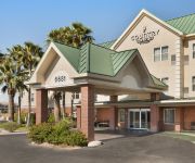
AZ Tucson Air Country Inn and Suites by Radisson
Videos from this area
These are videos related to the place based on their proximity to this place.
UP Switcher In Tucson Rail Yard Switching Cars.
3/12/09 UP Switcher 1485 Just Picked Up Empty Stack Cars From The Repair Shop.
127 MPH 760 horsepower Cadillac Northstar V8 Twin Turbo BuggyPart 2
Clocked at 127 mph OFF ROAD, this 760 horsepower Cadillac Northstar V8 twin turbo 4 seat custom sand rail buggy is truly the Cadillac of Sand Rail Buggy's. courtesy of J. Taggart at Bugs...
Product Video Sample 1
This is one of many collaborative projects between Tom Veneklasen Photography, Wild Time Media (production), and Reelworthy (postproduction). Together we provide services to companies that...
Flying the pattern solo Robinson R22 at Tucson Intl (TUS) with a headset-mounted camera
It was a beautiful day to fly, and my second unsupervised solo. Here's a takeoff to a hover from "Spot 3" on the practice taxiway, flying all four legs of the pattern, and a perfect approach...
Tucson Go Around On Landing
Not at all exciting, just the first time I have experienced a go around while landing. We were coming in to Tucson airport in AZ. You can see that initially we were on the approach glide slope...
Eldercare Channel: Tucson Skilled Nursing & Rehab Communities
Tucson Skilled Nursing & Rehab Communities.
Videos provided by Youtube are under the copyright of their owners.
Attractions and noteworthy things
Distances are based on the centre of the city/town and sightseeing location. This list contains brief abstracts about monuments, holiday activities, national parcs, museums, organisations and more from the area as well as interesting facts about the region itself. Where available, you'll find the corresponding homepage. Otherwise the related wikipedia article.
Drexel-Alvernon, Arizona
Drexel-Alvernon is a census-designated place (CDP) in Pima County, Arizona, United States. The population was 4,192 at the 2000 census.
Tucson International Airport
Tucson International Airport is a public and military use airport owned by the Tucson Airport Authority and located six nautical miles south of the central business district of Tucson, in Pima County, Arizona, United States. It is the second largest and busiest airport in Arizona, after Sky Harbor International Airport in Phoenix.
Kino Veterans Memorial Stadium
Kino Veterans Memorial Stadium is a baseball stadium in Tucson, Arizona. The Arizona Diamondbacks and Chicago White Sox formerly utilized the park for Cactus League games each March and had their minor league complexes on-site. It was also home to the Tucson Sidewinders of the Pacific Coast League for the team's last decade in Tucson, running from the stadium's 1998 opening season to the 2008 season. During that time, it was known as Tucson Electric Park.
Sunnyside High School (Tucson, Arizona)
Sunnyside High School, opened in 1955, is home to two thousand students located on the south side of Tucson, Arizona. Sunnyside offers a wide variety of extracurricular programs, advanced placement courses, and specialized career and technical training programs. It is a part of the Sunnyside Unified School District.
Desert View High School
Desert View High School is a public high school located in southern Tucson, Arizona approximately 1 mile west of I-10 and Valencia Road.
PPEP TEC High Schools
PPEP TEC High Schools is a set of 11 charter high schools located across Arizona. They are publicly financed and their goal is to provide an alternative educational program for students aged 15–21, grades 9-12. PPEP TEC High Schools is an affiliate of PPEP, Inc. The focus of the schools are on high academic standards, technology and school-to-work programs. Because it is a public school, all students from ages 15–21 may attend.
Alta Vista High School (Arizona)
Alta Vista High School is a public charter high school in Tucson, Arizona. It is operated by The Leona Group.
Tucson Air National Guard Base
Tucson Air National Guard Base is a United States Air Force base, located at Tucson International Airport, Arizona. It is located 7.4 miles south of Tucson, Arizona.


