Safety Score: 2,7 of 5.0 based on data from 9 authorites. Meaning we advice caution when travelling to United States.
Travel warnings are updated daily. Source: Travel Warning United States. Last Update: 2024-04-19 08:03:45
Discover Sunspots South Mobile Home Park
Sunspots South Mobile Home Park in Cochise County (Arizona) is a town in United States about 1,897 mi (or 3,053 km) west of Washington DC, the country's capital city.
Current time in Sunspots South Mobile Home Park is now 12:59 AM (Saturday). The local timezone is named America / Phoenix with an UTC offset of -7 hours. We know of 9 airports near Sunspots South Mobile Home Park, of which 3 are larger airports. The closest is airport we know is Cananea Airport in Mexico in a distance of 39 mi (or 63 km). The closest airport in United States is Sierra Vista Municipal Libby Army Air Field in a distance of 51 mi (or 63 km), South-West. Besides the airports, there are other travel options available (check left side).
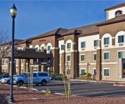
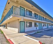
Also, if you like playing golf, there are a few options in driving distance. Looking for a place to stay? we compiled a list of available hotels close to the map centre further down the page.
When in this area, you might want to pay a visit to some of the following locations: Agua Prieta, Bisbee, Naco, Santa Cruz and Lordsburg. To further explore this place, just scroll down and browse the available info.
Local weather forecast
Todays Local Weather Conditions & Forecast: 26°C / 79 °F
| Morning Temperature | 14°C / 57 °F |
| Evening Temperature | 27°C / 80 °F |
| Night Temperature | 19°C / 66 °F |
| Chance of rainfall | 0% |
| Air Humidity | 9% |
| Air Pressure | 1013 hPa |
| Wind Speed | Gentle Breeze with 9 km/h (5 mph) from East |
| Cloud Conditions | Clear sky, covering 0% of sky |
| General Conditions | Sky is clear |
Saturday, 20th of April 2024
27°C (80 °F)
21°C (70 °F)
Overcast clouds, gentle breeze.
Sunday, 21st of April 2024
27°C (80 °F)
19°C (66 °F)
Sky is clear, moderate breeze, clear sky.
Monday, 22nd of April 2024
25°C (78 °F)
19°C (66 °F)
Sky is clear, fresh breeze, clear sky.
Hotels and Places to Stay
BEST WESTERN DOUGLAS INN STES
Gadsden Hotel
MOTEL 6 DOUGLAS
Videos from this area
These are videos related to the place based on their proximity to this place.
Magic Bus: RV-8 and RV-6A departing Douglas, Arizona
Flight of two RVs departing Runway 21 at Douglas, AZ (KDGL elevation 4173') and returning to Tucson International (KTUS). Trust me, this left crosswind turn is a lot more exciting in a 145hp...
522 E 6th St , Douglas AZ
3 bed 2 bath home with additional buildings and a 1 bed casita complete with kitchen and bath.
Caminando en lo Sobrenatural Vol. 1
Ministerios Palabra De Fe CCC. Douglas AZ. 85607 www.palabradefeccc.org.
Lo que quedo del incendio notidiario
060311 Hacen llamado urgente al gobernador desde Agua Prieta -300 familias afectadas tras incendio en Tianguis "La Teja" Juan Carlos Ruiz Olvera Agua Prieta, Sonora.- Son por lo menos 300...
Ridley Scott and Kevin McDonald´s The life in a day 1 of 4 Mexico Spanish
Primero de 4 videos grabados en español en Mexico para el documental one day in life.
MJX F45 Helicopter My first Flight
This was my very first time flying the MJX F-45 helicopter. If you visit my channel, you'll see how practice had paid off. You can tell the difference between this flight and the most recent ones.
Ridley Scott and Kevin McDonald´s The life in a day 2 of 4 Juan Carlos Ruiz Olvera Mexico Spanish
Segundo de 4 videos grabados en español en Mexico para el documental one day in life.
Agua Prieta - La Nueva Plebada
FOR PROMOTIONAL PURPOSES ONLY - NO COPYRIGHT INFRINGEMENT INTENDED Grupo Musical de Jovenes de Agua Prieta, Iniciamos con este video este portal donde pondremos varios ...
Videos provided by Youtube are under the copyright of their owners.
Attractions and noteworthy things
Distances are based on the centre of the city/town and sightseeing location. This list contains brief abstracts about monuments, holiday activities, national parcs, museums, organisations and more from the area as well as interesting facts about the region itself. Where available, you'll find the corresponding homepage. Otherwise the related wikipedia article.
Pirtleville, Arizona
Pirtleville is a census-designated place (CDP) in Cochise County, Arizona, United States. The population was 1,550 at the 2000 census.
Douglas, Arizona
Douglas is a city in Cochise County, Arizona, United States. Douglas has a border crossing with Mexico and a history of mining. The population was 14,312 at the 2000 census. According to 2008 Census Bureau estimates, the population of the city is 20,316.
Agua Prieta
Agua Prieta is a town and municipality in the northeastern corner of the Mexican state of Sonora . It stands on the U.S. –Mexico border, adjacent to the town of Douglas, Arizona, USA. The municipality covers an area of 3,631.65 km² (1,402.2 sq mi). In the 2010 census the town had a population of 79,138 people, making it the seventh-largest community in the state, and a literacy rate of 96.3%.
Douglas High School (Arizona)
Douglas High School (DHS) is a public high school in Douglas, Arizona. The school enrolled 1,378 in the 2011-2012 school year who primarily come from two feeder schools, Paul Huber Middle School and Ray Borane Middle School. The school was founded in 1908 originally located at 840 E. 12th St. in Douglas, Arizona.
KCDQ
KCDQ is a radio station broadcasting an adult contemporary format. It is licensed to Douglas, Arizona, USA. The station is currently owned by Cochise Broadcasting, LLC (a Wyoming LLC).
KDAP-FM
KDAP-FM is a radio station licensed to serve Douglas, Arizona, USA. The station is owned by Howard N. Henderson. It airs a Country music format. The station was assigned the KDAP-FM call letters by the Federal Communications Commission on March 1, 1990.
KDAP (AM)
KDAP (1450 AM, "Radio Cristiana") is a radio station licensed to serve Douglas, Arizona, USA. The station is owned by Howard N. Henderson. It airs a Spanish language Christian radio format. The station was assigned the KDAP call letters by the Federal Communications Commission.
Douglas Arizona Port of Entry
The Douglas, Arizona Port of Entry has been in existence since about 1914. The current border inspection station was built in 1933, and was significantly renovated and expanded by the General Services Administration in 1993. The crossing is open 24 hours per day,7 days per week.


