Safety Score: 3,0 of 5.0 based on data from 9 authorites. Meaning we advice caution when travelling to United Kingdom.
Travel warnings are updated daily. Source: Travel Warning United Kingdom. Last Update: 2024-04-25 08:17:04
Delve into Rhiwddolion
Rhiwddolion in Conwy (Wales) is a city located in United Kingdom about 191 mi (or 308 km) north-west of London, the country's capital town.
Current time in Rhiwddolion is now 11:04 AM (Thursday). The local timezone is named Europe / London with an UTC offset of one hour. We know of 11 airports closer to Rhiwddolion, of which 5 are larger airports. The closest airport in United Kingdom is Anglesey Airport in a distance of 31 mi (or 49 km), West. Besides the airports, there are other travel options available (check left side).
There are several Unesco world heritage sites nearby. The closest heritage site in United Kingdom is Castles and Town Walls of King Edward in Gwynedd in a distance of 6 mi (or 10 km), North-East. Also, if you like playing golf, there is an option about 17 mi (or 27 km). away. In need of a room? We compiled a list of available hotels close to the map centre further down the page.
Since you are here already, you might want to pay a visit to some of the following locations: Betws-y-Coed, Ffestiniog, Conwy, Maentwrog and Trawsfynydd. To further explore this place, just scroll down and browse the available info.
Local weather forecast
Todays Local Weather Conditions & Forecast: 7°C / 44 °F
| Morning Temperature | 4°C / 39 °F |
| Evening Temperature | 6°C / 43 °F |
| Night Temperature | 1°C / 34 °F |
| Chance of rainfall | 0% |
| Air Humidity | 76% |
| Air Pressure | 1005 hPa |
| Wind Speed | Gentle Breeze with 6 km/h (4 mph) from South-East |
| Cloud Conditions | Overcast clouds, covering 100% of sky |
| General Conditions | Light rain |
Friday, 26th of April 2024
6°C (43 °F)
2°C (36 °F)
Overcast clouds, gentle breeze.
Saturday, 27th of April 2024
9°C (48 °F)
5°C (40 °F)
Light rain, moderate breeze, overcast clouds.
Sunday, 28th of April 2024
7°C (45 °F)
7°C (45 °F)
Moderate rain, gentle breeze, overcast clouds.
Hotels and Places to Stay
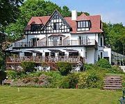
Craig-y-Dderwen Riverside Hotel
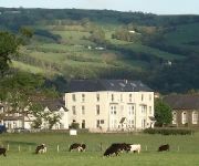
Glyntwrog House
The Eagles Hotel
Meadowsweet Hotel
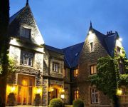
Maenan Abbey Hotel
Hafod Country
Videos from this area
These are videos related to the place based on their proximity to this place.
Swallow Falls, near Betws-y-Coed, North Wales, August 2011
Swallow Falls is close to Betws-y-Coed, and well worth a few minutes stop....
Cosy Snowdonia Log Cabin, near Betws y Coed
This cosy Snowdonia log cabin is located in a picturesque setting near Betws y Coed and is perfect for couples and small families. Set in the heart of Snowdonia with beautiful views of the...
Swallow Falls, Holyhead Road, Betws-y-coed (1926)
A view of the famous Welsh beauty spot. This extract comes from Claude Friese-Greene's 'The Open Road' - originally filmed in 1925/6 and now re-edited and digitally restored by the BFI National...
Abseiling Betws-y-Coed North Wales
Nikki & Steve making a great job of abseiling in Betws-y-Coed North Wales.
Capel Curig to Betws Y Coed, A5 gopro hero2 (triumph daytona 955i bike cam)
triumph daytona 955i (2002) with gopro hero 2.
SWALLOW FALLS betws-y-coed
My Day Trip to , SWALLOW FALLS (RHAEADR EWYNNOL) This waterfall on the Afon Llugwy has become a familiar natural celebrity over the past 100 years and has featured on film, postcard and ...
GoPro 3D Drive in Snowdonia near Betws-y-Coed
3D Drive through the beautiful Snowdonia (North Wales) countryside near Betws-y-Coed capturing the action using the GoPro 3D system on the car for the first time.
Videos provided by Youtube are under the copyright of their owners.
Attractions and noteworthy things
Distances are based on the centre of the city/town and sightseeing location. This list contains brief abstracts about monuments, holiday activities, national parcs, museums, organisations and more from the area as well as interesting facts about the region itself. Where available, you'll find the corresponding homepage. Otherwise the related wikipedia article.
Pont-y-Pant railway station
Pont-y-Pant railway station is a single platform passenger station in the Lledr Valley, Wales, on the Conwy Valley Line from Llandudno Junction to Blaenau Ffestiniog, which is operated by Arriva Trains Wales. The station house is well maintained and used as a private dwelling. The station, which is operated as an unstaffed halt and as a request stop, is across the River Lledr from the A470 main road and the bridge is a quarter of a mile to the north of the station.
Gwydir Forest
Gwydir Forest, also spelled Gwydyr, is located in Conwy county borough and the Snowdonia National Park in North Wales. It takes its name from the ancient Gwydir Estate, established by the John Wynn family of Gwydir Castle, which owned this area. The Forestry Commission uses the alternative spelling (i.e. Gwydyr Forest, Coedwig Gwydyr). Certainly as early as 1536, Leland wrote: "Gwydir lieth two bowshots above the River Conwy. It is a pretty place."
Llyn Elsi
Llyn Elsi is a lake located above the village of Betws-y-coed in the Snowdonia National Park in North Wales. It is a reservoir providing water for the village. There is a path round the lake, and at a height of over 700 ft it affords good views to the north-west towards the mountain ranges of the Carneddau and the Glyderau. Snowdon itself is not visible behind the mass of Moel Siabod. The 20 ft dam was built in 1914, but even so the lake only has a maximum depth of some 31 ft.
River Geirionydd
The River Geirionydd (Afon Geirionydd in Welsh) is a river in Snowdonia, North Wales. It is a tributary of the River Crafnant (Afon Crafnant), which flows over the Fairy Falls waterfall in Trefriw, and thence on into the River Conwy (Afon Conwy), which is the main river of the Conwy valley. It flows from Llyn Geirionydd down a steep gorge before joining the river Crafnant. It is less than a mile in length. The river passes the former Klondyke Mill, which used its waters.
Swallow Falls
For Swallow Falls along the Youghiogheny River in Maryland, United States, see Swallow Falls State Park. Swallow falls {{#invoke:InfoboxImage|InfoboxImage|image=Swallow falls.
Llyn Bodgynydd
Llyn Bodgynydd is a lake in the Gwydir Forest in North Wales. It covers an area of some 14 acres, and lies at a height of 822'. It is locally known as "Llyn Bod", or "Bod Mawr" (big), distinguishing it from a nearby, but much smaller lake ("Bod Bach" or "Cors Bodgynydd reservoir") to the north-east. Water from the larger lake flows to the smaller.
Llyn Glangors
Llyn Glangors is a lake in the Gwydir Forest in north Wales. It lies at a height of 900 ft and covers an area of 15 acres . An artificial reservoir, it was created to supply water for the nearby Pandora lead mine. Sarn Helen, the Roman road, is thought to have passed close to the lake.
Llyn Goddionduon
Llyn Goddionduon is a remote lake in the Gwydir Forest in north Wales. It lies at a height of 794 ft and covers an area of 10 acres . It is totally surrounded by coniferous forest, although a track leads up to it, enabling a water supply in the event of fire, and anglers also use this path.


