Safety Score: 3,0 of 5.0 based on data from 9 authorites. Meaning we advice caution when travelling to United Kingdom.
Travel warnings are updated daily. Source: Travel Warning United Kingdom. Last Update: 2024-04-23 08:18:23
Touring Pontycymer
Pontycymer in Bridgend county borough (Wales) with it's 4,288 residents is a town located in United Kingdom about 149 mi (or 239 km) west of London, the country's capital place.
Time in Pontycymer is now 12:32 PM (Tuesday). The local timezone is named Europe / London with an UTC offset of one hour. We know of 8 airports nearby Pontycymer, of which 3 are larger airports. The closest airport in United Kingdom is MOD St. Athan in a distance of 16 mi (or 25 km), South-East. Besides the airports, there are other travel options available (check left side).
There are several Unesco world heritage sites nearby. The closest heritage site in United Kingdom is Blaenavon Industrial Landscape in a distance of 31 mi (or 50 km), East. Also, if you like the game of golf, there is an option about 12 mi (or 19 km). away. Need some hints on where to stay? We compiled a list of available hotels close to the map centre further down the page.
Being here already, you might want to pay a visit to some of the following locations: Glyncorrwg, Treherbert, Cefn Cribwr, Clydach Vale and Bridgend. To further explore this place, just scroll down and browse the available info.
Local weather forecast
Todays Local Weather Conditions & Forecast: 7°C / 45 °F
| Morning Temperature | 7°C / 45 °F |
| Evening Temperature | 10°C / 50 °F |
| Night Temperature | 5°C / 41 °F |
| Chance of rainfall | 0% |
| Air Humidity | 86% |
| Air Pressure | 1025 hPa |
| Wind Speed | Gentle Breeze with 6 km/h (4 mph) from West |
| Cloud Conditions | Overcast clouds, covering 100% of sky |
| General Conditions | Light rain |
Wednesday, 24th of April 2024
11°C (51 °F)
7°C (44 °F)
Light rain, gentle breeze, broken clouds.
Thursday, 25th of April 2024
11°C (52 °F)
8°C (46 °F)
Light rain, moderate breeze, broken clouds.
Friday, 26th of April 2024
10°C (50 °F)
9°C (48 °F)
Light rain, gentle breeze, overcast clouds.
Hotels and Places to Stay
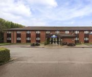
Days Inn Bridgend Cardiff Welcome Break Service Area
Bridgend Central
Videos from this area
These are videos related to the place based on their proximity to this place.
Say NO to cuts in Upper Afan Valley!!! NPTC, DON'T CUT MY FUTURE
nptbudget@npt.gov.uk E-mail NeathPortTalbot Council to tell them the affects that their savage cuts will have on your village in the Afan Valley.
Mickey's Magic
Filmed on Mickey's slope at the Bwlch in S. Wales. Mickey's is a 1000ft high grassy slope where the British record F3F record time was achieved. This days wind was light at about 12 mph so...
Ice Cream Slope July 14
The lads from A470soaring.blogspot.co.uk having a blast on the Ice Cream Slope at the Bwlch, South Wales. Wind NW approx 20 - 25mph.
Two new models
Two new models being flown from the Back of Wrecker slope at The Bwlch, South Wales. A 2m wing called the Amoccha, and an aerobatic mouldie called the Kineti...
Bwlch Mountain Road (A4061)
A wet December morning in Wales. 2011 KTM Adventure 990 filmed with a helmet mounted GoPro Hero 3 Black Edition 1080p 50fps wide field of view.
Pontycymer 2014 (Missy's slight return)
Missy the wonderdog returns to Pontycymer once again. 27th November 2014 (Featuring : Waun Bant, Lower Adare Street, Upper Adare Street, St David Street & The Royal Hotel at Bridgend Road)
Videos provided by Youtube are under the copyright of their owners.
Attractions and noteworthy things
Distances are based on the centre of the city/town and sightseeing location. This list contains brief abstracts about monuments, holiday activities, national parcs, museums, organisations and more from the area as well as interesting facts about the region itself. Where available, you'll find the corresponding homepage. Otherwise the related wikipedia article.
Abergwynfi
Abergwynfi is a village in the Welsh county borough of Neath Port Talbot. Abergwynfi is the first half of a village of two parts, the other being Blaengwynfi. The names of the two villages mean "Mouth of the Gwynfi" and "Source of the Gwynfi" respectively, the Gwynfi being the (rather short) river that separates the two. Aber and Blaengwynfi are generally referred to as "The Cape" by residents of the two villages and the neighbouring few.
Pontycymer
Pontycymer is a former mining village in Wales. It is situated in the Garw Valley, in Bridgend County Borough . The name, sometimes spelled "Pontycymmer", is Welsh: pont signifies "bridge", while cymer signifies "confluence" of watercourses. Original signs for the village use the incorrect spelling of Pontycymmer. Recent signage and postoffice records have now been changed to the correct spelling.
Gwynfi
Gwynfi is an electoral ward of Neath Port Talbot county borough, Wales. Gwynfi includes the villages if Abergwynfi and Blaengwynfi. Gwynfi is part of the parish of Glyncorrwg and the parliamentary constituency of Aberavon. Gwynfi is bounded by the wards of: Glyncorrwg to the northwest; Treherbert of Rhondda Cynon Taff to the east; Blaengarw of Bridgend county borough to the south; and Cymmer to the west.


