Safety Score: 3,0 of 5.0 based on data from 9 authorites. Meaning we advice caution when travelling to United Kingdom.
Travel warnings are updated daily. Source: Travel Warning United Kingdom. Last Update: 2024-04-18 08:12:24
Discover Rhoscolyn
Rhoscolyn in Anglesey (Wales) is a city in United Kingdom about 224 mi (or 360 km) north-west of London, the country's capital city.
Local time in Rhoscolyn is now 07:30 AM (Friday). The local timezone is named Europe / London with an UTC offset of one hour. We know of 12 airports in the vicinity of Rhoscolyn, of which 5 are larger airports. The closest airport in United Kingdom is Anglesey Airport in a distance of 3 mi (or 4 km), East. Besides the airports, there are other travel options available (check left side).
There are several Unesco world heritage sites nearby. The closest heritage site in United Kingdom is Castles and Town Walls of King Edward in Gwynedd in a distance of 37 mi (or 60 km), East. Also, if you like golfing, there are a few options in driving distance. We discovered 1 points of interest in the vicinity of this place. Looking for a place to stay? we compiled a list of available hotels close to the map centre further down the page.
When in this area, you might want to pay a visit to some of the following locations: Holyhead, Llanfachraeth, Llanfaethlu, Llangefni and Nefyn. To further explore this place, just scroll down and browse the available info.
Local weather forecast
Todays Local Weather Conditions & Forecast: 9°C / 48 °F
| Morning Temperature | 9°C / 48 °F |
| Evening Temperature | 9°C / 49 °F |
| Night Temperature | 8°C / 47 °F |
| Chance of rainfall | 0% |
| Air Humidity | 82% |
| Air Pressure | 1022 hPa |
| Wind Speed | Strong breeze with 18 km/h (11 mph) from East |
| Cloud Conditions | Overcast clouds, covering 95% of sky |
| General Conditions | Light rain |
Saturday, 20th of April 2024
10°C (49 °F)
7°C (45 °F)
Scattered clouds, fresh breeze.
Sunday, 21st of April 2024
9°C (49 °F)
7°C (45 °F)
Broken clouds, moderate breeze.
Monday, 22nd of April 2024
8°C (46 °F)
7°C (45 °F)
Overcast clouds, moderate breeze.
Hotels and Places to Stay
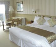
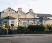
Trearddur Bay
TRAVELODGE HOLYHEAD
The Boathouse Hotel
Videos from this area
These are videos related to the place based on their proximity to this place.
Cwm Farm, holiday cottage in Anglesey, inside view
A video tour of the inside of Cwm Farm, a 3 bedroom self catering holiday cottage to let in Trearddur Bay, Anglesey with an additional 2 bedroom bothy, set in 40 acres of private land. Taken...
Tyn Towyn, Ty Piws | Holiday Cottage, Trearddur Bay, Anglesey
Tyn Towyn is a sleepy holiday development of beautifully finished self catering cottages, just a few minutes' walk from one of the prettiest beaches on Anglesey. There is so much to do in this...
Tyn Towyn, Ty Gwyrdd | Holiday Cottage, Trearddur Bay, Anglesey
In the popular seaside village of Trearddur Bay, this development of holiday cottages sits in lovely grounds with an abundance of wildlife. So much planning and care has gone into Tyn Towyn...
01: Y Stabl (Rhoscolyn, Anglesey) Slideshow
These photos are of Y Stabl and show various shots of the cottage. Y Stabl ('The Stable') is a self-catering holiday cottage located in the rural area of Rhoscolyn, Anglesey, North Wales....
No stabilisers / training wheels.
My son has just had his third birthday. He was riding his bicycle with no stabilisers (training wheels) before he turned three.
03: Rhoscolyn Coastal Path Slideshow
These photos are of the Anglesey Coastal Path around Rhoscolyn, and show various shots of the coastal walk. Y Stabl ('The Stable') is a self-catering holiday cottage located in the rural...
02: Rhoscolyn Beach Slideshow
These photos are of Rhoscolyn Beach and show shots from the beach, mainly during the summer. Y Stabl ('The Stable') is a self-catering holiday cottage located in the rural area of Rhoscolyn,...
Bryn Gors, holiday cottage in Anglesey
A video tour of Bryn Gors, a 3 bedroom self catering holiday cottage to let in Trearddur Bay, Anglesey with stunning views of the bay. Taken in June 2013. Rent this cottage at www.anglesey-escapes...
Mountain View, holiday cottage in Anglesey
Video tour of Mountain View, a 3 bedroomed holiday cottage to let in Rhoscolyn, Anglesey. Stunning views of the sea and Snowdonia mountain range. Video was taken in June 2013. To rent this...
Rhoscolyn Beacon Lobster Walk Aug 09
Large lobster out for a walk off rhoscolyn beacon, crabs and dogfish beware! Please add comments if you like :)
Videos provided by Youtube are under the copyright of their owners.
Attractions and noteworthy things
Distances are based on the centre of the city/town and sightseeing location. This list contains brief abstracts about monuments, holiday activities, national parcs, museums, organisations and more from the area as well as interesting facts about the region itself. Where available, you'll find the corresponding homepage. Otherwise the related wikipedia article.
Holy Island, Anglesey
Holy Island (Welsh: Ynys Gybi, 'the island of Cybi') is an island (15.22 sq mi) on the western side of the larger Isle of Anglesey, North Wales, from which it is separated by a narrow, winding channel. It is called "Holy" because of the high concentration of standing stones, burial chambers and other religious sites on the small island. The alternative and historic name of the island is Holyhead Island. According to the 2001 Census, the population is 13,579.
Valley, Anglesey
Valley is a village near Holyhead/Caergybi on the west coast of Anglesey, North Wales. Population (2001) 2,413. In Welsh it is referred to as either Y Dyffryn (meaning The Valley) or [Y Y] Fali (pronounced as Valley). Recent research, prompted by local opposition to the name of Y Fali, suggested that Valley may be a corruption of the Irish Bally (settlement), or Baile as it is spelled in Irish.
Ynys Benlas
Ynys Benlas is a small islet situated in the Inland Sea between Anglesey and Holy Island. It measures approximately 65 metres (east-west) by 35 metres (north-south) at low tide and covers about 0.2 hectares. Its name translates from the Welsh for "blue top island", which is thought to derive from the fact that bluebells apparently flourished on it.
Rhoscolyn
Rhoscolyn is a village located on Holy Island, Anglesey, Wales. It is just over five miles south of Holyhead and is the most southerly settlement on the island. The name Rhoscolyn is said to mean "The Moor" (Rhos) of The Column (colyn), referring to a pillar which the Romans put up to mark the edge of their territories. A little to the west of the village is a mediaeval well dedicated to St Gwenfaen beside which are the remains of a drystone well house measuring 4.5m east-west by 5.5m.
Four Mile Bridge
Four Mile Bridge (Welsh: Pontrhydybont / Pont-rhydbont / Pontrhypont) is the name given to a bridge and the village surrounding it in Anglesey, Wales. They are so named because they are located around four miles southeast of Holyhead, the largest town on the island. The bridge is one of three connecting the Anglesey mainland to the smaller Holy Island and was the sole route until the construction of the Stanley Embankment in 1823.
Valley Rural District
Valley was a rural district in the administrative county of Anglesey, Wales from 1894 to 1974. The district was formed by the Local Government Act 1894 as the successor to Holyhead Rural Sanitary District. It took its name from the village of Valley which lay at the centre of the district. The rural district was abolished in 1974, when the Local Government Act 1972 amalgamated all local authorities on the island into a single district of Ynys Môn - Isle of Anglesey.
Stanley Embankment
Stanley Embankment is a railway, road and cycleway embankment that connects the Island of Anglesey and Holy Island, Wales. It carries both the North Wales Coast Line for trains, which runs from Crewe to Holyhead and the A5 road between London and Holyhead. The embankment was designed by, and its construction overseen by, Thomas Telford and was named after the Stanley family who were significant benefactors to the area.
Beddmanarch-Cymyran SSSI
Beddmanarch-Cymyran SSSI is a site of special scientific interest on Anglesey extending to just over 90 Ha. It was first notified in 1961 for its coastal botanical and ornithological interest It comprises the area of coastal salt-marshes.


