Safety Score: 3,0 of 5.0 based on data from 9 authorites. Meaning we advice caution when travelling to United Kingdom.
Travel warnings are updated daily. Source: Travel Warning United Kingdom. Last Update: 2024-04-25 08:17:04
Discover Bannockburn
Bannockburn in Stirling (Scotland) with it's 7,040 citizens is a city in United Kingdom about 352 mi (or 567 km) north-west of London, the country's capital city.
Local time in Bannockburn is now 03:01 PM (Thursday). The local timezone is named Europe / London with an UTC offset of one hour. We know of 11 airports in the vicinity of Bannockburn, of which 5 are larger airports. The closest airport in United Kingdom is Edinburgh Airport in a distance of 23 mi (or 37 km), South-East. Besides the airports, there are other travel options available (check left side).
There are two Unesco world heritage sites nearby. The closest heritage site in United Kingdom is Old and New Towns of Edinburgh in a distance of 45 mi (or 72 km), East. Also, if you like golfing, there are a few options in driving distance. Looking for a place to stay? we compiled a list of available hotels close to the map centre further down the page.
When in this area, you might want to pay a visit to some of the following locations: Stirling, Alloa, Falkirk, Kirkintilloch and Motherwell. To further explore this place, just scroll down and browse the available info.
Local weather forecast
Todays Local Weather Conditions & Forecast: 9°C / 49 °F
| Morning Temperature | 3°C / 38 °F |
| Evening Temperature | 7°C / 44 °F |
| Night Temperature | 4°C / 39 °F |
| Chance of rainfall | 1% |
| Air Humidity | 45% |
| Air Pressure | 1004 hPa |
| Wind Speed | Gentle Breeze with 7 km/h (4 mph) from West |
| Cloud Conditions | Overcast clouds, covering 98% of sky |
| General Conditions | Light rain |
Friday, 26th of April 2024
9°C (49 °F)
3°C (38 °F)
Light rain, light breeze, overcast clouds.
Saturday, 27th of April 2024
10°C (51 °F)
5°C (41 °F)
Light rain, gentle breeze, scattered clouds.
Sunday, 28th of April 2024
11°C (52 °F)
6°C (43 °F)
Light rain, gentle breeze, broken clouds.
Hotels and Places to Stay
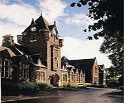
Colessio
Stirling Highland
Willow Court
King Robert Hotel
Holiday Inn Express STIRLING
ROYAL HOTEL
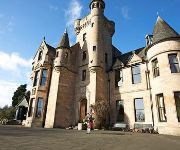
Broomhall Castle
TRAVELODGE STIRLING M80
J9) Stirling South (M9
Stirling City Centre
Videos from this area
These are videos related to the place based on their proximity to this place.
Stirling Bridge Commemoration 2014
Stirling Bridge Commemoration 2014 march, Attracting hundreds of patriotic Scots.
Stirling International Angling Festival - 6th - 10th of August 2014
Stirling International Angling Festival - 6th - 10th of August 2014 The Stirling International Angling Festival is will take place between the 6th to the 10th August this year bringing together...
Stirling Developments
Leading the way with quality new homes across Scotland. Help to Buy (Scotland) available: www.ogilviehomes.co.uk/helptobuy/ The High School (Stirling - FK8 2PX): ...
Lacrosse: Stirling vs Edinburgh - AirTV StirSport
Visit our website: http://airtvonline.com/ Like the AirTV Facebook page: https://www.facebook.com/airtvonline Follow our Twitter: https://twitter.com/airtvonline Follow our Vimeo: http://vimeo.com/...
Motorbikes Parade Armed Forces Day Stirling Scotland
Tour Scotland video of a parade of motorbikes on Armed Forces Day Stirling on ancestry visit to Stirling. Well done to the members of The Royal British Legion Riders Branch RBLR.
Argylls Homecoming Parade, Stirling
The 5th Battalion, The Royal Regiment of Scotland, The Argyll and Sutherland Highlanders, march through the City of Stirling with their mascot Cruachan III after returning from a 6 month tour...
Charolais Bull Sale held at Stirling Agricultural Centre Perth Bull Sales - February 2011
Charolais Bull Sales, February 2011 - part of the World Famous "Perth Bull Sales" Charolais met a dynamic trade in Stirling on Tuesday 22 February at the breed society's official spring sale...
Stirling Castle .... DJI Fly Over .... INNOVV C1
Short Video Shot Using Drone/Quadcopter over Stirling Castle. Stirling Castle is the grandest of Scotland's castles and one of the most popular visitor attractions in the country. 250 feet...
DVD/Bluray Update November 2012
Films I bought recently. Checkout my film Blog: www.raydvd.blogspot.com.
Videos provided by Youtube are under the copyright of their owners.
Attractions and noteworthy things
Distances are based on the centre of the city/town and sightseeing location. This list contains brief abstracts about monuments, holiday activities, national parcs, museums, organisations and more from the area as well as interesting facts about the region itself. Where available, you'll find the corresponding homepage. Otherwise the related wikipedia article.
Battle of Bannockburn
The Battle of Bannockburn (Blàr Allt a' Bhonnaich in Scottish Gaelic) (24 June 1314) was a significant Scottish victory in the Wars of Scottish Independence. It was one of the decisive battles of the First War of Scottish Independence.
St. Ninians
St. Ninians is a long-standing settlement which is now a district of the city of Stirling in central Scotland. It is located approximately one mile south of the city centre. It was originally known as Eccles (i.e. 'church'), and may have been a Christian site from an unusually early date (possibly 5th or 6th century). Later called 'St. Ringan's' (a variant of St Ninian's). This church was the administrative centre for churches across the strath of the River Forth.
Battle of Sauchieburn
The Battle of Sauchieburn was fought on June 11, 1488, at the side of Sauchie Burn, a stream about two miles south of Stirling, Scotland. The battle was fought between the followers of King James III of Scotland and a large group of rebellious Scottish nobles including Alexander Home, 1st Lord Home, nominally led by the king's 15-year-old son, Prince James, Duke of Rothesay.
St Modan's High School
St Modan's RC High School is an S1-S6 Catholic High School in Stirling, Scotland. The school roll currently stands at over 900 pupils. Pupils travel from the Denny, Banknock, Alloa, Tullibody, Sauchie, Alva, Raploch, Cowie, Bannockburn, Braehead, Riverside, Dunblane and Blanefield areas. In 2008 St. Modan's High School moved to a new site as part of Stirling Councils £10 million Public Private Partnership regeneration of schools.
Stirling services
Stirling services is a motorway service station near Stirling, Scotland. The service station is located where the M9 motorway and M80 motorway join. It is owned by Moto.
Annfield Stadium
Annfield Stadium was a football stadium in Stirling, Scotland. The stadium was home to Stirling Albion F.C. until 1993 when the stadium was closed down due to Stirling Albion moving to Forthbank Stadium. The stadium was sold and demolished to make way for a new housing development.
Forthbank Park
Forthbank Park was a sports venue in Stirling, Scotland until 1940. Forthbank park was home to King's Park F.C. until the beginning of World War II. During the war Forthbank was destroyed by the Luftwaffe. The ground was victim to the only German bomb strike on the town during the conflict. The majority of the stadium was damaged beyond financial repair by King's Park and was demolished. Shortly after the war King's Park closed down permanently.
New Williamfield
New Williamfield is a cricket ground in Stirling, Scotland. The first recorded match held on the ground came in 2001 when Stirling County v West Lothian. The ground held a neutral Women's One Day International in 2010 when Ireland Women played the Netherlands Women. The ground is used by Stirling County Cricket Club.


