Safety Score: 3,0 of 5.0 based on data from 9 authorites. Meaning we advice caution when travelling to United Kingdom.
Travel warnings are updated daily. Source: Travel Warning United Kingdom. Last Update: 2024-04-18 08:12:24
Delve into Joppa
The district Joppa of Edinburgh in Edinburgh (Scotland) is a district located in United Kingdom about 330 mi north of London, the country's capital town.
In need of a room? We compiled a list of available hotels close to the map centre further down the page.
Since you are here already, you might want to pay a visit to some of the following locations: Dalkeith, Glenrothes, Haddington, Livingston and Dundee. To further explore this place, just scroll down and browse the available info.
Local weather forecast
Todays Local Weather Conditions & Forecast: 9°C / 49 °F
| Morning Temperature | 7°C / 45 °F |
| Evening Temperature | 9°C / 48 °F |
| Night Temperature | 5°C / 41 °F |
| Chance of rainfall | 0% |
| Air Humidity | 57% |
| Air Pressure | 1019 hPa |
| Wind Speed | Fresh Breeze with 13 km/h (8 mph) from East |
| Cloud Conditions | Overcast clouds, covering 87% of sky |
| General Conditions | Light rain |
Saturday, 20th of April 2024
9°C (47 °F)
7°C (44 °F)
Scattered clouds, light breeze.
Sunday, 21st of April 2024
7°C (44 °F)
5°C (42 °F)
Light rain, light breeze, overcast clouds.
Monday, 22nd of April 2024
6°C (43 °F)
6°C (43 °F)
Light rain, light breeze, overcast clouds.
Hotels and Places to Stay
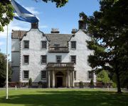
Prestonfield House
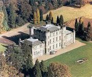
Melville Castle
Leith Apartments
Sandaig Guest House
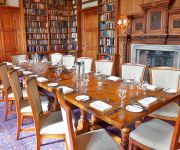
Carberry Tower Mansion House and Estate
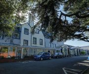
BEST WESTERN KINGS MANOR HOTEL
Mackenzie Guest House
TRAVELODGE EDINBURGH CAMERON TOLL
Park View House Hotel - Guest House
The Thistle House
Videos from this area
These are videos related to the place based on their proximity to this place.
Musselburgh Rugby Sevens
Musselburgh 7s Tournament and AndyG (POTY) Highlights (MRFC 7s 2008 - Musselburgh v QMU, Musselburgh Select, Edinburgh University, Watsonians RFC)
Musselburgh Train Station
Train Service From Edinburgh Waverley To North Berwick Calling At Musselburgh.
Borders Rail Ballast Drop!
This video starts with views of a Borders Rail project ballast train with 66615 & 66552 in T'n'T configuration running from Millerhill yard onto the worksite on 9/4/15. The working then ran...
Rugby Action - 'Offload'!?!
Musselburgh v Currie (IIs) - Stoneyhill 20th March 2010 Stout defending keeps home team in touch until rampaging away team secure victory late in hard-fought match (13v38)
60163 Tornado Royal Borderer Niddrie Junction Edinburgh 22 October 2010
60163 Tornado shunts at Niddrie Junctions south and west on the Edinburgh South Suburban line to turn to face south for the return journey. 60163 was dragged to this point from the Waverley...
View from the beach of Portobello in Edinburgh
This is the view from the beach of Portobello, a suburb of Edinburgh located on the east of the city. This video was taken in December 2011. For more Pictures of Scotland watch the playlist:...
Edinburgh beach
Three hours walking to get there and go back to the city centre. I enjoyed the walk!
Lothian Horticultural Services 2 21st June 2013
My parents sought three quotes for a range of gardening work from adverts in the East Lothian Courier recently. They're getting on and neither had the physical energy to do what they used to...
Portobello & Joppa Drama Group: Get-In 2015
We do the first day of our get-in for the Drama Group's run of The Gondoliers at Portobello & Joppa Parish Church. 30 seconds between pictures, between 1:54PM and 6:58PM (when my battery ran...
Videos provided by Youtube are under the copyright of their owners.
Attractions and noteworthy things
Distances are based on the centre of the city/town and sightseeing location. This list contains brief abstracts about monuments, holiday activities, national parcs, museums, organisations and more from the area as well as interesting facts about the region itself. Where available, you'll find the corresponding homepage. Otherwise the related wikipedia article.
Lothian
Lothian (forms a traditional region of the Scottish Lowlands, lying between the southern shore of the Firth of Forth and the Lammermuir Hills. The Lothian region includes Edinburgh City, West Lothian, Mid Lothian and East Lothian. The principal settlement in Lothian is the Scottish capital, Edinburgh. Towns include Livingston, Linlithgow, Bathgate and Dunbar. Historically, the term Lothian is used for a province encompassing the present area plus the Scottish Borders region.
Union Canal (Scotland)
The Union Canal is a canal in Scotland, running from Falkirk to Edinburgh, constructed to bring minerals, especially coal, to the capital. It was opened in 1822 and was initially successful, but the construction of railways, particularly the Edinburgh and Glasgow Railway, opened in 1842, diminished its value as a transport medium. It fell into slow commercial decline and became disused in the 1930s.
Portobello, Edinburgh
Portobello is a beach resort located three miles (5 km) to the east of the city centre of Edinburgh, along the coast of the Firth of Forth, in Scotland. It is now a suburb of Edinburgh, with a promenade fronting on to the wide sand beach. Its heyday as a resort was almost certainly in the late 19th century, and it was in slow decline throughout the 20th century.
River Esk, Lothian
The River Esk is a river which flows through Midlothian and East Lothian, Scotland. It initially runs as two separate rivers, the North Esk and the South Esk. The North Esk rises in the North Esk Reservoir in the Pentland Hills, in Midlothian, a mile (1½ km) north of the village of Carlops. It flows north-east past Penicuik, Auchendinny, through Roslin Glen, past Hawthornden Castle, Polton, Lasswade and Melville Castle.
Queen Margaret University
Queen Margaret University (formerly Queen Margaret University College and Queen Margaret College) is a Modern University located in Musselburgh, East Lothian near Edinburgh in Scotland. It is named after Saint Margaret, wife of King Malcolm III of Scotland.
Brunstane
Brunstane is a southeastern suburb of the city of Edinburgh, Scotland. It lies on the A1 and is served by Brunstane railway station on the Edinburgh Crossrail. Some of Brunstane is covered by new housing, such as the Gilberstoun estate. Prominent local features include the Milton Road campus of the Jewel and Esk Valley College and Edinburgh's largest Asda supermarket.
Craigentinny
Craigentinny (Scottish Gaelic: Creag an t-Sionnaich) is a suburb in the east of Edinburgh, Scotland. Its name is a corruption of the Scottish Gaelic Creag an t-Sionnaich meaning "Foxrock" or Creag an teinne meaning "Fire Crag".
Fernieside
Fernieside is a suburb on the southern edge of the city of Edinburgh, Scotland. It is very close to Craigour, which is just to its north and Ferniehill to the south. The suburb is 4 miles (6.5 km) southeast of the city centre. Laid out as public housing from 1947, many properties have been sold through right-to-buy legislation, while small private developments have been inserted to the north in the early 21st century.
Niddrie, Edinburgh
This article is about Niddrie, a suburb of Edinburgh. See also: Longniddry, Niddry Castle. ' Niddrie is a suburb of south-east Edinburgh, Scotland, UK. It is situated southwest of the seaside area of Portobello, and west of Musselburgh, East Lothian. The Wauchope family owned the majority of the area up to the 1930s, The family home Niddrie Marischal House was immediately west of the present day Jack Kane Centre sports complex in Hunters Hall Park.
Bingham, Edinburgh
Bingham is a suburb of Edinburgh, the capital of Scotland. It is east of Duddingston, west of Magdalene, south of Southfield and north of Niddrie. The main A1 road skirts Bingham to the north.
Eastfield, Edinburgh
Eastfield is a primarily residential district on the north eastern outskirts of Edinburgh, the capital of Scotland. It lies between Joppa and the Edinburgh City boundary with Musselburgh. The district is bounded on the north by the Firth of Forth, on the west by Joppa and the main East Coast rail line, and on the south by farmland and the grounds of Newhailes House a National Trust for Scotland property.
Greendykes
Greendykes is a suburb of Edinburgh, the capital of Scotland. It is a fairly large council scheme, which consists mostly of low-rise flats but also houses two 14 storey tower blocks (Greendykes House and Wauchope House). It is sometimes considered to be part of Craigmillar, areas such as Niddrie, Niddrie Mains and Newcraighall are also situated nearby.
Joppa, Edinburgh
Joppa is an eastern suburb of Edinburgh, the capital of Scotland. It is bounded on the north by the coast of the Firth of Forth, on the west by Portobello of which it was a suburb when Portobello was a burgh, to the south by the open area south of Milton Road and to the east by Musselburgh in East Lothian. The name "Joppa" appears in the late 18th century and is of uncertain origin.
Mountcastle, Edinburgh
Mountcastle is a suburb of Edinburgh, the capital of Scotland. It is east of the city centre and lies to the north-west of the neighbouring area of Portobello. Mountcastle is primarily a residential area, with a large number of early-mid 20th century houses.
Danderhall
Danderhall is a village in Midlothian, Scotland. It is just outside the city of Edinburgh, but inside the Edinburgh City Bypass. The village includes a large amount of council housing — although much of this is now privately owned by the occupiers. Danderhall was formerly a "mining village", supplying labour for the nearby coal mines of Edmonstone to the northwest, Sheriffhall to the southeast, Woolmet to the east and Monktonhall beyond that.
John Muir Way
The John Muir Way is a 73-kilometre continuous coastal path in East Lothian, Scotland, UK. It is named in honour of the Scottish 19th-century conservationist John Muir, who was born at Dunbar, East Lothian, in 1838 and became a founder of America's national park system. The path runs from the Edinburgh City boundary along the coast through East Lothian to the Scottish Borders.
Portobello High School
Portobello High School is a large secondary school in Portobello in the east of Edinburgh. With 1450 pupils it is one of the largest state schools in Edinburgh and Scotland. The headteacher is Peigi MacArthur.
Shawfair railway station
Shawfair railway station will be a newly planned station to be opened on the Waverley Line, a railway line to be reopened between Edinburgh and Tweedbank, just beyond Galashiels in Scotland. There is planned to be a half-hourly service at this stop to Gorebridge. This station is to serve the new development of Shawfair, a settlement south-east of Edinburgh.
Fort Kinnaird
Fort Kinnaird is a large outdoor retail park, which is located in the village of Newcraighall, just off the A1 in the southeast of Edinburgh, Scotland. It opened in 1989. Fort Kinnaird has many shops, restaurants and entertainment complexes and is soon to be extended for the second time in as many years in the area that once housed Megabowl, Chiquito, Frankie & Benny's, Odeon and Harveys..
Shawfair
Shawfair is the name of a new town planned to be built on the site of the former Monktonhall Colliery in the south-east wedge of Edinburgh. The name is derived from a local farm steading of the same name. Although it is within the boundary of the city-bypass, it will not technically be a suburb of Edinburgh as it is outwith the city council boundary and instead will actually be wholly within the Midlothian council area.
Robin Chapel
Robin Chapel is an ecumenical Christian place of worship in the Craigmillar area of Edinburgh, Scotland. It was built in memory of Lieutenant Robin Tudsbery, who was killed in the closing days of World War II. The chapel sits within the grounds of the Thistle Foundation, a housing complex for disabled people.
Fisherrow
Fisherrow is a harbour and former fishing village at Musselburgh, East Lothian, Scotland, UK, to the east of Portobello and Joppa, and on the left bank of the River Esk.
Niddrie Mains
Niddrie Mains is an area of east Edinburgh, north of Niddrie Mains Road. The Mains refers to the farm of Niddrie which occupied the land on which the social housing estate for southeast Edinburgh was built in the 1920s.
Musselburgh Grammar School
Musselburgh Grammar School is a large state secondary school that serves as the main secondary school for Musselburgh and the surrounding areas. It dates back to the sixteenth century, although the present building was erect in 1835. Until the 1950s the school was a 'proper' Grammar School, and fees were paid for there. As of December 2005 the school's roll was 1510. The current headteacher is Ronald Summers who has been in position since 2003.
Braid Burn
The Braid Burn is a stream 14 km in length that flows through south and east Edinburgh. The area of the basin drained by the burn and its tributaries amounts to 30.5 square km. From its source near Bonaly in the Pentland Hills south-west of the city it flows in a generally north-easterly direction, skirting the Braid Hills to the east and south, via the Braid Valley Park, the Hermitage of Braid, Blackford Glen, Cameron Toll and Inch Park.


