Safety Score: 3,0 of 5.0 based on data from 9 authorites. Meaning we advice caution when travelling to United Kingdom.
Travel warnings are updated daily. Source: Travel Warning United Kingdom. Last Update: 2024-04-23 08:18:23
Discover Gorgie
The district Gorgie of Edinburgh in Edinburgh (Scotland) is a district in United Kingdom about 331 mi north-west of London, the country's capital city.
Looking for a place to stay? we compiled a list of available hotels close to the map centre further down the page.
When in this area, you might want to pay a visit to some of the following locations: Dalkeith, Glenrothes, Livingston, Haddington and Perth. To further explore this place, just scroll down and browse the available info.
Local weather forecast
Todays Local Weather Conditions & Forecast: 10°C / 50 °F
| Morning Temperature | 4°C / 39 °F |
| Evening Temperature | 8°C / 46 °F |
| Night Temperature | 4°C / 40 °F |
| Chance of rainfall | 0% |
| Air Humidity | 52% |
| Air Pressure | 1026 hPa |
| Wind Speed | Gentle Breeze with 7 km/h (4 mph) from West |
| Cloud Conditions | Scattered clouds, covering 46% of sky |
| General Conditions | Scattered clouds |
Wednesday, 24th of April 2024
10°C (49 °F)
6°C (42 °F)
Sky is clear, gentle breeze, clear sky.
Thursday, 25th of April 2024
8°C (46 °F)
5°C (41 °F)
Light rain, light breeze, broken clouds.
Friday, 26th of April 2024
9°C (47 °F)
5°C (40 °F)
Light rain, gentle breeze, scattered clouds.
Hotels and Places to Stay
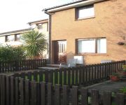
Kew House
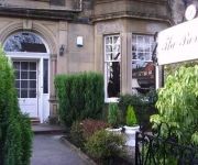
The Beverley
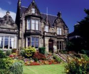
Grosvenor Gardens Hotel
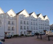
Holiday Inn EDINBURGH
The Dunstane Houses
The Dunstane
The Hampton Hotel
Lets Edinburgh
Tony Asga – Asga Apartment
The St. Valery Guest House
Videos from this area
These are videos related to the place based on their proximity to this place.
By the Trail of the Lonesome Tram
One wee benefit of Edinburgh's cursed tram project is the new path between Stenhouse and Balgreen. Probably more use than the rest of the project is, for a fraction of the cost. A great, traffic...
Ivan Prepares For His Kayak Trip 08 June 2007.MOV
Unedited, hand-held, made in one continuous take. Ivan did not realise he was being filmed - he thought I was taking occasional still pictures. The film is of Ivan testing out the home...
Colinton Dell
A brief wander along some of the old railway path through Colinton Dell, Edinburgh. April 23, 2008.
City Crafts - plaster cornice, coving, ceiling roses and plasterers Edinburgh, Scotland
City Crafts - plaster cornice, coving, ceiling roses and plasterers Edinburgh, Scotland.
Illegal overtake on Colinton Road
To be overtaken at a pelican crossing by a car crossing the zig-zag lines is bad enough, but to have two do it. Well, that's not nice at all.
Edinburgh, Scotland - Edimburgo, Escocia
Edinburgh is the capital of Scotland and its second largest city, after Glasgow, which is 45 miles away to the west. Is the seventh largest city in the United Kingdom.
Day 1: Post Office 1000 Challenge - Chris Moon
Chris Moon, a double amputee, is running 1000 miles, 36 miles every day. Supported by the Post Office®, Chris will be dropping in on many Post Office branches around the country and hopes...
British Isles - Scotland 09 - St Andrews & Balmoral Castle
Trip to the British Isles: June-July, 2009 Scotland St. Andrews and Balmoral Castle.
Painter and Decorator - Kirkwood Decor - Edinburgh
www.kirkwooddecor.co.uk Painter and Decorator from Edinburgh and The Lothians. Kirkwood Decor are situated in and operating throughout the Edinburgh and Lothian area for all commercial and...
Videos provided by Youtube are under the copyright of their owners.
Attractions and noteworthy things
Distances are based on the centre of the city/town and sightseeing location. This list contains brief abstracts about monuments, holiday activities, national parcs, museums, organisations and more from the area as well as interesting facts about the region itself. Where available, you'll find the corresponding homepage. Otherwise the related wikipedia article.
A71 road
The A71 is a major road in Scotland linking Edinburgh with Lanarkshire and Ayrshire. It adjoins the Livingston Bypass A899. It runs south west from Edinburgh for approximately 70 miles, through Saughton, Wilkieston and south of Livingston, Whitburn and Wishaw, then by way of Overtown, Garrion Bridge, Stonehouse, Strathaven, Darvel, Newmilns, Galston, Hurlford and Kilmarnock to Irvine on the North Ayrshire coast.
Scottish Rugby Union
The Scottish Rugby Union (SRU), or Aonadh Rugbaidh na h-Alba in Scottish Gaelic, is the governing body of rugby union in Scotland. It is the second oldest Rugby Union, having been founded in 1873, as the Scottish Football Union.
Murrayfield
Murrayfield is an affluent area in the west of Edinburgh, Scotland. It is to the east of Corstorphine and west of Roseburn and the city centre. The A8 road runs east-west through the north of the area. Murrayfield is often considered to include the smaller neighbouring areas of Ravelston (to the north) and Roseburn (to the east). It is known mostly for containing Murrayfield Stadium, home to the Scottish national rugby union team and venue for many sporting events.
Murrayfield Stadium
Murrayfield Stadium (usually just known as Murrayfield) is a sports stadium located in the west end of Edinburgh, the capital of Scotland. Its all-seater capacity was recently reduced from 67,800 to 67,144 to incorporate the largest permanent "big screens" in the country, though it remains the largest stadium in Scotland and one of the largest in the United Kingdom overall.
Ardmillan
Ardmillan is a mainly residential suburb of Edinburgh, Scotland. It borders on Dalry, Gorgie, and Polwarth. The name means the "high bare place" in Scottish Gaelic (Aird a' Mhaolain). The area contains many tenements as well as "Diggers" pub, so called because the gravediggers from the large graveyard in the Ardmillan-Dalry area would go in there after work.
Balgreen
Balgreen is a suburb of Edinburgh, located approximately two miles west of the city centre. It is located to the west of Murrayfield and Saughtonhall, to the east of Corstorphine, and to the north of Gorgie. It is bound to the north by Corstorphine Hill, to the west by Carrick Knowe Golf Course, and roughly to the east by Water of Leith.
Gorgie-Dalry
Gorgie-Dalry is the name given to the joint community council, consisting of Gorgie and Dalry in the west of Edinburgh, the Scottish capital. The area also incorporates Tynecastle and parts of Ardmillan. Street signposts often use the Gorgie-Dalry logo, which is a G and a D in orange, running into one another; this logo was designed as part of a local competition and part of community based initiatives to instill pride in the local area.
Murrayfield Ice Rink
Murrayfield Ice Rink is a 3,800-seat multi-purpose arena in the Murrayfield area of Edinburgh, Scotland, right next door to Murrayfield Stadium. It was built between 1938 and 1939. It is home to the Edinburgh Capitals ice hockey team. A 7-sheet curling rink was constructed in the 1970s following the closure of the Haymarket Ice Rink.
Polwarth, Edinburgh
Polwarth is a mainly residential area of Edinburgh, Scotland. It is bounded by Bruntsfield and Merchiston to the east and south, Gorgie and Dalry to the north, and Craiglockhart to the west. The Union Canal flows through Polwarth on its way from Edinburgh to Falkirk. Although within the boundary of Merchiston Community Council, Harrison Park – on the north bank of the canal – is commonly taken to be part of Polwarth.
Haymarket TMD
Haymarket TMD is a railway Traction Maintenance Depot situated inside Edinburgh, Scotland, next to Haymarket Station and Murrayfield Stadium. The depot is operated by First ScotRail. The depot code is HA.
Beechmount
Beechmount is a suburb of Edinburgh, the capital of Scotland. It is south of the A8.
Chesser
Chesser is a suburb of Edinburgh, Scotland, south of the water of Leith, Post Code area is EH14. Chesser is, mainly, a residential part of Edinburgh, situated between Longstone to the West and Slateford and Shandon to the East. The Edinburgh Corn Exchange is situated in Chesser, providing a venue for regular live events. Recent regeneration has seen the existing, predominantly early 20th century housing stock supplemented with modern developments.
Roseburn
Roseburn is a suburb of Edinburgh, the capital of Scotland. The area lies in the west of the city, beyond Haymarket and close to the Murrayfield area. It is immediately to the south of the A8 road. The Water of Leith flows along one side of Roseburn Park next to the Water of Leith Walkway. Other boundaries to the park are Murrayfield Stadium and Murrayfield Ice Rink. The park is used for football in the winter and cricket in the summer.
Slateford
Slateford (Scottish Gaelic: Àth na Sglèata) is a suburb of Edinburgh, the capital of Scotland. It is east of the Water of Leith. The former village of Slateford lies on the Lanark Road where it crosses the Water of Leith 1/4 of a mile south west of Slateford Station. The name "Slateford" comes from local rock found in the area and the old fording point on the Water of Leith that the village grew round.
Westfield, Edinburgh
Westfield is a suburb of Edinburgh, the capital of Scotland. It is north of A71.
A70 road
The A70 road is a major road in Scotland, United Kingdom . It runs a total of 74.3 miles from Edinburgh to Ayr. It begins as Ardmillan Terrace in Gorgie, Edinburgh from a junction with the A71, passing near but not through Lanark and ending as Holmston Road in Ayr.
Craiglockhart Castle
Craiglockhart Castle is ruined tower house in the Craiglockhart district of Edinburgh, Scotland. It is situated in the Craiglockhart Campus of Edinburgh Napier University, to the north of Wester Craiglockhart Hill. Historic Scotland record that the tower was built by the Lockharts of Lee in the 15th century, although other sources state that it was the work of the Kincaid family during the 12th century.
Edinburgh Corn Exchange
The Edinburgh Corn Exchange is a conference, banqueting, wedding, sports and live music venue in the Chesser suburb of Edinburgh, Scotland. The maximum dinner capacity is 1000 guests and for concerts 3000 spectators.
Shandon, Edinburgh
Shandon is an area of Edinburgh within North Merchiston approximately three miles west of the centre of Edinburgh. It is bounded by Slateford Road to the north, Harrison Road to the east, the Union Canal to the south and the Glasgow-Edinburgh (via Slateford) and Suburban rail lines to the west.
Gorgie East railway station
Gorgie East Railway Station (named Gorgie Station until 1952) was a railway station on the Edinburgh Suburban and Southside Junction Railway in Edinburgh, Scotland. It was opened on 1 December 1884 and served the Gorgie area of Edinburgh. Gorgie East station closed in 1962, when passenger rail services were withdrawn from the Edinburgh Suburban line as part of the British Railways rationalisation programme known as the Beeching Axe.
Craiglockhart railway station
Craiglockhart Railway Station was a railway station in Scotland on the Edinburgh Suburban and Southside Junction Railway (SSJR). It was opened on 1 December 1884. Located on Colinton Road next to the Myrside Aqueduct of the Union Canal, it served the Craiglockhart area of Edinburgh, in the Southside of the city.
Murrayfield Stadium tram stop
Murrayfield Stadium tram stop is a new tram stop currently under construction by Edinburgh Trams. It will provide direct access to Murrayfield Stadium and Murrayfield Ice Rink. The stop (and the entire tram line) are expected to open in mid 2014. Preceding station Edinburgh Trams Following station Haymarkettowards York Place York Place-Edinburgh Airport Balgreentowards Edinburgh Airport
Balgreen tram stop
Balgreen tram stop is a new tram stop currently under construction by Edinburgh Trams and will serve Balgreen. The stop (and the entire tram line) are expected to open in mid 2014. Preceding station Edinburgh Trams Following station Murrayfield Stadiumtowards York Place York Place-Edinburgh Airport Saughtontowards Edinburgh Airport
Craiglockhart Primary School
Craiglockhart Primary School is a primary school in the Shandon area of Edinburgh. The school buildings are in the Victorian style of architecture. The current Headteacher is Derek Law. He is assisted by Deputy headteacher Miss Gater and Business Manager Miss Stewart.
North British Distillery
The North British Distillery Company Ltd is a Scottish grain whisky distillery located in south western Gorgie district of Edinburgh. Established by a group of independent distillers in 1885, it is now a joint venture company between Diageo plc and the privately held Edrington Group. It is Edinburgh’s last working distillery, widely known as "NB". Tynecastle Stadium lies immediately to the southeast.


