Safety Score: 3,0 of 5.0 based on data from 9 authorites. Meaning we advice caution when travelling to United Kingdom.
Travel warnings are updated daily. Source: Travel Warning United Kingdom. Last Update: 2024-04-20 08:25:34
Delve into Netherlee
The district Netherlee of in East Renfrewshire (Scotland) with it's 4,550 habitants Netherlee is a subburb in United Kingdom about 342 mi north-west of London, the country's capital town.
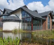
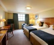
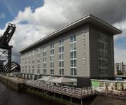
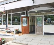
If you need a hotel, we compiled a list of available hotels close to the map centre further down the page.
While being here, you might want to pay a visit to some of the following locations: Giffnock, Glasgow, Paisley, Kirkintilloch and Hamilton. To further explore this place, just scroll down and browse the available info.
Local weather forecast
Todays Local Weather Conditions & Forecast: 12°C / 54 °F
| Morning Temperature | 3°C / 38 °F |
| Evening Temperature | 10°C / 50 °F |
| Night Temperature | 7°C / 44 °F |
| Chance of rainfall | 0% |
| Air Humidity | 47% |
| Air Pressure | 1030 hPa |
| Wind Speed | Light breeze with 5 km/h (3 mph) from North-East |
| Cloud Conditions | Scattered clouds, covering 31% of sky |
| General Conditions | Scattered clouds |
Sunday, 21st of April 2024
12°C (54 °F)
9°C (48 °F)
Overcast clouds, light breeze.
Monday, 22nd of April 2024
16°C (60 °F)
9°C (48 °F)
Broken clouds, light breeze.
Tuesday, 23rd of April 2024
12°C (54 °F)
6°C (44 °F)
Scattered clouds, light breeze.
Hotels and Places to Stay
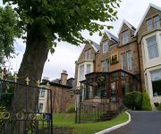
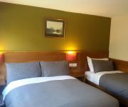
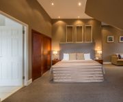
Number 10 Hotel
Crosshill House
Sherbrooke Castle Hotel
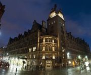
Grand Central Hotel
Holiday Inn GLASGOW - EAST KILBRIDE
Hallmark Glasgow
Hilton Garden Inn Glasgow City Centre
Glasgow Marriott Hotel
Redhurst
Glasgow City Centre Argyle St
Videos from this area
These are videos related to the place based on their proximity to this place.
Pipers At Giffnock Tennis Club
Pipers playing at Giffnock Tennis Club on the 16th of July 2014 as part of the Queen's baton rally for the Commonwealth Games.
Whole Foods Market Opening Giffnock
This is the whole (well almost) video of the opening of Whole Foods Market Giffnock 16-11-2011.
Queen's Baton Giffnock 16th July 2014
The Queen's baton being carried through Giffnock on the 16th of July 2014.
The Whores - Ghosts Of The Future - (2003)
Gonzoid electrothrash which blisses out gorgeously...well worth the trip.
Urban Jungle Paintball Promo Video (demo)
Scotland's newest and only Urban paintball site. Owned and run by The Scottish Warriors Tony and Gaz, it is a site run by paintballers, for paintballers. This is the "work in progress"...
Funny Airsoft outtakes 2013
Just a little extra outtake, a full ten minute video was uploaded on Tuesday 4th Sept.
Videos provided by Youtube are under the copyright of their owners.
Attractions and noteworthy things
Distances are based on the centre of the city/town and sightseeing location. This list contains brief abstracts about monuments, holiday activities, national parcs, museums, organisations and more from the area as well as interesting facts about the region itself. Where available, you'll find the corresponding homepage. Otherwise the related wikipedia article.
East Renfrewshire
East Renfrewshire (Scots: Aest Renfrewshire, Scottish Gaelic: Siorrachd Rinn Friù an Ear) is one of 32 council areas of Scotland. Until 1975 it formed part of the county of Renfrewshire for local government purposes along with the modern council areas of Renfrewshire and Inverclyde. Although no longer a local authority area, Renfrewshire still remains the registration county and lieutenancy area of East Renfrewshire.
Battle of Langside
The Battle of Langside, fought on 13 May 1568, was one of the more unusual contests in Scottish history, bearing a superficial resemblance to a grand family quarrel, in which a woman fought her brother who was defending the rights of her infant son. In 1567 Mary, Queen of Scots's short period of personal rule ended in recrimination, intrigue and disaster when after her capture at Carberry Hill she was forced to abdicate in favour of James VI, her infant son.
Pollokshaws
Pollokshaws is a district on the southside of the city of Glasgow, Scotland. The housing stock mostly consists of some sandstone tenement housing, tower blocks and modern brick tenement-style buildings. According to the 2001 Census Pollokshaws has a population of 4,295. Its residents are a mixture of working class and middle class social groups, and the area also has a large South Asian community.
Hampden Park
Hampden Park (often referred to simply as Hampden) is a football stadium in the Mount Florida area of Glasgow, Scotland. The 52,063 capacity venue serves as the national stadium of football in Scotland. It is the home venue of the Scotland national football team and amateur Scottish Football League club Queen's Park and hosts the latter stages of the Scottish Cup and Scottish League Cup competitions. It is also used for music concerts and other sporting events.
Eastwood, Strathclyde
Eastwood was one of nineteen local government districts in the Strathclyde region of Scotland from 1975 to 1996, lying south-west of the City of Glasgow. The district was formed from the area of the First District of the former county of Renfrewshire. The council's headquarters were at Giffnock. The district was named after the larger Eastwood civil parish itself named after a long-vanished woodland. The district was abolished by the Local Government etc.
Giffnock
Giffnock is a suburban town in East Renfrewshire set in the Central Lowlands of Scotland. It lies 3.7 miles east of Barrhead, 5.6 miles east-southeast of Paisley and 5.3 miles northwest of East Kilbride, at the southwest of the Greater Glasgow conurbation. Giffnock is mentioned in documents as early as the seventeenth century as a scattered agricultural settlement.
Queen's Park, Glasgow
Situated on the south side of the city of Glasgow, in Scotland, Queen's Park (Pàirc na Banrìghinn in Gaelic, Queen's Pairk in Scots) is 60 hectares in area and lies about 4 miles south of the city centre. The name can refer both to the park itself, the adjacent residential district, or the football team Queen's Park F.C.
Glasgow South (UK Parliament constituency)
Glasgow South is a burgh constituency of the House of Commons of the Parliament of the United Kingdom. It elects one Member of Parliament (MP) by the first past the post system of election. The constituency was first used in the general election of 2005.
Simshill
Simshill is a district in the Scottish city of Glasgow. It is situated south of the River Clyde. Former residents include Sir Alex Ferguson and Carol Smillie. It is next to the beautiful Linn Park. It is situated in between Castlemilk and Kings Park and and is only a short walk away from Hampden Park. There are three schools in Simshill. One secondary school (Kings Park) and two primary schools (St Fillans and St Mirins).
Stamperland
Stamperland is a district of the small suburban town of Clarkston, East Renfrewshire, Scotland. The area's close proximity to Glasgow effectively makes it a suburb of the city, though it remains administratively separate. Adjoining districts are Netherlee to the north and Giffnock to the west; it is also bordered by Clarkston Road to the west and the White Cart Water to the east. It is served by the Glasgow Central to East Kilbride line through Clarkston Station.
Newlandsfield Park
Newlandsfield Park is the home of Pollok Football Club and is located in the Newlands area of Glasgow, immediately adjacent to the Pollokshaws East railway station. It has a capacity of 4000 (1500 covered), and was opened for the 1928-29 season.
Hillpark Secondary School
aye getting mwi wae ma pals <3 Hillpark Secondary School Image:Hillpark secondary school. jpg Integer Vitae Location 36 Cairngorm Road Glasgow, Lanarkshire, Scotland Information Type State Funded Established 1967 Headmistress Joan Donnely Enrolment ~1300 Colors Black and grey Website http://www. hillpark-sec. glasgow. sch. uk Hillpark Secondary School is a secondary school located at 36 Cairngorm Road on the south side of Glasgow, Scotland.
ABC Muirend/Toledo
The ABC cinema (originally called the Toledo), on Clarkston Road in the Muirend area of Glasgow, existed from 1933 to 2001. At the time of its closing, it was the second-oldest working cinema in Glasgow, Scotland.
Williamwood High School
Williamwood High School, in Clarkston, East Renfrewshire, is a non denominational school. It has a school roll of over 1600 pupils and was recently built on Eaglesham road in Clarkston, replacing the old school on Seres road nearby. The new school is state-of-the-art and has been named as one of Scotland's most advanced schools and also one of the most expensive to build.
Holmwood House
Holmwood House is the finest and most elaborate residential villa designed by Scottish architect Alexander "Greek" Thomson. It is also rare in retaining much of its original interior decor, and being open to the public. The villa is located at 61-63 Netherlee Road, Cathcart in the southern suburbs of Glasgow.
Cathcart Castle
Cathcart Castle was a 15th century castle, located in what is now Linn Park in the Cathcart area of southern Glasgow, Scotland. The castle was abandoned in the 18th century, and the remaining ruins were pulled down in 1980, leaving only foundations visible.
Giffnock Synagogue
Giffnock and Newlands Synagogue, located at 222 Fenwick Road in Giffnock, East Renfrewshire (on the south side of Glasgow), is the largest Jewish religious congregation in Scotland. The synagogue also features a religious day school for both children and teenagers.
Langside College
Langside College is a further and higher education college located in the Mount Florida / Battlefield region of Glasgow. It was established in 1947 and enrols over 5,000 students every year of whom many are from countries outwith the European Union, the college currently operates in two main campuses and in over 80 community based venues spanning much of the Southside of Glasgow.
Greenbank Garden
Greenbank Garden, Clarkston, near Glasgow, Scotland is an 18th-century house and garden owned and operated by the National Trust for Scotland and open to the public. The house is situated about six miles (10 km) from the centre of Glasgow. The house has sixteen rooms, and also barns, stables and a 2.5-acre walled garden. The house is protected as a Category A listed building.
A727 road
Until the 1980s, the A727 number applied to what is now the B767, north of Clarkston. In 2006, following the opening of the Glasgow Southern Orbital route, the A727 number was recreated and took over part of what was formerly numbered as the A726.
Millbrae Crescent
Millbrae Crescent is a street located in Glasgow providing numerous examples of category A listed buildings thought to be designed by Alexander "Greek" Thomson, or posthumously by his architectural partner, Robert Turnbull. The street comprises an elegant row of two-storey terraced houses built using blonde sandstone and exemplifying Thomson's typical use of Egyptian-derived columns and ornamentation.
Linn Park, Glasgow, Scotland
Linn Park is a large park - 82 hectares in area - surrounded by the suburbs of Cathcart, Simshill and Netherlee on the southern fringes of Glasgow, Scotland, where the city borders East Renfrewshire. It is Glasgow’s second largest park, after Pollok Country Park. Both parks have the White Cart Water flowing through them.
Williamwood Parish Church
Williamwood Parish Church is a Parish church of the Church of Scotland, serving the Williamwood area of Clarkston, East Renfrewshire. It is within the Church of Scotland's Presbytery of Glasgow.
Glasgow Victoria Infirmary
The Glasgow Victoria Infirmary is a teaching hospital with an acute operational bed complement of approximately 370. The hospital is situated at Langside in the south-east of Glasgow, providing a range of high quality health care services including Accident and Emergency, General Medicine (including sub-specialties), General Surgery (including sub-specialties), Medicine for the Elderly (including Assessment, Rehabilitation, and Day Services), Orthopaedics and a wide range of Outpatient clinics.
Clarkston explosion
The Clarkston explosion was a disaster that occurred on 21 October 1971 at a shopping centre in Clarkston, East Renfrewshire, near Glasgow, Scotland. The death toll has been stated variously as 21 and 22. The explosion followed a build-up of gas in an underground space beneath the Clarkston Toll shopping centre, caused by a gas main leak later ruled to have been accidental.


