Safety Score: 3,0 of 5.0 based on data from 9 authorites. Meaning we advice caution when travelling to United Kingdom.
Travel warnings are updated daily. Source: Travel Warning United Kingdom. Last Update: 2024-04-24 08:14:40
Touring Woodburn
Woodburn in Mid and East Antrim (Northern Ireland) is a town located in United Kingdom about 325 mi (or 523 km) north-west of London, the country's capital place.
Time in Woodburn is now 11:38 AM (Wednesday). The local timezone is named Europe / London with an UTC offset of one hour. We know of 10 airports nearby Woodburn, of which 5 are larger airports. The closest airport in United Kingdom is George Best Belfast City Airport in a distance of 8 mi (or 12 km), South. Besides the airports, there are other travel options available (check left side).
There is one Unesco world heritage site nearby. The closest heritage site is Brú na Bóinne - Archaeological Ensemble of the Bend of the Boyne in Ireland at a distance of 72 mi (or 117 km). Also, if you like the game of golf, there are several options within driving distance. We collected 1 points of interest near this location. Need some hints on where to stay? We compiled a list of available hotels close to the map centre further down the page.
Being here already, you might want to pay a visit to some of the following locations: Carrickfergus, Newtownabbey, Larne, Belfast and Castlereagh. To further explore this place, just scroll down and browse the available info.
Local weather forecast
Todays Local Weather Conditions & Forecast: 8°C / 47 °F
| Morning Temperature | 5°C / 41 °F |
| Evening Temperature | 9°C / 47 °F |
| Night Temperature | 3°C / 38 °F |
| Chance of rainfall | 0% |
| Air Humidity | 76% |
| Air Pressure | 1019 hPa |
| Wind Speed | Gentle Breeze with 9 km/h (5 mph) from South |
| Cloud Conditions | Overcast clouds, covering 99% of sky |
| General Conditions | Overcast clouds |
Thursday, 25th of April 2024
10°C (49 °F)
6°C (44 °F)
Light rain, gentle breeze, overcast clouds.
Friday, 26th of April 2024
6°C (43 °F)
6°C (43 °F)
Moderate rain, moderate breeze, overcast clouds.
Saturday, 27th of April 2024
6°C (43 °F)
6°C (44 °F)
Moderate rain, fresh breeze, overcast clouds.
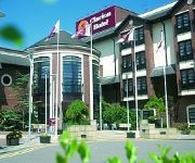
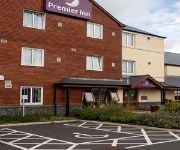
Hotels and Places to Stay
Hastings Culloden
Hotel Carrickfergus
Dobbins Inn Hotel
Carrickfergus
Videos from this area
These are videos related to the place based on their proximity to this place.
DeLorean Car Owners Association visit Carrickfergus 25th May 2011
Created on June 6, 2011 using FlipShare.
Print & Sign services Belfast
Signscript digital printing services Belfast, signs - banners - graphics, buy your signs and digital print on line at www.signscript.eu.
Skyrim Lets' Play Part 4 [GoT Mods] - I've gone Archer
Hey guys, part 4 of my let's play of Skyrim, I've decided to go Archer and see how it goes!
Skyrim Playthrough Part 1 - New Save - Modded (GoT)
Yes indeedy, it has been a while, but I'm back and I've decided to treat myself (and hopefully you guys) to some Skyrim. It's a new save, I have some mods, about 20, so I'm not going to list...
Garry's Mod Map Overview - rp_industrial17_beta6 (10 mins)
To all my subscribers - This is not a normal video, recently in my gaming community (raidinggamers.com) we've suggested this map as a change on our HL2RP server, and I wanted to give a medium...
Audi A3 Ultra SE Technik 1.6TDi 5dr (Sat-Nav)- 2016
Miles 12k, 83.1 MPG, Nil Road Tax, (110bhp) Navigation system, Cruise control, Air conditioning, Bluetooth, Rear parking sensors, x4 Electric windows, Trip computer, Rear wiper, Multiple airbags,...
Vauxhall Insignia SRi Nav 2.0CDTi (2012)
Vauxhall Insignia SRi Nav 2.0CDTi Ecoflex Black 5dr (130bhp) MOT June 2019, Timing belt replaced, 60.1 MPG, £30 Road Tax Navigation system, Cruise ...
Mercedes-Benz A180 Sport (2015)
Cosmos Black 72.4 MPG, £20 Road Tax, (110bhp) Cruise control, Partial leather sports seats, Sports steering wheel, Air conditioning, Bluetooth, Collision ...
Vauxhall Zafira Exclusiv 1.6i (2012)
Vauxhall Zafira Exclusiv 7 Seater 2012, Mileage 63k, Petrol Manual 7 Seats, MOT Nov 2019, x2 keys, 6 Months warranty, Front & Rear Parking Sensors, ...
Videos provided by Youtube are under the copyright of their owners.
Attractions and noteworthy things
Distances are based on the centre of the city/town and sightseeing location. This list contains brief abstracts about monuments, holiday activities, national parcs, museums, organisations and more from the area as well as interesting facts about the region itself. Where available, you'll find the corresponding homepage. Otherwise the related wikipedia article.
Carrickfergus Waterfront
Carrickfergus Waterfront is an area of Carrickfergus situated on the north shore of Belfast Lough, which includes two harbour facilities, several restaurants and bars and promenade areas. The waterfront area is mainly composed of two harbour facilities, a harbour and a marina. Both harbours feature rugged rubble stone breakwaters, absorbing energy from heavy swells.
Clipperstown railway station
Clipperstown railway station serves the west of Carrickfergus in County Antrim, Northern Ireland. Clipperstown station is within walking distance of (and clearly visible from) the larger Carrickfergus station, however road connections between the two are much more complicated. The timetable allows two minutes for the train to travel from Clipperstown to Carrickfergus. The station was opened on 1 April 1925.
Carrickfergus College
Carrickfergus College is a secondary school located in Carrickfergus, County Antrim, Northern Ireland. The college was opened in 1959 and has over 750 students and 52 teachers. It is within the North Eastern Education and Library Board area.
Carrickfergus Sailing Club
Carrickfergus Sailing Club is located in Carrickfergus, Northern Ireland on the north shore of Belfast Lough. The club was originally founded in 1866. The clubhouse moved from the building on stilts beside Carrickfergus Harbour to its current location beside Carrickfergus Marina in 1984.
St. Nicholas' Primary School, Carrickfergus
St. Nicholas' Primary School is a Roman Catholic maintained primary school located in Carrickfergus, County Antrim, Northern Ireland.
Mount railway station
Mount (also known as Mount Halt) was a station located near the town of Carrickfergus in Northern Ireland. At one time it formed part of a tight cluster of stations, each located one minute from the other. The station itself was a semi-private halt serving the local Courtaulds nylon factory. It closed in 1977 when Northern Ireland Railways services were cut back, though the factory remained open until the 1990s. Due to track re-laying and maintenance work, most traces of the platforms are gone.
Carrickfergus (barony)
Carrickfergus is a barony in County Antrim, Northern Ireland. It is bounded on the south-east by Belfast Lough, and otherwise surrounded by the barony of Belfast Lower. It is coextensive with the civil parish of Carrickfergus or St Nicholas and corresponds to the former county of the town of Carrickfergus, a county corporate encompassing Carrickfergus town.
Middle Road, Carrickfergus
Carrickfergus Cricket Club Ground is a cricket ground in Carrickfergus, Northern Ireland. It is the home of Carrickfergus Cricket Club. The ground was established in 1868, but the first recorded match on the ground was in 1999, when the Netherlands U-19s played Scotland Under-19s. The ground has hosted a single List-A match which saw the Netherlands play Oman in the 2005 ICC Trophy. In local domestic cricket, the ground is the home of Carrickfergus Cricket Club.


!['Skyrim Lets' Play Part 4 [GoT Mods] - I've gone Archer' preview picture of video 'Skyrim Lets' Play Part 4 [GoT Mods] - I've gone Archer'](https://img.youtube.com/vi/ad2pVw8CIK0/mqdefault.jpg)


