Safety Score: 3,0 of 5.0 based on data from 9 authorites. Meaning we advice caution when travelling to United Kingdom.
Travel warnings are updated daily. Source: Travel Warning United Kingdom. Last Update: 2024-04-25 08:17:04
Discover Ravernet
Ravernet in Lisburn and Castlereagh (Northern Ireland) is a city in United Kingdom about 320 mi (or 515 km) north-west of London, the country's capital city.
Local time in Ravernet is now 10:27 AM (Thursday). The local timezone is named Europe / London with an UTC offset of one hour. We know of 8 airports in the vicinity of Ravernet, of which 3 are larger airports. The closest airport in United Kingdom is George Best Belfast City Airport in a distance of 13 mi (or 20 km), North-East. Besides the airports, there are other travel options available (check left side).
There is one Unesco world heritage site nearby. The closest heritage site is Brú na Bóinne - Archaeological Ensemble of the Bend of the Boyne in Ireland at a distance of 57 mi (or 92 km). Also, if you like golfing, there are a few options in driving distance. Looking for a place to stay? we compiled a list of available hotels close to the map centre further down the page.
When in this area, you might want to pay a visit to some of the following locations: Lisburn, Belfast, Castlereagh, Newtownabbey and Banbridge. To further explore this place, just scroll down and browse the available info.
Local weather forecast
Todays Local Weather Conditions & Forecast: 8°C / 46 °F
| Morning Temperature | 4°C / 38 °F |
| Evening Temperature | 8°C / 47 °F |
| Night Temperature | 3°C / 37 °F |
| Chance of rainfall | 0% |
| Air Humidity | 65% |
| Air Pressure | 1005 hPa |
| Wind Speed | Gentle Breeze with 7 km/h (4 mph) from South |
| Cloud Conditions | Overcast clouds, covering 96% of sky |
| General Conditions | Overcast clouds |
Friday, 26th of April 2024
9°C (48 °F)
1°C (34 °F)
Light rain, gentle breeze, broken clouds.
Saturday, 27th of April 2024
8°C (47 °F)
3°C (37 °F)
Light rain, gentle breeze, broken clouds.
Sunday, 28th of April 2024
11°C (52 °F)
4°C (40 °F)
Broken clouds, gentle breeze.
Hotels and Places to Stay
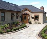
Dunhill Cottage
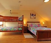
Drumlin Lane Self Catering
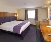
Beechlawn House Hotel
Lisburn
Videos from this area
These are videos related to the place based on their proximity to this place.
4x4 Late Exit - Lisburn Sprucefield
M1 motorway junction 8, lisburn sprucefield. Late exit by an Irish registered 4x4, a Toyota RAV4 I think. 29-02-2012 17:15 Captured on a Flip UltraHD with Panavise / Gekko suction...
Tyre blow out. - M1 Motorway Junction 6 - Lisburn
Not a good start to the new year! Had a tyre blow out on the M1 Motorway on the way to work, front near side. It didn't go with a bang or anything, more of a very rapid deflation. Managed...
Lagan Centre Lisburn Northern Ireland
The Dangem Blugrass Sessions Last Saturday of each Month For more info on thease sessions visit www.dangem.co.uk.
Ulster Masters 2012 Lisburn, 4 x 25m Freestyle Relay
Ulster Masters 2012 Championship in Lisburn, N.Ireland. 4 x 25 m Freestyle Relay. NAC Maters (Dublin) win.
martinbartnicki.com Wedding Photographers in Lisburn / Belfast
wedding photographers in belfast, wedding photography in belfast, wedding photographers in lisburn, wedding photography in lisburn, lisburn photographers, belfast photographers.
Videos provided by Youtube are under the copyright of their owners.
Attractions and noteworthy things
Distances are based on the centre of the city/town and sightseeing location. This list contains brief abstracts about monuments, holiday activities, national parcs, museums, organisations and more from the area as well as interesting facts about the region itself. Where available, you'll find the corresponding homepage. Otherwise the related wikipedia article.
Lisnagarvey
Lisnagarvey or Lisnagarvy is a townland in County Antrim, Northern Ireland. Lisnagarvey is also the original name of Lisburn and remains the Irish name for Lisburn today. The townland was named after an earthen ringfort (lios), which was in the area of present-day "Fort Hill" in Lisburn. Today, most of the north-eastern part of Lisburn is within Lisnagarvey townland.
Hillsborough Castle
Hillsborough Castle is an official government residence in Northern Ireland. It is the residence of the Secretary of State for Northern Ireland, and the official residence in Northern Ireland of Her Majesty Queen Elizabeth II and other members of the British Royal Family when they visit the region, as well as a guest house for prominent international visitors. From 1924 until 1973 it was the official residence of the Governor of Northern Ireland.
Sprucefield
Sprucefield is a major out-of-town retail park in the townland of Magherageery, County Down, Northern Ireland. It is on the southern edge of Lisburn; about one mile from the middle of Lisburn and ten miles (16 km) from the middle of Belfast. Sprucefield is located beside the M1 motorway and the A1 road. It is split in two parts: the Sprucefield Centre and Sprucefield Park. Sprucefield is also the site of the Lisnagarvey transmitting station.
Ravernet
Ravernet (from Irish: Ráth Bhearnait, meaning "ringfort of the gap") is a village and townland in County Down, Northern Ireland. It is on the Ravernet River, about 3km south of Lisburn and about 3km northeast of Hillsborough. Nearby is Sprucefield and the M1 motorway. In the 2001 Census it had a population of 559.
Lambeg, County Antrim
Lambeg is an urban townland and civil parish in County Antrim, Northern Ireland. Located between Belfast and Lisburn, it was once a small rural village, but is now within the Greater Belfast conurbation. Lambeg is also an electoral ward of Lisburn Council. In the 2001 Census it had a population of 60 people. The civil parish of Lambeg covers areas of County Down as well as County Antrim.
Drumlough, Hillsborough
Drumlough is a village and townland in County Down, Northern Ireland, south of Hillsborough and east of Dromore. In the 2001 Census it had a population of 96 people. It is situated in the Lisburn City Council area. Locally significant buildings include Drumlough Presbyterian Church and manse, Rose Cottage (pre 1830), and an Orange Hall built in 1907. Drumlough Pipe Band was formed in 1950 and competes in competitions organised by the Royal Scottish Pipe Band Association.
Lisnagarvey transmitting station
The Lisnagarvey transmitting station is a facility for mediumwave broadcasting located in the townland of Magherageery, on the southern edge of Lisburn, Northern Ireland. It is close to Sprucefield shopping centre and about one mile from the middle of Lisburn. The station was built by the BBC for the Regional Programme to be transmitted to Northern Ireland and it went into service in 1936. It is now owned by Arqiva.
Hillsborough (Parliament of Ireland constituency)
Hillsborough was a constituency represented in the Irish House of Commons until 1800.


