Safety Score: 3,0 of 5.0 based on data from 9 authorites. Meaning we advice caution when travelling to United Kingdom.
Travel warnings are updated daily. Source: Travel Warning United Kingdom. Last Update: 2024-04-25 08:17:04
Delve into Magheragall
Magheragall in Lisburn and Castlereagh (Northern Ireland) is a city located in United Kingdom about 324 mi (or 522 km) north-west of London, the country's capital town.
Current time in Magheragall is now 07:49 PM (Thursday). The local timezone is named Europe / London with an UTC offset of one hour. We know of 8 airports closer to Magheragall, of which 3 are larger airports. The closest airport in United Kingdom is Belfast International Airport in a distance of 11 mi (or 17 km), North-West. Besides the airports, there are other travel options available (check left side).
There is one Unesco world heritage site nearby. The closest heritage site is Brú na Bóinne - Archaeological Ensemble of the Bend of the Boyne in Ireland at a distance of 61 mi (or 99 km). Also, if you like playing golf, there are some options within driving distance. In need of a room? We compiled a list of available hotels close to the map centre further down the page.
Since you are here already, you might want to pay a visit to some of the following locations: Lisburn, Antrim, Belfast, Banbridge and Castlereagh. To further explore this place, just scroll down and browse the available info.
Local weather forecast
Todays Local Weather Conditions & Forecast: 9°C / 47 °F
| Morning Temperature | 5°C / 42 °F |
| Evening Temperature | 7°C / 44 °F |
| Night Temperature | 2°C / 35 °F |
| Chance of rainfall | 0% |
| Air Humidity | 69% |
| Air Pressure | 1004 hPa |
| Wind Speed | Gentle Breeze with 7 km/h (4 mph) from South-East |
| Cloud Conditions | Overcast clouds, covering 97% of sky |
| General Conditions | Light rain |
Friday, 26th of April 2024
9°C (48 °F)
1°C (34 °F)
Broken clouds, gentle breeze.
Saturday, 27th of April 2024
10°C (50 °F)
2°C (36 °F)
Light rain, gentle breeze, broken clouds.
Sunday, 28th of April 2024
11°C (51 °F)
5°C (40 °F)
Broken clouds, gentle breeze.
Hotels and Places to Stay
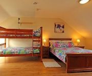
Drumlin Lane Self Catering
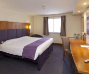
Dunhill Cottage
Lisburn
Videos from this area
These are videos related to the place based on their proximity to this place.
1991 - Laurel Hill HIgh School, Lisburn
A July day in 1991, New Deal t-shirts, unlanded flip tricks, lip tricks on brick banks, an "ollie handrail", Stuarty Anderson, Craig from Drumbeg, Derek Sloan, Ken Maze, Ian Pearce, myself...
4x4 Late Exit - Lisburn Sprucefield
M1 motorway junction 8, lisburn sprucefield. Late exit by an Irish registered 4x4, a Toyota RAV4 I think. 29-02-2012 17:15 Captured on a Flip UltraHD with Panavise / Gekko suction...
1 Lady Wallace Rise, Lisburn. Video Tour
Built by Porter & Co Homes, 1 Lady Wallce Rise Lisburn. Video Tour.
martinbartnicki.com Wedding Photographers in Lisburn / Belfast
wedding photographers in belfast, wedding photography in belfast, wedding photographers in lisburn, wedding photography in lisburn, lisburn photographers, belfast photographers.
7th Lisburn Boys' Brigade fund raising Balloon Race
Saturday 12th October 2013 in Trinity Methodist Church Lisburn. Balloons for the event provided by Luce Balloons http://www.luceballoonsandcrafts.com/index.php Thank you to all those people...
Videos provided by Youtube are under the copyright of their owners.
Attractions and noteworthy things
Distances are based on the centre of the city/town and sightseeing location. This list contains brief abstracts about monuments, holiday activities, national parcs, museums, organisations and more from the area as well as interesting facts about the region itself. Where available, you'll find the corresponding homepage. Otherwise the related wikipedia article.
HM Prison Maze
Her Majesty's Prison Maze (known colloquially as Maze Prison, The Maze, The H Blocks or Long Kesh) was a prison in Northern Ireland that was used to house paramilitary prisoners during the Troubles from mid-1971 to mid-2000. It was situated in the former Royal Air Force station of Long Kesh, on the outskirts of Lisburn. This was in the townland of Maze, about nine miles (14 km) southwest of Belfast.
RAF Long Kesh
Royal Air Force Long Kesh or more simply RAF Long Kesh was a Royal Air Force station at Maze, Lisburn, Northern Ireland. Various aircraft operated from the airfield during World War II, including the Supermarine Seafire and Spitfire.
Keshbridge
Keshbridge is a small village in County Antrim, Northern Ireland. In the 2001 Census it had a population of 99 people. It is situated in the Lisburn City Council area. Locally significant buildings include 19th century Kesh House and a number of features associated with the old canal, including the site of the old weighbridges, and coal stores.
Longkesh
Longkesh is a small village in County Antrim, Northern Ireland, near Lisburn. In the 2001 Census it had a population of 201 people. It is situated in the Lisburn City Council area.
Lower Broomhedge
Lower Broomhedge is a hamlet in County Antrim, Northern Ireland, near Lisburn. In the 2001 Census it had a population of 180 people. It lies within the Lisburn City Council area. It is usually considered part of Broomhedge itself rather than a separate village.
Lurganure
Lurganure (from Irish: Lurga an Iubhair, meaning "long ridge of the yew") is a small village and townland in County Antrim, Northern Ireland. It lies to the west of Lisburn and is separated from Mazetown by the River Lagan. In the 2001 Census it had a population of 441 people. It is in the Lisburn City Council area. Once a year, Lurganure plays host to the Party Duck, which nearly doubles its population.
Down Royal
Down Royal is a horse racing venue near Lisburn in Northern Ireland. The most valuable race run there is the JNwine. com Champion Chase, run at the Northern Ireland Festival of racing in November. The most valuable flat race to be run there annually is the Ulster Derby. Although actually in the United Kingdom, racing at Down Royal comes under the authority of Horse Racing Ireland as horse-racing in the British Isles is divided on a Great Britain / All-Ireland basis.
Maze Prison escape
The Maze Prison escape (known to Irish republicans as the Great Escape) took place on 25 September 1983 in County Antrim, Northern Ireland. HM Prison Maze (previously known as Long Kesh) was a maximum security prison considered to be one of the most escape-proof prisons in Europe, and held prisoners convicted of taking part in armed paramilitary campaigns during the Troubles.


