Safety Score: 3,0 of 5.0 based on data from 9 authorites. Meaning we advice caution when travelling to United Kingdom.
Travel warnings are updated daily. Source: Travel Warning United Kingdom. Last Update: 2024-04-24 08:14:40
Delve into Lambeg
Lambeg in Lisburn and Castlereagh (Northern Ireland) is located in United Kingdom about 322 mi (or 518 km) north-west of London, the country's capital town.
Current time in Lambeg is now 08:43 AM (Thursday). The local timezone is named Europe / London with an UTC offset of one hour. We know of 8 airports close to Lambeg, of which 3 are larger airports. The closest airport in United Kingdom is George Best Belfast City Airport in a distance of 9 mi (or 14 km), North-East. Besides the airports, there are other travel options available (check left side).
There is one Unesco world heritage site nearby. The closest heritage site is Brú na Bóinne - Archaeological Ensemble of the Bend of the Boyne in Ireland at a distance of 61 mi (or 98 km). Also, if you like playing golf, there are some options within driving distance. If you need a hotel, we compiled a list of available hotels close to the map centre further down the page.
While being here, you might want to pay a visit to some of the following locations: Lisburn, Belfast, Castlereagh, Newtownabbey and Antrim. To further explore this place, just scroll down and browse the available info.
Local weather forecast
Todays Local Weather Conditions & Forecast: 8°C / 46 °F
| Morning Temperature | 3°C / 38 °F |
| Evening Temperature | 8°C / 46 °F |
| Night Temperature | 2°C / 36 °F |
| Chance of rainfall | 0% |
| Air Humidity | 64% |
| Air Pressure | 1005 hPa |
| Wind Speed | Gentle Breeze with 7 km/h (4 mph) from South |
| Cloud Conditions | Overcast clouds, covering 96% of sky |
| General Conditions | Overcast clouds |
Friday, 26th of April 2024
9°C (48 °F)
1°C (34 °F)
Light rain, gentle breeze, broken clouds.
Saturday, 27th of April 2024
8°C (47 °F)
3°C (38 °F)
Light rain, gentle breeze, broken clouds.
Sunday, 28th of April 2024
11°C (51 °F)
4°C (40 °F)
Scattered clouds, gentle breeze.
Hotels and Places to Stay
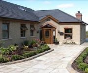
Dunhill Cottage
Crowne Plaza BELFAST
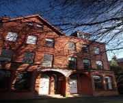
Victoria Apartments
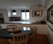
Dream Apartments St Thomas Hall
Beechlawn House Hotel
Greenmount Bed & Breakfast
Springfield B&B
Queens University Elms Village
Lisburn
Videos from this area
These are videos related to the place based on their proximity to this place.
Seal climbing the weir on the River Lagan at Lisburn
Taken at Lagan Valley Island, Lisburn NI on Sat 16th Nov 2013. Sorry the quality isn't better - it was getting quite dark!
Tyre blow out. - M1 Motorway Junction 6 - Lisburn
Not a good start to the new year! Had a tyre blow out on the M1 Motorway on the way to work, front near side. It didn't go with a bang or anything, more of a very rapid deflation. Managed...
Lisburn Community Circus
Lisburn Community Circus going for 10 years, (a branch of from the Belfast Community Circus) is possibly the Best thing kinds could be involved in!, and that's what my kids think, who am I...
Lagan Centre Lisburn Northern Ireland
The Dangem Blugrass Sessions Last Saturday of each Month For more info on thease sessions visit www.dangem.co.uk.
Ulster Cyclocross Series 2010 Round 3 , Aberdelghy , Lisburn
round 3 of the 2010 ulster cyclocross series hosted by dromara cc.
Ulster Masters 2012 Lisburn, 4 x 25m Freestyle Relay
Ulster Masters 2012 Championship in Lisburn, N.Ireland. 4 x 25 m Freestyle Relay. NAC Maters (Dublin) win.
martinbartnicki.com Lisburn / Belfast Wedding Photography
Diane and Jim wedding civic centre lisburn.
Videos provided by Youtube are under the copyright of their owners.
Attractions and noteworthy things
Distances are based on the centre of the city/town and sightseeing location. This list contains brief abstracts about monuments, holiday activities, national parcs, museums, organisations and more from the area as well as interesting facts about the region itself. Where available, you'll find the corresponding homepage. Otherwise the related wikipedia article.
Friends' School, Lisburn
Friends' School, Lisburn is a Quaker voluntary grammar school in the city of Lisburn, Northern Ireland founded in 1774.
Milltown, County Antrim
Milltown is a small settlement in County Antrim, Northern Ireland. It is within the townland of Derryaghy, about one mile to the north of Lisburn. Once a rural village, it is now part of the Greater Belfast conurbation. However, it is separated from the surrounding urban area by a narrow stretch of countryside. In the 2001 Census it had a population of 1,361 people.
Hilden railway station
Hilden railway station is located in Lisburn, County Antrim, Northern Ireland. The station opened on 1 May 1907.
Wallace Park
The Wallace Park in Lisburn, Northern Ireland was bequeathed to the people of Lisburn by Sir Richard Wallace. It is a pleasant park with tree-lined walkways. There is a number of football pitches, tennis courts, a duck pond and a children's adventure play area. The grounds of Lisburn Cricket Club are in the centre of the park where Cecil Walker MBE is the groundman. A velodrome was opened in 1953, but this fell into disrepair.
South Eastern Regional College
South Eastern Regional College (SERC) is a regional further and higher education college in the south-east of Northern Ireland. SERC was created following the merger of three institutes of further and higher education in the south-east of Northern Ireland. These were East Down Institute, Lisburn Institute and North Down and Ards Institute. The merger took effect from 1 August 2007.
St Patrick's GAA (Down)
St Patricks GAC is a Gaelic Athletic Association in County Down, Northern Ireland. The club was founded in 1950 and the current playing field is situated near Lisburn. The current playing field is not owned by St Pats. The old playing field was laid on with petrol which was believed to be sectarian. The GAA club currently plays Gaelic football only and has the ranks from juvenile up to senior. Even an over 40 team also play Gaelic football but not competitively.
Thiepval barracks bombing
The Thiepval Barracks bombing was a double car bomb attack carried out by the Provisional Irish Republican Army (IRA) on 7 October 1996. The bombs exploded inside Thiepval Barracks, the British Army headquarters in Northern Ireland. One British soldier was killed and 31 people were injured. This bombing was the first major attack on a military base in Northern Ireland since the ending of the IRA's ceasefire on 9 February 1996, when it exploded a large bomb in London's Docklands.
Lagan Valley Island
Lagan Valley Island is a conference and events centre located on a small Island in Lisburn City in Northern Ireland. The building was opened for business in March 2001 and was officially opened in November 2001 by Her Majesty the Queen.


