Safety Score: 3,0 of 5.0 based on data from 9 authorites. Meaning we advice caution when travelling to United Kingdom.
Travel warnings are updated daily. Source: Travel Warning United Kingdom. Last Update: 2024-04-24 08:14:40
Delve into Carrowclare
Carrowclare in Causeway Coast and Glens (Northern Ireland) is located in United Kingdom about 376 mi (or 606 km) north-west of London, the country's capital town.
Current time in Carrowclare is now 01:18 PM (Wednesday). The local timezone is named Europe / London with an UTC offset of one hour. We know of 11 airports close to Carrowclare, of which 5 are larger airports. The closest airport in United Kingdom is Ballykelly Airport in a distance of 2 mi (or 3 km), South. Besides the airports, there are other travel options available (check left side).
There is one Unesco world heritage site nearby. The closest heritage site is Brú na Bóinne - Archaeological Ensemble of the Bend of the Boyne in Ireland at a distance of 113 mi (or 181 km). Also, if you like playing golf, there is an option about 11 mi (or 18 km). away. If you need a hotel, we compiled a list of available hotels close to the map centre further down the page.
While being here, you might want to pay a visit to some of the following locations: Limavady, Londonderry, Coleraine, Ballymoney and Cookstown. To further explore this place, just scroll down and browse the available info.
Local weather forecast
Todays Local Weather Conditions & Forecast: 10°C / 50 °F
| Morning Temperature | 5°C / 41 °F |
| Evening Temperature | 8°C / 47 °F |
| Night Temperature | 4°C / 39 °F |
| Chance of rainfall | 0% |
| Air Humidity | 61% |
| Air Pressure | 1019 hPa |
| Wind Speed | Gentle Breeze with 8 km/h (5 mph) from South |
| Cloud Conditions | Scattered clouds, covering 36% of sky |
| General Conditions | Scattered clouds |
Thursday, 25th of April 2024
8°C (47 °F)
6°C (42 °F)
Moderate rain, light breeze, overcast clouds.
Friday, 26th of April 2024
6°C (42 °F)
5°C (42 °F)
Light rain, gentle breeze, overcast clouds.
Saturday, 27th of April 2024
8°C (46 °F)
6°C (43 °F)
Light rain, moderate breeze, overcast clouds.
Hotels and Places to Stay
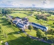
Roe Park Resort
Videos from this area
These are videos related to the place based on their proximity to this place.
Charity Boxing in Limavady June 9th 2012
First fight of the night, Gary Doherty V Scott "Rub" McImoyle.
Limavady Wolfhounds Cannonball Trials- Night at the Races 1 June 2012
Minor boys taking part in the trials for the main cannonball knockout competition. The eight selected for the Night at the Olympic Races quarterfinals will be revealed on Friday 1 June 2012...
The Bad Habits Limavady Jazz And Blues Festival 2009
The Bad Habits (Cara Robinson, Eilis Phillips and Jackie Rainey) playing in O'Briens, Limavady as part of the Limavady Jazz and Blues Festival 14th June 2009.
(G) Ballynarrig, Pride of Orange F.B Limavady 12th July 2008 (4)
Ballynarrig, Pride of Orange on Parade.
What is LOST?
What exactly is LOST? Well, it's far more than just "Limavady Outreach and Service Team"! We got a wide range of people that are or have been involved in LOST over the past ten years to share...
(D) Ballynarrig, Pride Of Orange F.B Limavady 12th July 2008 (1)
Ballynarrig, Pride Of Orange on Parade.
TY Fitness - Limavady - Magherafelt
Studio cycling, Pilates, Circuits, Step aerobics, Zumba, Kettlebells, Personal Training.
Videos provided by Youtube are under the copyright of their owners.
Attractions and noteworthy things
Distances are based on the centre of the city/town and sightseeing location. This list contains brief abstracts about monuments, holiday activities, national parcs, museums, organisations and more from the area as well as interesting facts about the region itself. Where available, you'll find the corresponding homepage. Otherwise the related wikipedia article.
Carrowclare
Carrowclare is a small village and townland in County Londonderry, Northern Ireland. In the 2001 Census it had a population of 129 people. It is within the Limavady Borough Council area.
Broharris Canal
The Broharris Canal is a canal situated in County Londonderry, Northern Ireland.
River Roe
The River Roe (Irish: Abhainn na Ró) flows north from Glenshane in the Sperrin Mountains to Lough Foyle, via the settlements of Dungiven, Burnfoot, Limavady and Myroe. The river located in Ulster and is contained within County Londonderry in Northern Ireland.
Shackleton Barracks
Shackleton Barracks, Ballykelly, County Londonderry, Northern Ireland, was a British Army base that was originally known as RAF Ballykelly, a Royal Air Force station which opened in 1941. More recently a small part of the base was used as a refuelling point by army helicopters and small fixed-wing aircraft usually operating out of RAF Aldergrove near the town of Antrim.


