Safety Score: 3,0 of 5.0 based on data from 9 authorites. Meaning we advice caution when travelling to United Kingdom.
Travel warnings are updated daily. Source: Travel Warning United Kingdom. Last Update: 2024-04-18 08:12:24
Delve into Andersonstown
The district Andersonstown of Belfast in Belfast (Northern Ireland) is a subburb in United Kingdom about 323 mi north-west of London, the country's capital town.
If you need a hotel, we compiled a list of available hotels close to the map centre further down the page.
While being here, you might want to pay a visit to some of the following locations: Lisburn, Castlereagh, Newtownabbey, Antrim and Carrickfergus. To further explore this place, just scroll down and browse the available info.
Local weather forecast
Todays Local Weather Conditions & Forecast: 8°C / 47 °F
| Morning Temperature | 3°C / 37 °F |
| Evening Temperature | 9°C / 49 °F |
| Night Temperature | 9°C / 47 °F |
| Chance of rainfall | 0% |
| Air Humidity | 91% |
| Air Pressure | 1020 hPa |
| Wind Speed | Moderate breeze with 12 km/h (8 mph) from East |
| Cloud Conditions | Overcast clouds, covering 100% of sky |
| General Conditions | Light rain |
Friday, 19th of April 2024
11°C (52 °F)
3°C (38 °F)
Light rain, moderate breeze, overcast clouds.
Saturday, 20th of April 2024
12°C (53 °F)
5°C (40 °F)
Scattered clouds, light breeze.
Sunday, 21st of April 2024
12°C (54 °F)
7°C (45 °F)
Scattered clouds, gentle breeze, broken clouds.
Hotels and Places to Stay
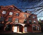
Fitzwilliam
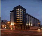
Maldron Belfast City Hotel
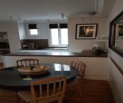
Belfast Apartment
Victoria Apartments
Dream Apartments St Thomas Hall
Brookhill Serviced Apartments
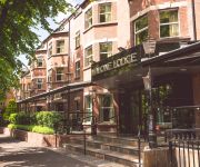
Malone Lodge Apartments
Malone Lodge
Crowne Plaza BELFAST
Dukes at Queens Boutique Hotel
Videos from this area
These are videos related to the place based on their proximity to this place.
Walls of Shame: Belfast - 26 Nov 07 - Ep 4 - Part 1
A look at life on both sides of the barriers dividing two warring communities.
Belfast to London in 9 Minutes
Return leg of recent filming trip to Belfast... After a horrendously long drive from London with 3 crew in a packed out Transit van full of camera equipment & props i decided that on the way...
(Northern) Ireland Vlog #1 - Trip to Belfast
First vlog finally here! Witness video evidence of my presence in Northern Ireland and adventures in the glorious city of Belfast.
12 July 2009 at Belfast City Sammy Videos Part 2
12 July 2009 at Belfast City Sammy Videos Part 2. Please Visit http://www.braidvalley.com/ and our Facebook Page at https://www.facebook.com/pages/BraidValleycom/126127594088595?v=wall ...
Sham & Marlow - Episode 2 - Reservoir Bogs
The rich and the famous keep coming to Ireland to trace their roots but why? Someone's on the case..... Secret Service Agent Marlow is sent deep undercover to this backward country to find...
Sustain and Build - Wilsons Yard
A Vvdeo about Wilsons salvage yard for the Sustain and Build website. Visit www.sustainandbuild.com Sustainandbuild.com is a portal offering open access to planning, building and environmental...
Red Bull Racing F1 car - D.C David Coulthart in Belfast
David Coulthard in Belfast, outside the city hall.....in the F1 Red Bull Racing car......20th March 2010. Belfast City Limits presents the F1 car at up 150 mph on a very short slippery stretch...
Minecraft: Pixelmon Lets Play Episode 6
today on minecraft bullo takes a trip to find diamonds and then takes a trip to the nether to find glow stone so he can make a pc, healing table and pokedex which he ends up finding the recipes...
Batman Arkham Origins #1
Set five years before: Arkham Asylum and follows a younger and less refined Batman who has a bounty placed on his head by crime lord Black Mask, drawing eight of the world's greatest assassins...
Videos provided by Youtube are under the copyright of their owners.
Attractions and noteworthy things
Distances are based on the centre of the city/town and sightseeing location. This list contains brief abstracts about monuments, holiday activities, national parcs, museums, organisations and more from the area as well as interesting facts about the region itself. Where available, you'll find the corresponding homepage. Otherwise the related wikipedia article.
Divis
Divis is a large mountain and area of sprawling moorland to the north-west of Belfast in County Antrim, Northern Ireland. The mountain is 478 m (1,568 ft) tall, making it the highest of the Belfast Hills. It extends north to the Antrim Plateau and shares its geology; consisting of a basaltic cover underlain by limestone and lias clay.
Milltown Cemetery attack
The Milltown Cemetery attack (also known as the Milltown Cemetery killings or Milltown Massacre) took place on 16 March 1988 in Belfast's Milltown Cemetery. During the funeral of three Provisional IRA volunteers killed in Gibraltar, an Ulster Defence Association (UDA) volunteer, Michael Stone, attacked the mourners with hand grenades and pistols. As Stone ran towards the nearby motorway, a large crowd began chasing him and he continued shooting and throwing grenades.
Casement Park
Casement Park (Irish: Páirc Mhic Easmainn) is the principal Gaelic Athletic Association stadium in Belfast, Northern Ireland, home to the Antrim football and hurling teams. Located on the Andersonstown Road in the west of the city, and named after the Republican revolutionary Sir Roger Casement (1864-1916), the ground has a capacity of 32,600.
Corporals killings
The corporals killings was the killing of corporals David Robert Howes and Derek Tony Wood, two British Army soldiers of the Royal Corps of Signals, on 19 March 1988 in Belfast, Northern Ireland. The out-of-uniform soldiers were shot by the Provisional Irish Republican Army (IRA), after they drove into the funeral procession of an IRA volunteer. Three days beforehand, loyalist volunteer Michael Stone had attacked an IRA funeral and killed three people.
Milltown Cemetery
Milltown Cemetery (Irish: Reilig Bhaile an Mhuilinn) is a large cemetery in west Belfast, Northern Ireland. It lies within the townland of Ballymurphy, between Falls Road and the M1 motorway. Milltown Cemetery opened in 1869 and there are now approximately 200,000 of Belfast's citizens buried there. Most of those buried there are Irish Catholic. Within the cemetery there are three large sections of open space, each about the size of a football field, designated as "poor ground".
Andersonstown
Andersonstown is a suburb of Belfast, Northern Ireland. The area was originally known as Whitesidetown after the family that owned the land but they were dispossessed for the support they gave to the Society of United Irishmen, resulting in a change of name. The district is sometimes colloquially referred to as "Andytown" or "A Town".
Finaghy railway station
Finaghy railway station is located in the townland of Finaghy (aka Ballyfinaghy) in south Belfast, County Antrim, Northern Ireland. The Great Northern Railway of Ireland opened the station on 9 February 1907.
Belfast City Cemetery
Belfast City Cemetery (Irish: Reilig Chathair Bhéal Feirste) is a cemetery in west Belfast, Northern Ireland. It lies within the townland of Ballymurphy, between Falls Road and Springfield Road, near Milltown Cemetery. It is maintained by Belfast City Council.
Donegal Celtic Park
Donegal Celtic Park, also known as Suffolk Road and Celtic Park or more recently The NSR(New Suffolk Road) due to the recent expansion, is the home of IFA Premiership team Donegal Celtic. It is situated in the Suffolk Road in west Belfast. The stadium holds 8,283, but is currently restricted to 6,254 under safety legislation. In early August 2009, work on two new stands was completed.
Black Mountain transmitting station
The Black Mountain transmitting station is a broadcasting and telecommunications facility, situated on land 301 metres above Ordnance Datum to the west of the city of Belfast, in Northern Ireland. It includes a guyed steel lattice mast which is 228.6 metres http://tx. mb21. co. uk/info/sitedata/index. asp in height. The height of the top of the structure above mean sea level is 529 metres . It is owned and operated by Arqiva.
Rathmore Grammar School
Rathmore Grammar School, normally referred to simply as "Rathmore", is a Catholic grammar school in Finaghy, Belfast, Northern Ireland. The current principal is Thérèse Hamilton who succeeded Sr. Ursula Canavan as principal at the beginning of academic year 2009/10. It is one of the leading grammar schools in Northern Ireland and is one of the top four over subscribed schools in the country. Rathmore is situated in Kingsway, Finaghy, Belfast, behind the St. Anne's "campus", consisting of St.
Gort na Mona GAC
Gort na Mona is a Gaelic Athletic Association club in County Antrim, Northern Ireland.
Musgrave Park Hospital
Musgrave Park Hospital is a regional specialist hospital, managed by Belfast Health and Social Care Trust in Belfast, Northern Ireland. It specialises in orthopaedics, rheumatology, sports medicine and rehabilitation of patients of all ages. These specialties are spread out across a large site in the leafy suburbs of South Belfast. The Hospital is named after the 48 acres of adjacent municipal parkland known as Musgrave Park, first opened to the public in 1920.
Belfast West (Assembly constituency)
Belfast West is a constituency in the Northern Ireland Assembly. The seat was first used for a Northern Ireland-only election for the Northern Ireland Assembly, 1973.
Dunmurry train explosion
The Dunmurry train explosion refers to the premature detonation of a Provisional Irish Republican Army (IRA) incendiary bomb aboard a Ballymena to Belfast passenger train service on 17 January 1980. The blast engulfed a carriage of the train in flames, killing three and injuring five others. One of the dead and the most seriously injured survivor were volunteers of the IRA.
Balmoral High School
Balmoral High School was a secondary school in Belfast, Northern Ireland. It was established by a merger of Deramore High School and Larkfield High School. The school was managed by the Belfast Education and Library Board (BELB). The school opened in September 1996 (The new building was opened in January 2002, not the school) and closed in August 2008, due to falling pupil numbers. It had been built as an education 'pathfinder' for the private finance initiative (PFI).
Christian Brothers' School (Glen Road, Belfast)
Christian Brothers' School, or C.B.S. as it is commonly known,, is a secondary school located on the Glen Road area of west Belfast, Northern Ireland, and is directly facing one of its many sister schools, St Mary's Grammar School. http://www. stmaryscbgs. com C.B.S. was founded in 1962 http://erstni. org/schools/christian-brothers-school-glen-road/ by the Christian Brothers, a religious order founded by Edmund Ignatius Rice in the early 19th century.
St Brigids GAC, Belfast
Saint Brigid's GAC is a Gaelic Athletic Association club from the Malone Road area in Belfast, County Antrim, Northern Ireland. It was founded in 1998 by Dermot Dowling and Conor McSherry in the parish hall of St Brigid's Church. There was a strong need for a local GAA club to be set up as there were a huge amount of potential people keen to get into the GAA in the Malone area.
Edward Harland
For the United States general see: Edward Harland (general) Sir Edward James Harland, 1st Baronet (15 May 1831 – 24 December 1895) was a British shipbuilder and politician. Born in Scarborough, North Yorkshire, he was educated at Edinburgh Academy. In 1846, aged 15, he took an apprenticeship at the engineering works of Robert Stephenson and Company in Newcastle upon Tyne.
Ballymurphy Massacre
The Ballymurphy Massacre is a name given to a series of incidents involving the killing of eleven civilians by the Parachute Regiment of the British Army in Belfast, Northern Ireland. The killings happened between 9 and 11 August 1971, during Operation Demetrius. The shootings are also known as "Belfast Bloody Sunday". The Northern Ireland "Troubles" had been raging for two years and Belfast was torn apart by political and sectarian violence.
Kennedy Centre, Belfast
Kennedy Centre is a retail and leisure development in a largely built-up residential area in west Belfast. Having agreed upon a new anchor tenant, the Kennedy Centre was redeveloped again in 2008. At approximately 97,000 ft², its anchor tenant is Sainsburys supermarket, the largest supermarket in Northern Ireland, which replaced the previous anchor, Curleys Supermarket. There is also a Sainsburys petrol station located within the grounds of the complex.
De La Salle College, Belfast
De La Salle College is a Catholic boy's secondary school and college in Belfast, Northern Ireland.
Gort Na Móna Secondary School
Divis transmitting station
Divis transmitting station is the main high-power UHF and BBC National FM/DAB station that serves County Antrim and parts of County Down. Sited just outside Belfast, it is the primary UHF/FM main station in Northern Ireland and was originally the country's main BBC 405-line television transmitter, coming into operation in this capacity on 21 July 1955. As such, it was the first permanent television transmitter to be established within the island of Ireland.
Musgrave Park, Belfast
Musgrave Park is a public park in Belfast, Northern Ireland. Situated in the south west of the city, in Ballygammon townland off Stockman's Lane, the surrounding area is a mix of trading estates and residential housing, with the M1 motorway passing close to one end. Facilities include a bowling pavilion, playing fields, walks, nature areas and bottle banks. Since 2010, it has been developing a therapy garden. The adjoining Musgrave Park Hospital specialises in rehabilitation for all ages.


