Safety Score: 3,0 of 5.0 based on data from 9 authorites. Meaning we advice caution when travelling to United Kingdom.
Travel warnings are updated daily. Source: Travel Warning United Kingdom. Last Update: 2024-04-16 08:26:06
Delve into Hyde Park
Hyde Park in Antrim and Newtownabbey (Northern Ireland) is located in United Kingdom about 327 mi (or 526 km) north-west of London, the country's capital town.
Current time in Hyde Park is now 11:11 AM (Tuesday). The local timezone is named Europe / London with an UTC offset of one hour. We know of 8 airports close to Hyde Park, of which 3 are larger airports. The closest airport in United Kingdom is George Best Belfast City Airport in a distance of 6 mi (or 10 km), South-East. Besides the airports, there are other travel options available (check left side).
There is one Unesco world heritage site nearby. The closest heritage site is Brú na Bóinne - Archaeological Ensemble of the Bend of the Boyne in Ireland at a distance of 70 mi (or 112 km). Also, if you like playing golf, there are some options within driving distance. We encountered 1 points of interest near this location. If you need a hotel, we compiled a list of available hotels close to the map centre further down the page.
While being here, you might want to pay a visit to some of the following locations: Newtownabbey, Belfast, Lisburn, Castlereagh and Carrickfergus. To further explore this place, just scroll down and browse the available info.
Local weather forecast
Todays Local Weather Conditions & Forecast: 9°C / 48 °F
| Morning Temperature | 3°C / 38 °F |
| Evening Temperature | 6°C / 43 °F |
| Night Temperature | 4°C / 39 °F |
| Chance of rainfall | 0% |
| Air Humidity | 59% |
| Air Pressure | 1019 hPa |
| Wind Speed | Fresh Breeze with 15 km/h (9 mph) from South-East |
| Cloud Conditions | Scattered clouds, covering 32% of sky |
| General Conditions | Light rain |
Wednesday, 17th of April 2024
5°C (41 °F)
5°C (41 °F)
Light rain, moderate breeze, overcast clouds.
Thursday, 18th of April 2024
10°C (50 °F)
8°C (47 °F)
Light rain, moderate breeze, broken clouds.
Friday, 19th of April 2024
11°C (52 °F)
8°C (46 °F)
Light rain, moderate breeze, overcast clouds.
Hotels and Places to Stay
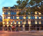
The Merchant Hotel
Fitzwilliam
Maldron Belfast City Hotel
BENEDICTS OF BELFAST
Clayton Belfast
Malmaison Belfast
Apple Apartments Belfast
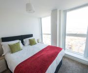
Dream Apartments Obel Tower
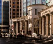
Hastings Europa Hotel
Hastings Europa
Videos from this area
These are videos related to the place based on their proximity to this place.
360 view from Cavehill Belfast
One of many amazing views from Cavehill Belfast. You can loose yourself up there, Belfast, the city in the country.
Cavehill Training Session 26 May 2008
Myself and big Justin practicing a few throws on the side of Cavehill in Belfast. Kev was there too, but someone had to hold the camera!
Patterson,s Spade Mill
I filmed this way back in 1997, Hear the hammers, smell the grit and feel the heat of traditional spade-making, As far as i know this is the last working water powered spade mill in the world,...
Joseph at Mid Antrim Two Phase 19th April 2008
Dressage video at Laurel View of Joseph competing in the Hungry House Competition.
12 July 2009 at Belfast City Sammy Videos
12 July 2009 at Belfast City Sammy Videos and Orange Lodges. Please Visit http://www.braidvalley.com/ and our Facebook Page at ...
Imagine a city of = Planting
3rd November 2012. Black Mountain, Belfast, Northern Ireland. The second phase of Christoff Gillen's public art project. Planting of oxide daisy and chamomile seeds.++ More information:...
Snow Hallions!
Stupid kids not just throwing snowballs at cars, but blocking Carnmoney Road North, opening doors of passing cars and pelting the occupants with ice balls while they're trying to control their...
Videos provided by Youtube are under the copyright of their owners.
Attractions and noteworthy things
Distances are based on the centre of the city/town and sightseeing location. This list contains brief abstracts about monuments, holiday activities, national parcs, museums, organisations and more from the area as well as interesting facts about the region itself. Where available, you'll find the corresponding homepage. Otherwise the related wikipedia article.
Belfast North (UK Parliament constituency)
Belfast North is a Parliamentary Constituency in the United Kingdom House of Commons.
Belfast North (Dáil Éireann constituency)
Belfast North, was a former potential Dáil Éireann parliamentary constituency. It was a Dáil constituency 1921-1922.
Craigarogan
Craigarogan (from Irish: Carraig Uí Ruagain, meaning "Ó Ruagain's rock") is a small village and townland to the west of Newtownabbey in County Antrim, Northern Ireland. The settlement has developed at the junction of the Bernice Road and the Clarke Lodge Road. The settlement of Roughfort is also within the townland. In the 2001 Census it had a population of 69 people. It is part of the Newtownabbey Borough Council area.
Roughfort
Roughfort is a small village in County Antrim, Northern Ireland. It is within the townland of Craigarogan and the Newtownabbey Borough Council area. In the 2001 Census it had a population of 216 people.
A8(M) motorway (Northern Ireland)
The A8(M) is a motorway in County Antrim, Northern Ireland. It is 1 mile (1.6 km) long and is a spur of the M2 motorway. It was opened on 24 October 1966 and built at the same time as the M2 section to which it connects. It is part of the unsigned European routes E01 and E18. The A8(M) does not meet any other motorways directly, with one end connecting to the A8, and the other connecting to the A6. The roundabout junction which links the A8(M) to the M2 is the A6.
Cullybackey High School
Cullybackey High School is a secondary school in the village of Cullybackey, in County Antrim, Northern Ireland. It was established in 1968 and has about 500 pupils and about 70 members of teaching staff.
St Enda's GAC
St Enda's G.A. C, Glengormley. is a Gaelic Athletic Association club from Glengormley, County Antrim, Northern Ireland. They cater for gaelic football, hurling and camogie.
1971 Scottish soldiers' killings
The three Scottish soldiers' killings was an incident that took place in Northern Ireland during The Troubles. It happened on 10 March 1971, when the Provisional Irish Republican Army shot dead three unarmed British Army soldiers of the 1st Battalion, Royal Highland Fusiliers. Two of the three were teenage brothers; all three were from Scotland.


