Safety Score: 3,0 of 5.0 based on data from 9 authorites. Meaning we advice caution when travelling to United Kingdom.
Travel warnings are updated daily. Source: Travel Warning United Kingdom. Last Update: 2024-04-19 08:03:45
Delve into Wednesfield
Wednesfield in Wolverhampton (England) with it's 33,555 habitants is located in United Kingdom about 112 mi (or 180 km) north-west of London, the country's capital town.
Current time in Wednesfield is now 10:23 AM (Friday). The local timezone is named Europe / London with an UTC offset of one hour. We know of 8 airports close to Wednesfield, of which 5 are larger airports. The closest airport in United Kingdom is Birmingham International Airport in a distance of 17 mi (or 28 km), South-East. Besides the airports, there are other travel options available (check left side).
There are several Unesco world heritage sites nearby. The closest heritage site in United Kingdom is Pontcysyllte Aqueduct and Canal in a distance of 43 mi (or 69 km), North-West. Also, if you like playing golf, there are some options within driving distance. We encountered 1 points of interest near this location. If you need a hotel, we compiled a list of available hotels close to the map centre further down the page.
While being here, you might want to pay a visit to some of the following locations: Wolverhampton, Dudley, Walsall, Oldbury and Albrighton. To further explore this place, just scroll down and browse the available info.
Local weather forecast
Todays Local Weather Conditions & Forecast: 11°C / 52 °F
| Morning Temperature | 8°C / 47 °F |
| Evening Temperature | 9°C / 49 °F |
| Night Temperature | 5°C / 40 °F |
| Chance of rainfall | 0% |
| Air Humidity | 62% |
| Air Pressure | 1019 hPa |
| Wind Speed | Fresh Breeze with 16 km/h (10 mph) from South-East |
| Cloud Conditions | Broken clouds, covering 64% of sky |
| General Conditions | Light rain |
Saturday, 20th of April 2024
10°C (49 °F)
4°C (39 °F)
Few clouds, gentle breeze.
Sunday, 21st of April 2024
7°C (45 °F)
3°C (38 °F)
Overcast clouds, gentle breeze.
Monday, 22nd of April 2024
10°C (50 °F)
5°C (41 °F)
Scattered clouds, moderate breeze.
Hotels and Places to Stay
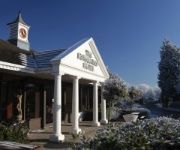
Wentbridge House
Clifton Rooms
Roman Way
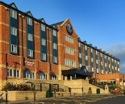
Quality Hotel Dudley
Village Hotel Birmingham Dudley
VILLAGE BIRMINGHAM WALSALL
Holiday Inn Express BIRMINGHAM - WALSALL
The York Hotel
JCT.10 Holiday Inn BIRMINGHAM - WALSALL M6
Quality Hotel Wolverhampton
Videos from this area
These are videos related to the place based on their proximity to this place.
Wonderful Homes and Dixons exhibiting our New Homes at Willenhall Carnival
Wonderful Homes exhibiting our New Homes development Aldermans Place at Willenhall Carnival 2014 with our selling agents Dixons.
SCRAP CAR CRUSHER @ TOWN AND COUNTRY SALVAGE
THE CAR CRUSHER @ TOWN AND COUNTRY SALVAGE TOP CASH PRICES FOR YOUR SCRAP AND UNWANTED VEHICLES.
Ken's Komments - Willenhall V Lincoln 23/8/08
Ken's Komments returns with his erudite review of the first half and his profane review of the second.
NXWM 4594, Route 529 - BX54 DCU (TransBus Trident/ALX400) [ZF]
National Express West Midlands TransBus Trident with ALX400 bodywork, fleet number 4594, on route 529 from Wolverhampton to Walsall. 4594 has been based at Wolverhampton garage since new ...
AFC Wulfrunians vs Wednesfield - League Cup Final (12/05/2012)
Danny Crudgington's winning goal & the lifting of the trophy for AFC Wulfrunians in the West Midlands (Regional) League cup final at Noose Lane, Willenhall.
Wednesfield Fair 2014 timelapse
Timelapse of the fair from the R.O.B.O.T's tent at Wednesfield High School 2014.
Videos provided by Youtube are under the copyright of their owners.
Attractions and noteworthy things
Distances are based on the centre of the city/town and sightseeing location. This list contains brief abstracts about monuments, holiday activities, national parcs, museums, organisations and more from the area as well as interesting facts about the region itself. Where available, you'll find the corresponding homepage. Otherwise the related wikipedia article.
Wednesfield
Wednesfield is a town within the city of Wolverhampton, West Midlands. It is 2 miles east-northeast of Wolverhampton city centre, and is part of the West Midlands conurbation. It is historically within the county of Staffordshire. Its name comes from the Old English Wōdnesfeld meaning Woden's Field, open land belonging to, or holy to, the high god of the Germanic Pantheon.
East Park, Wolverhampton
East Park is a park in Wolverhampton, England. Situated off Hickman Avenue, near Monmore Green stadium the park has excellent transport links to the city centre. Its name is also used for the East Park ward, which covers the Monmore Green and Deansfield areas. Work began on the original design "Utile Dolci" by Thomas Mawson on 18 hectares of land donated by The Duke of Sutherland, Sir Alfred Hickman and Mr Arther Sparrow in 1892, with the park opening for business on 21 September 1896.
Deansfield
Deansfield is an area of Wolverhampton, West Midlands, England. It is situated in the city council's East Park ward, to the east of the city centre. Most of the housing in the area was built by the local council during the 1950s. Deansfield High School, founded in 1968, is located in the area. It also has a main link road connecting Wednesfield to Bilston via Stowheath Lane.
Wednesfield South (ward)
Wednesfield South is a ward of Wolverhampton City Council, in the English county of West Midlands. It covers the southern and eastern parts of the town of Wednesfield, as well its town centre. It borders the East Park, Heath Town and Wednesfield North wards, as well as the Metropolitan Borough of Walsall. It forms part of the Wolverhampton North East constituency.
Wood End, Wolverhampton
Wood End is a suburb of Wolverhampton, West Midlands, England. It is situated to the north-east of the city centre, adjacent to the border with Staffordshire, near to Wednesfield. It lies where the wards of Fallings Park and Wednesfield North meet.
Wednesfield F.C
Wednesfield F.C. are a football club based in Wednesfield, West Midlands, England. They were established in 1961. They have reached the 3rd round of the FA Vase twice in their history. For the 2011-12 season, they are members of the West Midlands (Regional) League Premier Division.
Deansfield Community School
Deansfield Community School located in Wolverhampton, England, is a 11-18 comprehensive school. It serves the Deansfield area in the east of the city, around the Willenhall Road.
Wolverhampton United F.C
Wolverhampton United F.C. is a football club based in Wolverhampton, England. They are based at Prestwood Road in the Wednesfield area of the city. They play in the West Midlands (Regional) League Division One.
Bentley Bridge Retail Park
Bentley Bridge Retail Park is an extensive modern retail park located in the Wednesfield area of Wolverhampton in the West Midlands. It has been developed since the late 1990s, to the south of Wednesfield town centre. The park is split into two halves − a leisure area and a shopping area.
New Cross Hospital
New Cross Hospital (The Royal Wolverhampton Hospitals NHS Trust) is a hospital in Wolverhampton, West Midlands, England. It is located to the east of the city centre in Wednesfield.
East Park (ward)
East Park is the name of a ward of Wolverhampton City Council, West Midlands, England. It lies to the east of Wolverhampton city centre, stretching to the city's boundary with the Metropolitan Borough of Walsall. It also borders the wards of Bilston North, Ettingshall, St Peter's, Heath Town and Wednesfield South. It forms part of the Wolverhampton South East constituency. Its name comes from East Park, a large urban park in the south of the ward.
St Thomas' Church, Wednesfield
St Thomas' is the original parish church for Wednesfield in Wolverhampton, West Midlands, and serves most of the town along with its sister churches of St Alban's and St Chad's, and with the neighbouring parish church of St Gregory's.


!['NXWM 4594, Route 529 - BX54 DCU (TransBus Trident/ALX400) [ZF]' preview picture of video 'NXWM 4594, Route 529 - BX54 DCU (TransBus Trident/ALX400) [ZF]'](https://img.youtube.com/vi/EhgWigJFJIQ/mqdefault.jpg)


