Safety Score: 3,0 of 5.0 based on data from 9 authorites. Meaning we advice caution when travelling to United Kingdom.
Travel warnings are updated daily. Source: Travel Warning United Kingdom. Last Update: 2024-04-20 08:25:34
Touring New Ferry
The district New Ferry of Bromborough in Wirral (England) with it's 5,300 residents New Ferry is a subburb located in United Kingdom about 176 mi north-west of London, the country's capital place.
Need some hints on where to stay? We compiled a list of available hotels close to the map centre further down the page.
Being here already, you might want to pay a visit to some of the following locations: Liverpool, Wallasey, Neston, Ledsham and Shotwick. To further explore this place, just scroll down and browse the available info.
Local weather forecast
Todays Local Weather Conditions & Forecast: 11°C / 51 °F
| Morning Temperature | 4°C / 39 °F |
| Evening Temperature | 9°C / 48 °F |
| Night Temperature | 6°C / 42 °F |
| Chance of rainfall | 0% |
| Air Humidity | 50% |
| Air Pressure | 1031 hPa |
| Wind Speed | Gentle Breeze with 7 km/h (4 mph) from South-East |
| Cloud Conditions | Scattered clouds, covering 31% of sky |
| General Conditions | Scattered clouds |
Sunday, 21st of April 2024
7°C (45 °F)
8°C (47 °F)
Overcast clouds, light breeze.
Monday, 22nd of April 2024
9°C (48 °F)
9°C (48 °F)
Moderate rain, light breeze, overcast clouds.
Tuesday, 23rd of April 2024
7°C (45 °F)
6°C (42 °F)
Light rain, light breeze, overcast clouds.
Hotels and Places to Stay
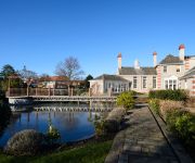
Leverhulme Hotel
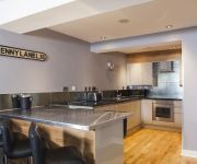
Epic Serviced Apartments - Campbell Street
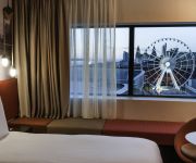
Pullman Liverpool
The Block Liverpool
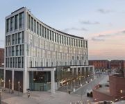
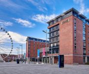
Hilton Liverpool City Centre
Staybridge Suites LIVERPOOL
Holiday Inn Express LIVERPOOL - ALBERT DOCK
Epic Aparthotel - Duke Street
Base Serviced Apartments - Spectrum
May's House
Videos from this area
These are videos related to the place based on their proximity to this place.
View from Radio City Tower, Liverpool
The incredible panoramic view from the top of the Radio City Tower, Liverpool.
Riddle at Bebington Civic Centre Wirral UK
Does anyone know the answer to this old riddle? Subtract 45 from 45 that 45 may remain.
Trailer- The rise of Rudy, One mans journey to the top
http://www.facebook.com/pages/Bromborough-United-Kingdom/Punch-It-Productions/121501599451?ref=search&sid=537174887.184212113..1 This is a trailer for the much anticipated Death Rattle ...
(Volume TWELVE) Eric Turnbow on Vacation ToLondon and Liverpool June, 12, 1992
(Volume TWELVE) Eric Turnbow on Vacation To London and Liverpool England June, 11, 1992. Tour of London. Tour guide adds lots of commentary. Tour of "Tower o...
Port Sunlight 10 k run 13 May 2012 Before the start
This is around 45 minutes before the start of the first 10 k race in Port Sunlight on 13 May 2012. This space is usually filled with visitors to the art gallery, but the centre of the village...
New Ferry Little Acorns Project
A short documentary about the District Centre of New Ferry, Wirral Merseyside. This is part of our community's application to the UK Government's "Portas Pilots" funding scheme, in our attempt...
Tall Ships visit the River Mersey, July 2008
Shorefields Nature Park at New Ferry, Wirral, is a fantastic location on the western bank of the River Mersey. It is the largest, flattest area remaining next to the river and has brilliant...
Mersey river and Liverpool from a distance
taken from the Wirral side Bank of the Mersey river, England , in this short video , you can see Liverpool City buildings from a distance (the Liver Buildings can be seen), the river itself,...
Videos provided by Youtube are under the copyright of their owners.
Attractions and noteworthy things
Distances are based on the centre of the city/town and sightseeing location. This list contains brief abstracts about monuments, holiday activities, national parcs, museums, organisations and more from the area as well as interesting facts about the region itself. Where available, you'll find the corresponding homepage. Otherwise the related wikipedia article.
Cammell Laird
Cammell Laird, one of the famous names in British shipbuilding during the nineteenth and twentieth centuries, came about following the merger of Laird, Son & Co. of Birkenhead and Johnson Cammell & Co. of Sheffield at the turn of the twentieth century. They also built railway rolling stock until 1929, when that side of the business was separated and became part of the Metropolitan-Cammell Carriage and Wagon Company.
Lady Lever Art Gallery
The Lady Lever Art Gallery was founded in 1922 by Sunlight Soap magnate, William Lever, 1st Viscount Leverhulme, and dedicated to the memory of his wife. Set in the attractive garden village of Port Sunlight, Merseyside, England, also created by Lord Lever, the gallery is famous for its British 18th-century and 19th-century paintings, 18th-century furniture and an outstanding collection of Wedgwood. The Grade II listed gallery is part of National Museums Liverpool.
Herculaneum Dock
Herculaneum Dock was part of the Port of Liverpool in Liverpool, England. It was situated at the southern end of the Liverpool dock system, on the River Mersey. To the north it was connected to Harrington Dock. The dock was named after the Herculaneum Pottery Company that had occupied the site before. From 1767, a tidal basin in the area that would become the dock was used for unloading copper for a smelting works. Between 1794 and 1841 it was the site of a pottery.
Toxteth Dock
Toxteth Dock was a dock, on the River Mersey and part of the Port of Liverpool. Situated in the southern dock system, it was connected to Brunswick Dock to the north and Harrington Dock to the south. It was built by George Fosbery Lyster and opened in 1841. The dock closed in 1972 and has since been filled in. Most of the dock buildings still exist and are split up into small business units as part of Brunswick Business Park.
Brunswick Dock
Brunswick Dock is also the name of a dock in London, which became part of the East India Docks. Brunswick Dock is a dock, on the River Mersey and part of the Port of Liverpool. It is situated in the southern dock system, connected to Coburg Dock to the north, Toxteth Dock to the south. The dock was opened in 1832, designed by Jesse Hartley, specifically as a timber dock. It consisted of two lock entrances from the river. In 1854, Cato, Miller & Company built ships at Brunswick Dock.
Harrington Dock
Harrington Dock was a dock on the River Mersey and part of the Port of Liverpool. Situated in the southern dock system, it was connected to Toxteth Dock to the north and Herculaneum Dock to the south. It was built by George Fosbery Lyster and opened in 1882. A tunnel from the Garston and Liverpool Railway emerged at the dock. The dock closed in 1972 and has since been filled in. Most of the dock buildings still exist and are divided into small business units as part of Brunswick Business Park.
Brunswick Half Tide Dock
Brunswick Half Tide Dock on the River Mersey, England was a half tide dock and part of the Port of Liverpool. Situated near Brunswick Dock in the southern dock system, it only connected directly to the river. Apart from the entrance channel, the dock has now been filled in.
South Ferry Basin
The South Ferry Basin is a dock on the River Mersey, England and part of the Port of Liverpool. Situated near the southern dock system, it is only connected directly to the river. From 4 April 1865 a ferry service was established between the South Ferry Basin and New Ferry on the Wirral Peninsula, with additional sailings to Liverpool Pier Head. Facilities at the basin consisted of a pontoon moored against the dock wall.
Tranmere Oil Terminal
Tranmere Oil Terminal is situated on the River Mersey, 1½ miles south of Birkenhead. It was opened on 8 June 1960 to handle vessels of up to 65,000 tons, and is connected to the Stanlow Oil Refinery by a 15-mile pipeline. Part of the terminal occupies the site of a former ferry service to Liverpool, with the extant pier considerably modified. The terminal is operated by the Mersey Docks and Harbour Board.
Bromborough Dock
Bromborough Dock was situated on the River Mersey at Bromborough, on the Wirral Peninsula, England. Owned by the manufacturer Lever Brothers (and its successor Unilever), it served the company's factory at Port Sunlight. The facility was once the largest private dock in the world. Consent for its construction was given by the Bromborough Dock Act of 1923. Officially opened on 17 April 1931, it replaced a smaller dock and wharf built at Bromborough Pool in 1895.
Cammell Laird F.C
Cammell Laird Football Club is an English Semi Professional football club based in Birkenhead, Merseyside. The club are members of the Northern Premier League Division One North, the eighth tier of English football, and play at the Kirklands Stadium.
Dibbinsdale
Brotherton Park and Dibbinsdale comprise an area of over 80 acres of park and woodland within the Metropolitan Borough of Wirral, England. Situated between Spital and Bromborough, the valley woodland is one of the finest examples of ancient woodland on Merseyside and is a Site of Special Scientific Interest (SSSI).
Rock Ferry railway station
Rock Ferry railway station is situated in the Rock Ferry area of Birkenhead, Wirral, England. It lies 4.5 miles south west of Liverpool Lime Street on the Chester and Ellesmere Port branches of the Wirral Line, part of the Merseyrail network. The disused Birkenhead Dock Branch joins with the Wirral Line at the station.
Bebington railway station
Bebington railway station serves the town of Bebington on the Wirral Peninsula, England. The station is situated on the Chester and Ellesmere Port branches of the Wirral Line, forming part of the Merseyrail network.
Wirral Waters
Wirral Waters is a large scale £4.5bn development that has been proposed by the Peel Group for Birkenhead, on the Wirral Peninsula, England. It is a sister programme of the Liverpool Waters project.
St John Plessington Catholic College
St John Plessington Catholic College (SJP) is a Roman Catholic secondary school and sixth form with academy status in Bebington, Wirral, England. The school was awarded 'Technology College' status in 1998. The school has close relations with the nearby primary schools, one in very close proximity (across the road) to SJP, St. John's Junior School. They are often referred to as sister schools. The pupils of St.
The Oval (Wirral)
The Oval (sometimes referred to as The Bebington Oval and Port Sunlight) is a Municipal athletics stadium in Bebington, Merseyside. The venue has played host to Tranmere Rovers F.C. reserve and ladies teams. The ground has an eight-lane running track which was originally paid for by Lever Brothers in the 1920s but has since undergone an upgrade. It was featured in the film Chariots of Fire and represented the Stade Olympique Yves-du-Manoir.
St Andrew's Church, Bebington
St Andrew's Church, Bebington is in the town of Bebington, Wirral, England. It is designated by English Heritage as a Grade I listed building. The architectural historian Raymond Richards considers it to be the finest old parish church in Wirral. It is an active Anglican parish church in the diocese of Chester, the archdeaconry of Chester and the deanery of Wirral North.
St Barnabas' Church, Bromborough
St Barnabas' Church, Bromborough is in the town of Bromborough, Wirral, Merseyside, England. The church is designated by English Heritage as a Grade II* listed building, and stands within the boundary of the Bromborough Village Conservation Area. It is an active Anglican parish church in the diocese of Chester, the archdeaconry of Chester and the deanery of Wirral South. The authors of the Buildings of England series describe it a "handsome church for a village-gone-prosperous".
Wellington School, Bebington
Wellington School was a small private school in Wellington Road, Bebington, Wirral, England. Founded and for many decades run by its first headmaster, J.P. Fogg, Wellington School became a prominent institution in the 1960s, '70s and '80s, with an academic and sporting record that created a wide catchment area. The school was founded by J.P. Fogg, whose educational philosophy was that "given the right environment, a boy will seek to emulate the good example of those who strive to guide him".
Toxteth Dock railway station
Toxteth Dock railway station was on the Liverpool Overhead Railway, adjacent to the dock of the same name and the Brunswick Goods station on the Cheshire Lines railway. It was situated above a London Midland & Scottish goods railway station. It was opened on 6 March 1893 by the Marquis of Salisbury and station closed, along with the rest of the line, on 30 December 1956. No evidence of this station remains.
Herculaneum Dock railway station
Herculaneum Dock railway station was the original southern terminus for the Liverpool Overhead Railway. Actually adjacent to Harrington Dock it was named after Herculaneum Dock, a somewhat larger dock beyond the end of the line. It was opened on 6 March 1893 by the Marquis of Salisbury.
Rock Ferry High School
Rock Ferry High School was a secondary school located in Birkenhead, Wirral, England.
New Ferry Butterfly Park
New Ferry Butterfly Park is a 2-hectare urban nature reserve in New Ferry, on the Wirral Peninsula, England. It is managed by the Cheshire Wildlife Trust. The reserve is located on a site formerly occupied by abandoned sidings north of Bebington railway station.
Woodslee Primary School
Woodslee Primary School is a primary school located in Bromborough, Wirral. The headteacher is Mrs. Evans and has 124 pupils. The school opened in 1931. Kids with autism go to a base class and is taught by Mrs. Dutton and Mrs. Redmond. There are only 7 pupils allowed. Every Friday, an assembly called Special Praise airs and one kids in all the classes win the certificate. The school is between Dibbinsdale Woods and not far from the shopping park Croft Park. The school is keen on Look and Read.


