Safety Score: 3,0 of 5.0 based on data from 9 authorites. Meaning we advice caution when travelling to United Kingdom.
Travel warnings are updated daily. Source: Travel Warning United Kingdom. Last Update: 2024-04-19 08:03:45
Delve into Tytherton Lucas
Tytherton Lucas in Wiltshire (England) is located in United Kingdom about 84 mi (or 135 km) west of London, the country's capital town.
Current time in Tytherton Lucas is now 02:23 PM (Friday). The local timezone is named Europe / London with an UTC offset of one hour. We know of 9 airports close to Tytherton Lucas, of which 5 are larger airports. The closest airport in United Kingdom is RAF Lyneham in a distance of 4 mi (or 7 km), North-East. Besides the airports, there are other travel options available (check left side).
There are several Unesco world heritage sites nearby. The closest heritage site in United Kingdom is City of Bath in a distance of 20 mi (or 32 km), East. Also, if you like playing golf, there are some options within driving distance. If you need a hotel, we compiled a list of available hotels close to the map centre further down the page.
While being here, you might want to pay a visit to some of the following locations: Bremhill, Chippenham, Lacock, Seend and Biddestone. To further explore this place, just scroll down and browse the available info.
Local weather forecast
Todays Local Weather Conditions & Forecast: 12°C / 53 °F
| Morning Temperature | 9°C / 48 °F |
| Evening Temperature | 10°C / 50 °F |
| Night Temperature | 5°C / 40 °F |
| Chance of rainfall | 0% |
| Air Humidity | 69% |
| Air Pressure | 1020 hPa |
| Wind Speed | Moderate breeze with 13 km/h (8 mph) from South-East |
| Cloud Conditions | Overcast clouds, covering 100% of sky |
| General Conditions | Light rain |
Saturday, 20th of April 2024
10°C (49 °F)
3°C (38 °F)
Scattered clouds, gentle breeze.
Sunday, 21st of April 2024
8°C (47 °F)
2°C (36 °F)
Broken clouds, moderate breeze.
Monday, 22nd of April 2024
8°C (46 °F)
5°C (40 °F)
Light rain, moderate breeze, scattered clouds.
Hotels and Places to Stay
Bowood Spa & Golf Resort
The Foxham Inn
Bowood Hotel
Beechfield House
Best Western Plus Angel
The Pines Guest Accommodation
Diana Lodge
Chippenham
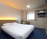
TRAVELODGE CHIPPENHAM LEIGH DELAMERE M4
TRAVELODGE LEIGH DELAMERE M4 WEST
Videos from this area
These are videos related to the place based on their proximity to this place.
trains near chippenham station
2 first great westerns near chippenham 1st one to london paddington 2nd to bristol temple meads PLEASE SUBSCRIBE.
Holidays in Chippenham
Visit http://www.holidaycottages.co.uk/cotswolds/chippenham to view our collection of holiday cottages in Chippenham. With a great mix of traditional architecture and modern renovations...
ZMR250 Quadcopter FPV in Chippenham
ZMR250 Race Quad FPV at Monkton Park in Chippenham Build Pictures Here http://imgur.com/a/bmhYH.
Chippenham Folk Festival 2009
The Chippenham Folk Festival of 2009 as presented by William Seaward. A glorious weekend of wondrous glory and gloryful wonder.
Fishing Trip!
Twitter - https://twitter.com/PrepcraftGaming □Twitch- http://www.twitch.tv/PrepcraftGaming.
Andybus AJ11BUS Route 92 Chippenham Bus Stn - Railway Stn
Lovely vehicle in Andrew James's tidy little fleet based just outside Malmesbury, Wiltshire. Flickr photo of AJ11BUS (My photo): http://www.flickr.com/photos/benz996/8436571624/in/photostream.
FGW 43154 with 43160 at the rear pass through Chippenham station at speed on the 26/08/2013
via YouTube Capture.
Videos provided by Youtube are under the copyright of their owners.
Attractions and noteworthy things
Distances are based on the centre of the city/town and sightseeing location. This list contains brief abstracts about monuments, holiday activities, national parcs, museums, organisations and more from the area as well as interesting facts about the region itself. Where available, you'll find the corresponding homepage. Otherwise the related wikipedia article.
North Wiltshire
North Wiltshire was a local government district in Wiltshire, England, formed on 1 April 1974, by a merger of the municipal boroughs of Calne, Chippenham, and Malmesbury along with Calne and Chippenham Rural District, Cricklade and Wootton Bassett Rural District and Malmesbury Rural District. It shared its name with the North Wiltshire parliamentary constituency, which had similar, but not identical, boundaries. The district council was based at Monkton Park, Chippenham.
Langley Burrell
Langley Burrell is a village just north of Chippenham, Wiltshire. It is notable in particular as one of the termini of Maud Heath's Causeway and, also for its Early English and Perpendicular church. The Georgian parsonage was for many years the home of the Rev. Robert Kilvert, father of the famous diarist Francis Kilvert, who from 1863 to 1864 and 1872 to 1876 was curate to his father here.
Maud Heath's Causeway
Maud Heath's Causeway is a pathway in rural Wiltshire which rises above the Avon floodplain on sixty-four brick arches, as it carries an undistinguished country road between Bremhill and Langley Burrell. The causeway is the gift of the eponymous Maud Heath; a sundial on the spot reports that she made her fortune carrying eggs to market at Chippenham.
Kellaways – West Tytherton, River Avon SSSI, Wiltshire
Kellaways - West Tytherton, River Avon SSSI is a 4.1 hectare geological Site of Special Scientific Interest in Wiltshire, notified in 1998. Located 3 miles north east of Chippenham, this SSSI is of geological interest as the banks of the River Avon expose Callovian highly-fossiliferous sandstone which contains well-preserved bivalves, gastropods, brachiopods, belemnites and ammonites.
Sutton Lane Meadows
Sutton Lane Meadows is a 3.44 hectare biological Site of Special Scientific Interest in Wiltshire, notified in 1988.
A342 road
The A342 is an A road that runs from Pewsham near Chippenham, Wiltshire to Andover, Hampshire. The road begins at the A4 junction just outside of the small village Pewsham, to the east of Chippenham. It heads south past the village of Derry Hill towards Devizes, briefly meeting with the A3102 near Sandy Lane. Just outside Devizes the road meets the A361 and once in the centre of town meets the A360.
Stanley Bridge Halt railway station
Stanley Bridge Halt was a railway station on the Great Western Railway's branch line from Chippenham to Calne. It closed in 1965. Preceding station Disused railways Following station Chippenham BR (Western Region) Black Dog Halt
Stanley Abbey
Stanley Abbey was a medieval abbey near Chippenham, Wiltshire in England which flourished between 1151 and 1536.


