Safety Score: 3,0 of 5.0 based on data from 9 authorites. Meaning we advice caution when travelling to United Kingdom.
Travel warnings are updated daily. Source: Travel Warning United Kingdom. Last Update: 2024-04-23 08:18:23
Touring Foxham
Foxham in Wiltshire (England) is a town located in United Kingdom about 82 mi (or 132 km) west of London, the country's capital place.
Time in Foxham is now 12:23 PM (Tuesday). The local timezone is named Europe / London with an UTC offset of one hour. We know of 9 airports nearby Foxham, of which 5 are larger airports. The closest airport in United Kingdom is RAF Lyneham in a distance of 2 mi (or 3 km), North-East. Besides the airports, there are other travel options available (check left side).
There are several Unesco world heritage sites nearby. The closest heritage site in United Kingdom is City of Bath in a distance of 19 mi (or 30 km), South-East. Also, if you like the game of golf, there are several options within driving distance. Need some hints on where to stay? We compiled a list of available hotels close to the map centre further down the page.
Being here already, you might want to pay a visit to some of the following locations: Bremhill, Chippenham, Charlton, Lacock and Hankerton. To further explore this place, just scroll down and browse the available info.
Local weather forecast
Todays Local Weather Conditions & Forecast: 9°C / 48 °F
| Morning Temperature | 4°C / 39 °F |
| Evening Temperature | 9°C / 48 °F |
| Night Temperature | 5°C / 41 °F |
| Chance of rainfall | 0% |
| Air Humidity | 67% |
| Air Pressure | 1024 hPa |
| Wind Speed | Moderate breeze with 10 km/h (6 mph) from South |
| Cloud Conditions | Overcast clouds, covering 96% of sky |
| General Conditions | Light rain |
Wednesday, 24th of April 2024
8°C (47 °F)
2°C (36 °F)
Light rain, gentle breeze, overcast clouds.
Thursday, 25th of April 2024
11°C (52 °F)
5°C (41 °F)
Light rain, gentle breeze, overcast clouds.
Friday, 26th of April 2024
9°C (48 °F)
6°C (43 °F)
Light rain, gentle breeze, overcast clouds.
Hotels and Places to Stay
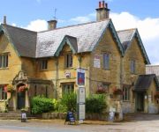
The Foxham Inn
Bowood Hotel
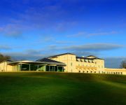
Bowood Spa & Golf Resort
The Duke Hotel
Best Western Plus Angel
The Pines Guest Accommodation
Videos from this area
These are videos related to the place based on their proximity to this place.
Avro Vulcan XH558 at RAF Lyneham 27th Sept 2009
Last flight of the year , see you in the spring 558 ;)
Avro Vulcan XH558 RAF Lyneham Family Day 2010
In loving memory of Uncle Mick The Avro Vulcan XH558 - "The Spirit Of Great Britain" in its "50th Anniversary" at Lyneham Family Day 7th August 2010 http://www.vulcantothesky.org/
M4 Minibus Centre: Merecedes Sprinter 511 CDI Wheelchair accessible bus
www.m4sales.co.uk Call: 01249 890000.
M4 Minibus centre:Ford Tansit 17 seat- High Roof
Ford Transit 17 Seat Minibus. High Roof. Call M4 Minibus Centre Sales On: 01249 890000.
Videos provided by Youtube are under the copyright of their owners.
Attractions and noteworthy things
Distances are based on the centre of the city/town and sightseeing location. This list contains brief abstracts about monuments, holiday activities, national parcs, museums, organisations and more from the area as well as interesting facts about the region itself. Where available, you'll find the corresponding homepage. Otherwise the related wikipedia article.
RAF Lyneham
Royal Air Force Station Lyneham or more simply RAF Lyneham is a former Royal Air Force station located 6.3 miles north east of Chippenham, Wiltshire and 10.3 miles south west of Swindon, Wiltshire, England. It was the home of all the Lockheed C-130 Hercules transport aircraft of the Royal Air Force (RAF) before they were relocated to RAF Brize Norton. The station was also home to No. 38 Expeditionary Air Wing.
Spirthill
Spirthill is a small hamlet in the county of Wiltshire in England, situated 5 km to the south of Lyneham, it is too small to be defined as a village and has no specific 'centre'. It is on top of a hill with views over the Avon valley and the towns of Calne and Chippenham can be seen from some points. It is a quiet community of farmland and residential housing spread out along a very narrow and unlit lane. There are 19 homes in the hamlet, including five farms with livestock or arable crops.
Stanley Bridge Halt railway station
Stanley Bridge Halt was a railway station on the Great Western Railway's branch line from Chippenham to Calne. It closed in 1965. Preceding station Disused railways Following station Chippenham BR (Western Region) Black Dog Halt
Bradenstoke Priory
Bradenstoke Priory is a medieval priory in the village of Bradenstoke, Wiltshire, England. It is noted today for its structures having been used by William Randolph Hearst for the renovation of St Donat's Castle, near Llantwit Major, Wales, in the 1930s.
Dauntsey railway station
Dauntsey railway station served the village of Dauntsey, Wiltshire from 1869 to 1965. It was situated on the Great Western Main Line which runs from London to Bristol. The station is located a mile and a half south of Dauntsey village and is near Dauntsey Lock which suggests that the station was important to the Wilts & Berks Canal.
Christian Malford Halt railway station
Christian Malford Halt served the village of Christian Malford, Wiltshire from 1926 to 1965. It was situated on the Great Western Main Line which runs from London to Bristol. The station is located half a mile south of Christian Malford where the railway passes over Station Road. The halt consisted of two timber platforms, each with a wooden shelter. There is no trace of the halt today, although the access path on the up side is still there.
Fishers Brook
Fishers Brook is a small hamlet in Wiltshire, England, with a population of approximately 25 residents. It is essentially a small collection of houses situated just to the south of Fishers Brook bridge. The brook itself flows into the River Marden approximately 1 km to the west of the settlement. Fishers Brook is signposted from the A3102 Calne bypass route and lies some 2.5 km to the northwest of central Calne (the closest town).


