Safety Score: 3,0 of 5.0 based on data from 9 authorites. Meaning we advice caution when travelling to United Kingdom.
Travel warnings are updated daily. Source: Travel Warning United Kingdom. Last Update: 2024-04-24 08:14:40
Discover Poynings
Poynings in West Sussex (England) is a city in United Kingdom about 43 mi (or 69 km) south of London, the country's capital city.
Local time in Poynings is now 06:14 AM (Thursday). The local timezone is named Europe / London with an UTC offset of one hour. We know of 10 airports in the vicinity of Poynings, of which 5 are larger airports. The closest airport in United Kingdom is Shoreham Airport in a distance of 6 mi (or 9 km), South-West. Besides the airports, there are other travel options available (check left side).
There are several Unesco world heritage sites nearby. The closest heritage site in United Kingdom is Stonehenge, Avebury and Associated Sites in a distance of 20 mi (or 32 km), North. Also, if you like golfing, there are a few options in driving distance. We discovered 2 points of interest in the vicinity of this place. Looking for a place to stay? we compiled a list of available hotels close to the map centre further down the page.
When in this area, you might want to pay a visit to some of the following locations: Fulking, Henfield, Brighton, Rottingdean and Lewes. To further explore this place, just scroll down and browse the available info.
Local weather forecast
Todays Local Weather Conditions & Forecast: 10°C / 49 °F
| Morning Temperature | 8°C / 46 °F |
| Evening Temperature | 9°C / 48 °F |
| Night Temperature | 9°C / 47 °F |
| Chance of rainfall | 1% |
| Air Humidity | 69% |
| Air Pressure | 1006 hPa |
| Wind Speed | Moderate breeze with 13 km/h (8 mph) from North-East |
| Cloud Conditions | Overcast clouds, covering 100% of sky |
| General Conditions | Light rain |
Friday, 26th of April 2024
8°C (46 °F)
8°C (46 °F)
Light rain, moderate breeze, overcast clouds.
Saturday, 27th of April 2024
12°C (53 °F)
11°C (52 °F)
Moderate rain, fresh breeze, overcast clouds.
Sunday, 28th of April 2024
11°C (52 °F)
10°C (50 °F)
Moderate rain, high wind, near gale, overcast clouds.
Hotels and Places to Stay
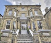
The Claremont
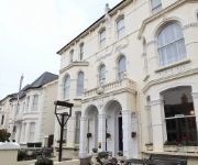
The Oriental - Guest House
Adastral
The Neo
Mercure Brighton Seafront Hotel
TRAVELODGE BRIGHTON
Pelirocco
Holiday Inn BRIGHTON - SEAFRONT
Kings
Britannia Study Hotel
Videos from this area
These are videos related to the place based on their proximity to this place.
Paragliding Devils Dyke
Paragliding Devils Dyke on August Bank Holiday weekend, 2011. Notice the faster grey/blue wing near the end of the movie nearly run into me from my left and behind.
She Rides back from Devil's Dyke 10 March 2013
After thawing out with a hot drink in the Devil's Dyke pub, Bekah, Lisa, Charlotte and Alison rode back to Hove. We took a different route back to make the full ride more of a loop, sweeping...
Tongue and Groove pay the bar bill
Tongue and Groove live at Albourne on 5th October 2013. Comedy moment as venue staff insist that singer Phil 'The Fox' comes to the bar to pay his tab. Features excerpts from cover versions...
Wickwoods 14th December 2012 1
It's Christmas with After Dark Disco at Wickwoods Country Club, Shaves Wood Lane, Albourne, Nr Hassocks, West Sussex, BN6 9DY. Wedding DJ, Party DJ.
Shooting with the HC-X1000
Views over the Sussex Downs with the Panasonic HC-X1000 4K camcorder Using Scene File 1; Format: 3840x2160 25p.
A27 Southwick Tunnel to A23 Patcham [Brighton] intersection
First sun seemingly since Xmas and great ride above Brighton - beware sound volume in hi-speed section via MS MovieMaker !
Videos provided by Youtube are under the copyright of their owners.
Attractions and noteworthy things
Distances are based on the centre of the city/town and sightseeing location. This list contains brief abstracts about monuments, holiday activities, national parcs, museums, organisations and more from the area as well as interesting facts about the region itself. Where available, you'll find the corresponding homepage. Otherwise the related wikipedia article.
Devil's Dyke, Sussex
Devil's Dyke is a 100m deep V-shaped valley on the South Downs Way in southern England, near Brighton and Hove. Devil's Dyke was a major local tourist attraction in the late 19th and early 20th century.
Mile Oak F.C
Mile Oak F.C. are a football club based in the Hove district of Mile Oak, England. They were established in 1960 and joined the Sussex County League in 1987. In the 2005–06 season, they reached the 2nd round of the FA Vase. They were relegated in 2010 to the Sussex County League Division Two. They enjoy a fierce, if good natured, local rivalry with neighbours Southwick FC
Southwick Hill Tunnel
The Southwick Hill Tunnel is a 490 metre twin-bore road tunnel in Shoreham-by-Sea, West Sussex, England. The tunnel was opened in early 1996 as part of the A27 Brighton bypass. The border between West Sussex and the unitary authority of Brighton and Hove is close to the eastern entrance of the tunnel. Non-motorised traffic (e.g. pedestrians, cyclists) and mopeds under 50 cc are prohibited from using the tunnel, with a warning sign indicating an alternative route.
Danny House
Danny is an impressive Grade I listed Elizabethan red brick Mansion near Hurstpierpoint in West Sussex, England. It lies at the northern foot of Wolstonbury Hill and one of the finest stately houses in Sussex, with 56 bedrooms and 28 apartments. The present house was built 1593-95 by George Goring, slightly to the east of an older house. It is set in eight acres (32,000 m²) of gardens at the foot of the South Downs.
Golf Club Halt railway station (Hove)
Golf Club Halt railway station, was a railway station in Hove, in East Sussex, England which opened in 1891 and closed in 1939. The station served the Brighton & Hove Golf Club, established in 1887. Preceding station Disused railways Following station Rowan Halt Dyke Railway Company Devil's Dyke
Waterhall Mill, Patcham
Waterhall Mill, also known as Patcham Windmill, is a grade II listed tower mill at Patcham, Sussex, England which has been converted to residential use.
Church of the Transfiguration, Pyecombe
The Church of the Transfiguration is an Anglican church in the village of Pyecombe, in the Mid Sussex district of West Sussex, England. The mostly 12th- and 13th-century building, in an isolated setting facing the South Downs, has been listed at Grade I by English Heritage: this status is given to buildings of "exceptional interest" and national importance. It is the parish church of Pyecombe.









!['A27 Southwick Tunnel to A23 Patcham [Brighton] intersection' preview picture of video 'A27 Southwick Tunnel to A23 Patcham [Brighton] intersection'](https://img.youtube.com/vi/O-xMVnkZwk4/mqdefault.jpg)
