Safety Score: 3,0 of 5.0 based on data from 9 authorites. Meaning we advice caution when travelling to United Kingdom.
Travel warnings are updated daily. Source: Travel Warning United Kingdom. Last Update: 2024-04-19 08:03:45
Discover Borden
Borden in West Sussex (England) is a town in United Kingdom about 45 mi (or 73 km) south-west of London, the country's capital city.
Current time in Borden is now 08:22 PM (Friday). The local timezone is named Europe / London with an UTC offset of one hour. We know of 12 airports near Borden, of which 5 are larger airports. The closest airport in United Kingdom is Chichester/Goodwood Airport in a distance of 11 mi (or 18 km), South. Besides the airports, there are other travel options available (check left side).
There are several Unesco world heritage sites nearby. The closest heritage site in United Kingdom is Dorset and East Devon Coast in a distance of 23 mi (or 37 km), South. Also, if you like playing golf, there are a few options in driving distance. We discovered 1 points of interest in the vicinity of this place. Looking for a place to stay? we compiled a list of available hotels close to the map centre further down the page.
When in this area, you might want to pay a visit to some of the following locations: Milland, Lindford, Kingsley, Chichester and Farnham. To further explore this place, just scroll down and browse the available info.
Local weather forecast
Todays Local Weather Conditions & Forecast: 13°C / 55 °F
| Morning Temperature | 9°C / 48 °F |
| Evening Temperature | 9°C / 48 °F |
| Night Temperature | 7°C / 44 °F |
| Chance of rainfall | 0% |
| Air Humidity | 73% |
| Air Pressure | 1017 hPa |
| Wind Speed | Fresh Breeze with 14 km/h (9 mph) from South-East |
| Cloud Conditions | Broken clouds, covering 75% of sky |
| General Conditions | Light rain |
Saturday, 20th of April 2024
10°C (49 °F)
2°C (36 °F)
Broken clouds, moderate breeze.
Sunday, 21st of April 2024
9°C (49 °F)
2°C (36 °F)
Scattered clouds, moderate breeze.
Monday, 22nd of April 2024
10°C (49 °F)
5°C (42 °F)
Overcast clouds, light breeze.
Hotels and Places to Stay
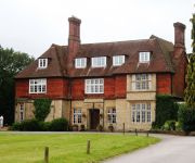
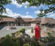
Champneys Forest Mere
Old Thorns Manor
Overglen Court
Angel
Videos from this area
These are videos related to the place based on their proximity to this place.
Driving from High Pitfold, Hindhead to Liphook on B2131, Surrey county, England
Driving from High Pitfold, Hindhead to Liphook on B2131, Surrey county, England.
Yamanouchi Oshika - N Scale Layout
Japanese outline 1:150 scale (N) layout 9mm gauge track. DC This is a L&DMRC layout. This has been our star layout for two years, having been featured twice in "Continental Modeller" magazine...
Yamanouchi Oshika - N Scale Layout
Japanese outline 1:150 scale (N) layout 9mm gauge track. DC This is a L&DMRC layout. This has been our star layout for two years, having been featured twice in "Continental Modeller" magazine...
LB&SCR (Lumpy Barmcake & Salted Cracker Railway)
British outline 1:29 (G) scale narrow gauge Representing a 15" gauge miniature railway in G scale using 16.5 mm track Built by Matt Wildsmith (L&DMRC member) Whimsical cartoon narrow gauge...
Erhwald - N Scale Layout
German outline 1:160 scale (N) layout 9mm track gauge DCC with sound Built by Ben Russ (L&DMRC Chairman) Ehrwald roughly translated means "honoured forest". Ben is our alpine layout specialist ...
Erhwald - N Scale Layout
German outline 1:160 scale (N) layout 9mm track gauge DCC with sound Built by Ben Russ (L&DMRC Chairman) Ehrwald roughly translated means "honoured forest". Ben is our alpine layout specialist ...
Oliver Cromwell Steam Train 2009
View the Oliver Cromwell Steam train passing through Liphook train station in Hampshire on 13th April 2009.
Liss to Petersfield on 450039+450094
The journey from Liss to Petersfield aboard 450039 and 450094 working 1P23 0930 London Waterloo to Portsmouth Harbour on Monday 26th August 2013.
Videos provided by Youtube are under the copyright of their owners.
Attractions and noteworthy things
Distances are based on the centre of the city/town and sightseeing location. This list contains brief abstracts about monuments, holiday activities, national parcs, museums, organisations and more from the area as well as interesting facts about the region itself. Where available, you'll find the corresponding homepage. Otherwise the related wikipedia article.
Dureford Abbey
Dureford Abbey, in Sussex, England, was a Premonstratensian monastery. It was founded by Henry Hussey who in 1161 granted land to the abbot of Welbeck Abbey, to establish the new community near Rogate, Sussex.
Rogate railway station
Rogate railway station, also known variously as Rogate for Harting, and Rogate and Harting, supposedly served these two villages in the county of West Sussex in England. However the station was a mile and a half away from both of these places, and was in fact in the village of Nyewood. The station was on the former London and South Western Railway line between Petersfield and Midhurst. The line opened on 1 September 1864.
Elsted railway station
Elsted railway station served the village of Elsted in the county of West Sussex in England. However like most country stations the village itself was a mile away to the north. The station was on the line between Petersfield and Midhurst, which was operational between 1 September 1864 and 5 February 1955. The station building has now been cleared for an industrial development, although nearby railway cottages are still in existence.
Chithurst Buddhist Monastery
Cittaviveka, popularly known as Chithurst Buddhist Monastery, is a Theravada Buddhist Monastery in the Thai Forest Tradition. It is situated in West Sussex, England in the hamlet of Chithurst between Midhurst and Petersfield. It was established in 1979 in accordance with the aims of the English Sangha Trust, a charity founded in 1956 to support the ordination and training of Buddhist monks (bhikkhus) in the West. The current abbot, since 1992, is Ajahn Sucitto.
Midhurst (electoral division)
Midhurst is an electoral division of West Sussex in the United Kingdom, and returns one member to sit on West Sussex County Council.
St George's Church, Trotton
St. George's Church is an Anglican church in Trotton, a village in the district of Chichester, one of seven local government districts in the English county of West Sussex. Most of the structure was built in the early 14th century. However, some parts date to around 1230, and there is evidence suggesting an earlier church on the same site. In 1904, a largely intact and unusually detailed painting was found on the west wall depicting the Last Judgment as described in Matthew 25:31–46.
Tuxlith Chapel
Tuxlith Chapel, also known as Milland Old Church, is a redundant Anglican church in the village of Milland, West Sussex, England. It has been designated by English Heritage as a Grade II listed building, and is under the care of the Friends of Friendless Churches.
List of United Kingdom locations: Mill


