Safety Score: 3,0 of 5.0 based on data from 9 authorites. Meaning we advice caution when travelling to United Kingdom.
Travel warnings are updated daily. Source: Travel Warning United Kingdom. Last Update: 2024-04-23 08:18:23
Discover Church End
Church End in Warwickshire (England) is a town in United Kingdom about 94 mi (or 151 km) north-west of London, the country's capital city.
Current time in Church End is now 03:40 PM (Tuesday). The local timezone is named Europe / London with an UTC offset of one hour. We know of 10 airports near Church End, of which 5 are larger airports. The closest airport in United Kingdom is Birmingham International Airport in a distance of 9 mi (or 14 km), South-West. Besides the airports, there are other travel options available (check left side).
There are several Unesco world heritage sites nearby. The closest heritage site in United Kingdom is Derwent Valley Mills in a distance of 56 mi (or 90 km), North-East. Also, if you like playing golf, there are a few options in driving distance. Looking for a place to stay? we compiled a list of available hotels close to the map centre further down the page.
When in this area, you might want to pay a visit to some of the following locations: Keresley, Meriden, Berkswell, Coventry and Hampton in Arden. To further explore this place, just scroll down and browse the available info.
Local weather forecast
Todays Local Weather Conditions & Forecast: 9°C / 49 °F
| Morning Temperature | 3°C / 37 °F |
| Evening Temperature | 7°C / 44 °F |
| Night Temperature | 3°C / 37 °F |
| Chance of rainfall | 0% |
| Air Humidity | 58% |
| Air Pressure | 1024 hPa |
| Wind Speed | Moderate breeze with 12 km/h (7 mph) from South |
| Cloud Conditions | Overcast clouds, covering 88% of sky |
| General Conditions | Light rain |
Wednesday, 24th of April 2024
9°C (49 °F)
3°C (37 °F)
Broken clouds, gentle breeze.
Thursday, 25th of April 2024
11°C (52 °F)
7°C (45 °F)
Light rain, gentle breeze, overcast clouds.
Friday, 26th of April 2024
10°C (51 °F)
8°C (46 °F)
Light rain, light breeze, overcast clouds.
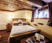
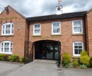
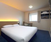
Hotels and Places to Stay
Old Hall House
Forest of Arden Marriott Hotel & Country Club
DoubleTree by Hilton at the Ricoh Arena - Coventry
Atherstone Red Lion
TRAVELODGE TAMWORTH M42
Tamworth South
Videos from this area
These are videos related to the place based on their proximity to this place.
Hail storm, M6, Corley Services, Coventry
Just as I pulled in to the service area I was hit by a wall of hail.
Unboxing Nikon D3200 18 55 VR II Kit
Unboxing new Nikon D3200 camera Recorded: Apple iPad mini 2 Edited: GoPro Studio.
Hartshill Parish Council
Please read all info below: This film shows wildlife eviction of Hartshill Cemetery Extension Under close direction and supervision of Alan Spiers the Cemetery gardener, Hartshill Parish pay...
Transformers Prime Beast Hunters : Ultra Magnus
Ultra Magnus. Is a Transformers. he is acting as Deputy Commander of the Autobot's who ordered them from Optimus Prime, a leading supporter and also vice Dear Leader and has the habit of ...
F1 2014 Gameplay PC : 100% Race Italy 1080p HD F1 Game Backmarker Career Mode.
https://www.facebook.com/goofyvidproductions?fref=ts https://twitter.com/GoofVP F1 2014 Gameplay : 100% Race Career - Realistic Damage. Coming off a podium finish in the Hungarian Grand Prix,...
Solar Eclipse 20th March 2015, Atherstone, Warwickshire, UK
The Solar Eclipse filmed in my back garden in Atherstone, Warwickshire, UK.
Spartan Super and Sprint, Birmingham Atherstone UK
Ran super spartan 12K and spartan sprint 6K (K = kilometers). 24 obstacles on each lap. Total of 18K and 72 obstacles.
Videos provided by Youtube are under the copyright of their owners.
Attractions and noteworthy things
Distances are based on the centre of the city/town and sightseeing location. This list contains brief abstracts about monuments, holiday activities, national parcs, museums, organisations and more from the area as well as interesting facts about the region itself. Where available, you'll find the corresponding homepage. Otherwise the related wikipedia article.
Arley, Warwickshire
Arley is a civil parish in the North Warwickshire district of Warwickshire, England. The parish includes two settlements, New Arley and Old Arley. Old Arley is to the west of the Bourne Brook and the railway line, and New Arley is to the east. Old Arley contains the mediaeval church of St Wilfred, and a Methodist church nearby. New Arley contains St Michael's C of E and St Joseph's Catholic Church, both originally built in response to the influx of miners in the first half of the 20th century.
Bentley, Warwickshire
Bentley is a village and civil parish in the North Warwickshire district of Warwickshire, England, about two miles south-west of Atherstone. According to the 2001 census it had a population of 101.
Atherstone Rural District
Atherstone was a rural district in the administrative county of Warwickshire, England, from 1894 to 1974. It was named after its main town and administrative headquarters of Atherstone. Over the years the district gained territory on the abolition of neighbouring rural districts. In 1932 it gained part of Nuneaton Rural District and in 1965 it gained most of Tamworth Rural District.
Merevale Hall
Merevale Hall is a private country house in Merevale, near Atherstone, Warwickshire. It is a Grade II* listed building. The Manor of Merevale was granted in 1540 to Sir Walter Devereux. The Devereux estates were sequestered in 1601 following the attainder and execution of Robert Devereux, 2nd Earl of Essex for treason. The estate was purchased by Edward Stratford in 1649.
Astley Castle
Astley Castle is a ruinous moated fortified 16th century manor house in North Warwickshire. It has been listed as a Grade II* listed building since 1951 and as a Scheduled Ancient Monument since 1994. It was derelict and sadly neglected since it was severely damaged by fire in 1978 whilst in use as an hotel and was officially a Building at Risk. The building reopened as a holiday let in 2012 after extensive and novel renovations that combine modern elements with the medieval remains.
Arley and Fillongley railway station
Arley and Fillongley railway station was a station on the Midland Railway, which operated in the Midland county of Warwickshire, in England.
East Warwickshire Plateau
The East Warwickshire Plateau is a plateau in the Midlands of England. Forming the eastern part of the larger Midlands Plateau, it is separated by the valley of the River Blythe from the Birmingham Plateau to the west. To the north and south it is bounded by the valleys of the Trent and the Avon.
Daw Mill
Daw Mill was a coal mine located near the village of Arley, near Nuneaton, in the English county of Warwickshire. The mine was Britain's biggest coal producer. On 7 March 2013 the owner, UK Coal, announced the mine would be closed following a major fire. It was the last remaining colliery in the West Midlands.


